November 25, 2023
Saturday Morning Update
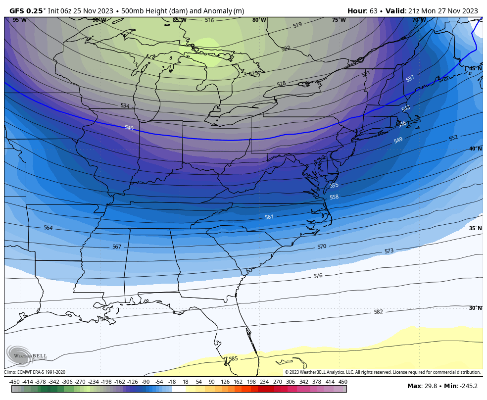
It is feeling a bit like winter, and the weather map looks like it. Today, we have High Pressure in control, which is a dry air mass. But it is cold! The afternoon will remain in the 40s for the first time since March 19th.
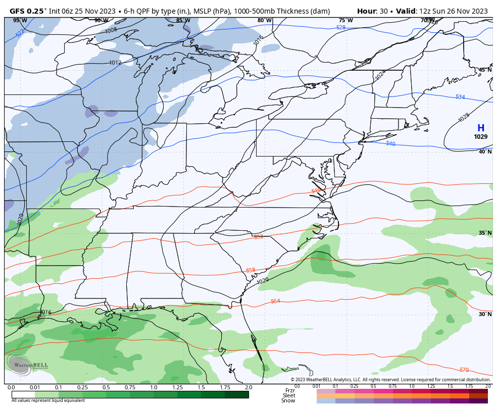
A coastal storm and cold front we were watching to end the weekend will still be a ‘near miss’ for us. However, it may provide some rain showers on Sunday night.
Then we watch even colder air with more energy arrive early in the work week. It may carry some snow showers and flurries over the mountains by Tuesday.
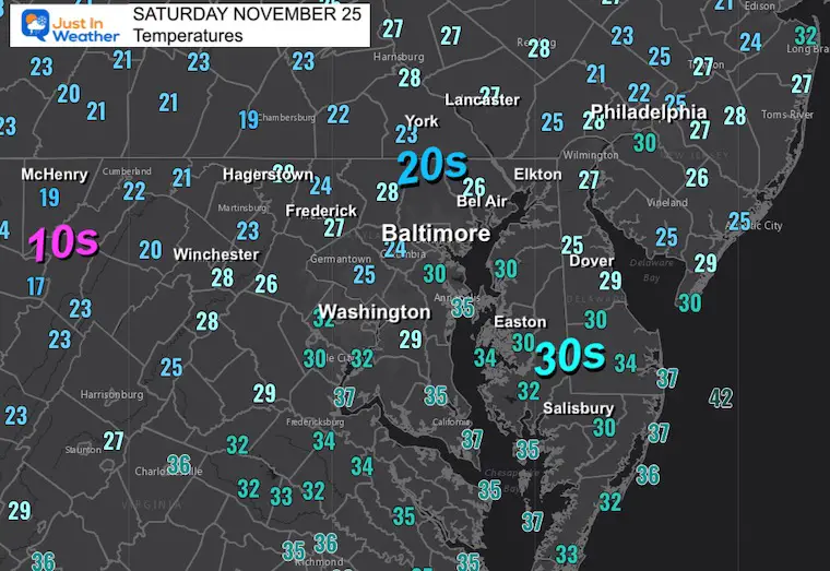
Morning Temperatures
One of the coldest mornings we’ve had since last winter.
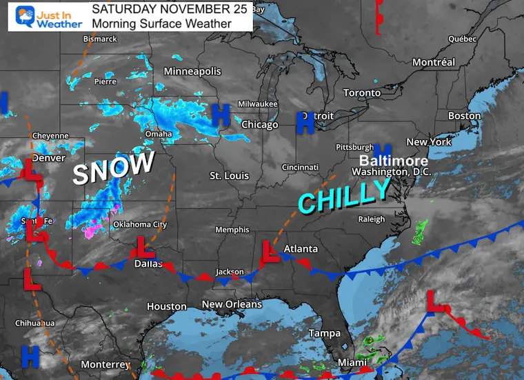
Morning Surface Weather
High Pressure is in control. Not a strong wind, but a breeze is helping to reinforce the chilliest air we have felt since last winter.
The map has a winter feel to it, with snow breaking out across the central US. That will not reach us, but we may have some flakes in our forecast.
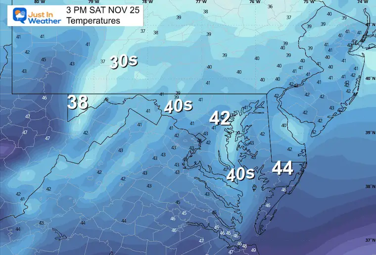
Temperatures
3 PM
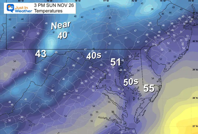
One of the chilliest days since last winter!
CLIMATE DATA: Baltimore
TODAY November 25
Sunrise at 7:01 AM
Sunset at 4:46 PM
Normal Low in Baltimore: 34ºF
Record 18ºF in 1950 and 1956
Normal High in Baltimore: 54ºF
Record 75ºF 1973
Winter Outlook Reports:
El Niño Winter Updates
Computer Models Support East Coast Storm Track

El Niño Advisory
The latest NOAA report is confident in a Very Strong event. Possibly HISTORIC! This refers to the temperatures in the Pacific, with impacts on the US Winter Storm Track.

Winter Weather Folklore: Top 20 and more signals from nature for snow.
NOAA’s Winter Outlook 2024
Winter Outlook 2024 From Two Farmers Almanacs Return to Cold and Snow
Subscribe for eMail Alerts
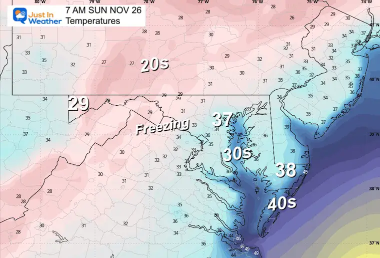
Temperatures Sunday
Morning
Afternoon
Storm Simulation:
Sunday Morning to Monday Afternoon
Snapshot Monday Afternoon
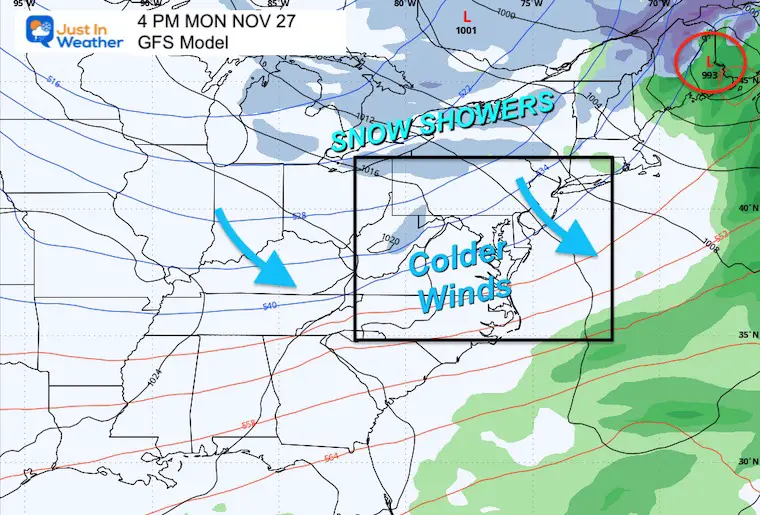
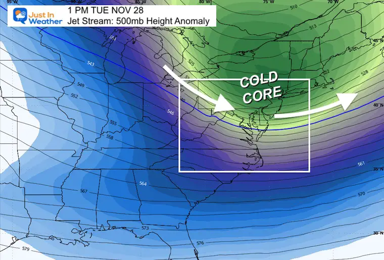
The storm winding up in eastern Maine will help pull down much colder air behind it. We will begin to feel it on Monday, and it will set the stage for much of the week.
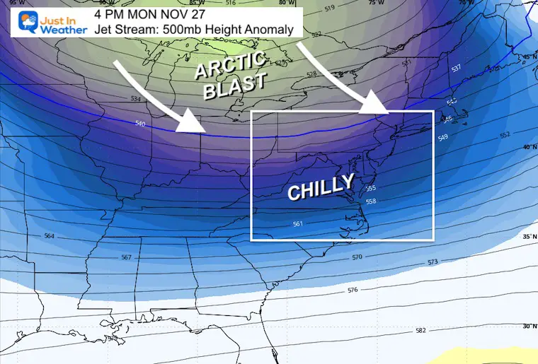
Jet Stream Monday Afternoon
The leading edge of the arctic blast will be pushing across the Northern US.
Simulation
Monday Afternoon to Thursday Afternoon
There will be a coastal storm (that may miss us), but it will pull down much colder air from Canada behind it.
Snapshot: Tuesday Afternoon
We will feel the core of this colder air/Arctic Blast!
The upper air disturbance helping to bring this air mass in may carry enough energy to bring snow showers and flurries east of the mountains on Tuesday afternoon.
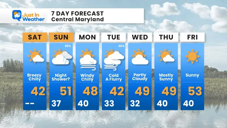
7 Day Forecast
This is definitely looking like an early winter forecast.
Colder air during the week will accompany a disturbance that may bring snow flurries even into metro areas on Tuesday.
A coating of snow is possible in the mountains.
Temperatures remain below average throughout the week.
Explore More
Maryland Snow Climate History And Other Winter Pages

Faith in the Flakes Gear

STEM Assemblies/In School Fields Trips Are Back
Click to see more and ‘Book’ a visit to your school

Subscribe for eMail Alerts
Please share your thoughts and best weather pics/videos, or just keep in touch via social media
RESTATING MY MESSAGE ABOUT DYSLEXIA
I am aware there are some spelling and grammar typos and occasional other glitches. I take responsibility for my mistakes and even the computer glitches I may miss. I have made a few public statements over the years, but if you are new here, you may have missed it: I have dyslexia and found out during my second year at Cornell University. It didn’t stop me from getting my meteorology degree and being the first to get the AMS CBM in the Baltimore/Washington region. One of my professors told me that I had made it that far without knowing and to not let it be a crutch going forward. That was Mark Wysocki, and he was absolutely correct! I do miss my mistakes in my own proofreading. The autocorrect spell check on my computer sometimes does an injustice to make it worse. I also can make mistakes in forecasting. No one is perfect at predicting the future. All of the maps and information are accurate. The ‘wordy’ stuff can get sticky. There has been no editor who can check my work when I need it and have it ready to send out in a newsworthy timeline. Barbara Werner is a member of the web team that helps me maintain this site. She has taken it upon herself to edit typos when she is available. That could be AFTER you read this. I accept this and perhaps proves what you read is really from me… It’s part of my charm.
#FITF


