September 15, 2023
Friday Morning Update
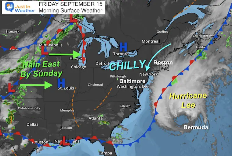
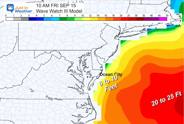
Hurricane Lee is passing north of Bermuda this morning. It is well offshore, but helping to pull in cooler winds for our region this morning. Today will be the closest we get with just an added breeze and high waves.
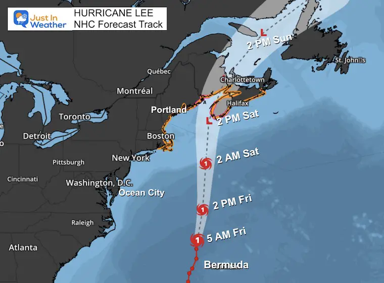
Warnings are posted for New England and Lee may be downgraded to a Tropical Storm as it makes landfall in Nova Scotia Canada Saturday evening.
Morning Surface Weather
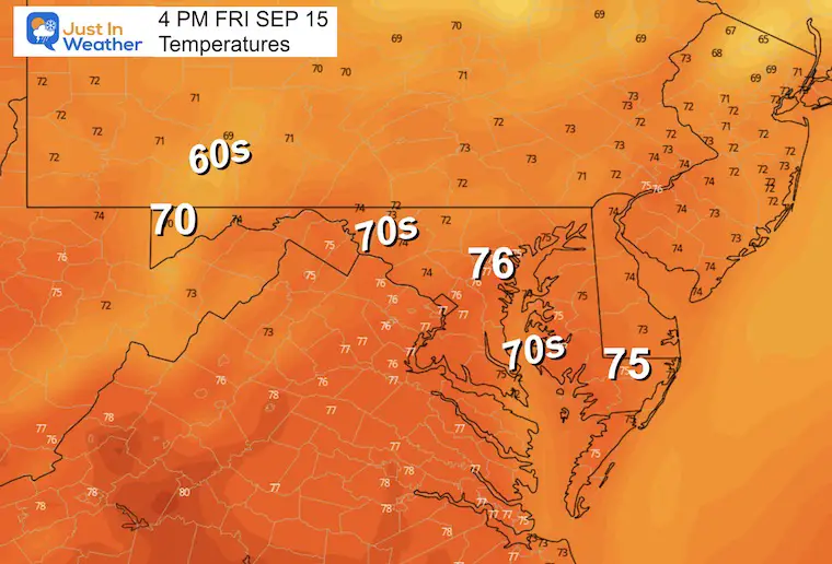
We can see Lee on the Map and High Pressure combined to bring us a chilly breeze. Our winds will be stronger this morning, then ease. Temps will hold in the 70s with low humidity.
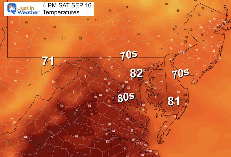
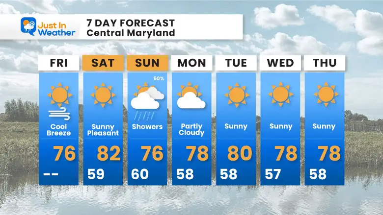
A slight bump in temps on Saturday with the sun, then rain showers will arrive with the next cold front on Sunday.
Morning Temperatures
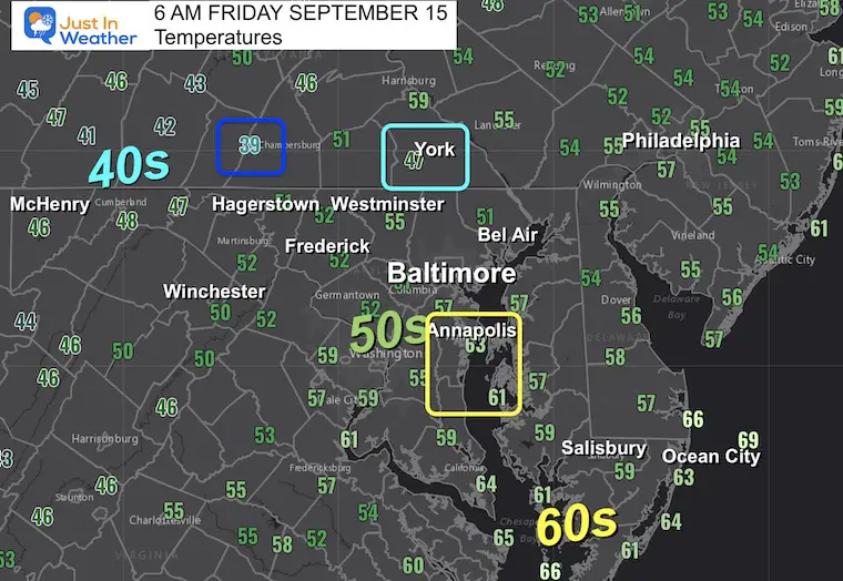
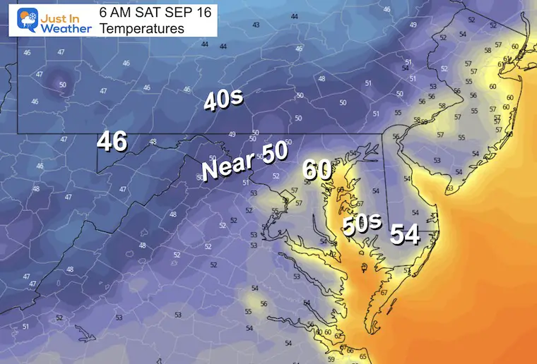
The 40s were not as close as I showed last night but we have pockets in southern PA and western Maryland. Most areas have dropped into the 50s inland away from the cities and Bay water.
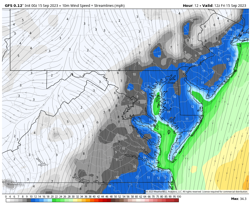
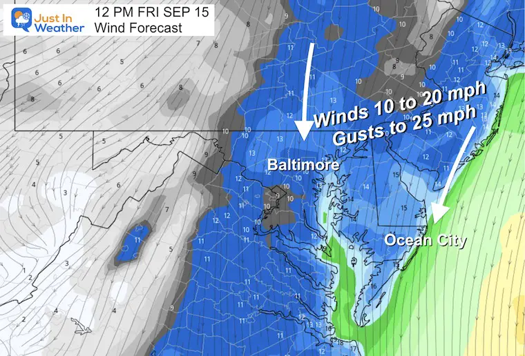
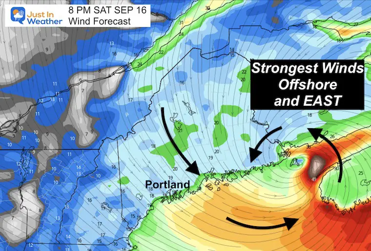
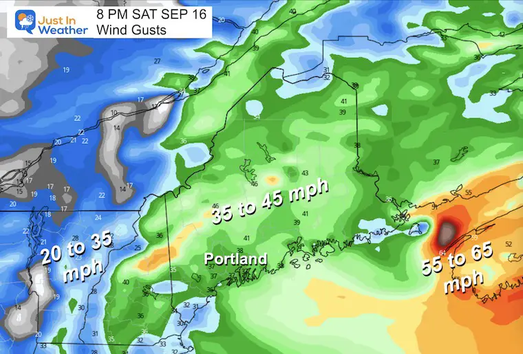
Wind Forecast 8 AM to 8 PM
Snapshot at Noon
The winds FROM the north will be between 10 to 20 mph. Gusts over 20 mph by noon, then easing later in the day. This will help keep temps in the 70s for most of our region.
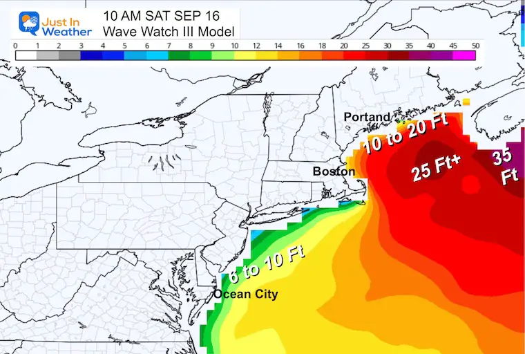
Waves Forecast
Temperature Forecast
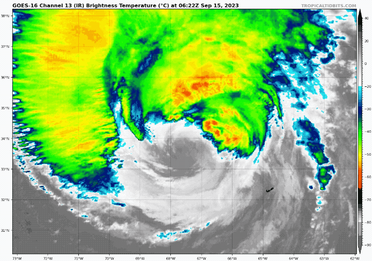
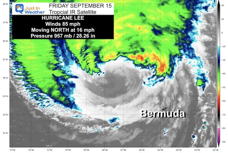
Hurricane Lee Satellite Loop
Holding at Category 1, Hurricane Lee has winds holding at 85 mph. This is now showing signs of spreading out as it moves north, which will be followed by weakening.
- Hurricane Force Winds reach 105 miles from the center.
- Tropical Storm Force Winds reach 320 miles from the center.
National Hurricane Center Advisory
5 AM Update
- LOCATION…34.4N 67.5W
- ABOUT 215 MI…340 KM NW OF BERMUDA
- ABOUT 490 MI…785 KM SSE OF NANTUCKET MASSACHUSETTS
- MAXIMUM SUSTAINED WINDS…85 MPH…140 KM/H
- PRESENT MOVEMENT…N OR 10 DEGREES AT 16 MPH…26 KM/H
- MINIMUM CENTRAL PRESSURE…957 MB…28.26 INCHES
SUMMARY OF WATCHES AND WARNINGS IN EFFECT:
A Hurricane Watch is in effect for…
- Petit Manan Point, Maine to the U.S./Canada border
- New Brunswick from the U.S./Canada border to Point Lepreau, including Grand Manan Island
- Nova Scotia from Digby to Medway Harbour
A Tropical Storm Warning is in effect for…
- Bermuda
- Westport Massachusetts northward to the U.S./Canada border
- Martha’s Vineyard
- Nantucket
- New Brunswick from the U.S./Canada border to Fort Lawrence, including Grand Manan Island
- Nova Scotia from Fort Lawrence to Point Tupper
Forecast Track From The National Hurricane Center
This track is trending to hold for landfall in Nova Scotia, Canada. This keeps Maine and New England on the weaker West side. They will still feel some impact.
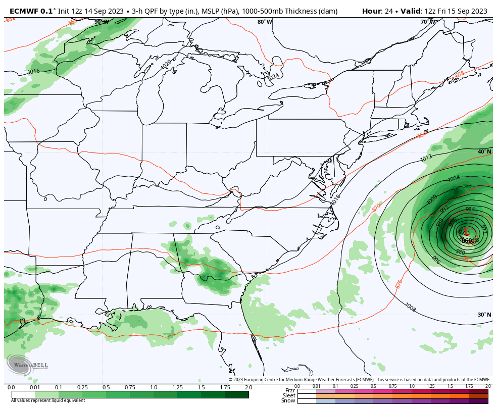
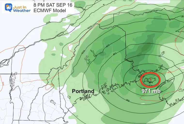
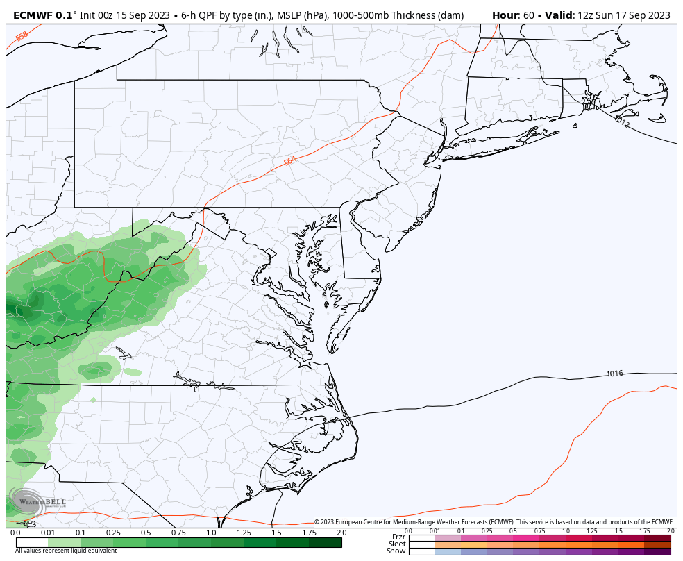
ECMWF Model Forecast
Friday Morning to Saturday Night
Landfall
Saturday Night
Waves
Storm Surge Forecast
- Flushing, NY to U.S./Canada border…1-3 ft
- Long Island Sound…1-3 ft
- Cape Cod…1-3 ft
- Martha’s Vineyard and Nantucket…1-3 ft
- Boston Harbor…1-3 ft
- Rockaway Inlet, NY to Montauk Point, NY…1-2 ft
Winds
CLIMATE DATA: Baltimore
TODAY September 15
Sunrise at 6:48 AM
Sunset at 7:15 PM
Normal Low in Baltimore: 59ºF
Record 40ºF in 1873
Normal High in Baltimore: 80ºF
Record 97ºF 1927
Subscribe for eMail Alerts
Temperature Forecast
Saturday Morning
Cold but not as chilly.
Saturday Afternoon
Sunny and a little milder.
Looking Ahead
Sunday Morning To Monday Evening
The next cold front will arrive with showers on Sunday. Locally this may be an afternoon event, with more to the west of the cities. Then rain at night to the morning by the beaches… followed by the next cool and dry air mass into next week.
Snapshot Sunday
7 Day Forecast
Definitely a bit autumn-like here as we have turned the page on the weather pattern. The blip will be Sunday with showers, then back to dry weather next week.
EXPLORE MORE
EARLIER IN AUGUST: Maryland Trek 10 For These Kids
I will have a follow-up and recap on our amazing week shortly.

Subscribe for eMail Alerts

Please share your thoughts and best weather pics/videos, or just keep in touch via social media
RESTATING MY MESSAGE ABOUT DYSLEXIA
I am aware there are some spelling and grammar typos and occasional other glitches. I take responsibility for my mistakes and even the computer glitches I may miss. I have made a few public statements over the years, but if you are new here, you may have missed it: I have dyslexia and found out during my second year at Cornell University. It didn’t stop me from getting my meteorology degree and being the first to get the AMS CBM in the Baltimore/Washington region. One of my professors told me that I had made it that far without knowing and to not let it be a crutch going forward. That was Mark Wysocki, and he was absolutely correct! I do miss my mistakes in my own proofreading. The autocorrect spell check on my computer sometimes does an injustice to make it worse. I also can make mistakes in forecasting. No one is perfect at predicting the future. All of the maps and information are accurate. The ‘wordy’ stuff can get sticky. There has been no editor who can check my work when I need it and have it ready to send out in a newsworthy timeline. Barbara Werner is a member of the web team that helps me maintain this site. She has taken it upon herself to edit typos when she is available. That could be AFTER you read this. I accept this and perhaps proves what you read is really from me… It’s part of my charm.


