September 11, 2023
Monday Morning Update
Today is September 11, 22 years after the attack on our nation. Never forget those who lost their lives.
Hurricane Lee truly has mood swings. After the record ramp up to Category 5, it was back to a Category 2 yesterday. Now it is a Major Hurricane again. Winds this morning are at 120 mph, making it a Category 3. Further strengthening is expected. What is new is the timing and track, which may allow it to creep closer to New England.
Locally we have a morning cluster of thunderstorms crossing central Maryland and centered on metro Baltimore. I have the Live Radar and Lighting Widget plus our forecast below. A series of cold fronts will swing through midweek and bring in autumn air in a few days.
Let’s begin once again with the Hurricane….
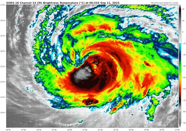
Hurricane Lee Satellite Loop
Back up to Category 3, Hurricane Lee has winds of 120 mph. It has moved away from the wind shear, allowing it to regenerate. Further strengthening is likely today.
- Hurricane Force Winds reach 75 miles from the center.
- Tropical Storm Force Winds reach 185 miles from the center.
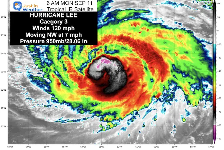
National Hurricane Center Advisory
5 AM Update
- LOCATION…23.1N 62.6W
- ABOUT 340 MI…545 KM N OF THE NORTHERN LEEWARD ISLANDS
- ABOUT 650 MI…1045 KM SSE OF BERMUDA
- MAXIMUM SUSTAINED WINDS…120 MPH…195 KM/H
- PRESENT MOVEMENT…NW OR 310 DEGREES AT 7 MPH…11 KM/H
- MINIMUM CENTRAL PRESSURE…950 MB…28.06 INCHES
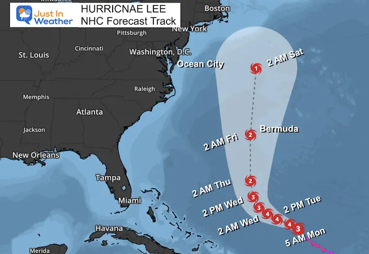
Forecast Track From The National Hurricane Center
We see the Major Hurricane Intensity holding for a few days… then strengthen back up to Category 4. A close pass to Bermuda, but still to the west. It will weaken as it moves north.
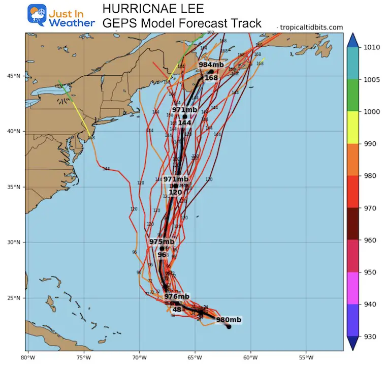
Longer Range Guidance
GEPS Member Spread
We continue to see a turn to the North AWAY from the US East Coast. This plot now shifts the final landfall west towards eastern New England.
Forecast Animation:
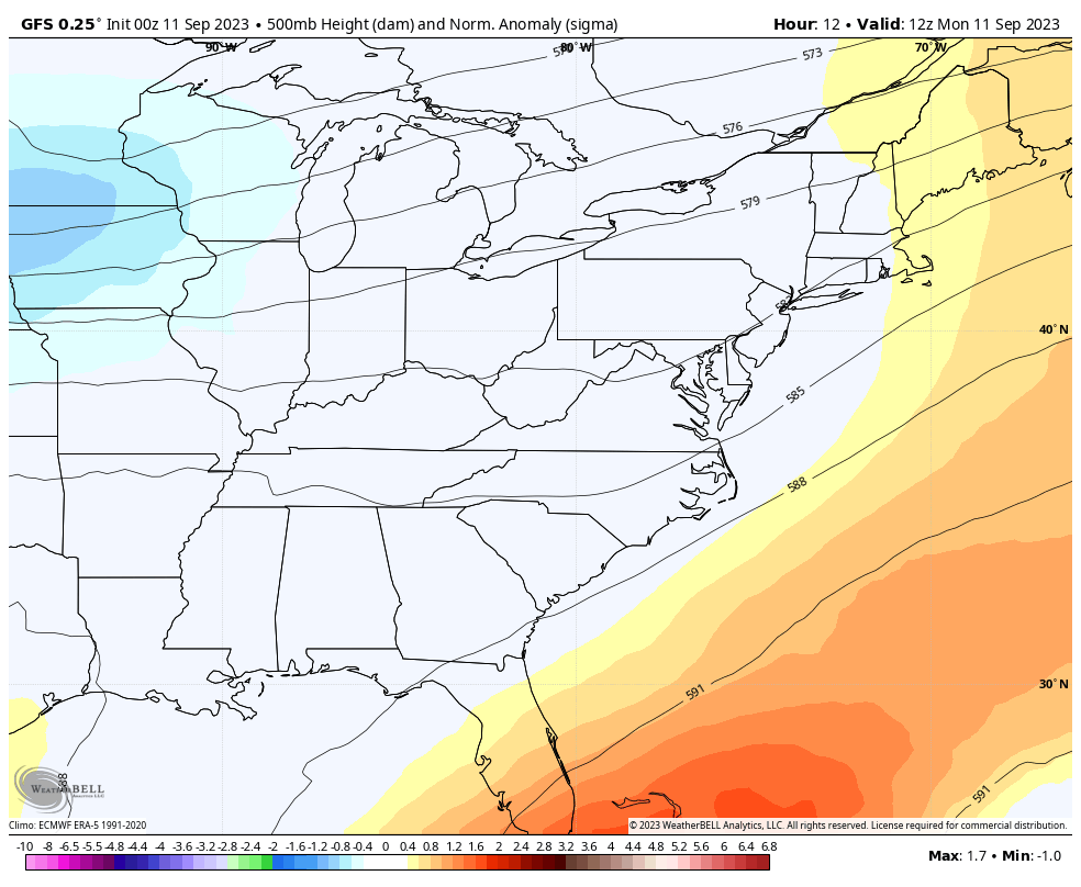
Jet Stream GFS Model
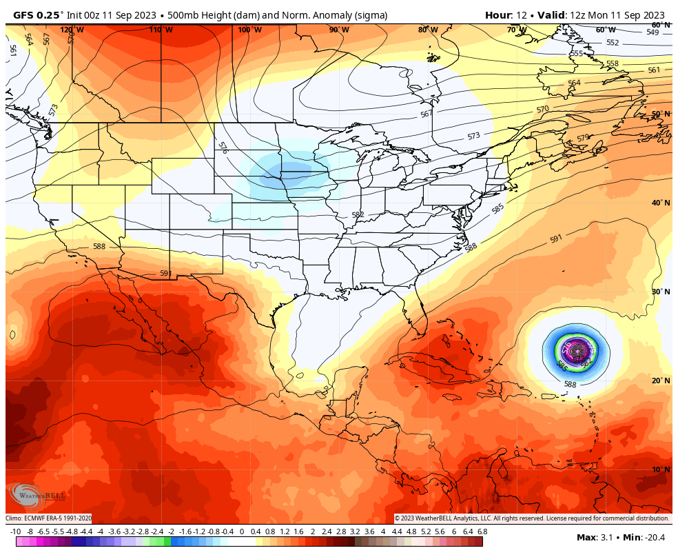
The cooling and wet pattern that will shift to the Eastern US (see more below) will be part of a trough we expect will help curve and shift Lee away from the Mid-Atlantic.
The new concern is the timing. Here we see a slow down of Hurricane Lee allowing it to slip up behind the trough and maybe closer to New England.
I would not lock in on this yet. If we see two more model runs with this solution, then we can consider this landfall more possible.
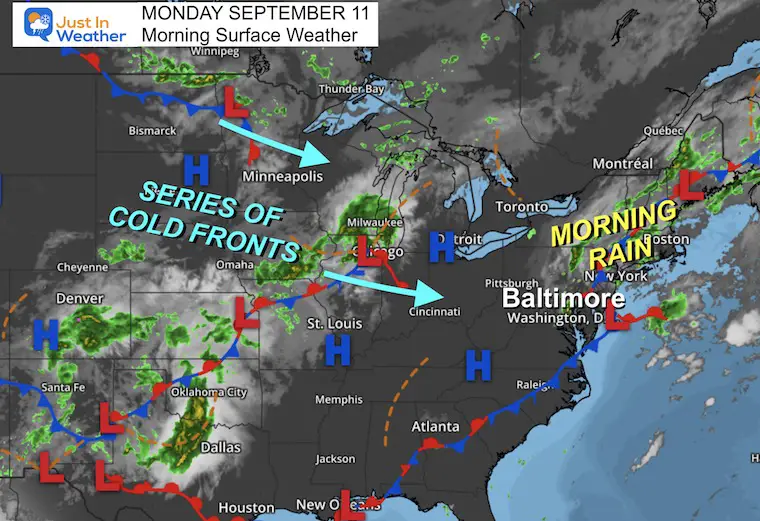
Morning Surface Weather
A stationary front has kept the Mid-Atlantic soggy. Overnight and early morning rain will be moving through for the morning commute, then allowing a break later this morning into the mid-day.
This is unsettled and still may develop more storms during the afternoon.
A series of cold fronts will be arriving from the north central US. They will finally sweep through Wednesday, followed by an autumn chill and pushing Hurricane Lee off of our coast.
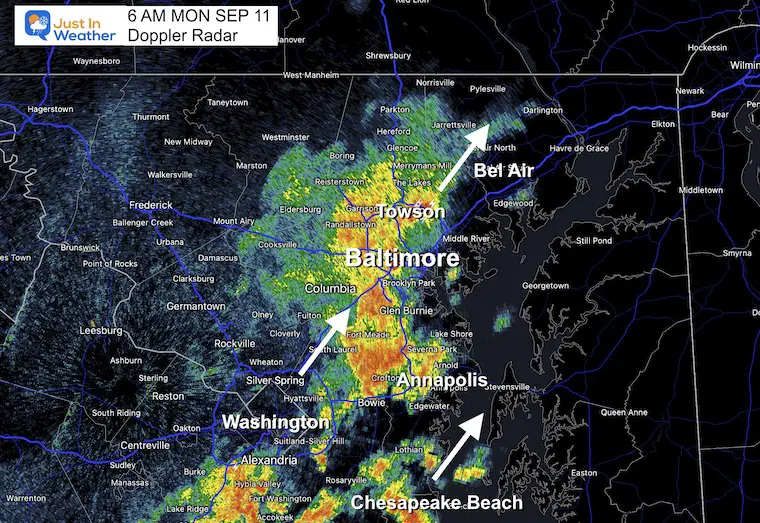
6 AM Doppler Radar
A cluster of heavy rain and thunderstorms was continuing to develop before sunrise. This included more lighting strikes as seen here over Towson.
The cells were moving slowly North-Northeast and will take a few hours to move through to the eastern counties.
Live Radar and Lightning Widget
Radar Simulation
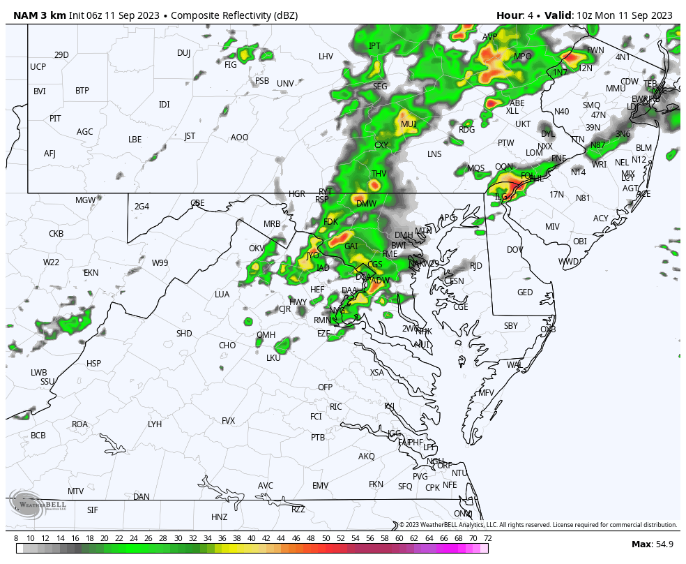
NAM 3 Km Model 6 AM Sun to 8 PM
This model has underperformed but is the only one that handled this morning’s rain across central Maryland. While it looks unimpressive this afternoon, we need to still consider more scattered showers and thunderstorms that may flare up than shown here.
Timing will be after 2 PM.
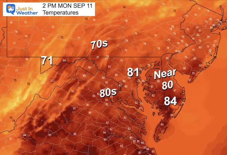
Afternoon Temperatures
With more clouds, this should be a nearly seasonable day like yesterday.
CLIMATE DATA: Baltimore
TODAY September 11
Sunrise at 6:44 AM
Sunset at 7:22 PM
Normal Low in Baltimore: 61ºF
Record 43ºF in 1917
Normal High in Baltimore: 82ºF
Record 100ºF 1983
Subscribe for eMail Alerts
Temperature Forecast
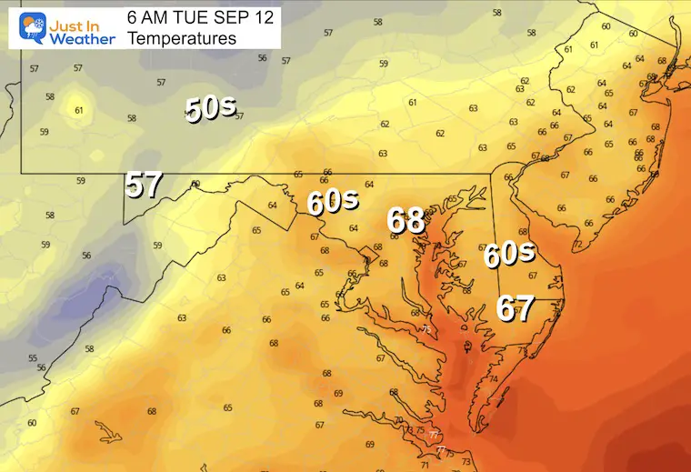
Tuesday Morning
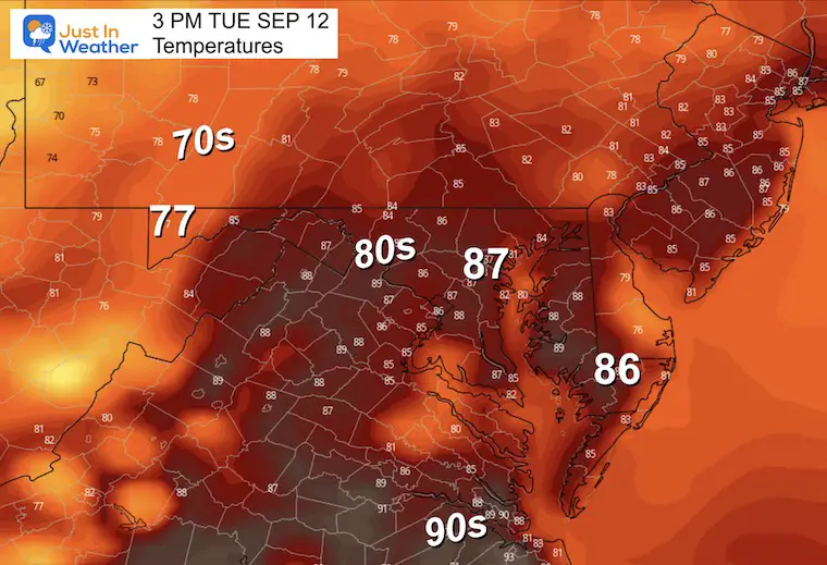
Tuesday Afternoon
Back to the warm and humid air again. This will feed into more thunderstorms.
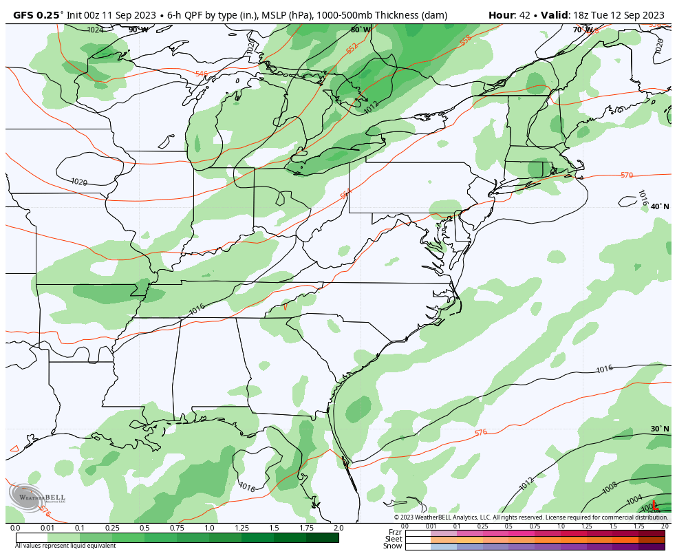
Rain Forecast: Tuesday to Sunday
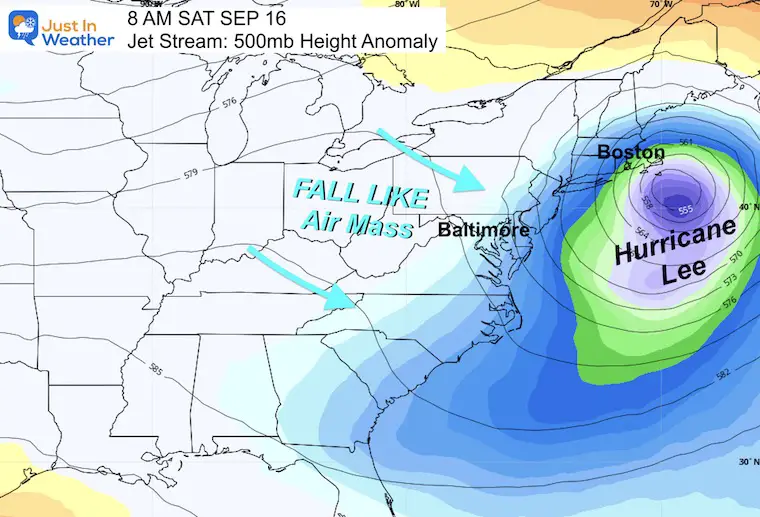
The pattern for daily storms will last into Wednesday. More likely pulsing late day and overnight… even into the mornings again. Then the front clears the coast… AND we can see Hurricane Lee passing well to our east. This will get steered away as a strong, cool, Canadian Fall Like air mass settles in.
There is concern now for some impact on Eastern New England.
Jet Stream: Monday to Sunday
This is the same time frame as the wider view I showed above with Hurricane Lee. We can see it here on the right edge staying well off our coast.
Snapshot Saturday
The concern is that the slowdown of Lee will allow our next Autumn Air Mass to move through, allowing Lee to sneak up farther west behind the trough. This is still many days away, so worth watching but not locking in on this new solution yet.
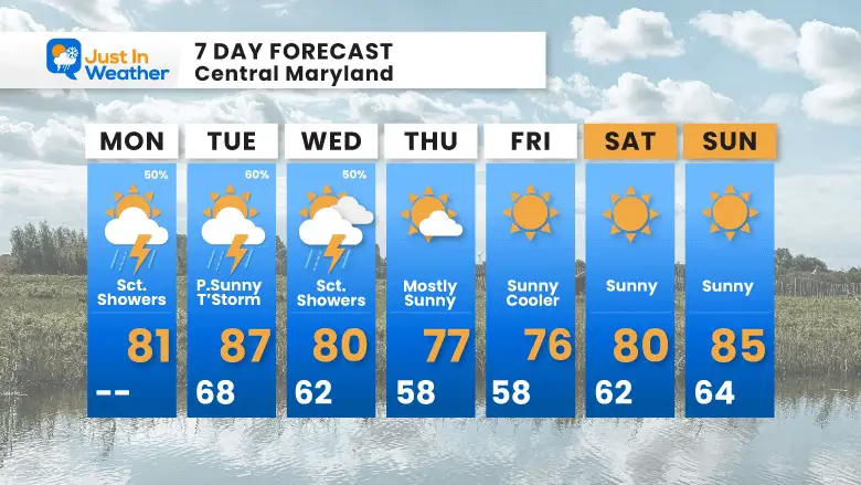
7 Day Forecast
The risk of rain will last into Wednesday. Once that front reaches the coast, it should both steer Lee away AND usher in cooler early Autumn weather for us. A long stretch of sunny days is expected. Some mornings will be in the 50s, perhaps 40s well inland! Then warming over the weekend.
EXPLORE MORE
EARLIER IN AUGUST: Maryland Trek 10 For These Kids
I will have a follow-up and recap on our amazing week shortly.

Subscribe for eMail Alerts

Please share your thoughts and best weather pics/videos, or just keep in touch via social media
RESTATING MY MESSAGE ABOUT DYSLEXIA
I am aware there are some spelling and grammar typos and occasional other glitches. I take responsibility for my mistakes and even the computer glitches I may miss. I have made a few public statements over the years, but if you are new here, you may have missed it: I have dyslexia and found out during my second year at Cornell University. It didn’t stop me from getting my meteorology degree and being the first to get the AMS CBM in the Baltimore/Washington region. One of my professors told me that I had made it that far without knowing and to not let it be a crutch going forward. That was Mark Wysocki, and he was absolutely correct! I do miss my mistakes in my own proofreading. The autocorrect spell check on my computer sometimes does an injustice to make it worse. I also can make mistakes in forecasting. No one is perfect at predicting the future. All of the maps and information are accurate. The ‘wordy’ stuff can get sticky. There has been no editor who can check my work when I need it and have it ready to send out in a newsworthy timeline. Barbara Werner is a member of the web team that helps me maintain this site. She has taken it upon herself to edit typos when she is available. That could be AFTER you read this. I accept this and perhaps proves what you read is really from me… It’s part of my charm.
#FITF


