


May 9 Cooler With Rain And Severe Storm Risk Tonight South
Thursday May 9 Morning Report Today is the first day of the year with sunrise before 6 AM in Baltimore, but we won’t see it. After a high temperature of…
Friday Afternoon Update
For the second day in a row, we have the risk of developing storms that may turn severe. A stationary frontal boundary is stalled over our region and will work with the heat and humidity to build up storms that could turn severe.
This setup is a little later than yesterday. Storms are more likely late afternoon through this evening. Perhaps some lingering storms overnight as well.
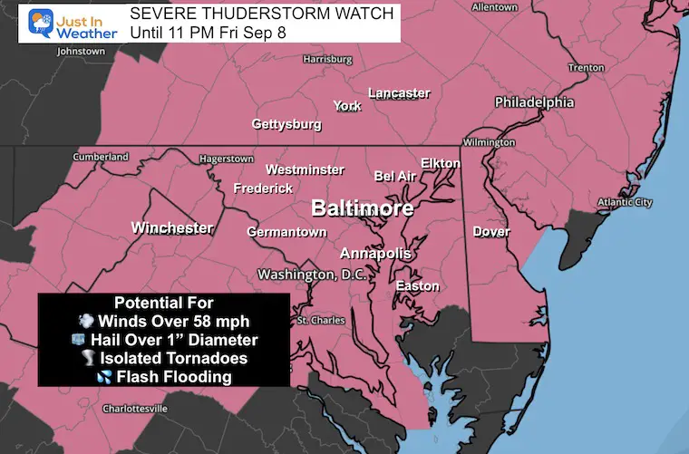
A Watch is for a broad area. This would be for a higher POTENTIAL of severe storms. NOT A PROMISE.
A Warning is issued for active storms in progress. These will be tracked for around 45 minutes or so across counties and specific towns in the path.
The potential exists for storms to form. Not all, but some may produce damaging winds over 58 mph, hail over 1 inch in diameter, isolated tornadoes, and or flash flooding.
I have a list of the counties included by state below the Live Radar.
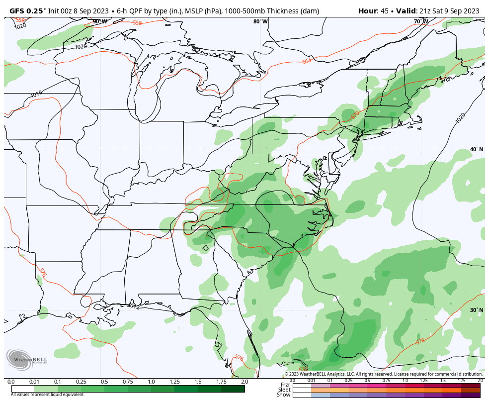
This stationary front will be with us through the weekend, so we may have to continue and deal with this risk each afternoon and evening.
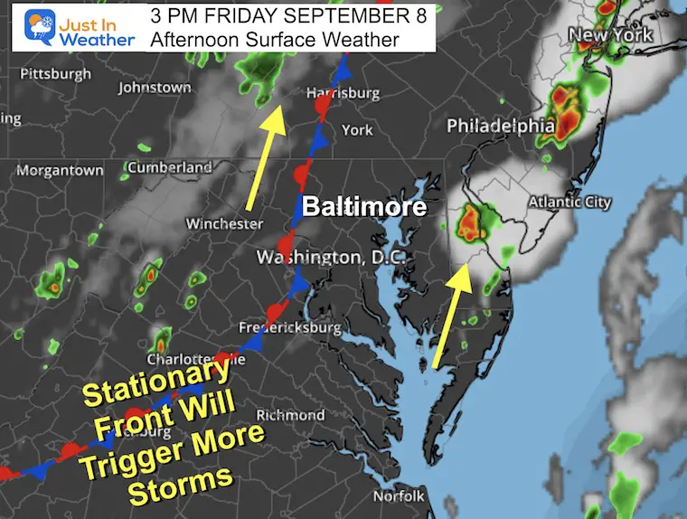
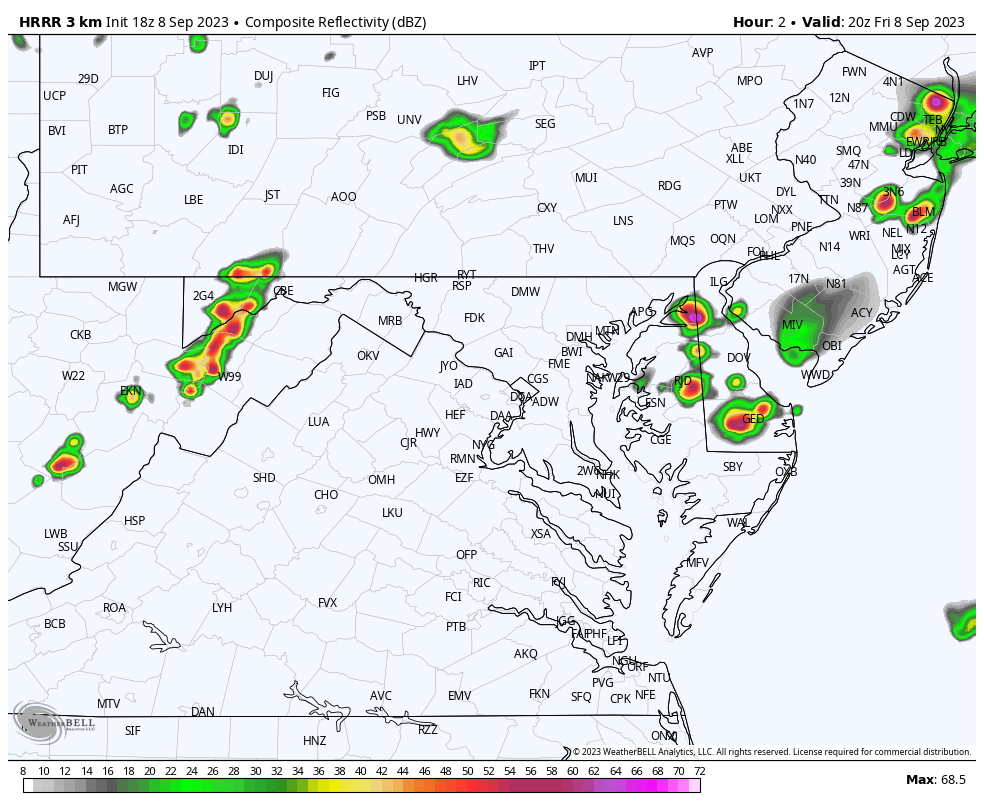
Here we can see the flow from South to North.
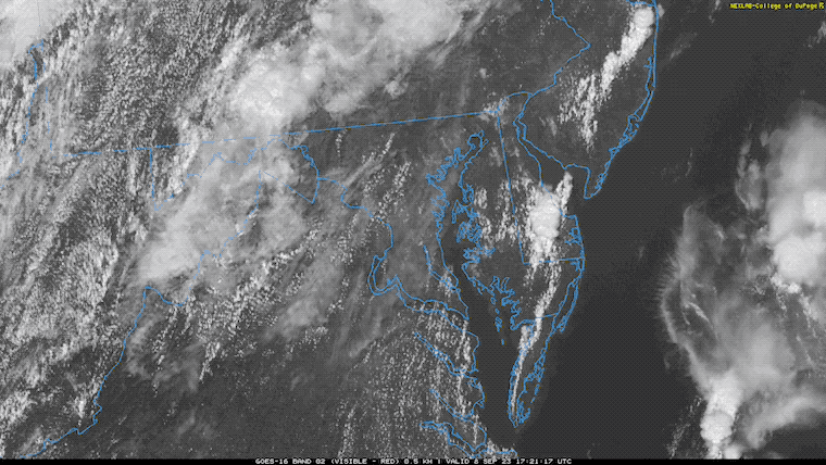
Over Delaware, there was already a severe thunderstorm, which can be tracked with the explosive cloud expansion after 1 PM.
See the setup and forecast maps below.
MARYLAND COUNTIES INCLUDED ARE
ALLEGANY ANNE ARUNDEL BALTIMORE
CALVERT CAROLINE CARROLL
CECIL CHARLES FREDERICK
HARFORD HOWARD KENT
MONTGOMERY PRINCE GEORGE’S QUEEN ANNE`S
ST. MARYS TALBOT WASHINGTON
PENNSYLVANIA COUNTIES INCLUDED ARE
ADAMS BEDFORD BERKS
BUCKS CARBON CHESTER
COLUMBIA CUMBERLAND DAUPHIN
DELAWARE FRANKLIN FULTON
HUNTINGDON JUNIATA LACKAWANNA
LANCASTER LEBANON LEHIGH
LUZERNE MIFFLIN MONROE
MONTGOMERY MONTOUR NORTHAMPTON
NORTHUMBERLAND PERRY PHILADELPHIA
PIKE SCHUYLKILL SNYDER
UNION WAYNE WYOMING
YORK
VIRGINIA COUNTIES INCLUDED ARE
ALBEMARLE ARLINGTON AUGUSTA
CLARKE CULPEPER FAIRFAX
FAUQUIER FREDERICK GREENE
HIGHLAND KING GEORGE LOUDOUN
MADISON NELSON ORANGE
PAGE PRINCE WILLIAM RAPPAHANNOCK
ROCKINGHAM SHENANDOAH SPOTSYLVANIA
STAFFORD WARREN
VIRGINIA INDEPENDENT CITIES INCLUDED ARE
ALEXANDRIA CHARLOTTESVILLE FAIRFAX
FALLS CHURCH FREDERICKSBURG HARRISONBURG
MANASSAS MANASSAS PARK STAUNTON
WAYNESBORO WINCHESTER
This Slight Risk is Level 2 of 5. It is a potential and NOT a promise. There will be scattered thunderstorms, some of which may reach severe levels.
These may produce winds over 58 mph, hail over 1 inch in diameter, isolated tornados, or even flash flooding.
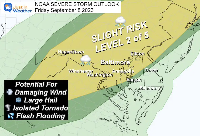
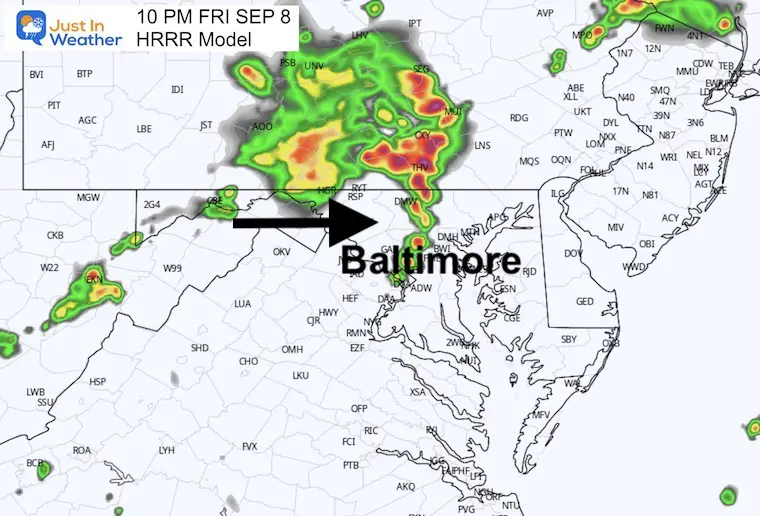
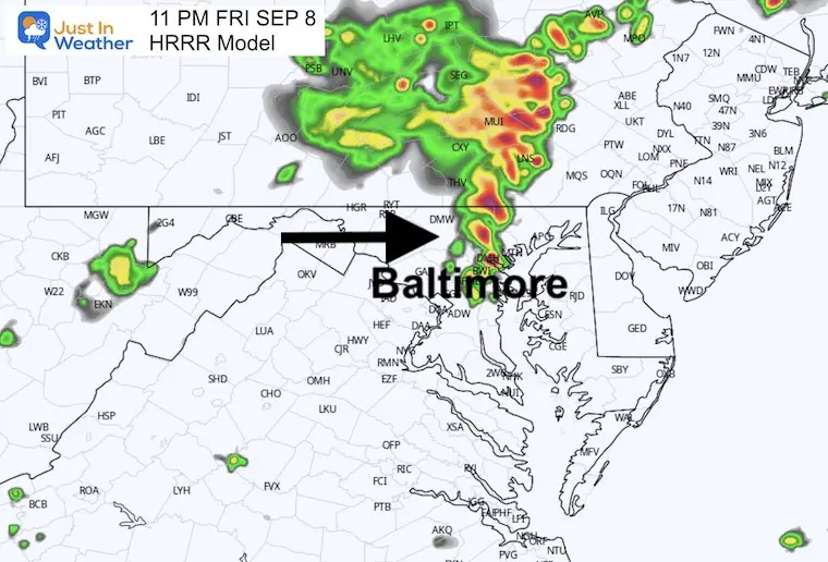
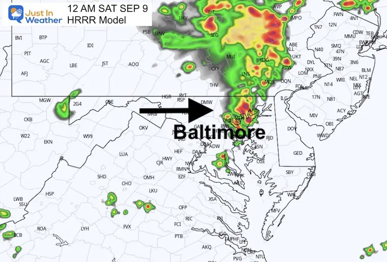
This is still underperforming, but still a guide for the formation. I would expect more than shown here.
We do see the best chance for metro Baltimore after 9 PM, with lingering storms after midnight.
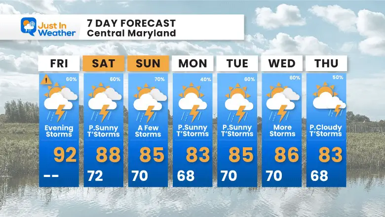
We will remain unsettled with a chance for storms each day and evening. This will be mostly pulsing with the heating of the day.
I am showing the extended look into next Friday so we can see how this should steer Hurricane Lee (right side) away from the East Coast.
The same unsettled pattern that will bring us a chance of rain each day will also help to steer Hurricane Lee off the coast.
The rain risk does not promise you will get it each day, but it is worth considering in your plans.
I will have a follow-up and recap on our amazing week shortly.


I am aware there are some spelling and grammar typos and occasional other glitches. I take responsibility for my mistakes and even the computer glitches I may miss. I have made a few public statements over the years, but if you are new here, you may have missed it: I have dyslexia and found out during my second year at Cornell University. It didn’t stop me from getting my meteorology degree and being the first to get the AMS CBM in the Baltimore/Washington region. One of my professors told me that I had made it that far without knowing and to not let it be a crutch going forward. That was Mark Wysocki, and he was absolutely correct! I do miss my mistakes in my own proofreading. The autocorrect spell check on my computer sometimes does an injustice to make it worse. I also can make mistakes in forecasting. No one is perfect at predicting the future. All of the maps and information are accurate. The ‘wordy’ stuff can get sticky. There has been no editor who can check my work when I need it and have it ready to send out in a newsworthy timeline. Barbara Werner is a member of the web team that helps me maintain this site. She has taken it upon herself to edit typos when she is available. That could be AFTER you read this. I accept this and perhaps proves what you read is really from me… It’s part of my charm.
#FITF