


May 12 Mothers Day Showers And Another Aurora Viewing Tonight May Be Better
Sunday May 12 Mother's Day Morning Report Today, we focus on the all-important Mother’s Day weather and the ongoing impact of the latest Solar Storm. We have been stuck in…
September 8, 2023
Friday Morning Update
There are two major weather stories today and each one deserves the time. The biggest event is Hurricane Lee which reached Category 5 intensity overnight in record time. It now has winds of 165 mph and may still get stronger today. We will explore the latest info and long-range forecast into next week.
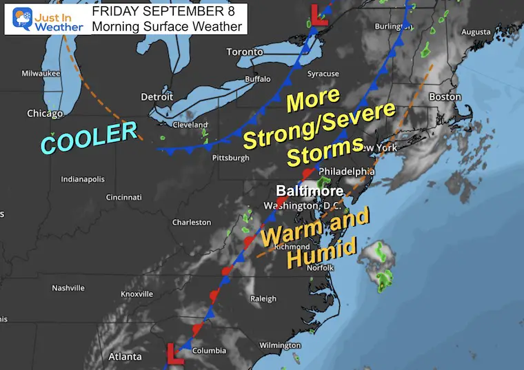
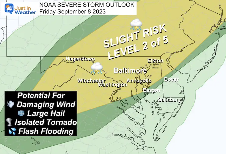
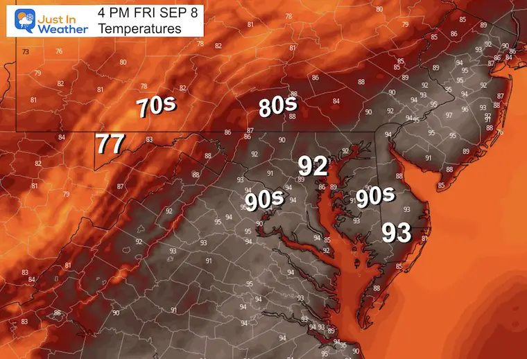
The other story is our local weather. After 98ºF yesterday in Baltimore, we did not reach a record for the first time this week. That was broken with an eruption of severe storms and large hail. Today we have another Risk for severe storms.
Let’s begin with the Hurricane…
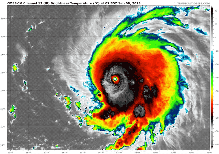
Record explosive development: We now are looking at a Category 5 Hurricane with winds of 165 mph.
This may look ragged at times but appears to be undergoing an eyewall replacement cycle, part of a major hurricane engine life cycle to maintain or increase growth.
Hurricane Force Winds reach 45 miles from the center.
Tropical Storm Force Winds reach 140 miles from the center.
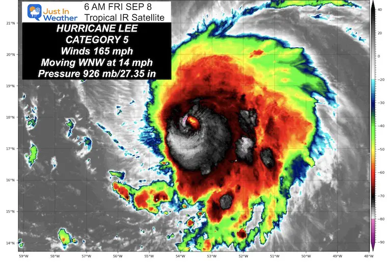
This is expected to remain a major hurricane for the next 5 days, with a gradual drop back to Category 4 as it runs into slightly cooler water and upper level winds that will eventually turn it North.
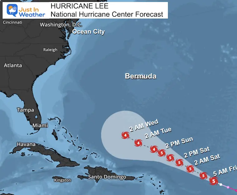
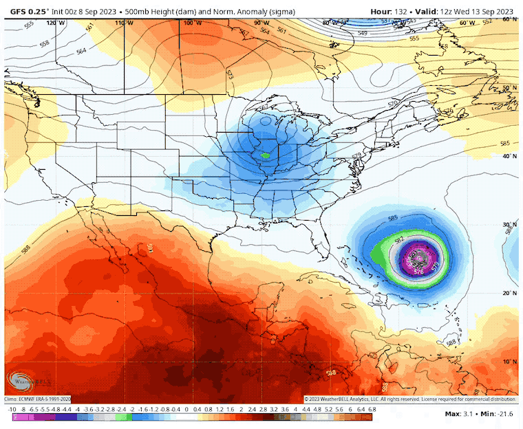
We continue to see an eventual turn to the North missing the US. There is a wide spread of where it will go from there, but more than likely NOT hitting the US. New England to Nova Scotia still need to pay attention.
The cooling and wet pattern that will shift to the Eastern US (see more below) will be part of a trough we expect will help curve and shift Lee away from the US mainland.
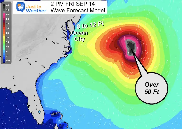
High Surf for sure with the far pass off the coast.
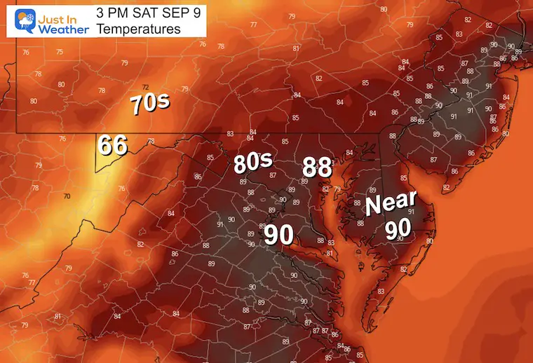
Hot and more humid today, but not reaching the record. This time we have a cold front approaching that will help ignite showers and severe storms.
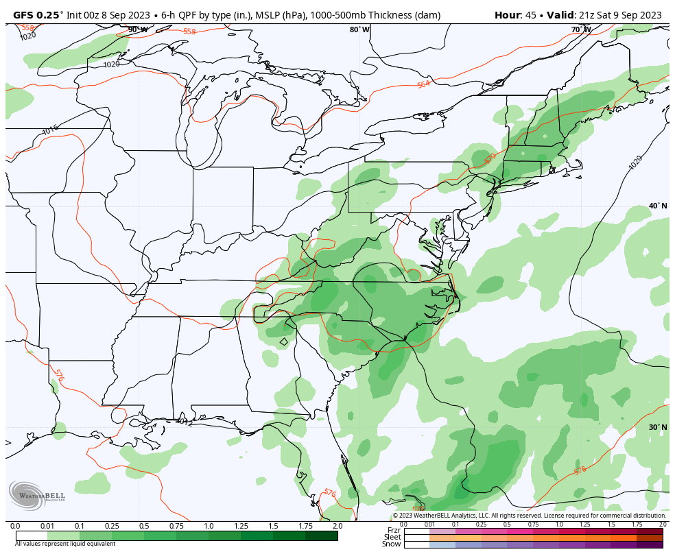
I am sorry the map looks ‘off’ today. I have an issue with my graphics program and put this together as a backup in a rush.
This is NOT a promise there will be storms that turn severe. Just a higher chance they could occur from the mountains through central Virginia, Maryland, and Pennsylvania.
Hot but no records. The humidity will make it feel uncomfortable again. This will also help to fuel the developing storms.
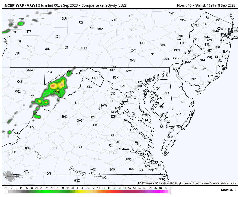
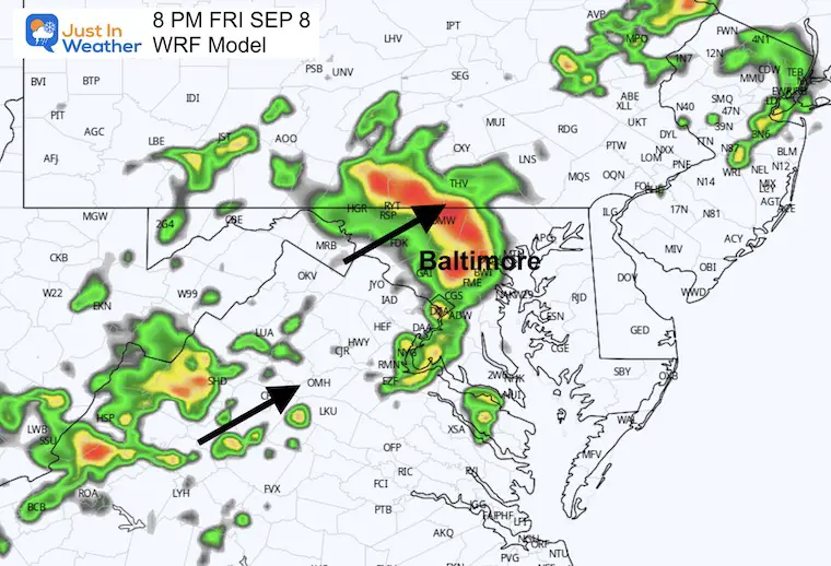
The better chance for storms will be after 4 PM through this evening and midnight.
Sunrise at 6:41 AM
Sunset at 7:27 PM
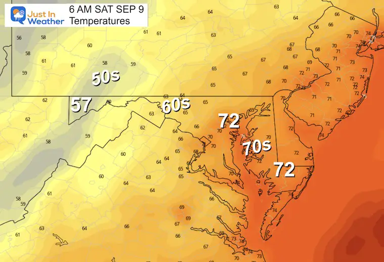
Normal Low in Baltimore: 62ºF
Record 46ºF in 1962
Normal High in Baltimore: 82ºF
Record 100ºF 1938
New Report: Winter Outlook 2024 From Two Farmers Almanacs
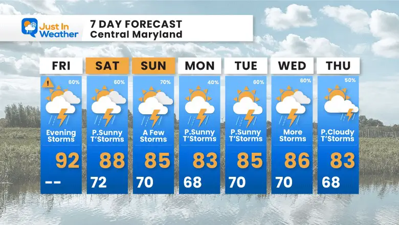
We will remain unsettled with a chance for storms each day and evening. This will be mostly pulsing with the heating of the day.
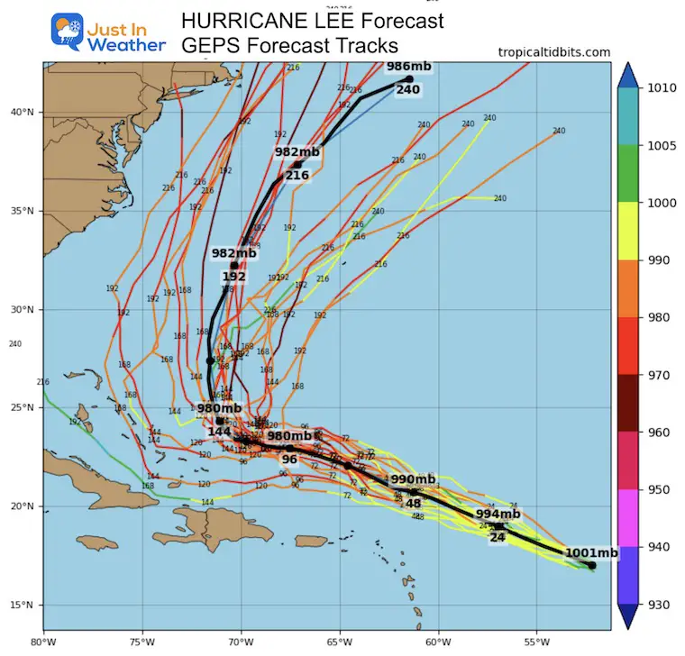
I am showing the extended look into next Friday so we can see how this should steer Hurricane Lee (right side) away from the East Coast.
The same unsettled pattern that will bring us a chance of rain each day will also help to steer Hurricane Lee off the coast.
The rain risk does not promise you will get it each day, but it is worth considering in your plans.
I will have a follow-up and recap on our amazing week shortly.


I am aware there are some spelling and grammar typos and occasional other glitches. I take responsibility for my mistakes and even the computer glitches I may miss. I have made a few public statements over the years, but if you are new here, you may have missed it: I have dyslexia and found out during my second year at Cornell University. It didn’t stop me from getting my meteorology degree and being the first to get the AMS CBM in the Baltimore/Washington region. One of my professors told me that I had made it that far without knowing and to not let it be a crutch going forward. That was Mark Wysocki, and he was absolutely correct! I do miss my mistakes in my own proofreading. The autocorrect spell check on my computer sometimes does an injustice to make it worse. I also can make mistakes in forecasting. No one is perfect at predicting the future. All of the maps and information are accurate. The ‘wordy’ stuff can get sticky. There has been no editor who can check my work when I need it and have it ready to send out in a newsworthy timeline. Barbara Werner is a member of the web team that helps me maintain this site. She has taken it upon herself to edit typos when she is available. That could be AFTER you read this. I accept this and perhaps proves what you read is really from me… It’s part of my charm.
#FITF