


May 11 Aurora Viewing Forecast Weather And More Photos
Saturday May 11, 2024 The display of Northern Lights last night was historic. As the name implies, this is more common in the Northern Latitudes. On rare occasions we can…
September 6, 2023
Wednesday Morning Update
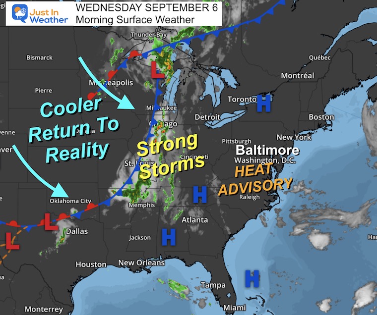
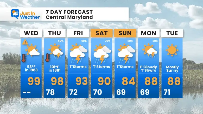
The expectations have been verified so far this week. We have had three days in a row with record-high temperatures, and today should be the 4th! The difference now is increased humidity and decreased comfort. As a result, Heat Advisories have been issued for a wide area.
The heat will begin to break down tomorrow with the return of storms. We need the rain!
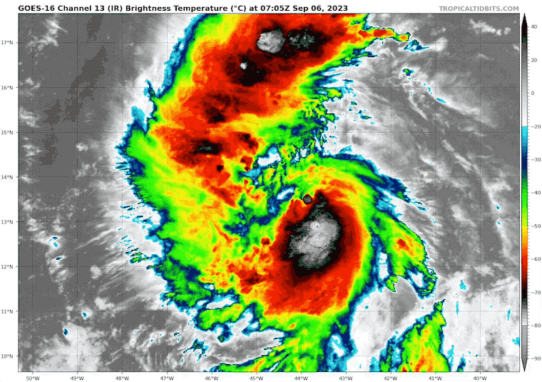
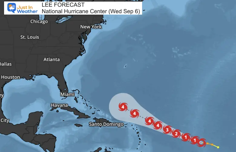
Additionally, Tropical Storm Lee has formed. Here is a brief look at what we know.
Record Highs For Baltimore
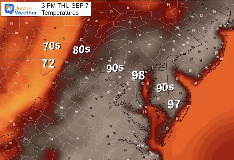
A 3rd record high in a row was broken for Baltimore yesterday with another high temperature at 99ºF. We have a chance to tie or break new records again today. That would make 4 days in a row, matching a record September heat wave in 1970.
(Sun) Sept 3 = 97ºF in 1898 – Broken with 1 minute at 98ºF
(Mon) Sept 4 = 96ºF in 2019+ – Broken with 99ºF
(Tue) Sept 5 = 96ºF in 1954 – Broken with 99ºF
(Wed) Sept 6 = 98ºF in 1983
——Expected Cooling This Week——
(Thu) Sept 7 = 101ºF in 1881 *Hottest September day for Baltimore
(Fri) Sept 8 = 100ºF in 1939
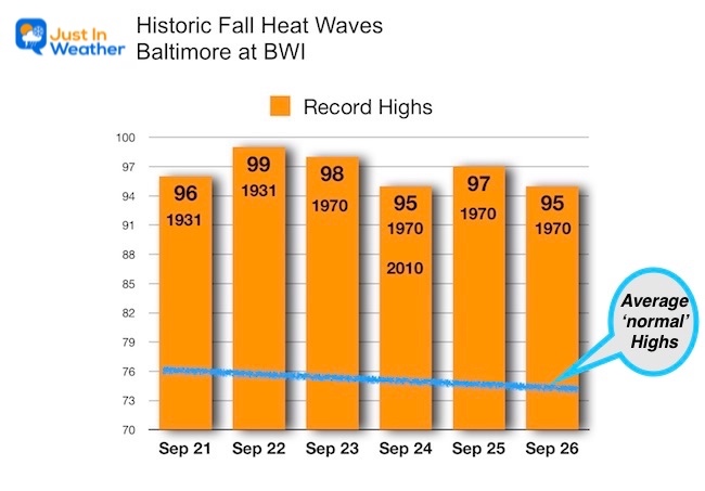
Before the sensationalism you may hear this week, long-duration record heat waves have happened in September before.
Here are the late September records for Baltimore. In 1931, there were two records for the 21st and 22nd, which were the 3rd records for that year/month.
1970: September 23 to 26 had 4 days with record highs. The 24th was tied in 2010 and may be the one that shows up on some apps/news reports.
New Report:
Winter Outlook 2024 From Two Farmers Almanacs
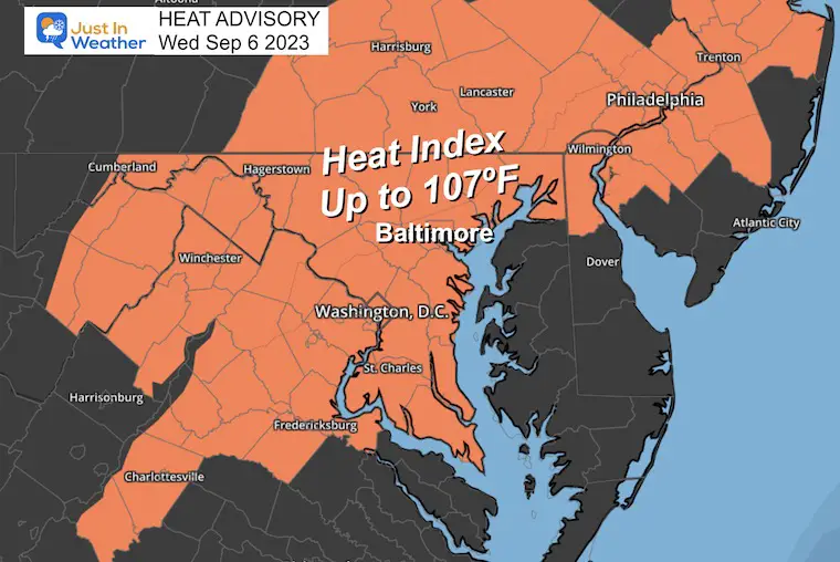
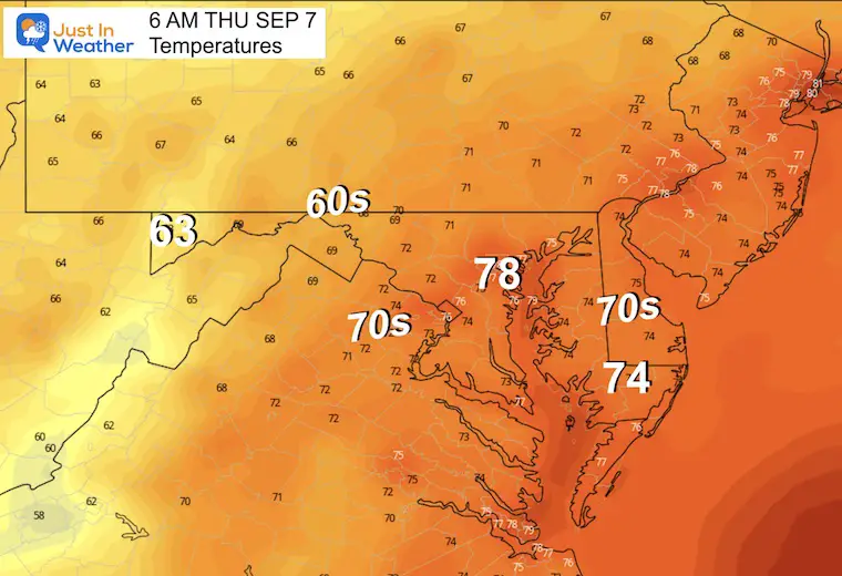
Already a hot start and more humidity has prompted a Heat Advisory.
Relief is in sight with an approaching cold front. This will bring in more clouds and storms to cool us down starting tomorrow.
That front may stall overhead and keep the rain risk through the weekend.
The humidity has crept up and as a result, the high temperatures will feel hotter. So while the actual temperatures will be similar, it may feel as hot as 107ºF in these areas.
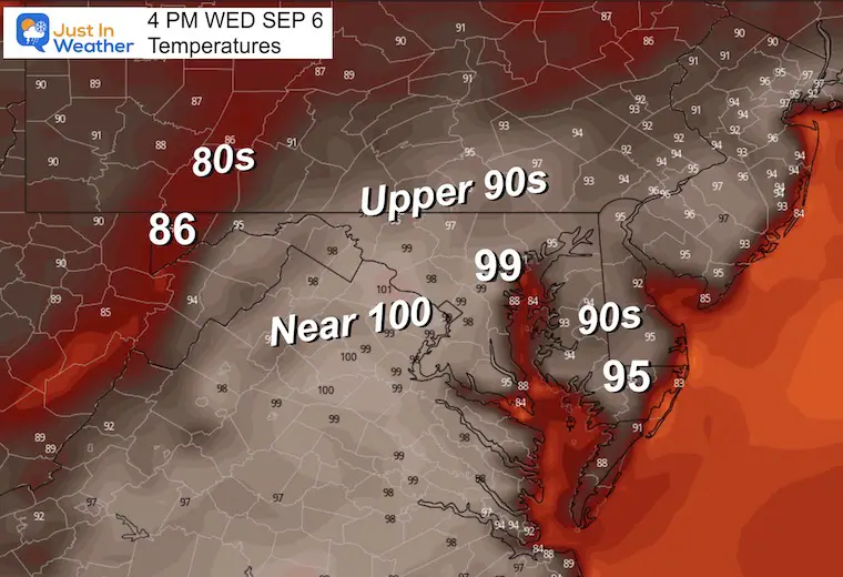
Here comes the heat! The record high in Baltimore was 98ºF in 1983. We are likely to break that at BWI today.
This was named yesterday and is expected to become a major hurricane. The realistic expectation is that it will remain over the ocean but like Franklin and Idalia, send high waves to the East Coast.
SUMMARY OF 500 AM AST…0900 UTC…INFORMATION
———————————————-
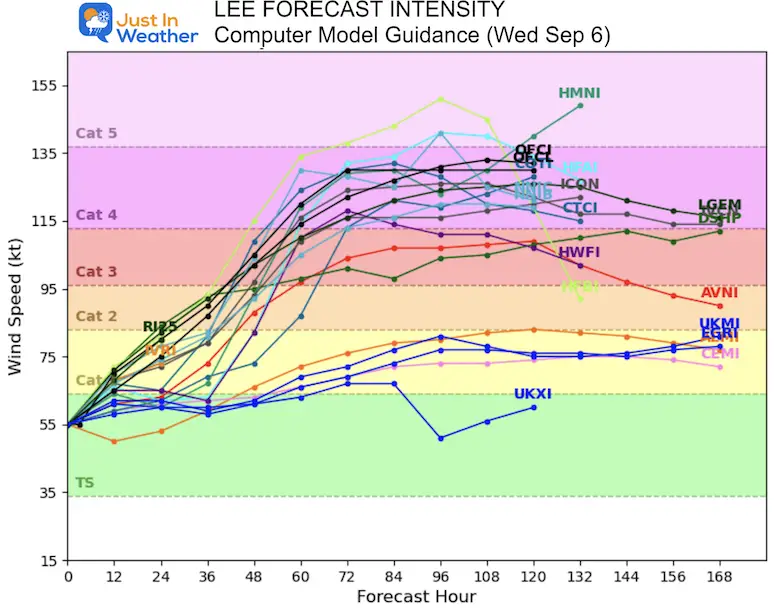
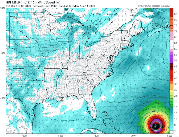
I still do not trust this model beyond 5 days… It has already shown the track shifting to curve north well before it reaches the East Coast.
Sunrise at 6:40 AM
Sunset at 7:30 PM
Normal Low in Baltimore: 62ºF
Record 46ºF in 1962
Normal High in Baltimore: 83ºF
Record 98ºF 1983
Click the image to see the full report, including Maryland, Pennsylvania, Virginia, and West Virginia.
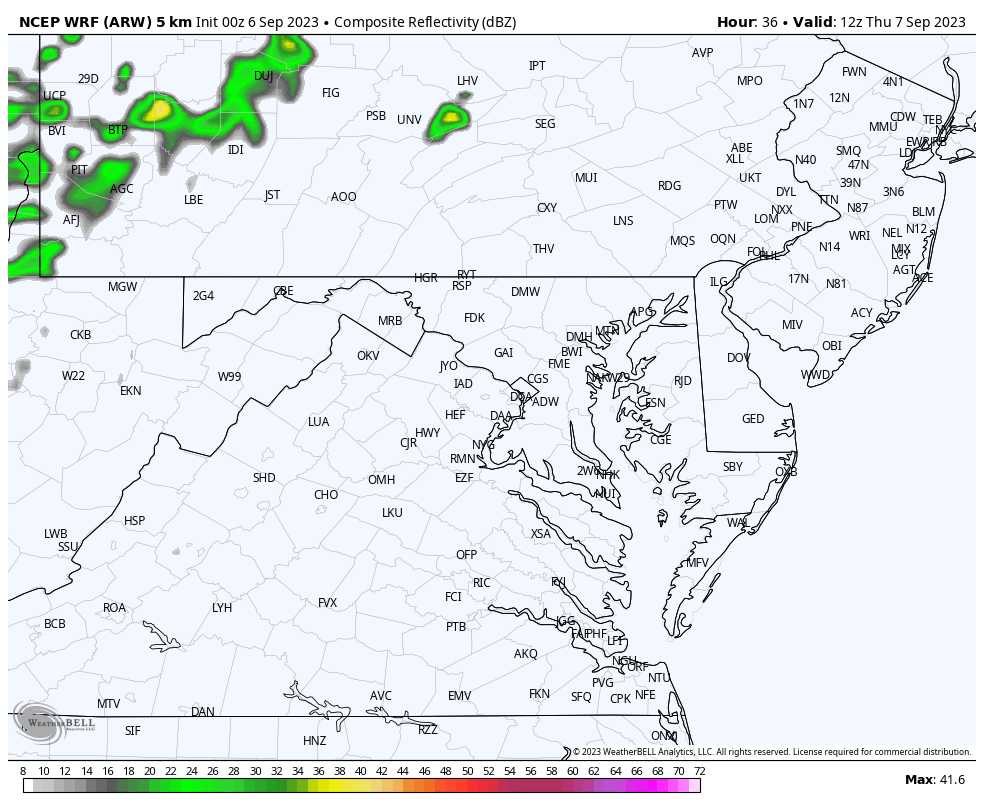
Showers and thunderstorms are expected to pop up early in the afternoon and last through the night. There may be some severe storms working off the high temperatures as additional energy.
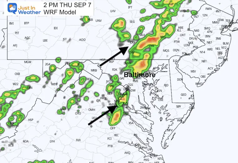
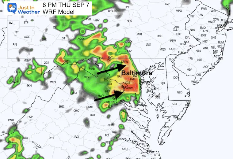
Increased chance for daily storms especially in the afternoon and evenings for the next 4 days. They will peak into the weekend, then fade to scattered showers on Monday.
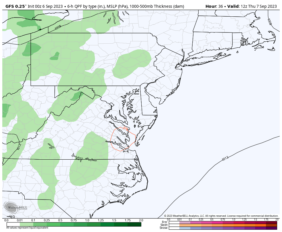
We may get a 4th record high in a row, then fall just short tomorrow as more clouds, showers, and thunderstorms move in. That front is expected to stall and keep the risk of rain around for the next 4 days.
I will have a follow-up and recap on our amazing week shortly.


I am aware there are some spelling and grammar typos and occasional other glitches. I take responsibility for my mistakes and even the computer glitches I may miss. I have made a few public statements over the years, but if you are new here, you may have missed it: I have dyslexia and found out during my second year at Cornell University. It didn’t stop me from getting my meteorology degree and being the first to get the AMS CBM in the Baltimore/Washington region. One of my professors told me that I had made it that far without knowing and to not let it be a crutch going forward. That was Mark Wysocki, and he was absolutely correct! I do miss my mistakes in my own proofreading. The autocorrect spell check on my computer sometimes does an injustice to make it worse. I also can make mistakes in forecasting. No one is perfect at predicting the future. All of the maps and information are accurate. The ‘wordy’ stuff can get sticky. There has been no editor who can check my work when I need it and have it ready to send out in a newsworthy timeline. Barbara Werner is a member of the web team that helps me maintain this site. She has taken it upon herself to edit typos when she is available. That could be AFTER you read this. I accept this and perhaps proves what you read is really from me… It’s part of my charm.
#FITF