


May 12 Mothers Day Showers And Another Aurora Viewing Tonight May Be Better
Sunday May 12 Mother's Day Morning Report Today, we focus on the all-important Mother’s Day weather and the ongoing impact of the latest Solar Storm. We have been stuck in…
August 28, 2023
Monday Update
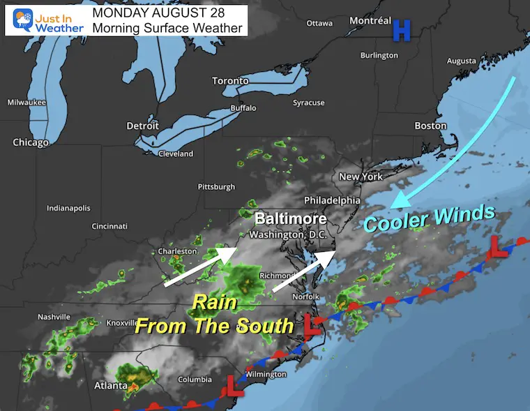
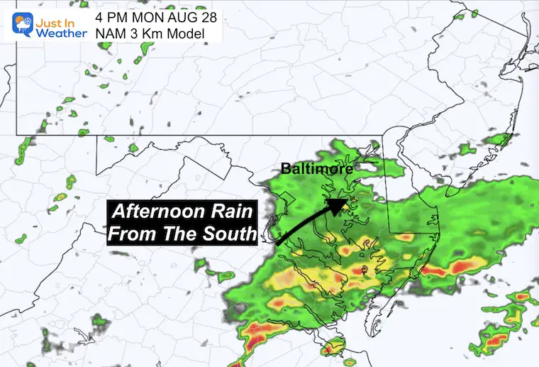
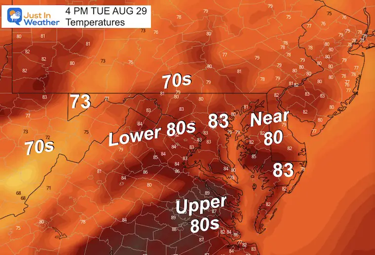
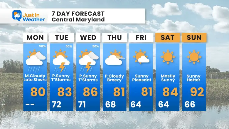
There is a lot to talk about as more schools in central Maryland begin today. Temps locally will be cooler with more clouds and some rain trying to advance from the south this afternoon. We will be in the mix of showers and some thunderstorms for a few days. Then cooling to end the week as Hurricane Idalia passes to the south. That will be followed by summer heat by Labor Day.
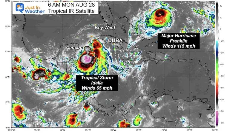
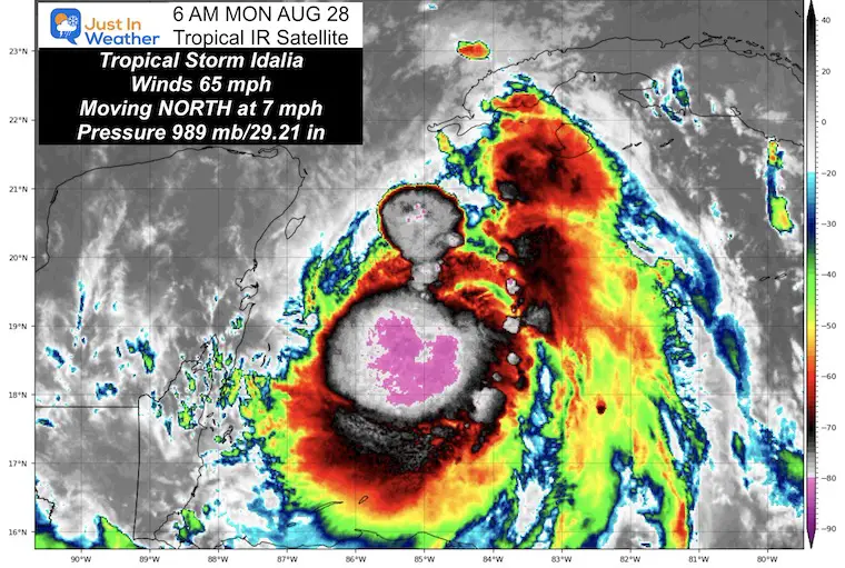
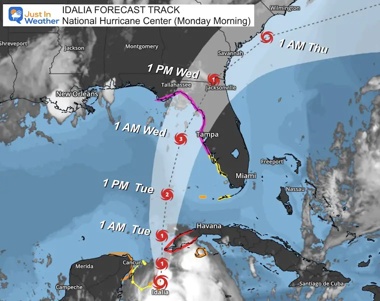
The tropics do need some attention and I have a focus on that below. Tropical Storm Idalia is expected to become a major hurricane in the Gulf and then make landfall in Florida.
Hurricane Franklin is already at Category 3 and passing west of Bermuda this week. Both will make for rough water off the east coast all week.
More on the tropics below.
Morning Surface Weather
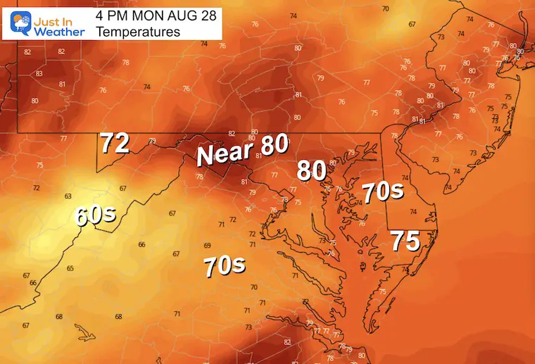
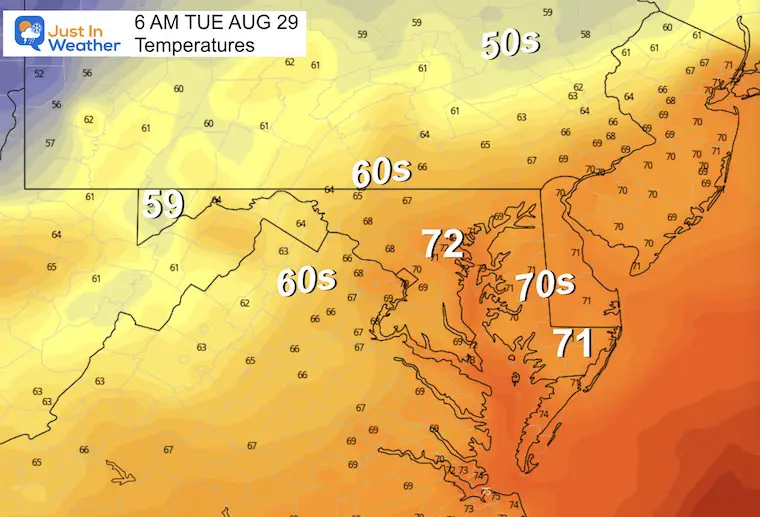
High Pressure in New England has helped to shift the winds from the East and Northeast. That has brought in cooler temps and clouds.
A weak system from the south is trying to bring in some rain. Nothing heavy at this time, but showers may spread into central Maryland this afternoon.
Compare to the Forecast Simulation Below
This is a long loop, but I wanted to show you that rain on each day does not mean all day!
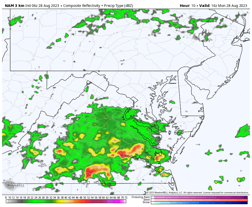
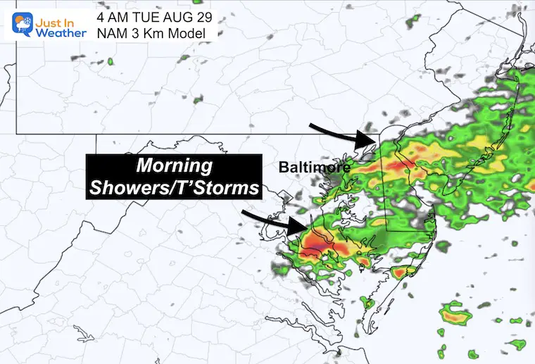
Rain is expected to spread into parts of Central and Southern Maryland to Delmarva.
The better chance for rain and storms may be before sunrise.
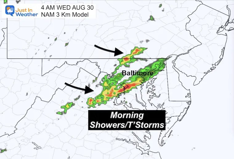
Snapshot Wednesday at 4 AM
The better chance for rain and storms may be before sunrise again.
Sunrise at 6:301AM
Sunset at 7:44 PM
Normal Low in Baltimore: 65F
Record 48ºF in 1986
Normal High in Baltimore: 85ºF
Record 101ºF 1948
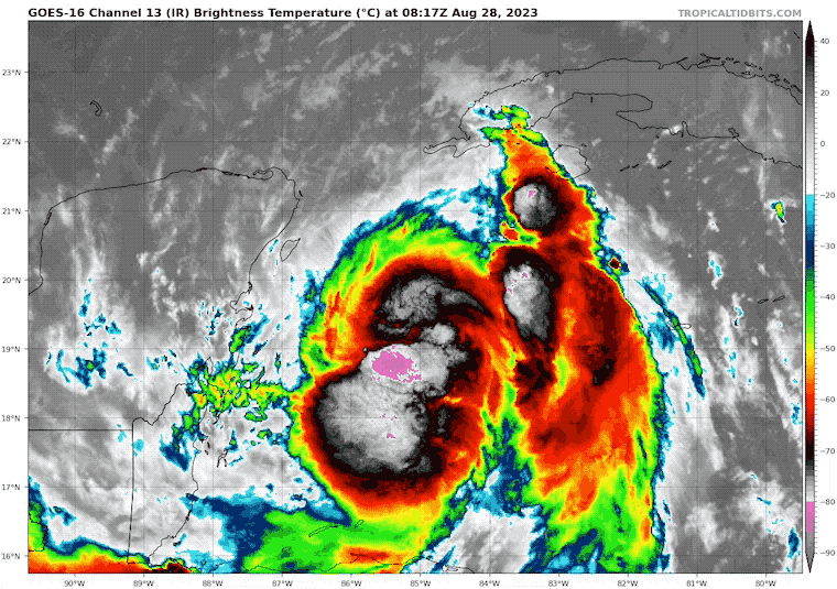
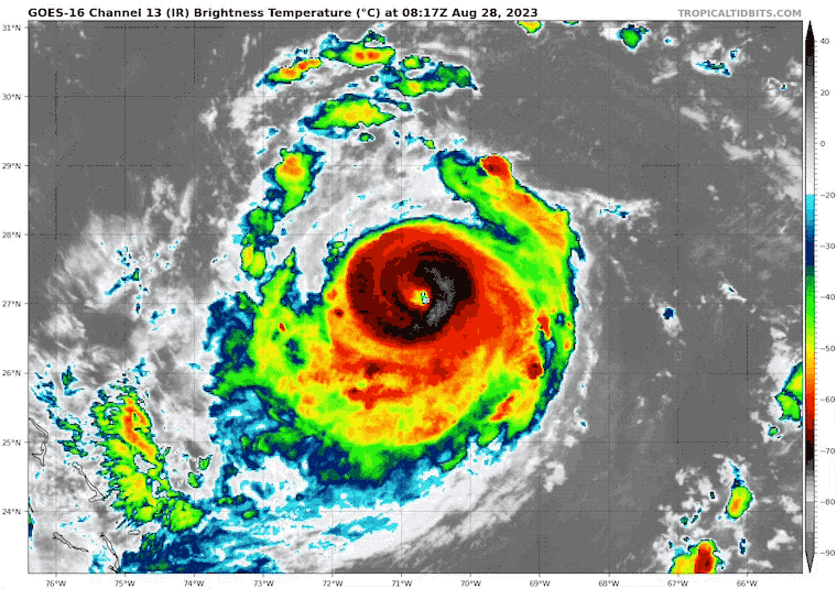
This is rapidly developing as seen on satellite with better organization. It is now expected to become a major hurricane this week before landfall.
This storm looks healthy and will be running into very warm water in the Gulf of Mexico. There is concern that it may end up stronger as we see with each update creeping higher.
A Hurricane Warning is in effect for…
* Pinar del Rio Cuba
A Tropical Storm Warning is in effect for…
* Yucatan Peninsula from Tulum to Rio Lagartos, including Cozumel
* Isle of Youth Cuba
* Dry Tortugas Florida
A Storm Surge Watch is in effect for…
* Chokoloskee to Indian Pass Florida, including Tampa Bay
A Hurricane Watch is in effect for…
* Englewood to Indian Pass Florida, including Tampa Bay
A Tropical Storm Watch is in effect for…
* South of Englewood to Chokoloskee Florida
* Lower Florida Keys west of the west end of the Seven Mile Bridge
Located in the Atlantic, winds are up to 115 mph and it will make a turn more north and strengthen into a major hurricane It is forecast to miss the United States early next week, but send high waves to the East Coast. It will be closer to Bermuda.
Hurricane Force Winds extend 30 miles from the center.
Tropical Storm Force Winds: Extend 150 miles from the center.
Notice the parallel curve of both storms. The cross over will lead to rough water off the east coast all week. This may affect some boat and cruise traffic. Surfers will love the waves, but rip currents will be dangerous.
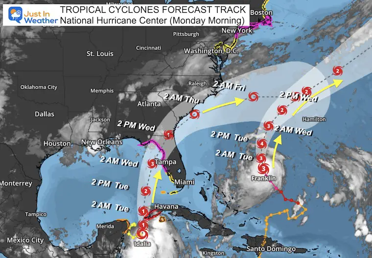
We will have scattered showers and storms until mid week. At this point, it looks like Hurricane Idalia will hit Florida and pass off the South Carolina coast missing us. We may actually get nicer weather from it to end the week. Then heating up on Labor Day weekend.
I will have a follow-up and recap on our amazing week shortly.


I am aware there are some spelling and grammar typos and occasional other glitches. I take responsibility for my mistakes, and even the computer glitches I may miss. I have made a few public statements over the years, but if you are new here you may have missed it: I have dyslexia, and found out during my second year at Cornell University. It didn’t stop me from getting my meteorology degree and being the first to get the AMS CBM in the Baltimore/Washington region. One of my professors told me that I had made it that far without knowing, and to not let it be a crutch going forward. That was Mark Wysocki and he was absolutely correct! I do miss my mistakes in my own proofreading. The autocorrect spell check on my computer sometimes does an injustice to make it worse. I also can make mistakes in forecasting. No one is perfect at predicting the future. All of the maps and information are accurate. The ‘wordy’ stuff can get sticky. There has been no editor who can check my work when I need it and have it ready to send out in a newsworthy timeline. Barbara Werner is a member of the web team that helps me maintain this site. She has taken it upon herself to edit typos when she is available. That could be AFTER you read this. I accept this and perhaps proves what you read is really from me… It’s part of my charm.
#FITF