


May 10 Chilly With More Rain Showers Today And Into Mothers Day Weekend
Friday May 10 Morning Report Today is the second day of the year, with sunrise before 6 AM in Baltimore, but like yesterday, we won’t see it. After a high…
Sunday, August 27 Night Update
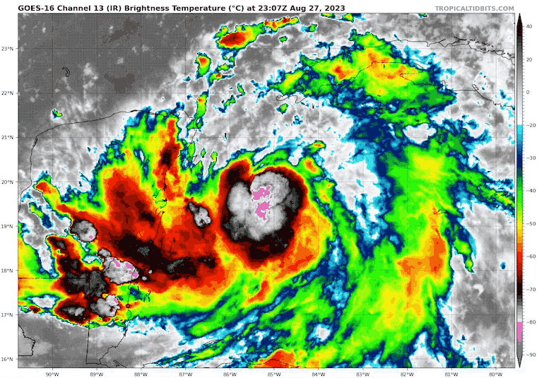
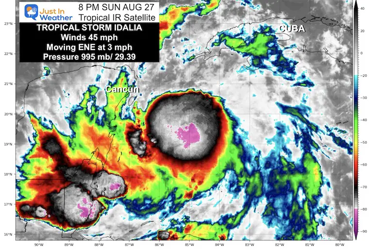
A new storm came on the scene today, which was expected. While it is just east of Cancun, Mexico, and poorly organized, that is expected to change in a hurry. The forecast is for hurricane intensity as it moves north towards Florida.
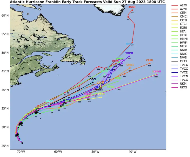
There continues to be Hurricane Franklin in the Atlantic also undergoing rapid strengthening. This is soon to be a Major Hurricane that will miss land but send high waves to the beaches.
I’ll touch on both below.
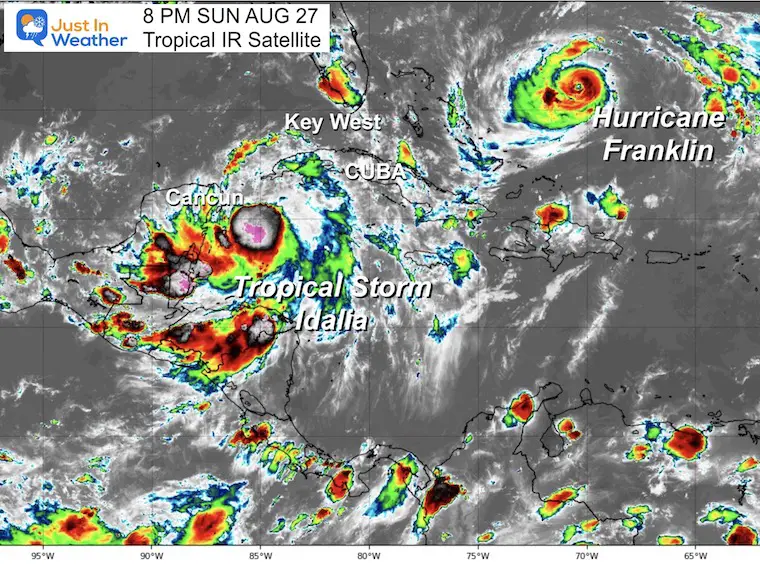
This was named earlier today, but barely has 45 mph winds. That wind field extends 70 miles from the center. This has doubled in size since the prior advisory.
The expanding convection makes this look healthy. The size has doubled and the expectation for rapid development is supported. In short, the likelihood is it will become a hurricane before reaching Florida this week.
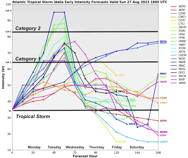
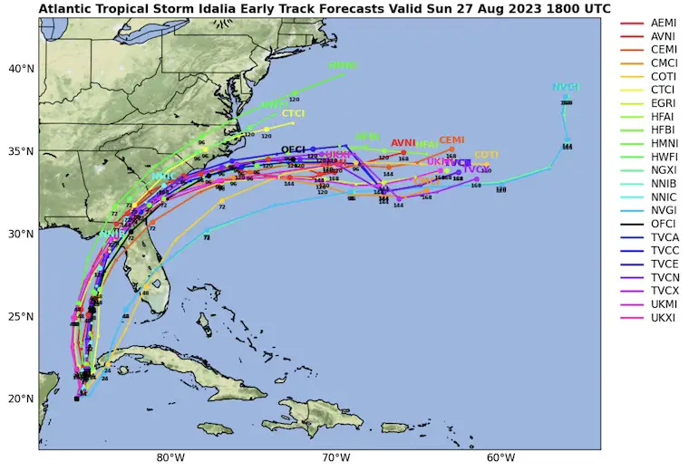
Computer Model Guidance suggests:
This will become a hurricane by Monday night. The rapid drop on Wednesday is in response to landfall in the Northeastern Gulf of Mexico.
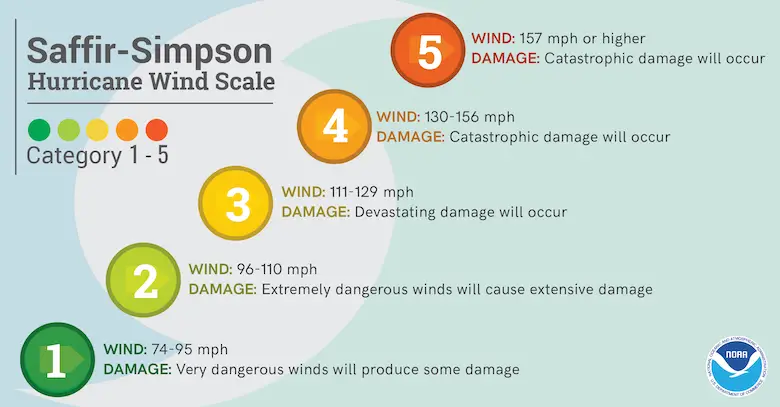
Ranking of Categories Based On Wind Speed
Computer Model Guidance suggested landfall
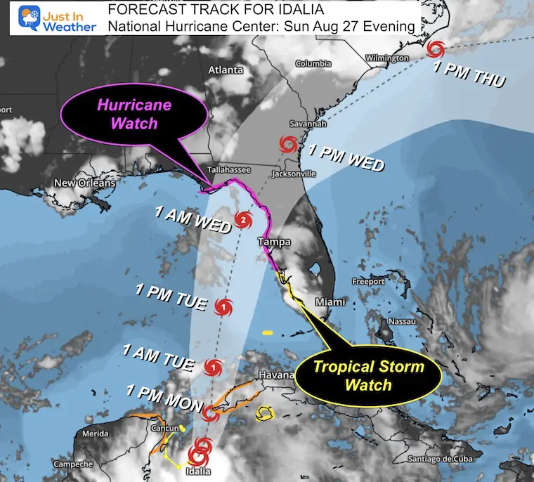
Warning And Advisories
The Watch is for the expectation this will become a hurricane before landfall.
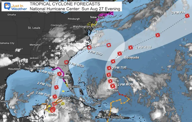
Idalia and Franklin
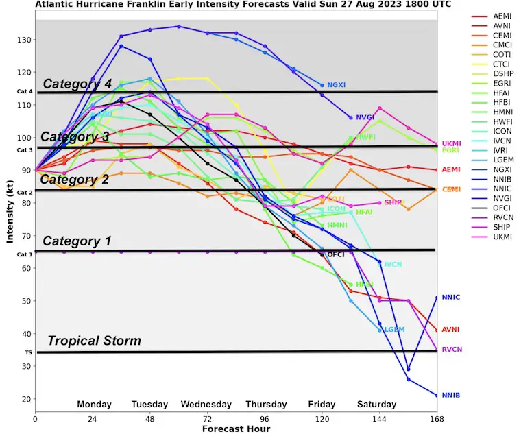
Idalia may reach Cat 2; Franklin will become a major Hurricane at Category 3. It may peak on Tuesday at Category 4.
This includes Idalia And Franklin
As Franklin passes well offshore, Idalia will make landfall in Florida and then curve across South or North Carolina.
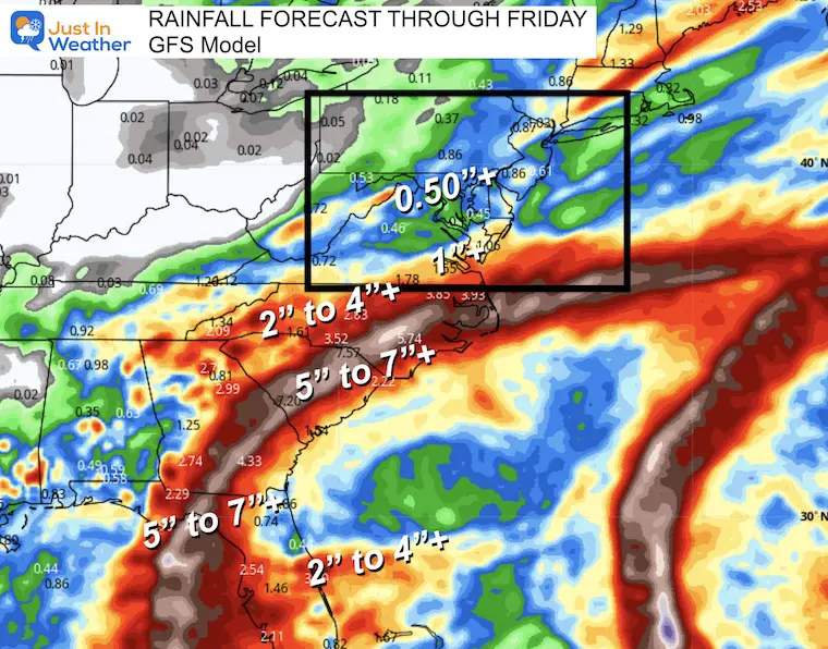
The Mid Atlantic should be protected by a ridge to the north. This is what will curve the storm but also may keep most of the needed rainfall suppressed to the south as well.
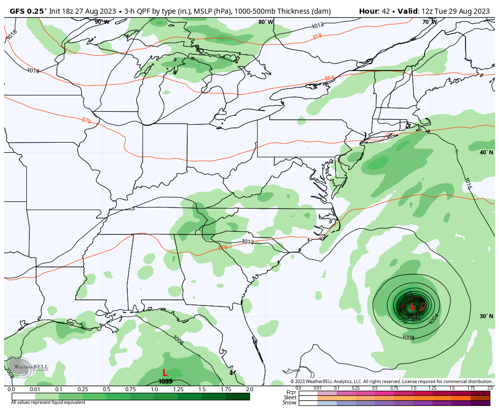
This includes some rain in the Mid Atlantic on Tuesday, NOT associated with the tropical systems.
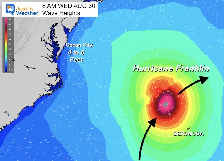
This is the stronger of the two storms but will be passing west of Bermuda and missing the US East Coast.
Hurricane Force Winds extend 25 miles from the center.
Tropical Storm Force Winds Extend 140 miles from the center.
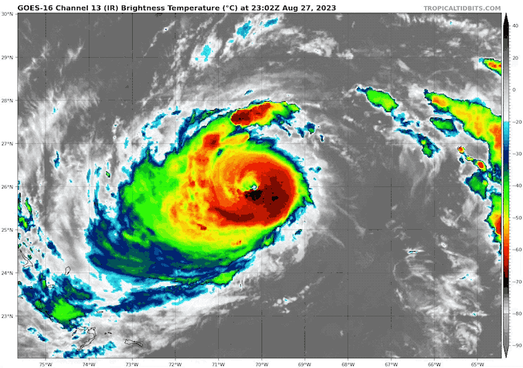
This will become a major hurricane at Category 3 but may reach Cat 4 at its peak.
Ocean City, MD may get 4 to 6-foot swells peaking Wednesday morning.
There will be additional flow from the Southeast with the next system over the weekend.
I will have a follow-up and recap on our amazing week shortly.


I am aware there are some spelling and grammar typos and occasional other glitches. I take responsibility for my mistakes, and even the computer glitches I may miss. I have made a few public statements over the years, but if you are new here you may have missed it: I have dyslexia, and found out during my second year at Cornell University. It didn’t stop me from getting my meteorology degree and being the first to get the AMS CBM in the Baltimore/Washington region. One of my professors told me that I had made it that far without knowing, and to not let it be a crutch going forward. That was Mark Wysocki and he was absolutely correct! I do miss my mistakes in my own proofreading. The autocorrect spell check on my computer sometimes does an injustice to make it worse. I also can make mistakes in forecasting. No one is perfect at predicting the future. All of the maps and information are accurate. The ‘wordy’ stuff can get sticky. There has been no editor who can check my work when I need it and have it ready to send out in a newsworthy timeline. Barbara Werner is a member of the web team that helps me maintain this site. She has taken it upon herself to edit typos when she is available. That could be AFTER you read this. I accept this and perhaps proves what you read is really from me… It’s part of my charm.
#FITF