


May 9 Cooler With Rain And Severe Storm Risk Tonight South
Thursday May 9 Morning Report Today is the first day of the year with sunrise before 6 AM in Baltimore, but we won’t see it. After a high temperature of…
July 7, 2023
Mid-Day Friday Update
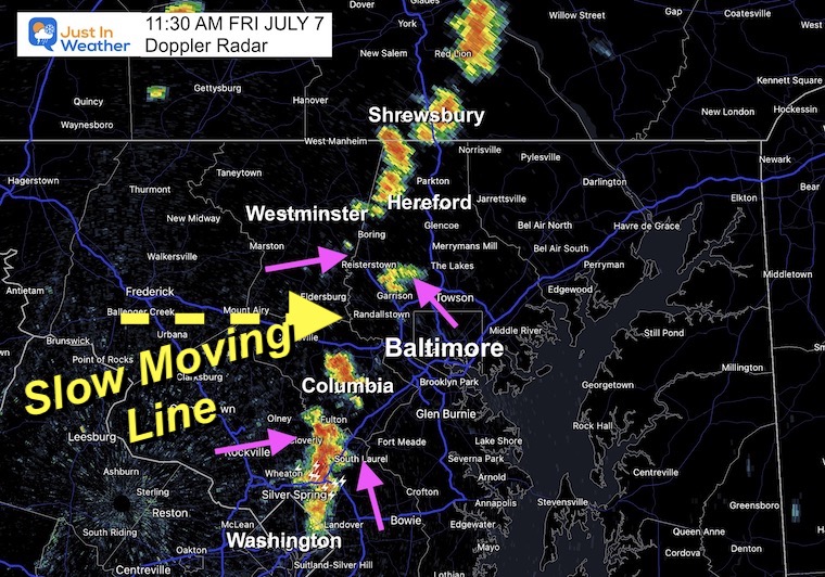
There is a weak boundary in the atmosphere that has helped develop thunderstorms this morning. This appears to be a pre-frontal trough, with just enough lift ahead of the cold front to take our very humid air and force this convection early.
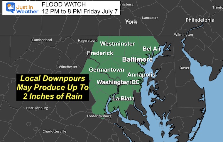
A Flood Watch has been issued until 8 PM in Central Maryland by the National Weather Service. This is for slow-moving storms that may produce a few inches of rain. Runoff may overflow some streams, creek beds, and rivers.
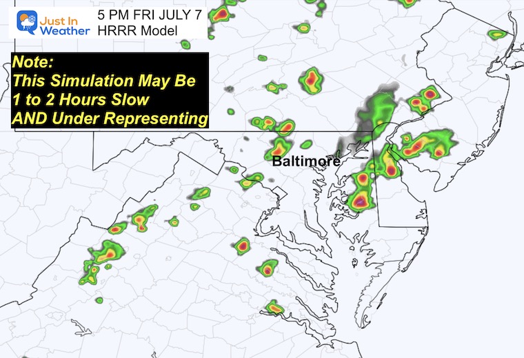
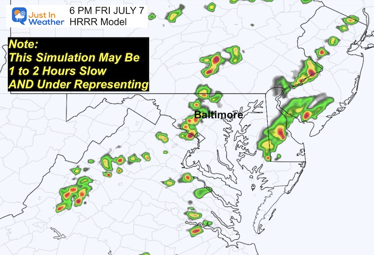
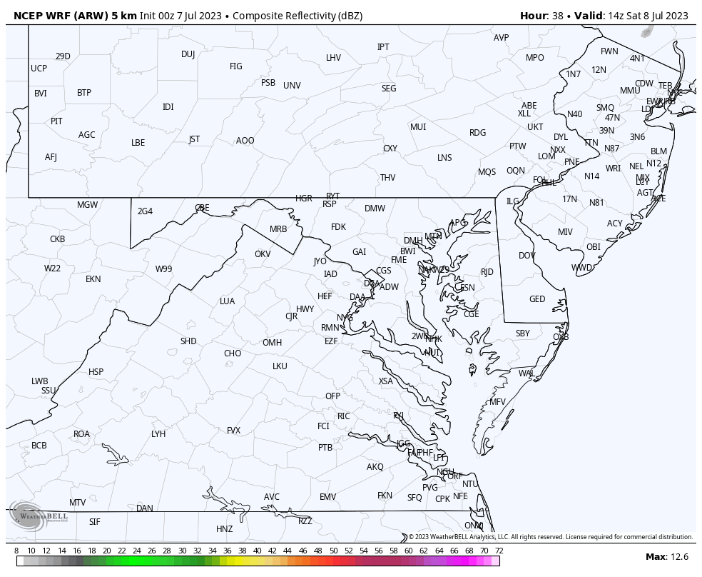
Here is a quick look at how this is developing and the short-range forecast for how it may play out through the afternoon. Please remember that the model simulation is a suggestion and not perfect. So I have added the live radar and lighting widget to compare.
The highlighted counties in green were issued by the National Weather Service. Rain in slow-moving storms can produce up to 2 inches of rain and lead to local flooding.
Warnings: If there is flooding or any severe weather actually observed in person or on radar, a warning may be issued. This will highlight specific towns in the path.
The highlighted trough is the forcing mechanism for rising air and forming the line of storms.
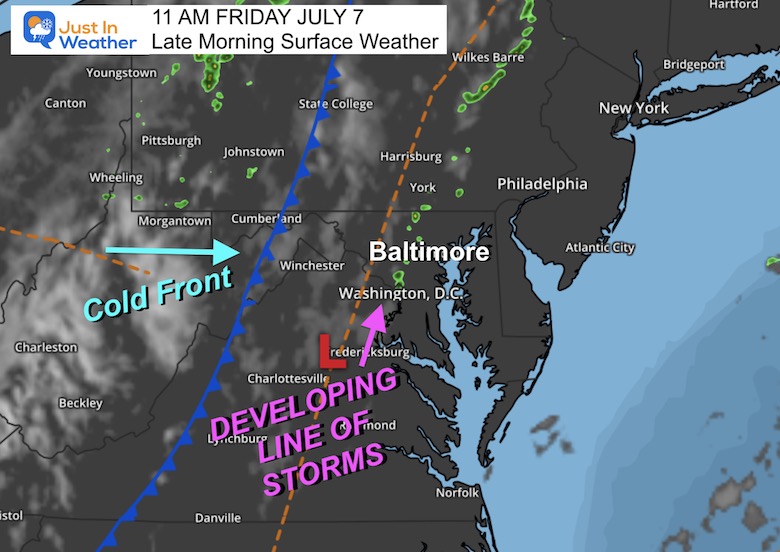
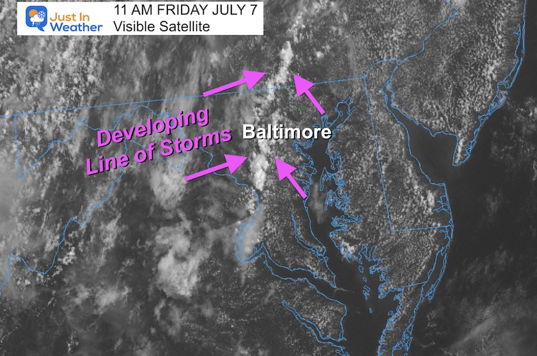
I’ve annotated the trough line where storms have been developing. See the loop below to watch it form.
This line has developed quickly. The concern is the slow-moving storm cells. It will take upper-level winds to shift them to the east… but they may linger over some areas for a while, dumping localized heavy rain.
It appears the flare-up of storms will be along the boundary/trough…
As the clouds grow taller, the upper-level winds carry the cells or line east, then more form behind it.
The activity will fade with the sunset.
These are suggestions and not exact. So use the Live Radar Widget to compare.

This forecast appears to show the storms firing up more than 1 hour later than we have seen already form.
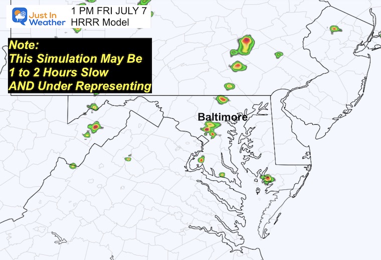
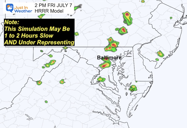
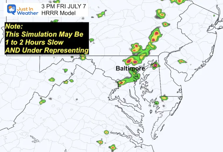
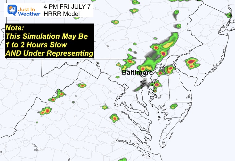
The trigger in the atmosphere may be in places over central Maryland near I-95. This is where we see the flare-up of showers.
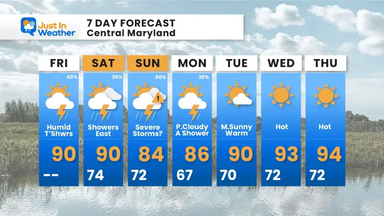
A cold front will make this a very active weather day. Storms will have the risk to turn severe across central Maryland and southward.
Please keep in mind that this is a few days away. The expected severe storm region may shift and expand.
This means thunderstorms may contain damaging wind, large hail, flash flooding, and isolated tornadoes.
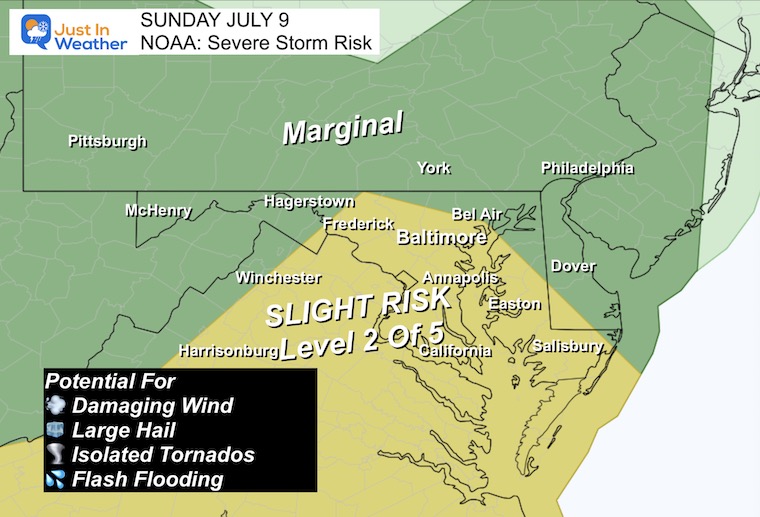
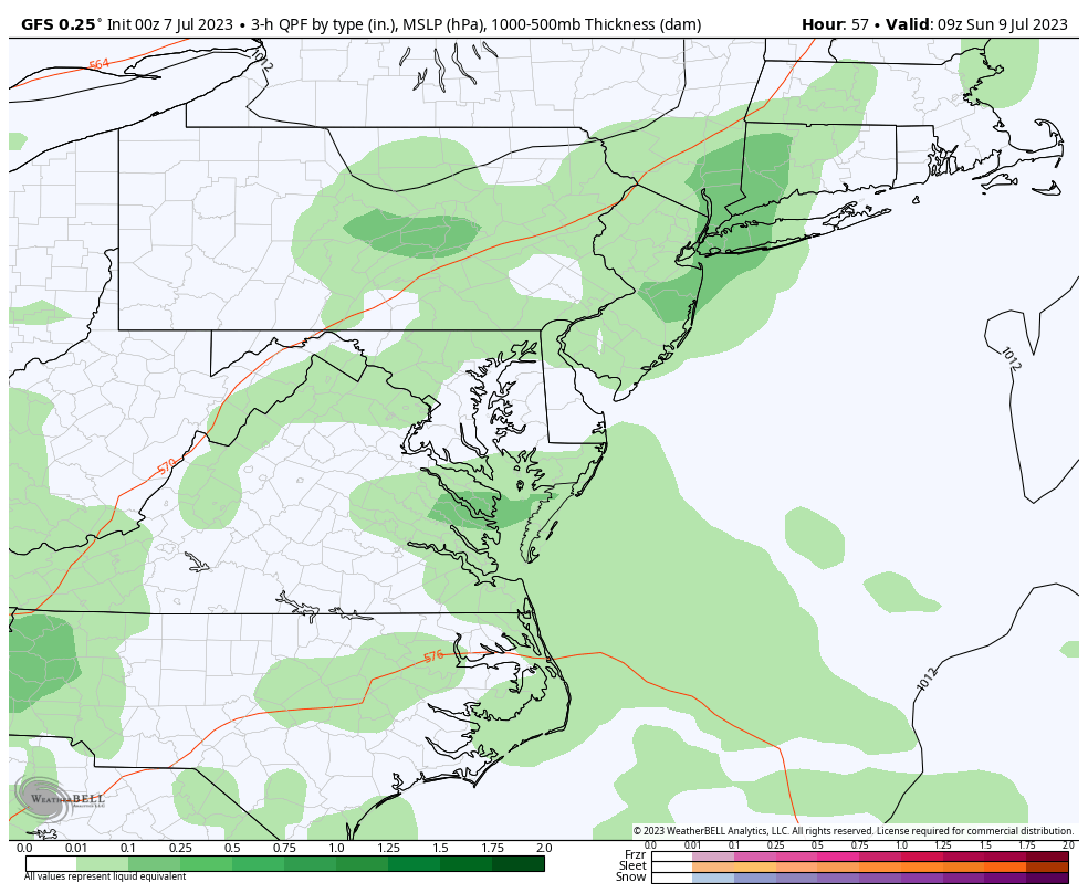
The very active storm development will be on Sunday and may be at any time of the day. This means more clouds and cooler temperatures.
Monday may still have some thundershowers, followed by High Pressure and sunshine for the middle of next week. This will be accompanied by the 90s again.
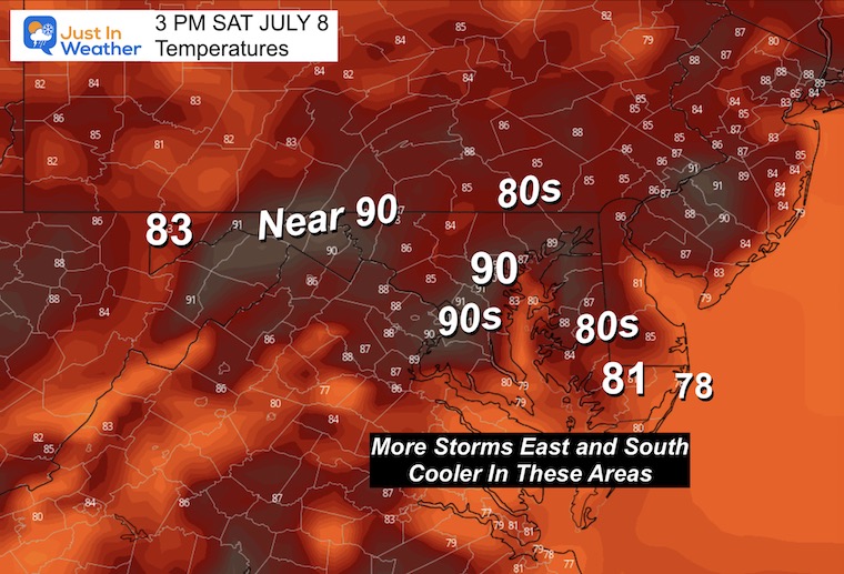
At first glance, this is a typical July weather forecast. The heat and humidity will spark more showers and storms. Sunday will be the most active, and as a result of earlier showers, the coolest.
When the sun returns, temps will jump back to the 90s next week.

I am aware there are some spelling and grammar typos and occasional other glitches. I take responsibility for my mistakes, and even the computer glitches I may miss. I have made a few public statements over the years, but if you are new here you may have missed it: I have dyslexia, and found out during my second year at Cornell University. It didn’t stop me from getting my meteorology degree, and being the first to get the AMS CBM in the Baltimore/Washington region. One of my professors told me that I had made it that far without knowing, and to not let it be a crutch going forward. That was Mark Wysocki and he was absolutely correct! I do miss my mistakes in my own proofreading. The autocorrect spell check on my computer sometimes does an injustice to make it worse. I also can make mistakes in forecasting. No one is perfect predicting the future. All of the maps and information are accurate. The ‘wordy’ stuff can get sticky. There has been no editor that can check my work when I needed it and have it ready to send out in a newsworthy timeline. Barbara Werner is a member of the web team that helps me maintain this site. She has taken it upon herself to edit typos, when she is able. That could be AFTER you read this. I accept this and perhaps proves what you read is really from me… It’s part of my charm.
#FITF