


May 9 Cooler With Rain And Severe Storm Risk Tonight South
Thursday May 9 Morning Report Today is the first day of the year with sunrise before 6 AM in Baltimore, but we won’t see it. After a high temperature of…
July 2, 2023
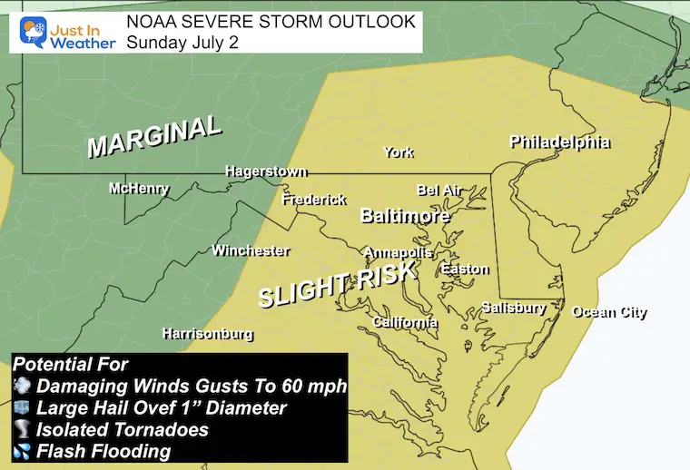
Earlier today I shared the NOAA Outlook for a Slight Risk of severe thunderstorms today. I know that terminology has been confusing. In short, it means we will have widespread thunderstorms with an increased chance that some (not all) can turn severe.
Click to see SEVERE STORM RISK MONDAY JULY 3
UPDATE
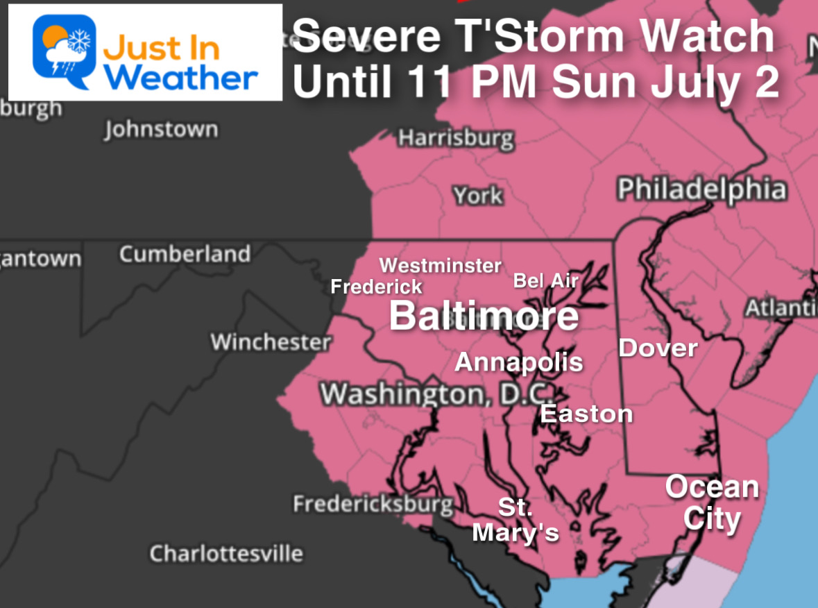
SEVERE THUNDERSTORM WATCH Until 11 PM
This is a holiday weekend and I do have a life! Ha! I am with my wife’s family in Delmarva and writing this report mid-afternoon for a few reasons. I was out training this morning and laid down for a brief nap. We have over 20 people here with plenty of kids and a pool. Before I go back out, I may be expected to have some answers for the timing of our local storm timeline so we can plan the pool time and grilling.
With that in mind, if you are checking this on your phone at your own event, I hope this brief report can help you prepare.
Please keep in mind: The computer model simulations I show are NOT perfect. That is why I suggest applying a buffer of 1 hour before or after the snapshots as to when potential storms may reach you.
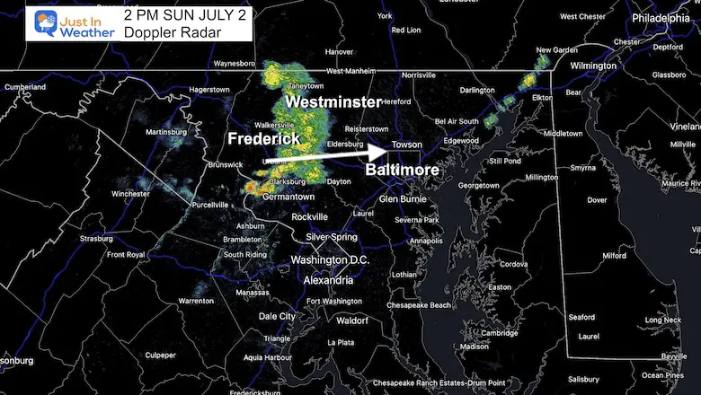
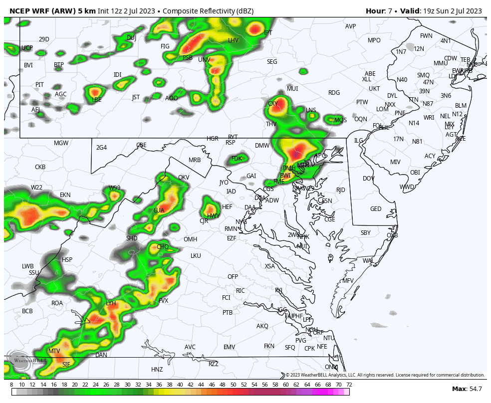
The initial cluster of showers was moving east of Frederick over Mount Airy and into western Carroll and Howard Counties.
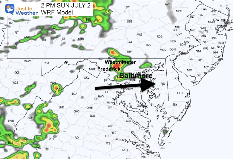
This model forecast was the closest to what we have observed. The HRRR Model was missing this and the NAM 3 Km was about 1 hour behind.
Before looking at the forecast, I want to remind you of this…
The ‘Slight Risk’ in yellow may be confusing. This area will get widespread showers and storms with an increased risk that some turn severe.
A storm is considered SEVERE if it contains:
*Any thunderstorm can contain dangerous lightning. The most dangerous time is before the first drop of rain, so best to get inside before it starts raining.
This has been the best-performing short-range model when compared to the HRRR and NAM 3 Km. So I am limiting the display to this for now. See key time frames below.
Snapshots with the most likely locations affected at these times. Please consider the potential this may be within 1 hour before or after what is shown.
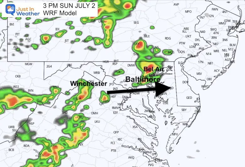
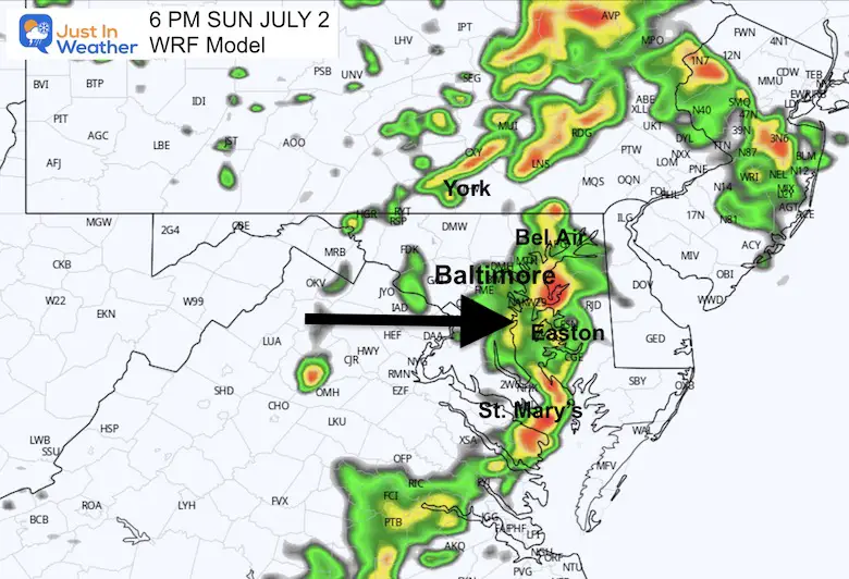
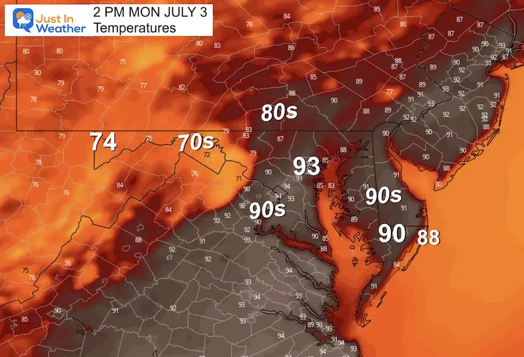
This cell we were tracking at 2 PM may cross metro Baltimore into Harford County, with a flare-up around Bel Air. Annapolis and south may be dry.
A new line of showers may form out of the mountains of Virginia and head toward Winchester.
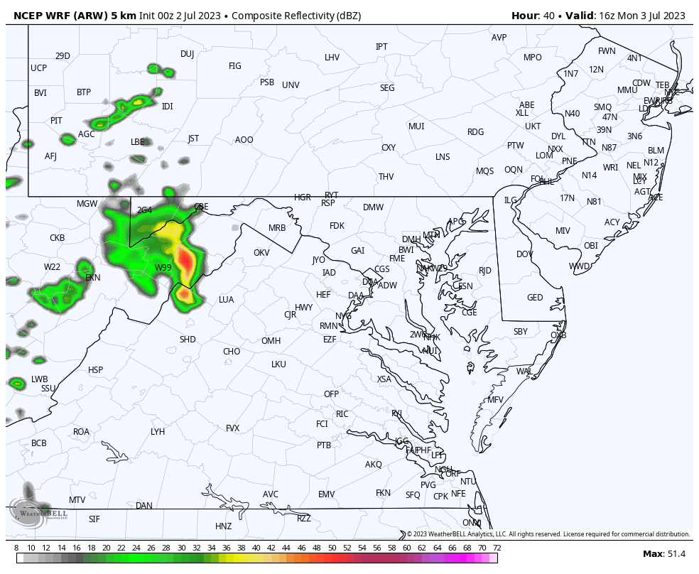
The first cell may cross Cecil County and affect Northeast to Wilmington DE and expand to Philadelphia.
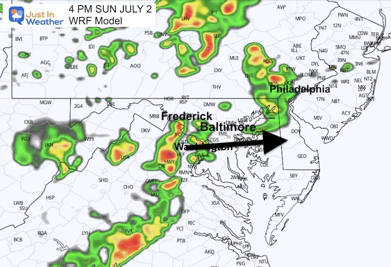
This may be prime time in central Maryland. Storms may fire up between Washington and Baltimore. The time window may include Westminster earlier, to Annapolis within an hour later.
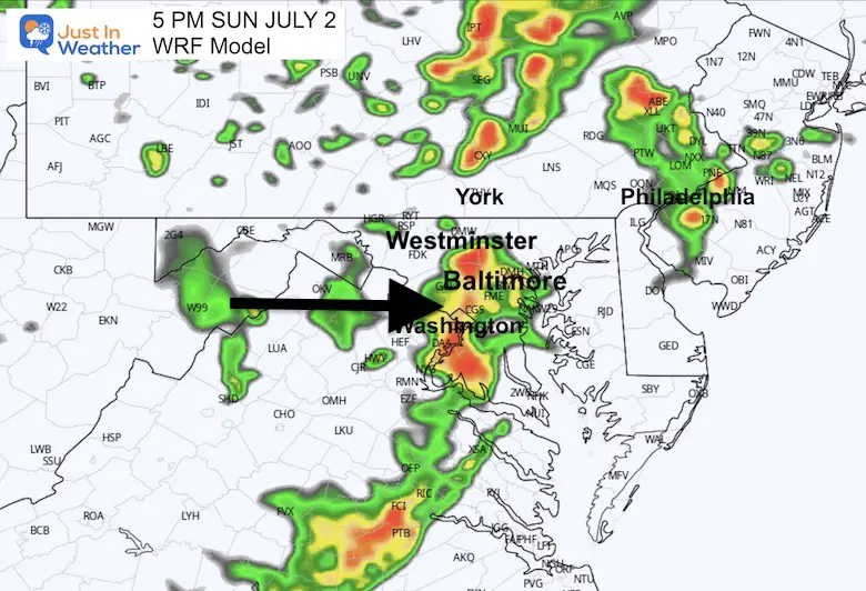
That storm line is expected to cross the Bay and affect Rock Hall to Easton, Cambridge, and south from St. Mary’s to Crisfield.
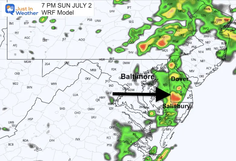
This is when that cluster may cross between Salisbury, MD to Seaford, DE, and eventually towards the beaches.
Again, this is a rough estimate to plan around. I would still refer to the live radar above or whatever app you use.
Noon to 8 PM
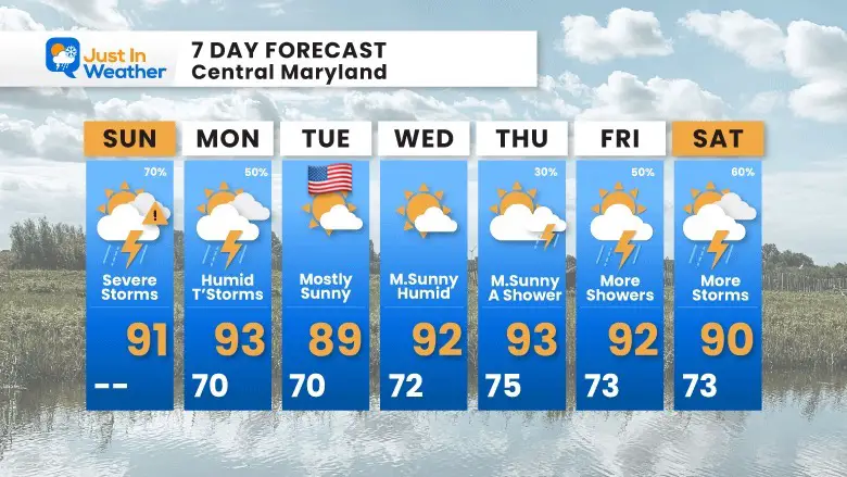
There may be some more strong thunderstorms in the afternoon. I do not see a widespread severe risk like today, but some cells could produce damaging weather.
Typical summer weather has settled in. July 4th looks GREAT!
The week ahead spells out a return of heat and humidity. This actually helps keep the wildfire smoke away but will bring some showers and storms back by the end of the week.

I am aware there are some spelling and grammar typos, and occasional other glitches. I take responsibility for my mistakes, and even the computer glitches I may miss. I have made a few public statements over the years, but if you are new here you may have missed it: I have dyslexia, and found out during my second year at Cornell University. It didn’t stop me from getting my meteorology degree, and being first to get the AMS CBM in the Baltimore/Washington region. One of my professors told me that I had made it that far without knowing, and to not let it be a crutch going forward. That was Mark Wysocki and he was absolutely correct! I do miss my mistakes in my own proofreading. The autocorrect spell check on my computer sometimes does an injustice to make it worse. I also can make mistakes in forecasting. No one is perfect predicting the future. All of the maps and information are accurate. The ‘wordy’ stuff can get sticky. There has been no editor that can check my work when I needed it and have it ready to send out in a newsworthy timeline. Barbara Werner is a member of the web team that helps me maintain this site. She has taken it upon herself to edit typos, when she is able. That could be AFTER you read this. I accept this and perhaps proves what you read is really from me… It’s part of my charm.
#FITF