


May 17 Clouding Up Ahead Of A Soggy Preakness Saturday Then We Warm Up
Friday May 17 Morning Report Today may end up mild, but it will bring an increase in clouds ahead of our next storm. If you are heading to the mountains,…
April 28, 2023
Friday Afternoon Update
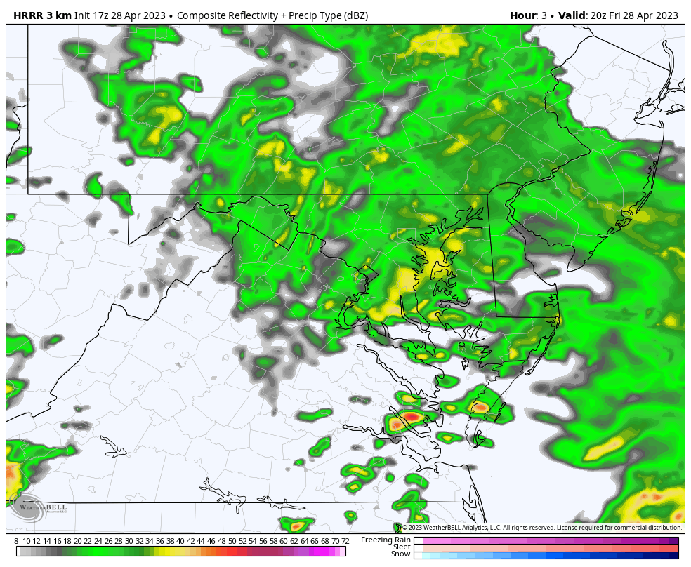
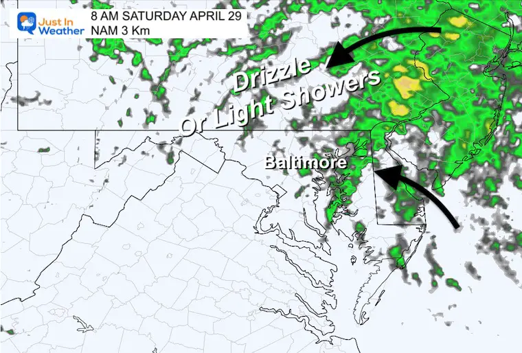
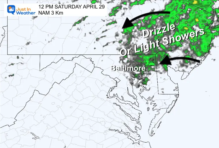
The rain we have in place may be stubborn to move out. The latest information suggests that some of us will have periods of moderate rain continuing this evening. The adjustment may be Saturday morning when light rain and drizzle could linger longer. This includes parts of metro Baltimore to the north and east.
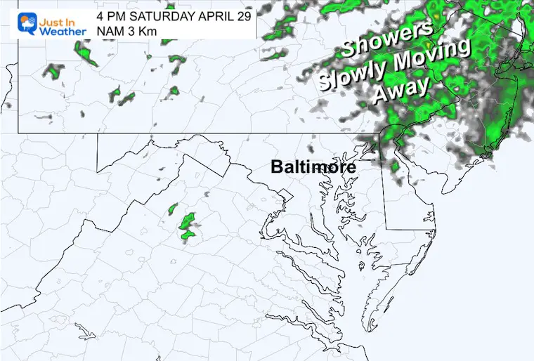
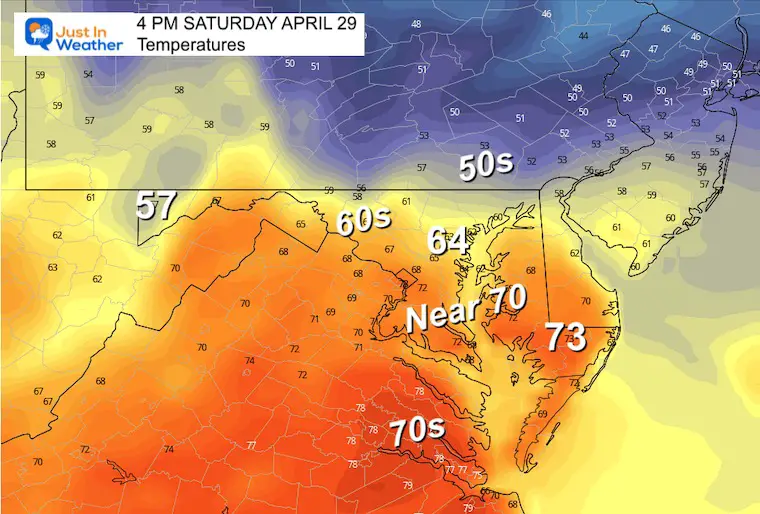
If you live farther south or west, you have a better chance to improve earlier. The afternoon is still an opportunity for most of the region to get some dry and mild weather.
Sunday remains another wet day with morning rain and strong afternoon thunderstorms.
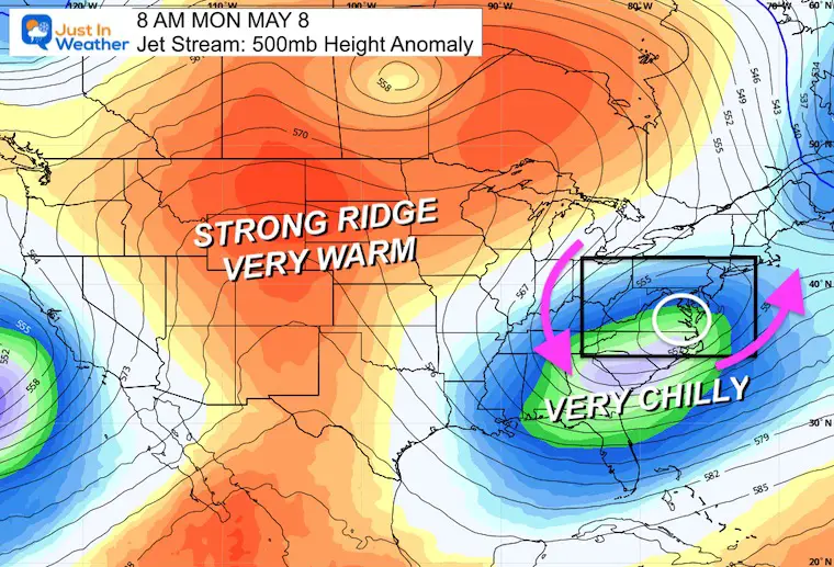
The Surface Low affecting us is still to our south and governed by the flow around the Upper Air Low in Ohio. Basically, this cool and damp pattern will be hard to shake.
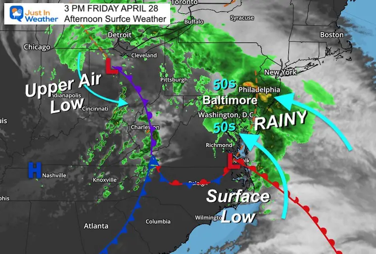
This slow moving Low Pressure will continue to generate rain around central Maryland, the Chesapeake Bay, and Delmarva. It will begin to break up to showers with varying light to heavy intensity.

Compare the latest to the simulations today and this weekend.
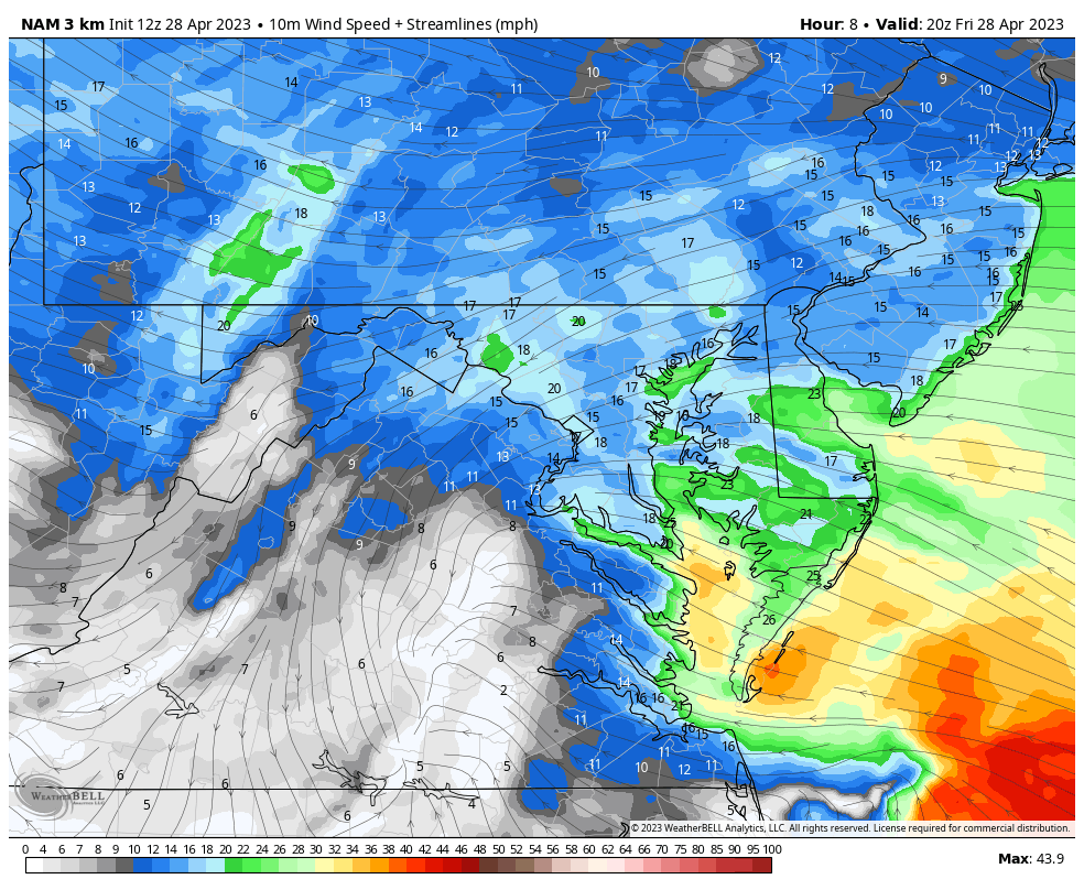
The steady east wind will remain in place… so the cool and wet weather will remain. Even after the rain stops, drizzle and fog will last into the morning.
High Water will remain on the Western Shore of the Chesapeake Bay.
The rain showers and drizzle will linger a little longer. Especially in the morning and to the Northeast. If you live west or south of Baltimore then you will dry out sooner.
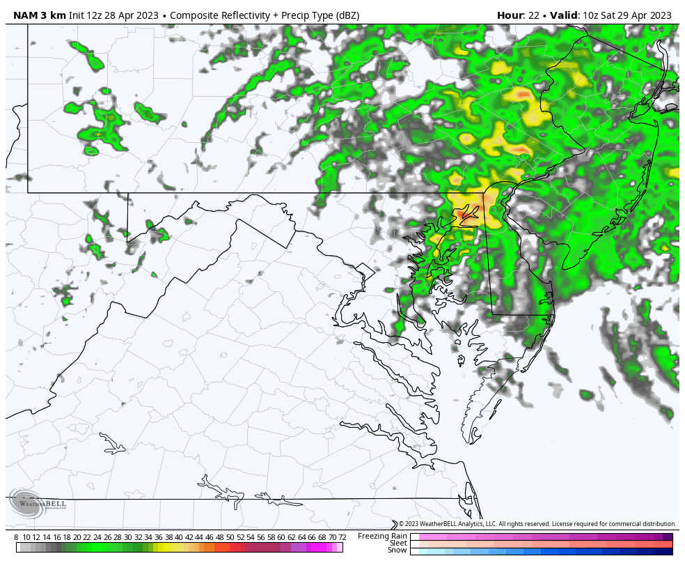
It will still be damp… The upper level disturbance will keep the risk of showers around beyond daybreak. This will range from drizzle to light showers.
More from Baltimore to the North and East, and a better chance to dry out sooner to the South and West.
It will be chilly and damp still.
It will be slow to push this system out, and Northeastern Maryland to metro Philadelphia will remain damp.
The afternoon is when we all have a better chance to dry out. If we get breaks of partly sunny sky, then temps will push into the 60s to near 70 to the south.
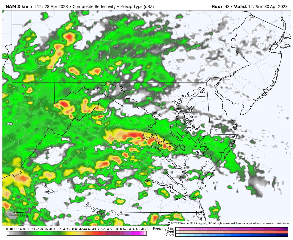
The rain will be returning by morning, then become steadier in the afternoon and evening. I made this snapshot for 8 PM to show the location of the Low Pressure as it will track west of I-95 and pass through our region overnight.
Steady rain in the morning then showers and thunderstorms in the afternoon. We may have to watch for one or two intense lines and potential severe elements.
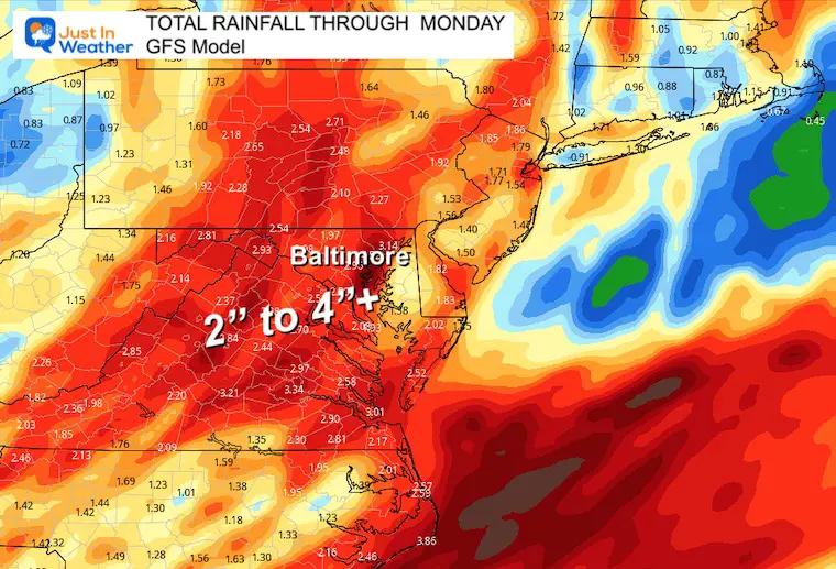
By Monday morning, it is possible that a large portion of the Mid Atlantic could get over 2 inches of rain. On the high end, some spots could push beyond 4 inches.
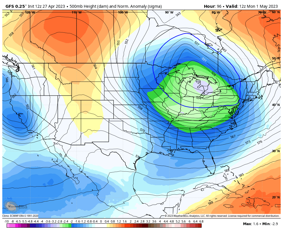
In a true winter pattern fashion, The Great Lakes will open up with the next disturbance Tuesday into Wednesday. While we may see some rain showers again, the high mountains may be in store for a rare May snow. This is more likely above 2,000 Ft elevation which includes Garrett County, MD, and parts of West Virginia to Western PA.
Cold Air Pattern
If this was winter we would certainly be talking about multiple snow events. But in May we will just get a deep chill and perhaps another frosty morning inland.
In fact, the set up seen below, if it verifies, could bring a coastal storm next week followed by a dangerous frost to parts of the Southeast US.
If only we had this in winter… Simply the cold getting reinforced.
This is a long range outlook, so take it with a grain of salt. But if this is close to verifying, then there could be another weekend coastal storm followed by abnormal cold with danger for frost in interior section of the Southeast US.
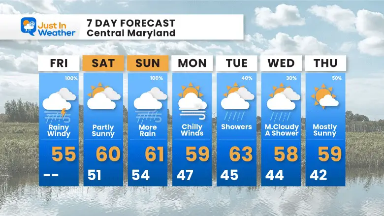
Chilly and wet is the theme. There will be a break on Saturday before the second storm.
Monday looks dry with chilly winds, then showers during the week. Temps will remain 10 to 20 degrees cooler than average to start May.
Click to see more and ‘Book’ a visit to your school

I am aware there are some spelling and grammar typos, and occasional other glitches. I take responsibility for my mistakes, and even the computer glitches I may miss. I have made a few public statements over the years, but if you are new here you may have missed it: I have dyslexia, and found out during my second year at Cornell University. It didn’t stop me from getting my meteorology degree, and being first to get the AMS CBM in the Baltimore/Washington region. One of my professors told me that I had made it that far without knowing, and to not let it be a crutch going forward. That was Mark Wysocki and he was absolutely correct! I do miss my mistakes in my own proofreading. The autocorrect spell check on my computer sometimes does an injustice to make it worse. I also can make mistakes in forecasting. No one is perfect predicting the future. All of the maps and information are accurate. The ‘wordy’ stuff can get sticky. There has been no editor that can check my work when I needed it and have it ready to send out in a newsworthy timeline. Barbara Werner is a member of the web team that helps me maintain this site. She has taken it upon herself to edit typos, when she is able. That could be AFTER you read this. I accept this and perhaps proves what you read is really from me… It’s part of my charm.
#FITF
