


May 19 Weather Sunday Starts Foggy The Warming With Sun And Summer Heat On The Way
Sunday May 19 Morning Report The aftermath of the rainy Saturday is plenty of leftover moisture. This has left us with a bit of humidity and areas of thick fog…
April 28, 2023
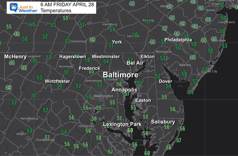
Friday Morning Update
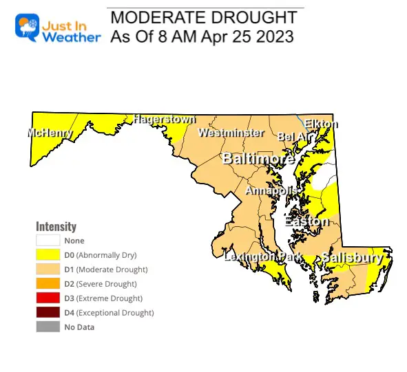
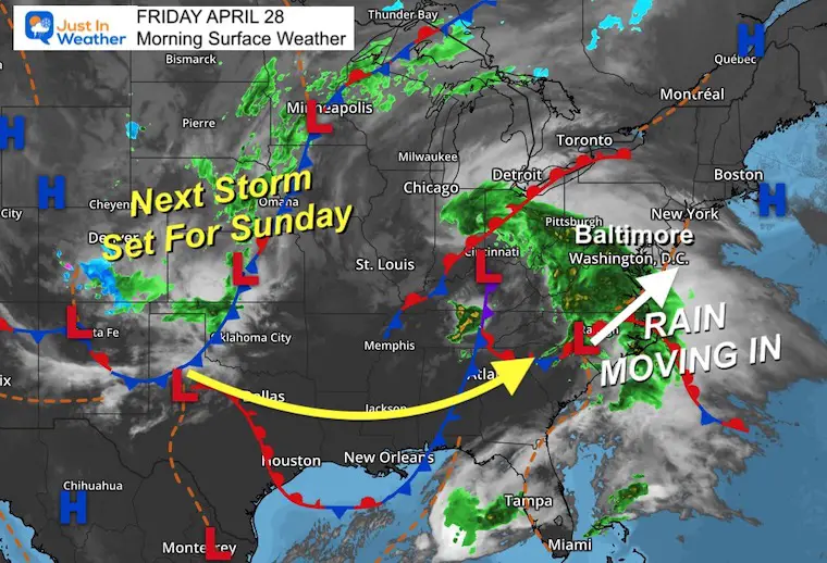
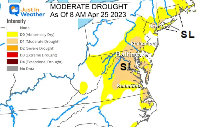
The first of two storms around the weekend is going to be responsible for a major dent or event ending the drought. Yes, Baltimore has a rain deficit I highlighted last night and as a result is part of a moderate drought designated for much of the region.
Rain moving in today will be steady, and heavy at times. This will include increasing winds and chilly temps to make it feel more like March!
Local flooding on the western Bay from the push of water AND perhaps some inland areas with downpours.
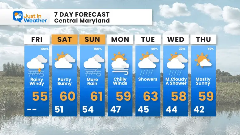
We will get a break on Saturday, then another storm with perhaps even heavier rain on Sunday. This will be followed by a persistent chilly pattern to start the first week of May.
Drought Conditions
As of this week, Maryland (for example in the middle of my coverage region) has been identified with a Moderate Drought. Using the Baltimore weather station as reference, here are the rainfall deficits:
These numbers will remain steady or drop this afternoon with the rain.
Today is the first of two storms we expect this weekend. Today will feature a building wind from the ocean to feed into more rainfall.
The next one is organizing in the Rockies and will follow the same path to arrive on Sunday.
Live Radar Widget
Compare this to the simulation timelines below.
8 AM To Midnight
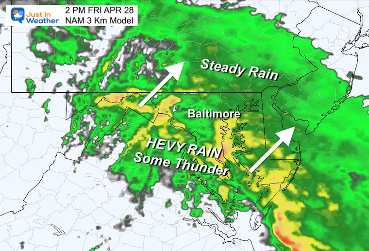
Just a wet day. Steady rain will become heavier in the afternoon and evening. Some thunder is possible.
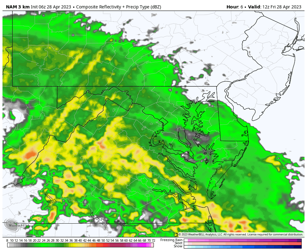
Pockets of heavy rain will be building in from the south. That break in the rain looks close, but will take all day to push through.
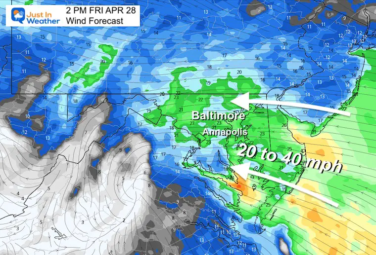
A steady wind from The East will range from 20 to 40 mph. It will feed moisture into the storm AND push/slosh the water to the western shore of the Chesapeake Bay. Higher than normal tides and coastal flooding is possible, including Annapolis and Bowley’s Quarters.
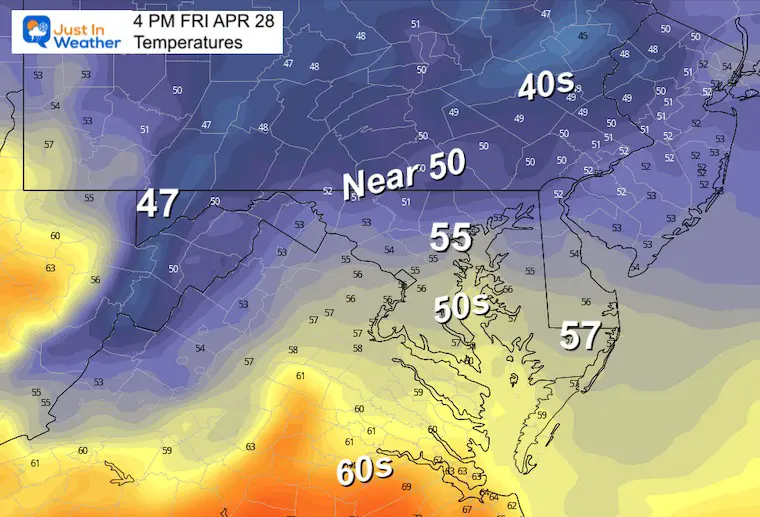
We remain steady or drop a few degrees. It will be chilly in the 50s with the wind and rain.
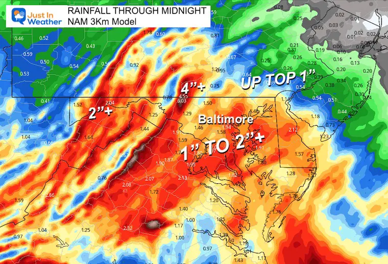
This may end up a good soaker with 1 to 2+ inches.
Normal Low in Baltimore: 48ºF
Record 33ºF in 1998
Snow: Trace in 1898
Normal High in Baltimore: 71ºF
Record 90ºF 1957

Temps will be steady or falling slightly through the lower 50s with the rain. These numbers will be 15 to 20 degrees BELOW AVERAGE and more like early March.
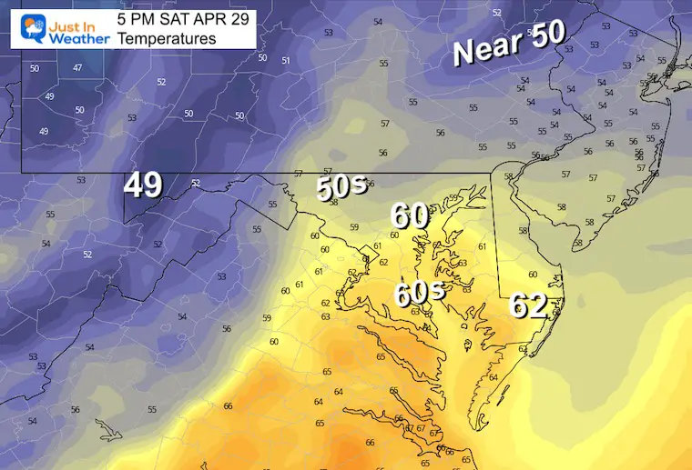
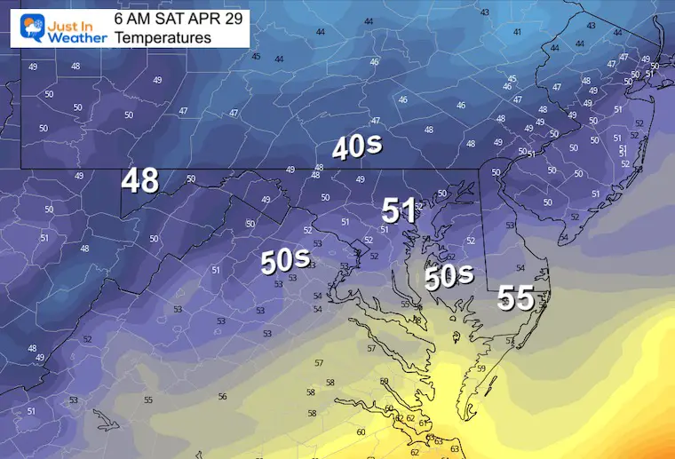
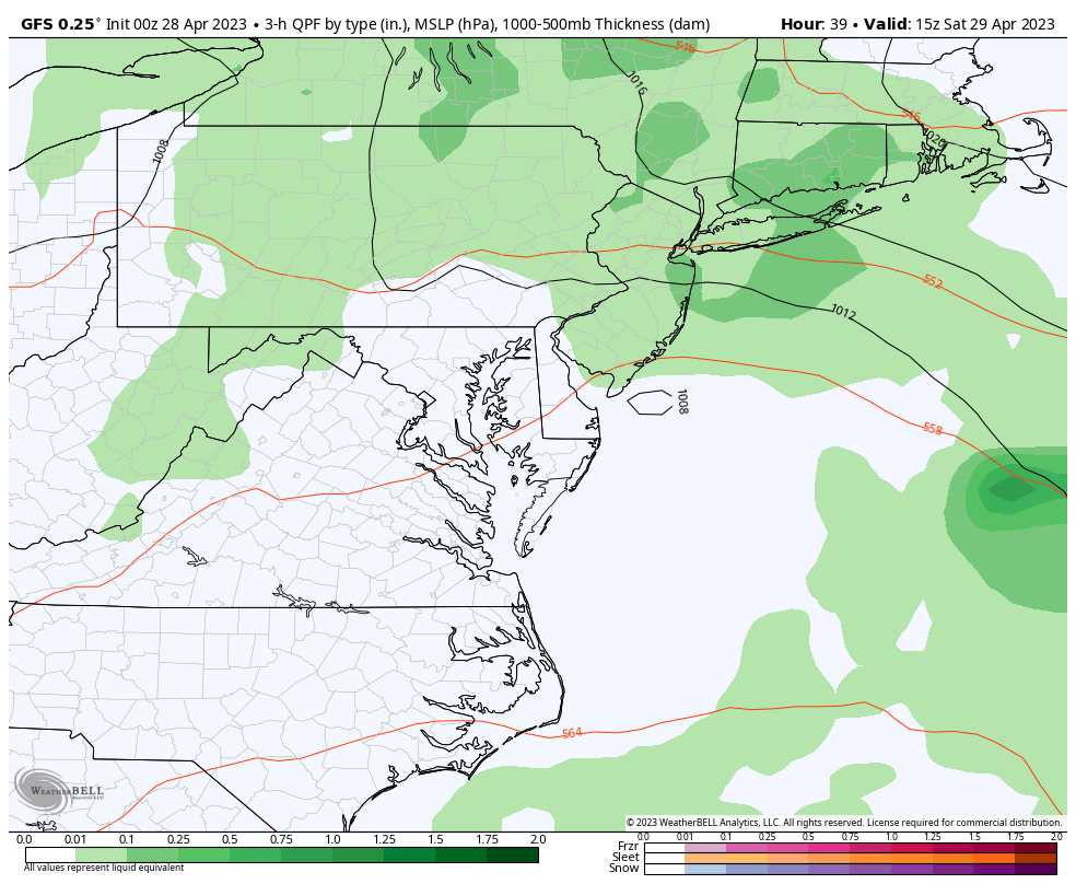
This should turn out to be a dry day, perhaps with some breaks of sun. However, the ground will be quite soggy. Something to keep in mind for sports or other outdoor plans.
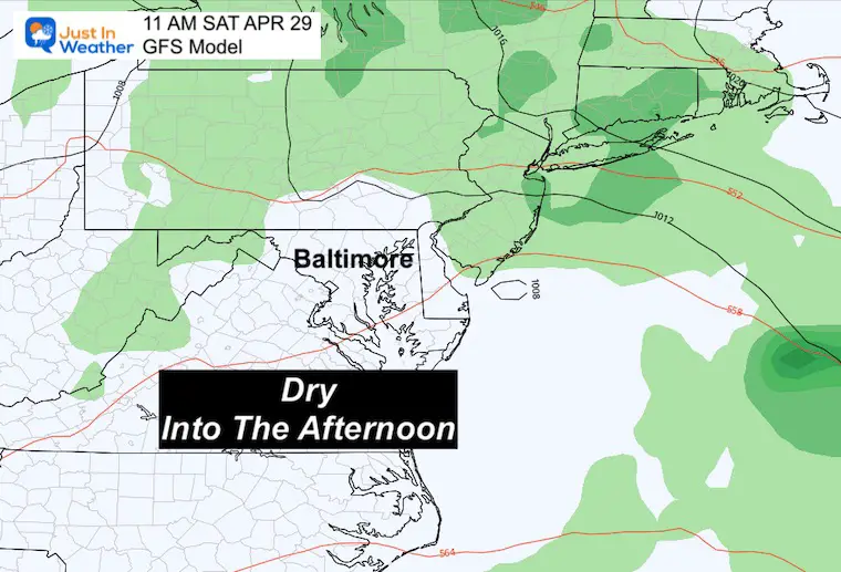
We pick this up with the dry Saturday afternoon, then the rain returns Sunday. This will increase and be heavy again into the afternoon and evening.
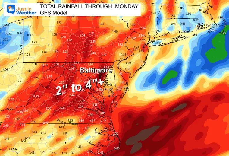
I have seen a steady increase in expectations for both events. We can now legitimately expect 2 to 4 inches (or more) by Monday morning.
There is a moderate drought in the Mid Atlantic that has a chance to be erased this weekend.
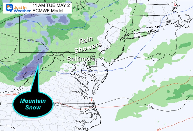
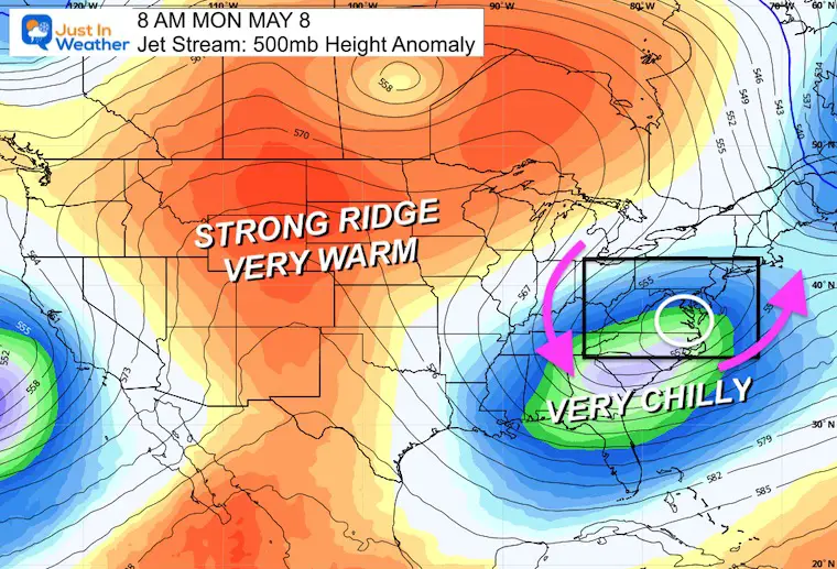
The following weather system will tap into that core of colder air. The net result will bring us more rain AND higher elevation snow. This may produce some accumulation for Garrett County Maryland and the high ridge in West Virginia.
If only we had this in winter… Simply the cold getting reinforced.
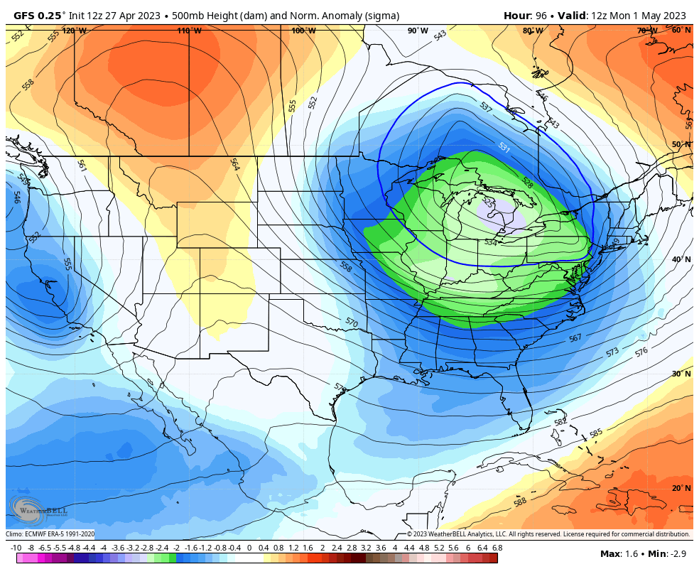
This is a long range outlook, so take it with a grain of salt. But if this is close to verifying, then there could be another weekend coastal storm followed by abnormal cold with danger for frost in interior section of the Southeast US.
Chilly and wet is the theme. There will be a break Saturday before the second storm.
Monday looks dry with chilly winds, then showers during the week. Temps will remain 10 to 20 degrees cooler than average to start May.
Click to see more and ‘Book’ a visit to your school

I am aware there are some spelling and grammar typos, and occasional other glitches. I take responsibility for my mistakes, and even the computer glitches I may miss. I have made a few public statements over the years, but if you are new here you may have missed it: I have dyslexia, and found out during my second year at Cornell University. It didn’t stop me from getting my meteorology degree, and being first to get the AMS CBM in the Baltimore/Washington region. One of my professors told me that I had made it that far without knowing, and to not let it be a crutch going forward. That was Mark Wysocki and he was absolutely correct! I do miss my mistakes in my own proofreading. The autocorrect spell check on my computer sometimes does an injustice to make it worse. I also can make mistakes in forecasting. No one is perfect predicting the future. All of the maps and information are accurate. The ‘wordy’ stuff can get sticky. There has been no editor that can check my work when I needed it and have it ready to send out in a newsworthy timeline. Barbara Werner is a member of the web team that helps me maintain this site. She has taken it upon herself to edit typos, when she is able. That could be AFTER you read this. I accept this and perhaps proves what you read is really from me… It’s part of my charm.
#FITF