May 10 Chilly With More Rain Showers Today And Into Mothers Day Weekend
Friday May 10 Morning Report Today is the first day of the year with sunrise before 6 AM in Baltimore, but we won’t see it. After a high temperature of…
April 26, 2023
Wednesday Morning Update
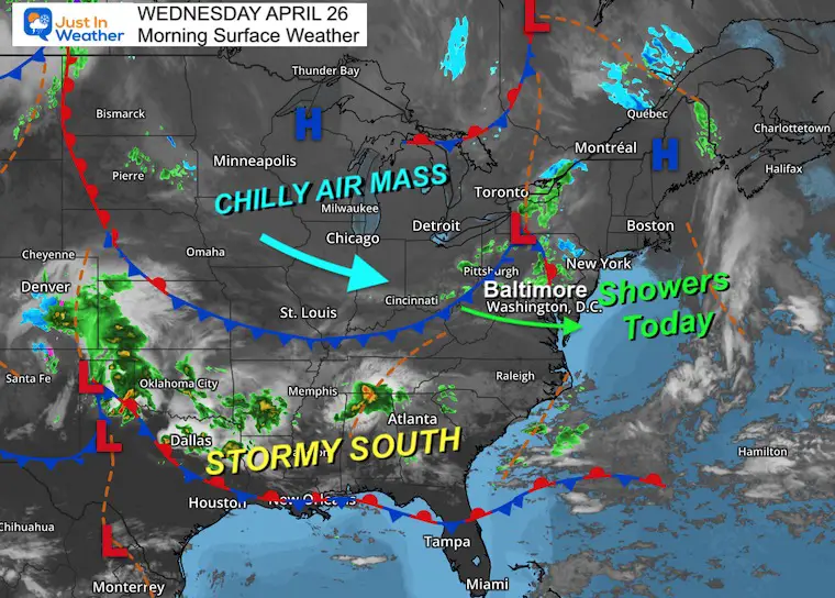
The weather pattern is looking more like winter, but we are approaching May. The net result will be an active storm track with temperatures running between 10 and 20 degrees below average.
Today we see a weak weather system that will spark showers. The computer guidance is having trouble with the depiction. I have that below and the live radar to compare. If you have plans, expect a stray shower possible any time after 2PM.
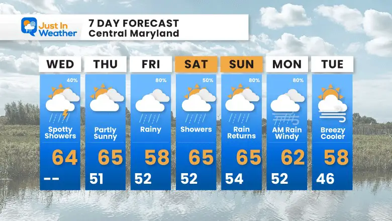
More rain with 2 more storms between Friday and Monday, then remaining cooler than average through next week.
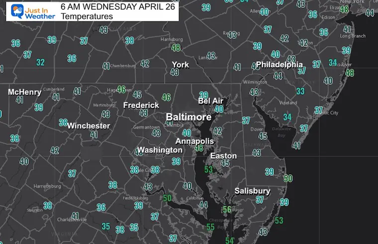
Morning Temperatures
This little weather system will be the reason for rain showers today and reinforcing the chilly weather pattern. A stormy south is a signal for sending more rain our way by the end of the week.
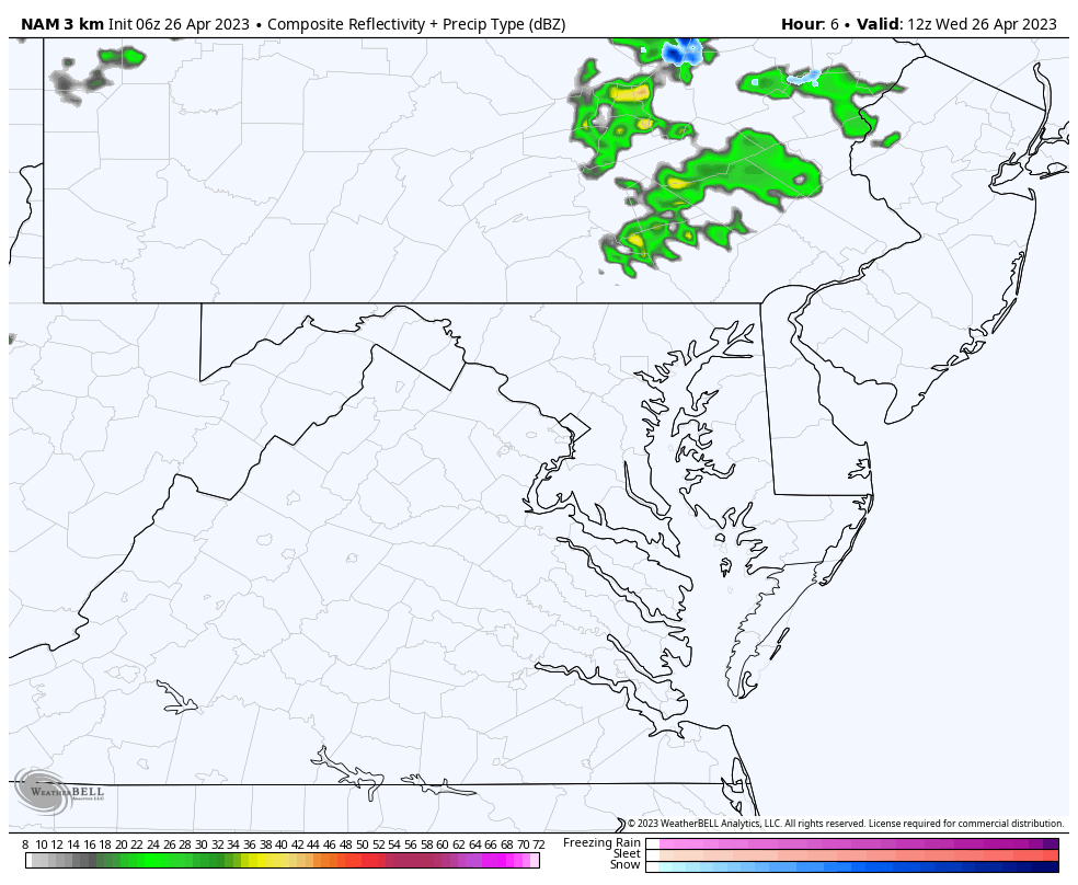
There have been more showers than expected this early. The computer guidance has fallen short. It will not be a washout, but you may get drops on the windshield or even a few minutes of of light rain.
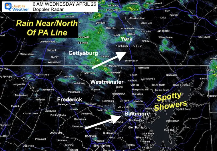
This product is lower resolution than the snapshot below. So this may broad brush some light rain showers that are more likely spotty or drizzle. There has been light rain tracking through NOT shown on the model guidance. Spotty showers this morning and more in the afternoon.
I think this product is missing some of the showers. We can expect this to be precise as there may be more light spotty showers than shown here. I am including the live radar widget below to compare and check back.
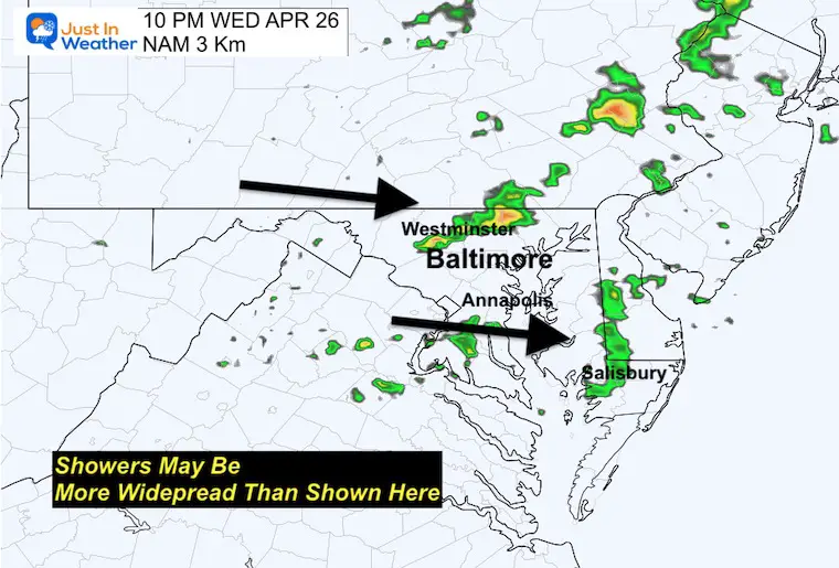
This line of rain looks more broken and farther east than we saw yesterday. I don’t trust it. I would plan for any showers or a pocket of T’storms any time after 3 PM in metro areas.
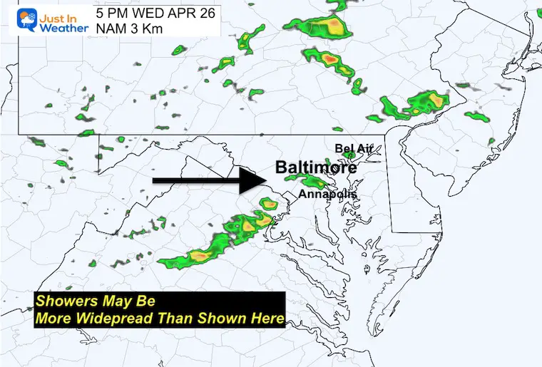
The idea here is that there will be a few rounds of showers or a T’storm through the evening as well.
Normal Low in Baltimore: 47ºF
Record 32ºF in 2001
Snow: Trace in 1919
Normal High in Baltimore: 70ºF
Record 92ºF 1990

Chilly but not as cold as the past two mornings.
Another chilly afternoon with mid 50s to near 60s. This will be limited by increasing clouds and approaching rain.
Two storms around the weekend. First arrives on Friday, the second will be later Sunday into Monday. In between there will be dry hours during the weekend. However, it will remain unsettled with a chilly and damp feel.
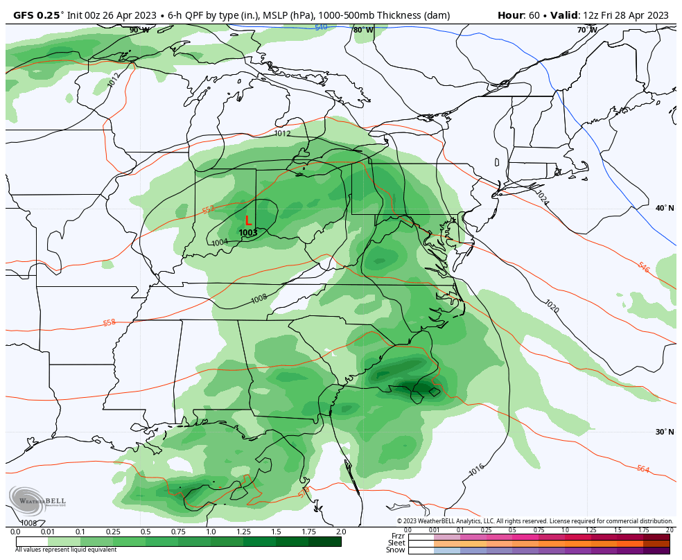
The timing has sped up a little, but that was to be expected. A steady rain will arrive for most of the day and lock in the chilly air.
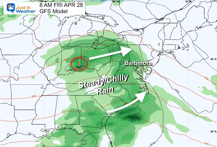
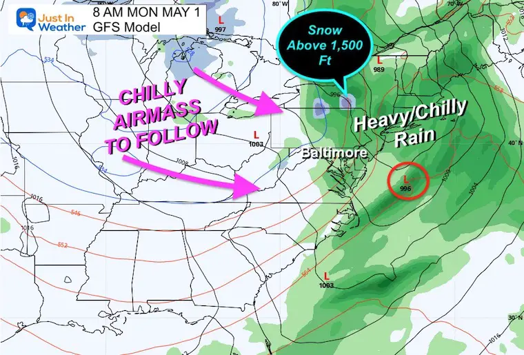
The coastal Low along the front is what may keep the rain around longer AND increase the wind flow. The bulk of the storm will fall overnight Sunday, then depart (for us) by Monday afternoon.
It will be cold enough for high elevation snow along the Pennsylvania and Maryland border.
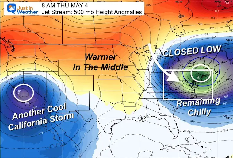
This shows the reinforcing cold pattern through next week.
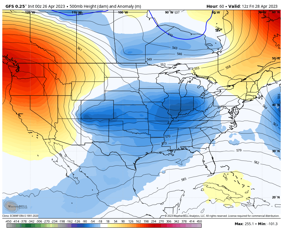
This closed Low is an impressive feature! If this was winter, we should have a very active snow pattern. Instead, this simply keeps us chilly with temps 10 to 20 degrees below average.
Showers on Wednesday then we watch for the two storms this weekend. The first on Friday has sped up to be an all day thing. Then the second on Sunday arrives during the day into Monday morning.
While there will be a lull Saturday, we could still have lingering showers.
Next week will remain cooler and there could be more inland frost on the clear mornings.