


May 10 Chilly With More Rain Showers Today And Into Mothers Day Weekend
Friday May 10 Morning Report Today is the second day of the year, with sunrise before 6 AM in Baltimore, but like yesterday, we won’t see it. After a high…
March 2, 2023
Thursday Night Update
There is still a little winter to report in our region, and the storm will be a factor for all of us on Friday. The same old storm track to our west will bring most of our region a chilly rain. However, a brief start with an alert inland and possibly a line of thunderstorms for much of our region at night.
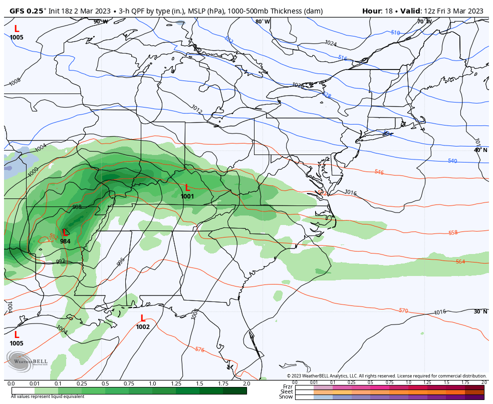
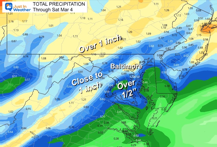
This will bring a moderate to heavy rain with many getting close to or over 1 inch.
It will feel uncomfortable, as below we can see the rain timeline and key time-frames with the temperatures.
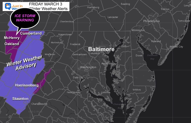
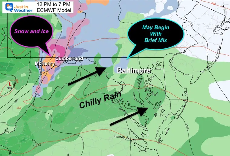
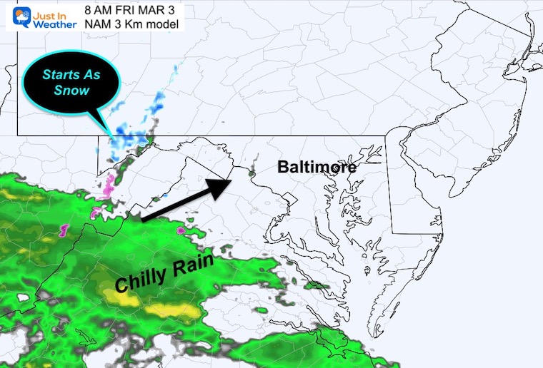
The ice problems will be in the mountains. Metro areas and most of Maryland will get a chilly rain beginning close to noon.
It may start with sleet or wet snow over the inland northern suburbs. This will not last long and will not stick on pavements.
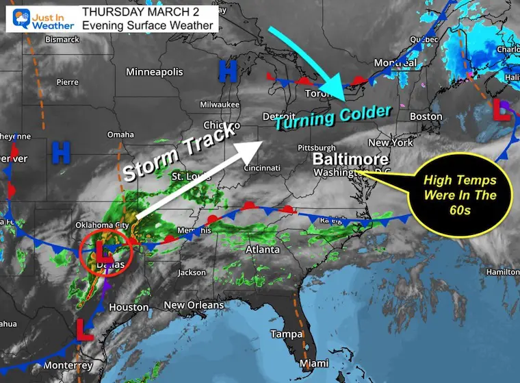
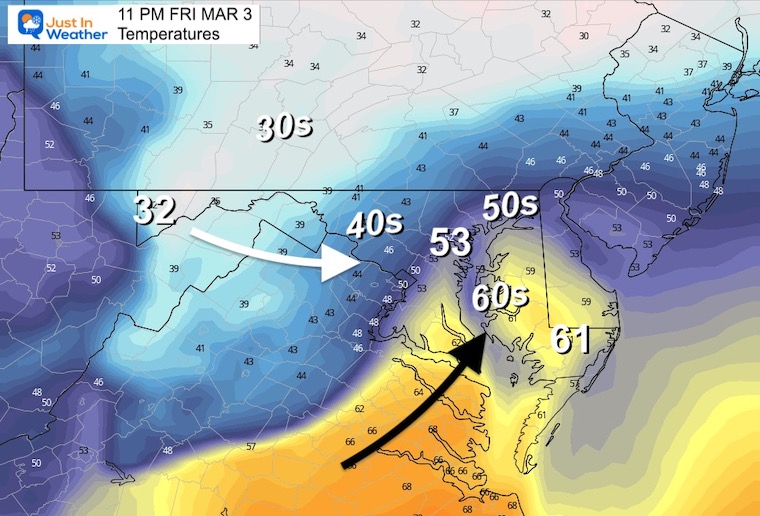
After high temperatures in the mid 50s to mid 60s today, cooler air is settling in tonight just ahead of the storm.
Low Pressure is located around Dallas, TX and will be heading north towards Detroit. It will bring a cluster of severe storms to the Mississippi and Ohio Valley on Friday.
In our region, it’ll be just cold enough for ice in the mountains, with mostly a chilly rain for the rest of us.
7 AM Friday to 7 PM Saturday
The winter zone will be on the edge of Detroit, New York, and Boston. Inland will get more snow and ice, including interior Pennsylvania. Here in the Mid Atlantic, we get a chilly rain during the day, then possibly strong thunderstorms at night with the cold front.
8 AM Friday to 8 AM Saturday (see key time-frames below)
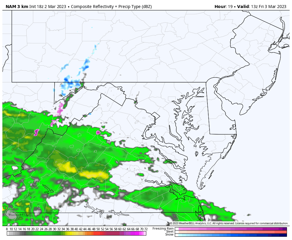
Radar Simulation
Temperatures
Chilly, but the freezing air does not make it in here.
Radar Simulation
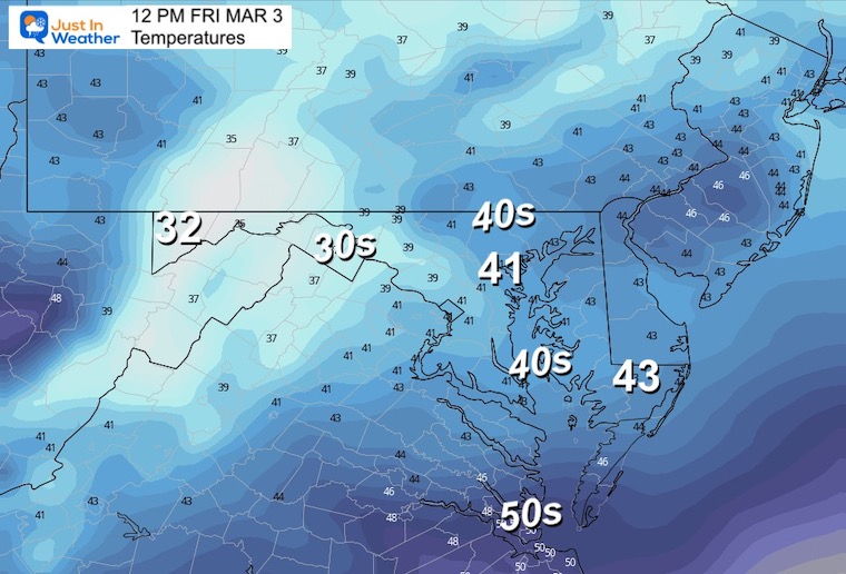
Expecting the arrival around lunchtime. That is a vague few hours around noon. Often we end up seeing the start 1 to 2 hours earlier than shown.
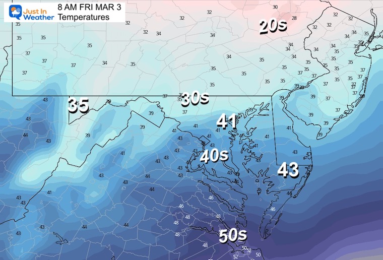
Temperatures
Still chilly, but the only freezing temps will be in the mountains where there are weather alerts in place.
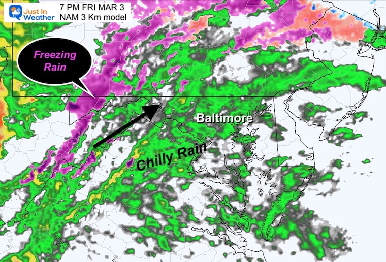
Radar Simulation
Rain will be settled in through the evening. Freezing rain will remain in the higher mountains.
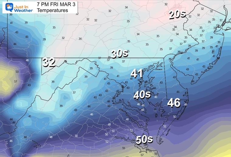
Temperatures
Notice the urban temps remain in the lower 40s, with the inland northern suburbs dropping into the upper 30s. But check out the next time frame!
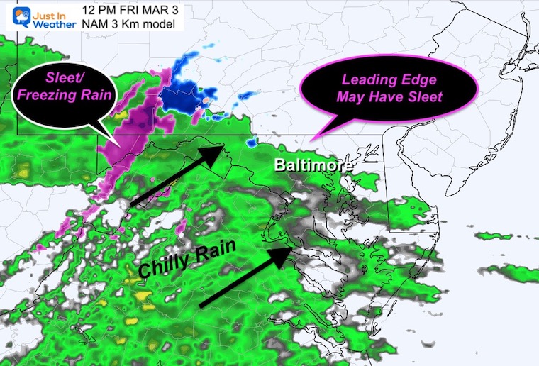
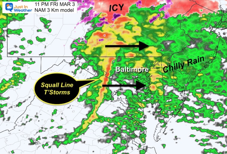
Radar Simulation
The final push of the storm will be the cold front. This will have a history of severe storms from earlier in the day back in the Ohio Valley. There is a chance this may still produce a brief intense squall with lightning and thunder. You can plan for gusty winds for sure!
Temperatures
A surge of warmer air ahead of the Cold Front may push the 60s into Southern Maryland up to near Kent Island. Metro Baltimore may briefly get to the 50s, just as the cold front and colder air arrives.
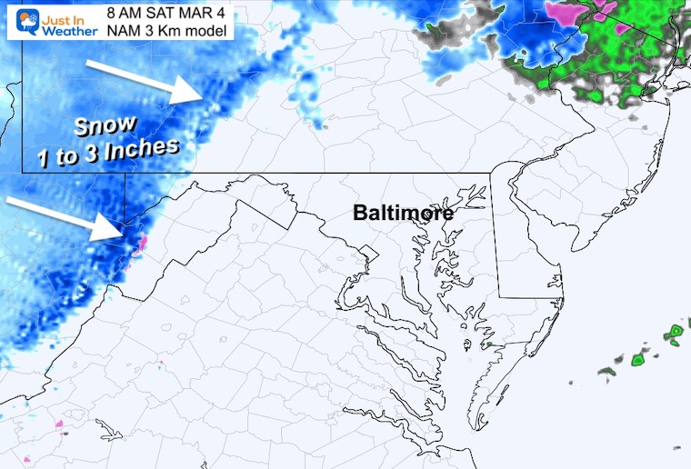
This will end with mountain Lake Enhanced snow. A total of 1 to 3 inches is possible for the ski areas to help freshen up the slopes.
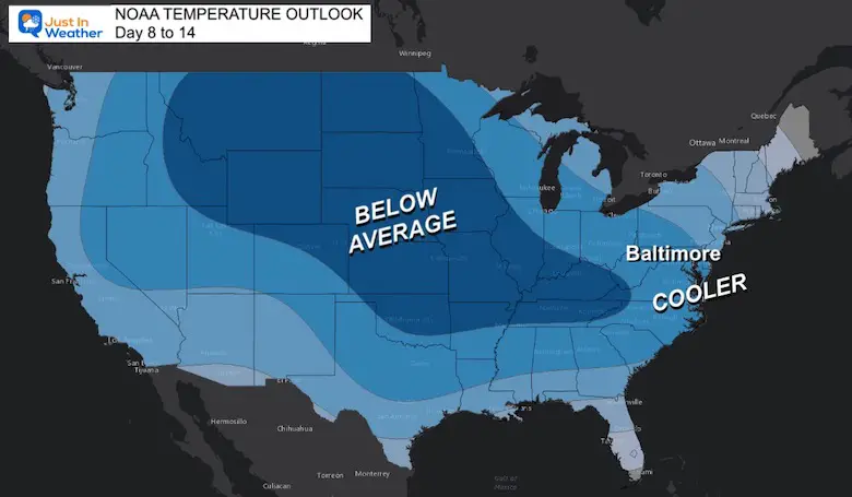
The immediate weather outlook is mild into next week. Farther out, NOAA is now on board with a colder trend for the rest of the month.
Explore More: NOAA March Outlook Colder
Winter History: Low Snow And Late Starts
See my research based on Baltimore data since 1883.

Click to see more and ‘Book’ a visit to your school

I see many factors to support colder influence with multiple systems. Early and later in winter. Check it out. https://justinweather.com/2022/11/22/winter-outlook-2023-for-snow-not-typical-la-nina-plus-polar-vortex-disruption/
Winter Outlook 2023 Early Look At Snow From Two Farmers Almanacs
https://justinweather.com/2022/09/09/winter-outlook-2023-la-nina-triple-dip-expectations/
If you want a snowy winter, this is what you might want to look for in the rest of the tropical season. https://justinweather.com/2022/08/31/record-august-for-no-named-tropical-storms-closer-look-at-snow-following/
https://justinweather.com/2022/10/25/winter-weather-outlook-from-the-wooly-bear-caterpillar/

