


May 12 Mothers Day Showers And Another Aurora Viewing Tonight May Be Better
Sunday May 12 Mother's Day Morning Report Today, we focus on the all-important Mother’s Day weather and the ongoing impact of the latest Solar Storm. We have been stuck in…
March 3, 2023
Friday Morning
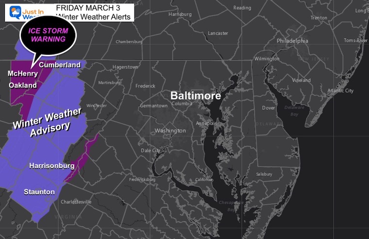
We have a strange day ahead of us. It will turn out to be a chilly and wet day for most of our region, but there are some peripherals to explain. To our west, an Ice Storm is expected in the high mountains, where some ski areas will end up with fresh snow on Saturday.
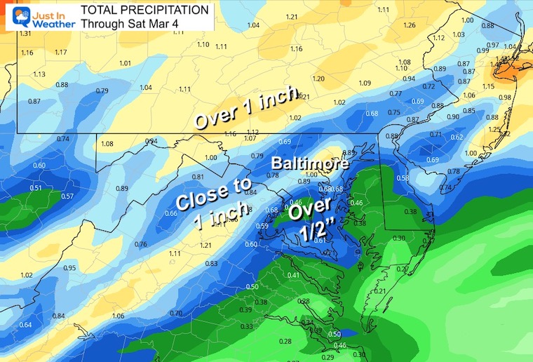
Locally, we get the rain arriving midday and temps remain chilly for the most part. Inland areas still may get an hour or two with sleet, but no stickage. Then the rain will get heavy tonight and thunder is possible closer to midnight.
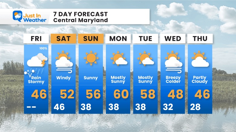
Strong winds will be noticeable this afternoon and more so on Saturday.
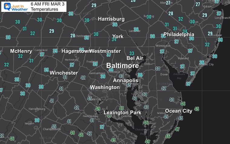
It has cooled down, but expecting to get colder as the precipitation arrives. This will take western Maryland and Virginia mountains down below freezing.
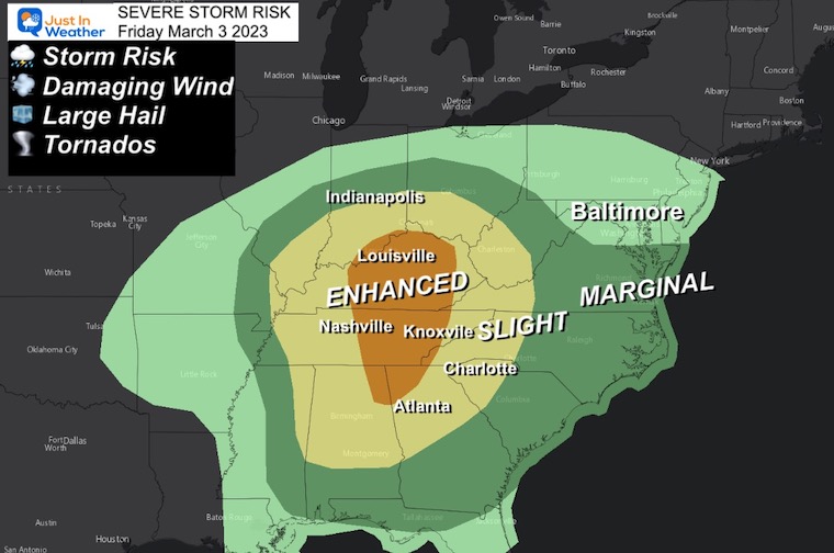
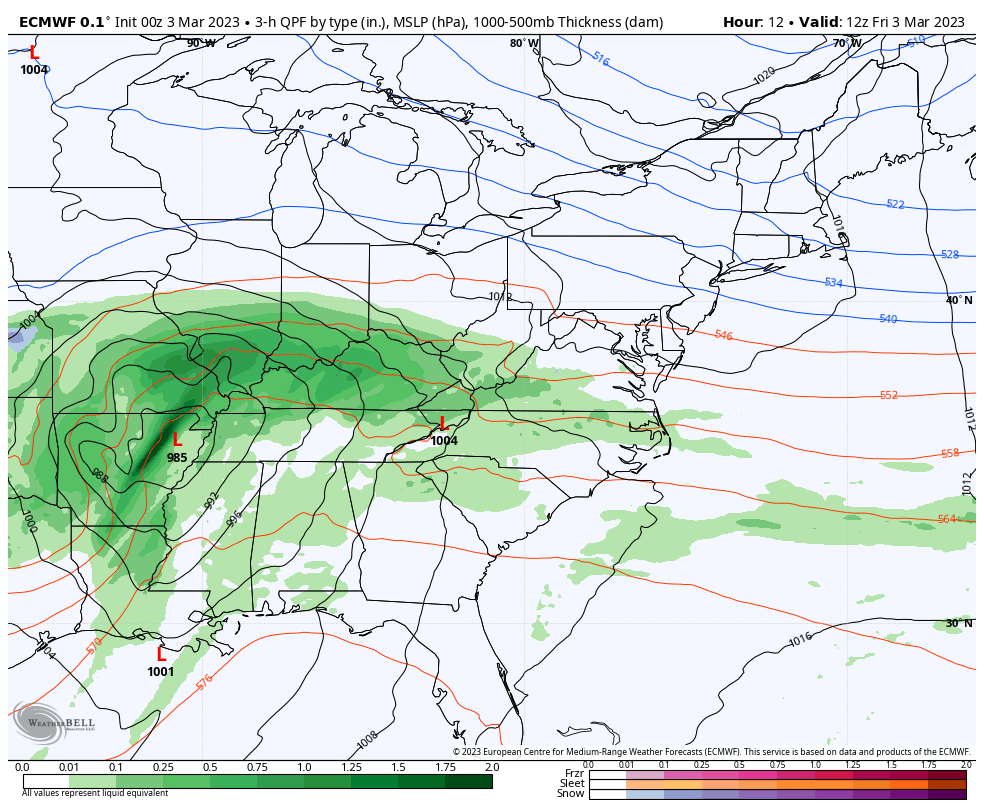
An outbreak of severe storms will erupt across the Ohio Valley, with the bullseye on Tennessee. The ENHANCED Risk is level 3 of 5 and likely to have damaging wind and tornadoes. The expanse of storms may impact travel and delay flights around the entire Eastern US.
A Marginal Risk extends to Virginia and Southern Maryland.
Some residual rumbles of thunder may carry through our metro areas tonight.
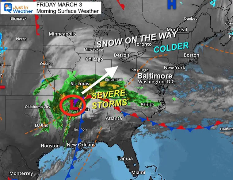
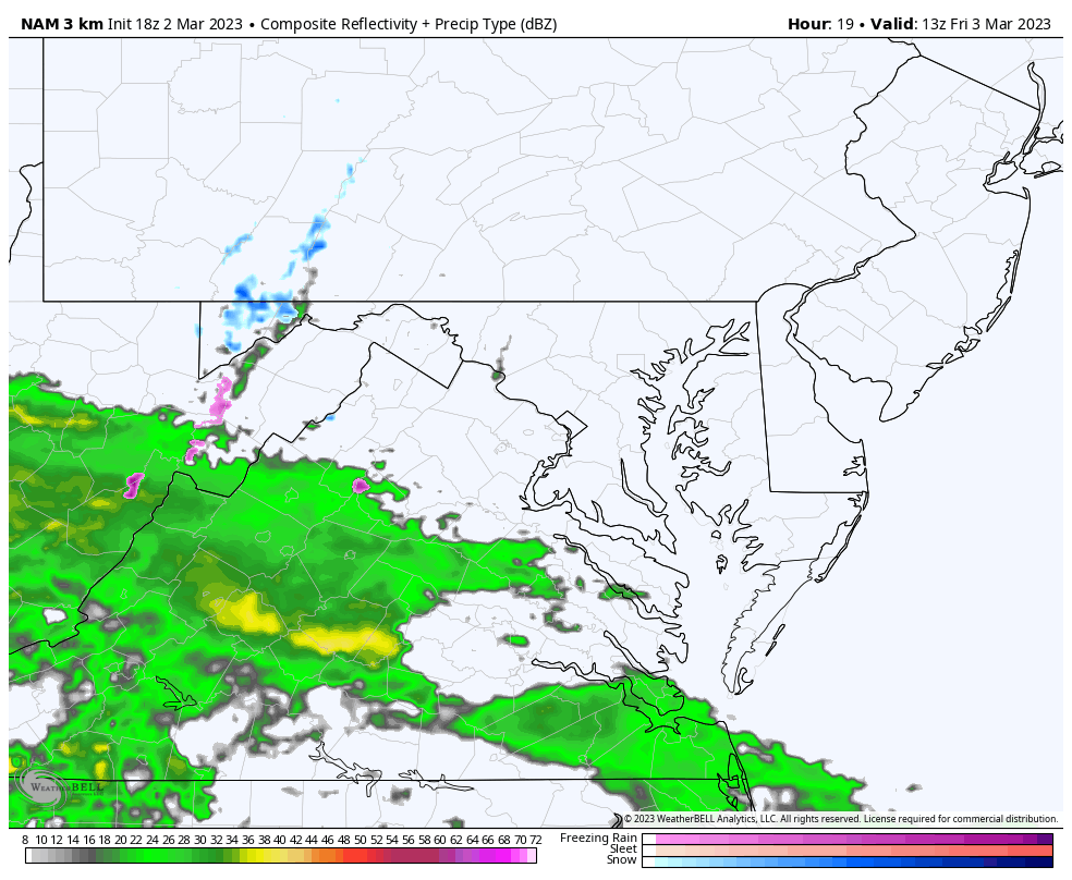
The Storm is centered near Memphis, TN this morning. It will track to the Great Lakes where a snow storm is expected between Detroit, Buffalo, and Boston.
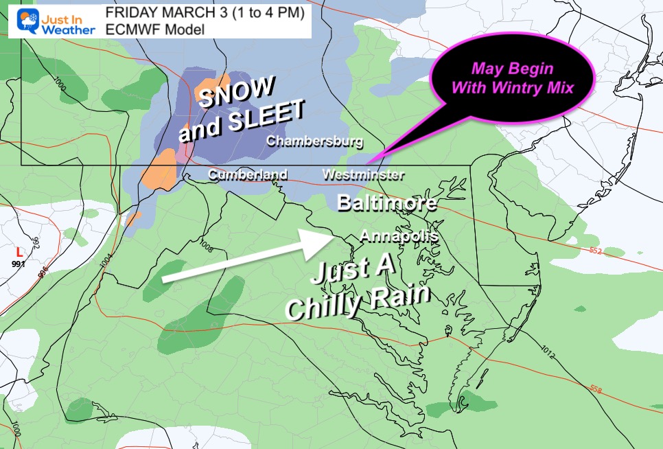
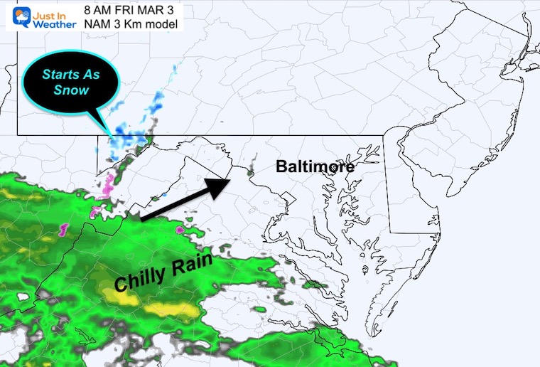
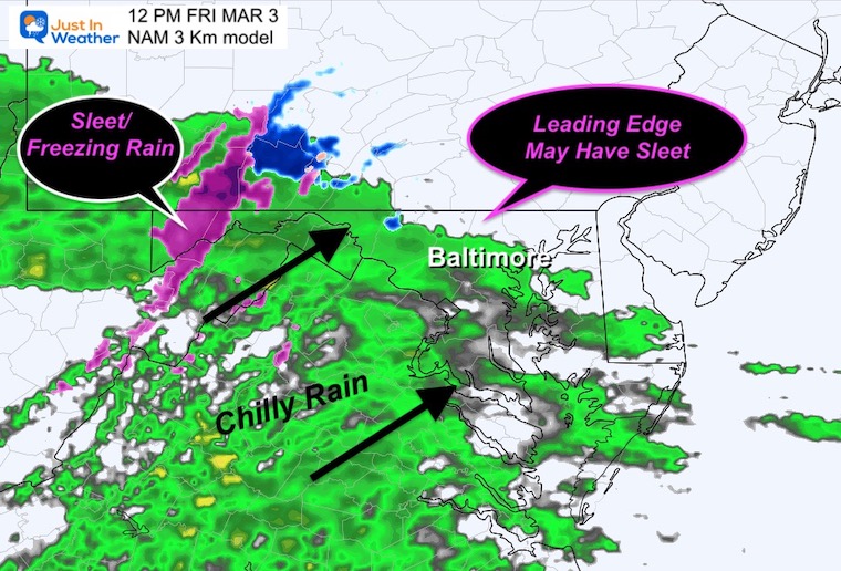
We will get the leading edge of the precipitation arriving late morning to early afternoon. As this meets up with colder air, there may be some initial sleet, then just a chilly rain for most of the day.
The severe storms will cross the mountains, and leftover rumbles of thunder could cross our region around midnight.
Live Doppler Radar Widget
Tracking the precipitation arriving today.
7 AM Friday to 7 PM Saturday
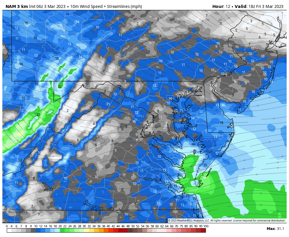
The winter zone will be on the edge of Detroit, New York, and Boston. Inland will get more snow and ice, including interior Pennsylvania. Here in the Mid Atlantic, we get a chilly rain during the day, then possibly strong thunderstorms at night with the cold front.
This may begin with sleet or snow mixed INLAND, then turn to rain. The ice will remain an issue in the mountains. Most of our region just gets a chilly rain.
8 AM Friday to 8 AM Saturday (see key time-frames below)
Radar Simulation
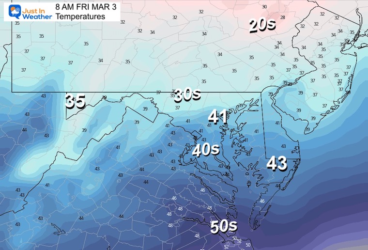
Temperatures
Chilly, but the freezing air does not make it in here.
Radar Simulation
Expecting the arrival around lunchtime. That is a vague few hours around noon. Often we end up seeing the start 1 to 2 hours earlier than shown.
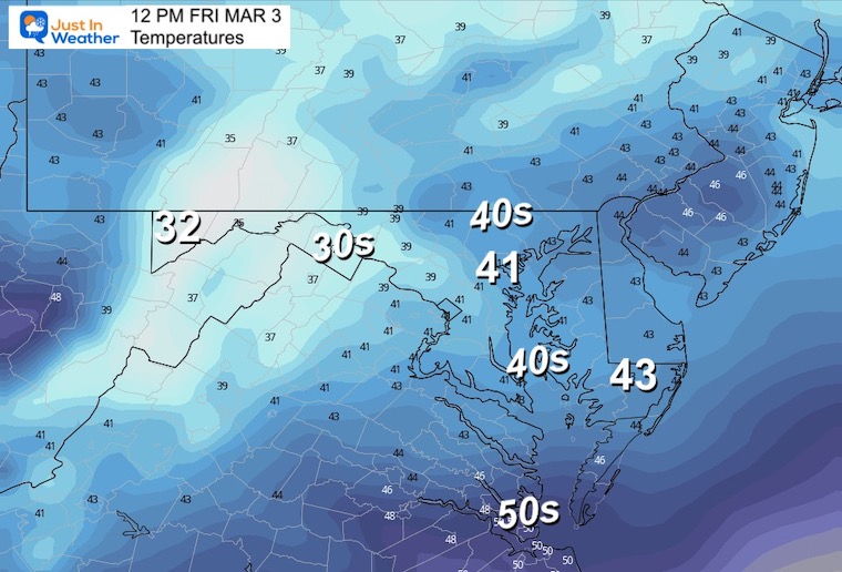
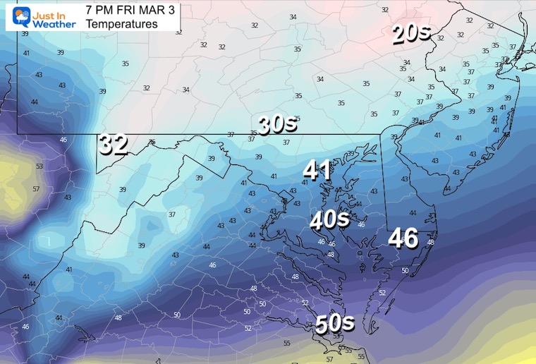
Temperatures
Still chilly, but the only freezing temps will be in the mountains where there are weather alerts in place.
Radar Simulation
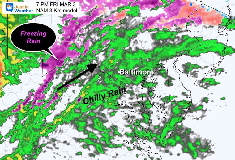
Rain will be settled in through the evening. Freezing rain will remain in the higher mountains.
Temperatures
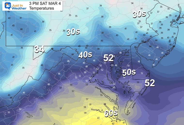
Notice the urban temps remain in the lower 40s, with the inland northern suburbs dropping into the upper 30s. But check out the next time frame!
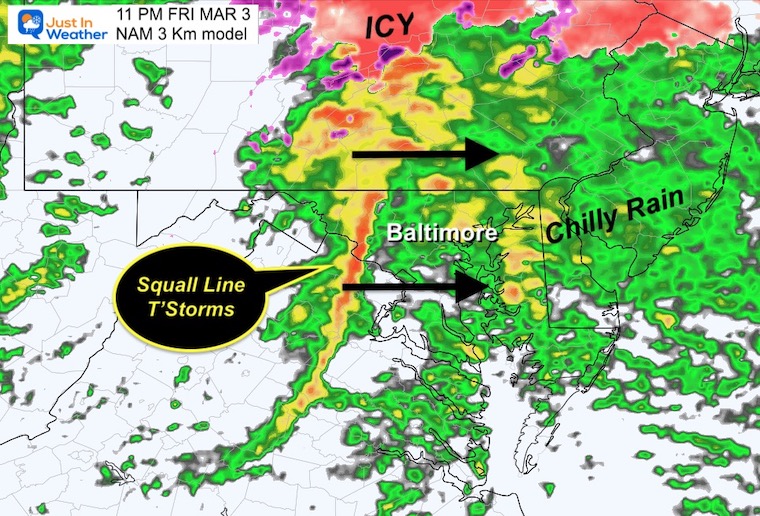
Radar Simulation
The final push of the storm will be the cold front. This will have a history of severe storms from earlier in the day back in the Ohio Valley. There is a chance it may still produce a brief intense squall with lightning and thunder. You can plan on gusty winds for sure!
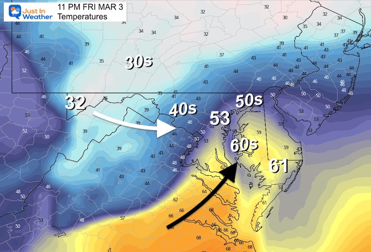
Temperatures
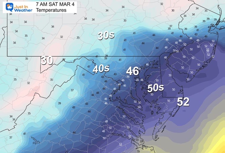
A surge of warmer air ahead of the Cold Front may push the 60s into Southern Maryland up to near Kent Island. Metro Baltimore may briefly get to the 50s, just as the cold front and colder air arrives.
The winds will be moving in today and increase as they switch from the West tomorrow.
Normal Low in Baltimore: 30ºF
Record 5ºF in 2014
SNOW: 10” in 1960
Normal High in Baltimore: 51ºF
Record 72ºF in 1923
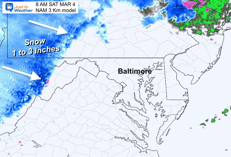
This will end with mountain Lake Enhanced snow. A total of 1 to 3 inches is possible for the ski areas to help freshen up the slopes.
Mild weather will return for a few days, but a distinct pattern change is expected to arrive by the end of next week.
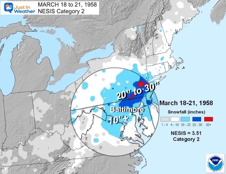
Winter History: Low Snow And Late Starts
See my research based on Baltimore data since 1883.

Click to see more and ‘Book’ a visit to your school

I see many factors to support colder influence with multiple systems. Early and later in winter. Check it out. https://justinweather.com/2022/11/22/winter-outlook-2023-for-snow-not-typical-la-nina-plus-polar-vortex-disruption/
Winter Outlook 2023 Early Look At Snow From Two Farmers Almanacs
https://justinweather.com/2022/09/09/winter-outlook-2023-la-nina-triple-dip-expectations/
If you want a snowy winter, this is what you might want to look for in the rest of the tropical season. https://justinweather.com/2022/08/31/record-august-for-no-named-tropical-storms-closer-look-at-snow-following/
https://justinweather.com/2022/10/25/winter-weather-outlook-from-the-wooly-bear-caterpillar/

