January 11, 2023
Wednesday Morning Report
This morning brings a taste of winter with cold temps and moisture in the air. The net result is thick frost you may need some extra time to thaw or scrape off your vehicle. There are also areas of patchy thick fog.
The day ahead will bring an increase in clouds, then some rain showers tonight. A brief mix is possible in the higher hills, but the focus is on the warming.
The next storm may bring two rounds of heavy rain bands and some thunder, followed by a colder weekend.
Headlines
- Morning – Thick Frost
- Tonight – Rain Showers
- Thursday Night – Warm With Rain And Thunder Possible
- Weekend – Cooler and maybe flurries to end
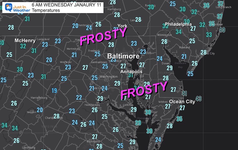
Morning Temperatures
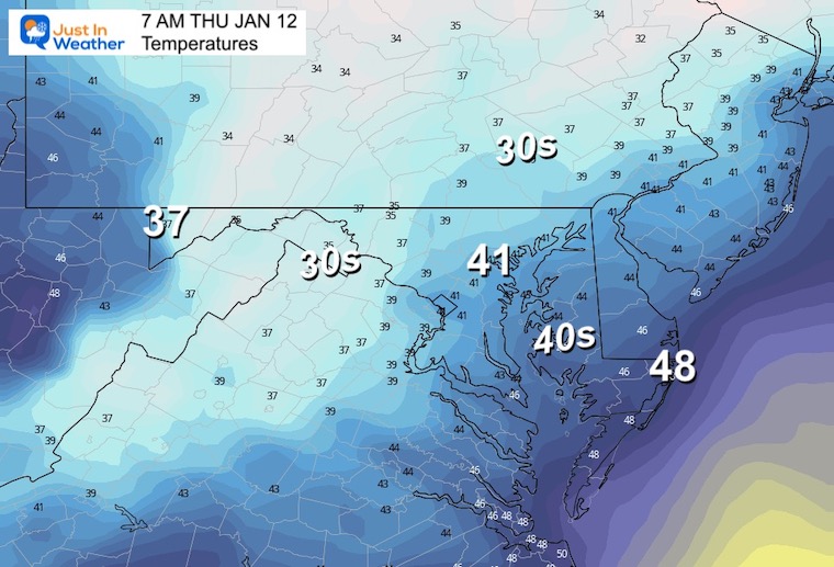
Colder air, back to near normal….
There is thick frost on many vehicles this morning. Consider taking an extra 10 minutes to thaw or scrape.
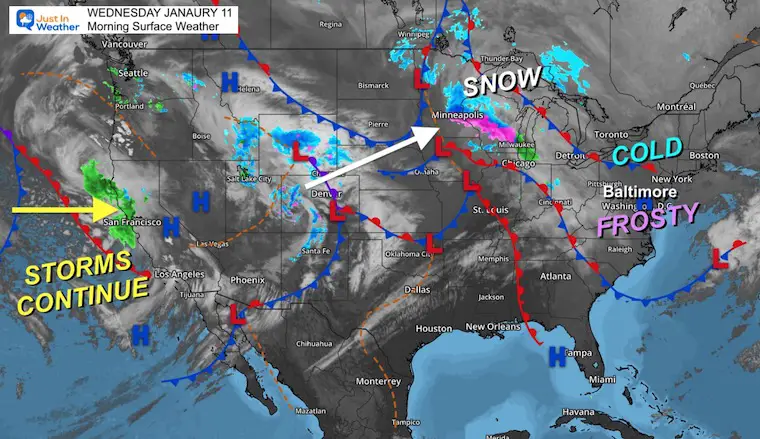
Surface Weather
The storms continue for California, and that inland track keeps taking the cold and snow from the Rockies to the Great Lakes.
After our frosty morning, we will get in on the warming ahead of that storm, resulting in a rain event.
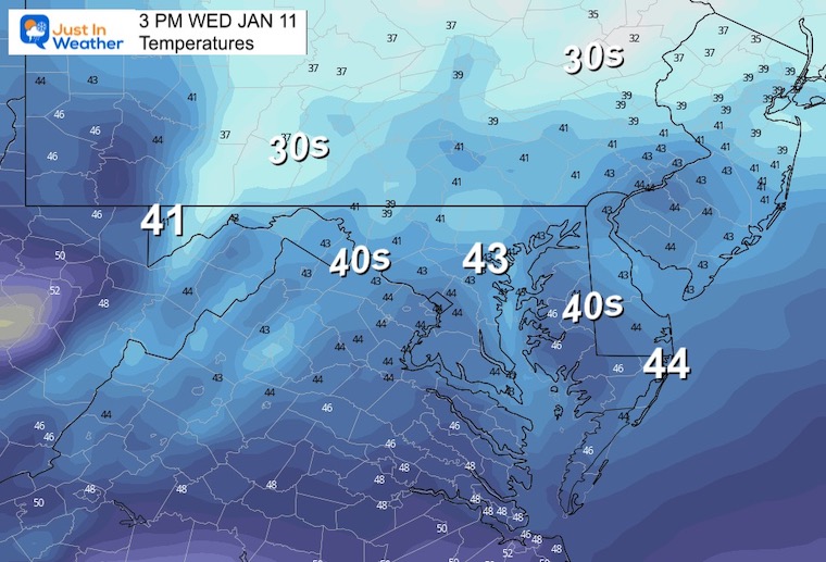
3 PM Temperatures
Seasonably Cold
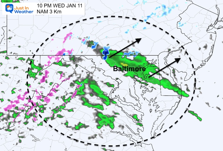
Evening Radar: 10 PM
The first showers will arrive this evening and tonight, as the warmer air builds in. There may be some snow or sleet mixing in north of Baltimore briefly.
Subscribe for eMail Alerts
CLIMATE DATA
TODAY January 11
Normal Low in Baltimore: 26ºF
Record 1ºF in 1982
SNOW: 3.8” 1954
Normal High in Baltimore: 43ºF
Record 73ºF 1975
Thursday Storm
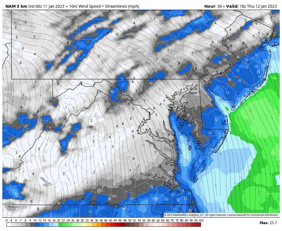
Wind Forecast
1 PM Thu to 1 PM Fri
The winds will increase from the South, pumping in warmer air to feed the rain. Then on Friday morning, it will swing to the West as the storm moves away.
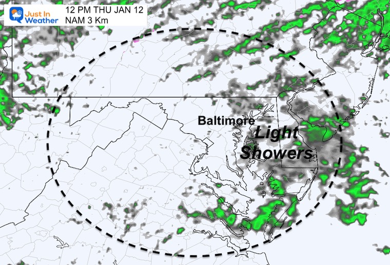
Rain Forecast
Noon
Light showers and drizzle.
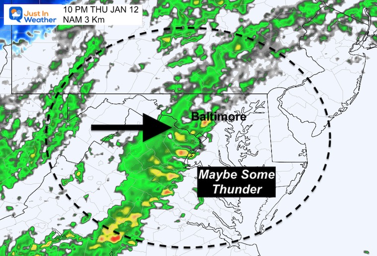
Thursday Night
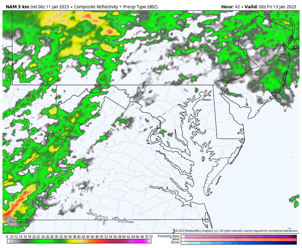
This is the first of two bands of heavy rain that may contain some thunder.
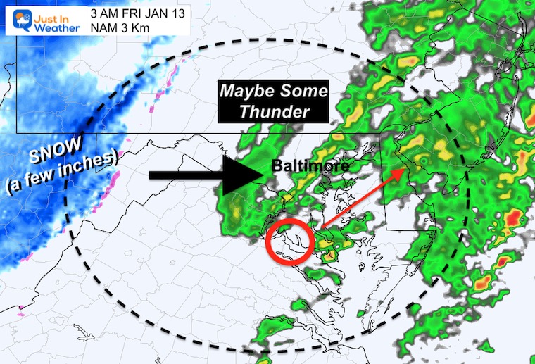
Early Friday Morning
The second band of heavy rain. This one with Low Pressure passing through central Maryland.
Colder air behind the storm will bring a few inches of fresh snow to the western Maryland mountains.
Radar Simulation: NAM 3 Km
7 PM Thu to 7 AM Fri
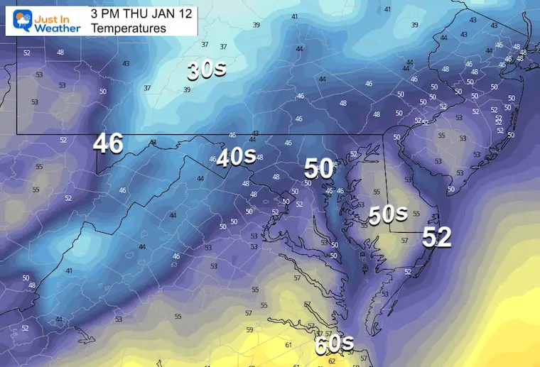
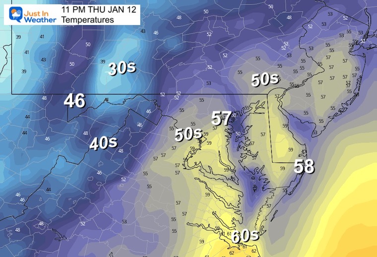
Temperatures
Morning
Afternoon
Night
Warmer air keeps flowing in with the rain. The high temperature should be just before midnight.
Looking Ahead:
Last night I wrote this report about the time window for the pattern change… Yes, it is later, but still expected before the end of the month.
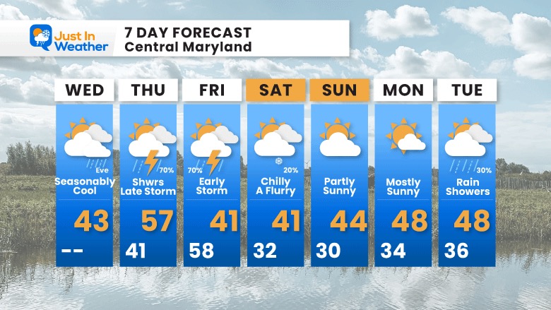
7 Day Forecast
Rain showers Thursday into Friday morning. Then the colder air will follow (again).
Faith in the Flakes Gear

What is Faith in the Flakes?
It began with my son in 2009
December 5th Snow In Baltimore And The Start Of Faith In The Flakes FITF
SNOWSTIX – Available Now

STEM Assemblies/In School Fields Trips Are Back
Click to see more and ‘Book’ a visit to your school

My Winter Outlook: Not A Typical La Niña!
I see many factors to support colder influence with multiple systems. Early and later in winter. Check it out.
Winter Outlook 2023 For Snow Not Typical La Niña Plus Polar Vortex Disruption
Also See The Winter Outlook Series:
Atmospheric Memory Suggests Active Winter Storm Pattern Outlook
Winter Outlook 2023 From NOAA Very Different Than Farmers Almanacs
Farmer’s Almanac Comparison
Winter Outlook 2023 Early Look At Snow From Two Farmers Almanacs
Triple Dip La Niña Winter
Winter Outlook 2023 La Niña Triple Dip Expectations
CONNECTION TO WINTER?
If you want a snowy winter, this is what you might want to look for in the rest of the tropical season. (You might be seeing a lot of commercial snow removal people out this Winter).
Record August For No Named Tropical Storms: Closer Look At Snow Following
Wooly Bear Caterpillars
Winter Weather Outlook From The Wooly Bear Caterpillar
Persimmon Seeds
Winter Weather Outlook: Persimmon Seeds And Snow Folklore
Click to see Top 20 and MORE
Winter Weather Folklore Top 20 And More Outlook Signals From Nature For Cold And Snow
Normals And Records: Maryland and Baltimore Climate History

Please share your thoughts, best weather pics/videos, or just keep in touch via social media


