


May 9 Cooler With Rain And Severe Storm Risk Tonight South
Thursday May 9 Morning Report Today is the first day of the year with sunrise before 6 AM in Baltimore, but we won’t see it. After a high temperature of…
December 21 2022
Wednesday Morning Update
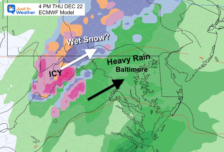
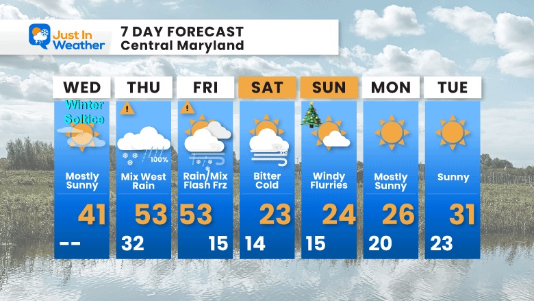
Today is the Winter Solstice and it is about to truly feel like it. I have been hearing from doubters and all I can say is, ‘let’s talk again on Friday’. The storm will cover 2 days for us, with the back end being the worst.
However, a Winter Weather Advisory and Winter Storm Warning have been issued for tomorrow morning in the mountains. We will be warm with mostly rain, then an arctic blast will bring most of our region below freezing by noon on Friday.
The Flash Freeze is a real threat, not a hope. Please just be cautious of the true potential.
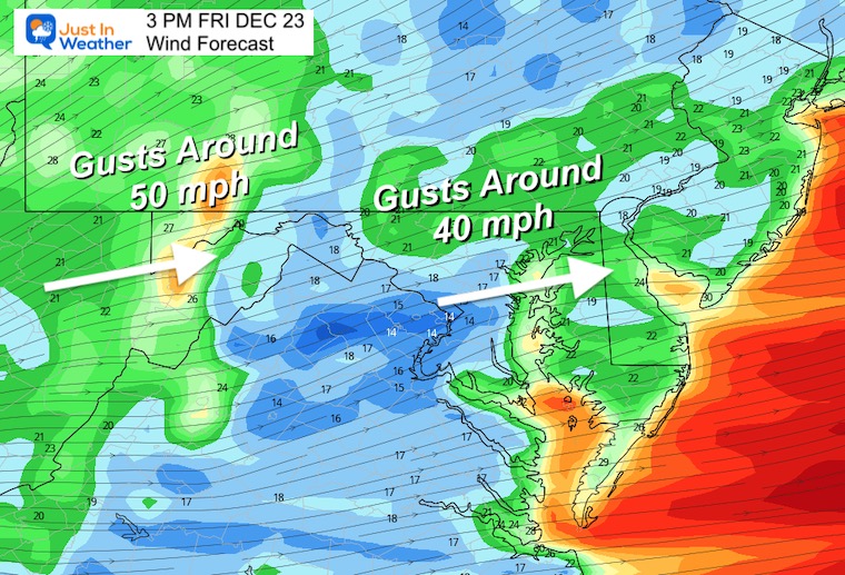
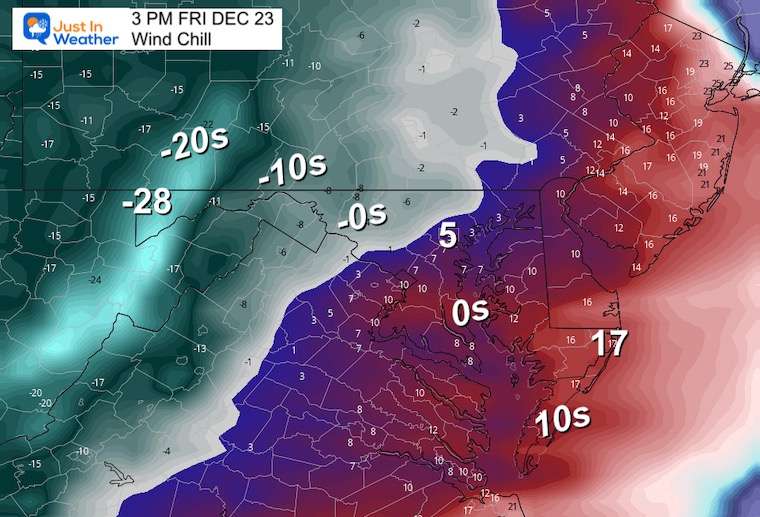
Winds will gust to 40 mph and wind chills will drop below zero leading to a frigid Christmas Weekend.
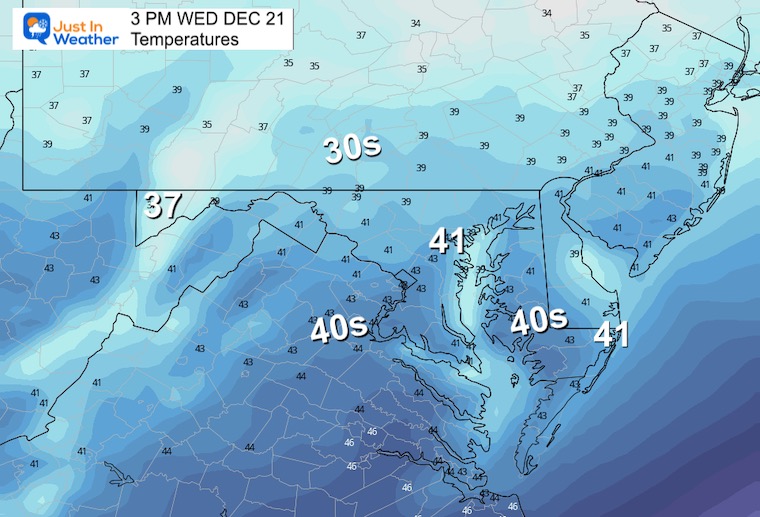
The cold air in place is seasonal, but colder winds will hold temps down this afternoon.
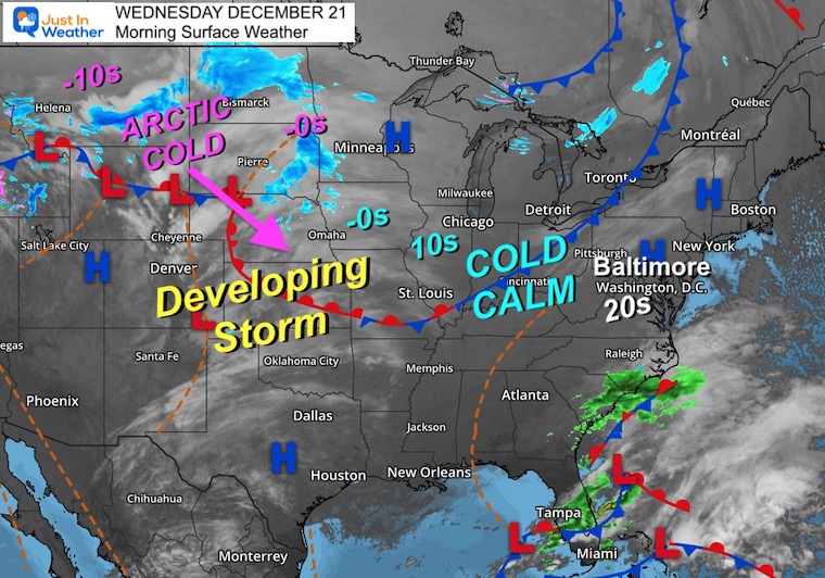
The storm may not look like much this morning, but it will be taking form today. The main energy includes air from Siberia and Alaska entering Montana this morning.
Arctic air already in Montana and North Dakota, temps in the -10s. Wind chills in northern states will drop close to -50ºF.
Close to where the last few days have been.
Normal Low in Baltimore: 29ºF
Record 5ºF in 1942
SNOW: 4.3” 1962
Normal High in Baltimore: 46ºF
Record 71ºF 2013
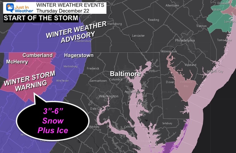
The freezing line is highlighted north and west of Baltimore.
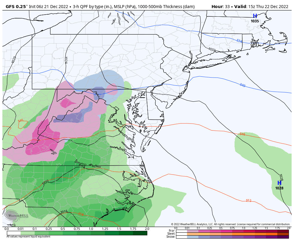
With a faster arrival, there will be slightly colder air to allow the start as snow. This may reach parts of Frederick, Carroll, and York counties. But those temps will be marginal. It will be around I-81 and west where stickage could be a problem.
Some morning issues west of the I-68 split and south of Hagerstown on I-81.
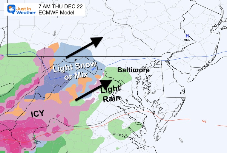
Some minor issues west and north of Frederick. More concern along and west of I-81.
Gradual thaw, except in the Winter Storm Warning area that may remain icy longer.
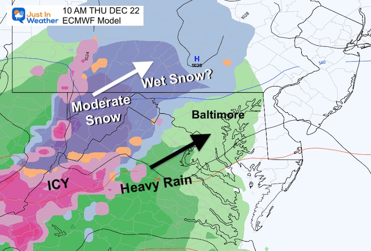
7 AM to Noon (in slower motion)
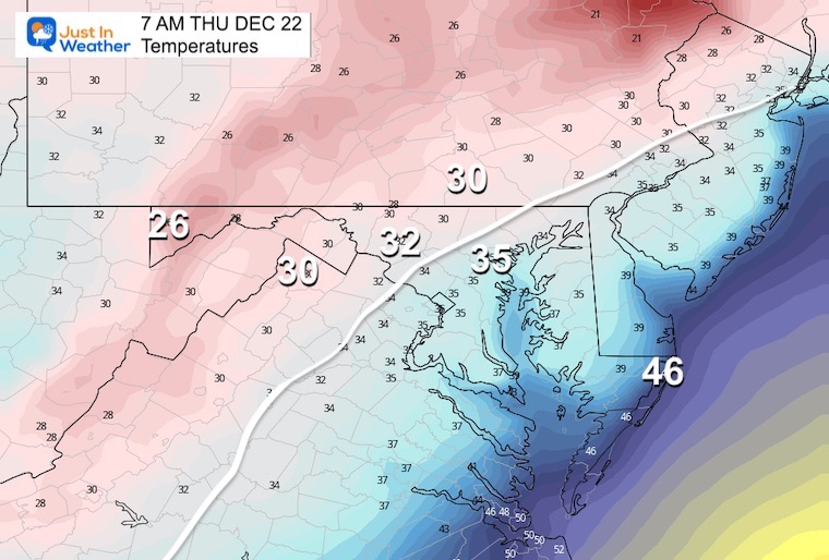
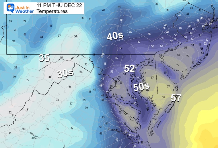
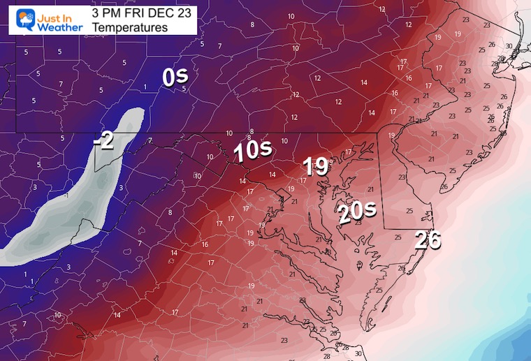
The warmest part of the day will be early morning. Then the arctic front arrives, which has been trending earlier.
It looks like local areas can plan for 8 AM to 11 AM (to the Bay) for the Freeze, and expanding to the Beaches by mid afternoon.
Temps will quickly drop to the 20s while the pavement is likely to remain wet. This is the concern for icy roads.
Thursday morning to Friday afternoon.
This is the most aggressive with snow, because it develops a Low Pressure wave along the front. If this verifies, the snowfall would be up to 1 inch.
That is debatable. The main issue is keeping moisture falling and roads wet to allow for freezing.
We could see gusts to 40 mph. Yes, that can dry out the ground, when the precipitation stops. But with the cold it will hurt!
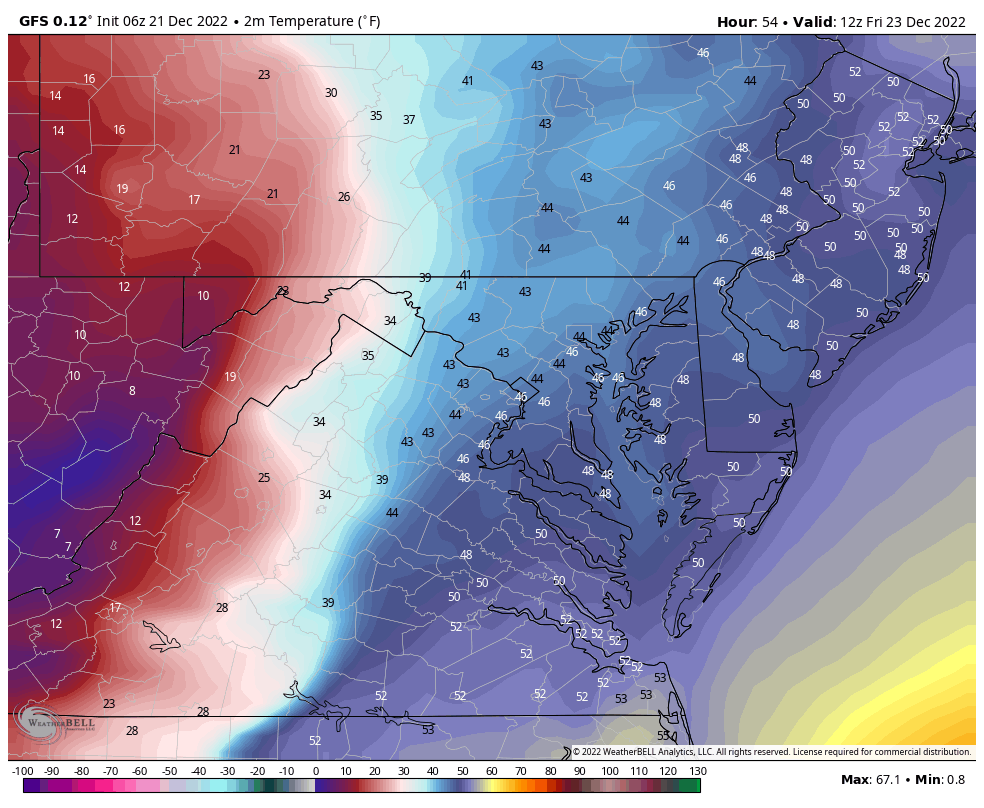
Deep freeze to the beaches by afternoon.
This is the painful part of the forecast. We will all feel this in the afternoon!
Saturday Morning – Christmas Eve Day will be FRIGID!
The coldest air will settle in over the weekend. There is a small chance for flurries in the cold air, but do not expect local accumulation.

December 5th Snow In Baltimore And The Start Of Faith In The Flakes FITF

Click to see more and ‘Book’ a visit to your school

I see many factors to support colder influence with multiple systems. Early and later in winter. Check it out.
Winter Outlook 2023 For Snow Not Typical La Niña Plus Polar Vortex Disruption
Atmospheric Memory Suggests Active Winter Storm Pattern Outlook
Winter Outlook 2023 From NOAA Very Different Than Farmers Almanacs
Winter Outlook 2023 Early Look At Snow From Two Farmers Almanacs
If you want a snowy winter, this is what you might want to look for in the rest of the tropical season. (You might be seeing a lot of commercial snow removal people out this Winter).
Record August For No Named Tropical Storms: Closer Look At Snow Following
Winter Weather Folklore Top 20 And More Outlook Signals From Nature For Cold And Snow
