


July 18 Flood Watch In The Mountains Then Storms Expand Back This Weekend
Friday, July 18 2025 Morning Report There is some relief in sight, but I remain cautious. For the short term, today remains muggy, while the focus of strong storms and…
December 7 2022
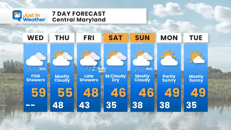
Wednesday Morning Update
The weather system we had yesterday is still here. The added moisture and convoluted warm front has forced a wedge of colder and damp air. The result has been some very thick fog in parts of the region, which will impact travel.
Numbers listed in miles: Thick fog will affect travel around and north of Baltimore.
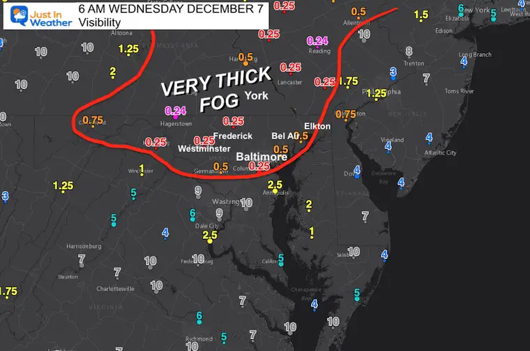
The thick fog is located in the ‘wedge’ of colder air where the warm front has not been able to push through yet.
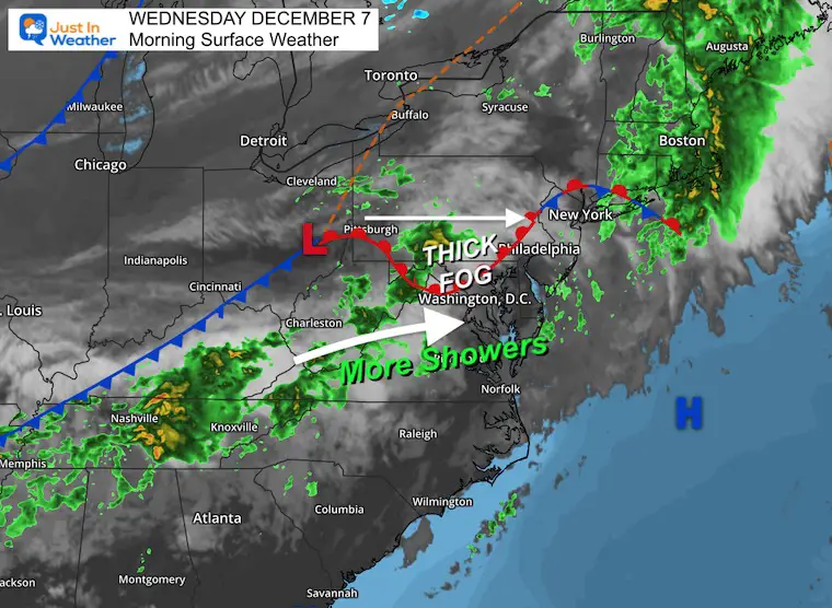
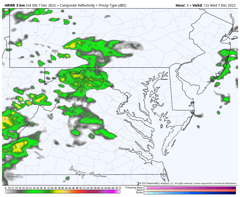
One band of rain to the north, and another will pass across our southern areas.
Use the controls to zoom and shift the view.
The HRRR Model has continued to show that northern rain band diminishing. However, it has looked stronger on radar than the model has shown, so our local Southern PA area may still get that with an attempt to push in warmer air. To the South: A steady rain is more likely to pass near and south of Rt 50 then across the Bay mid day.
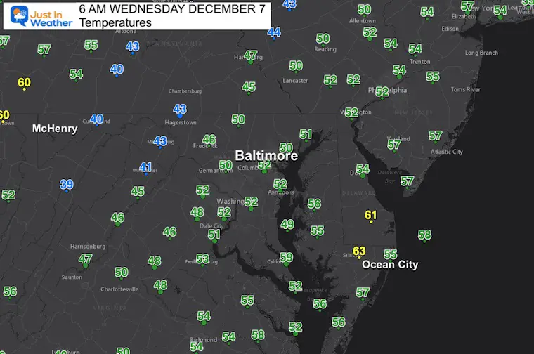
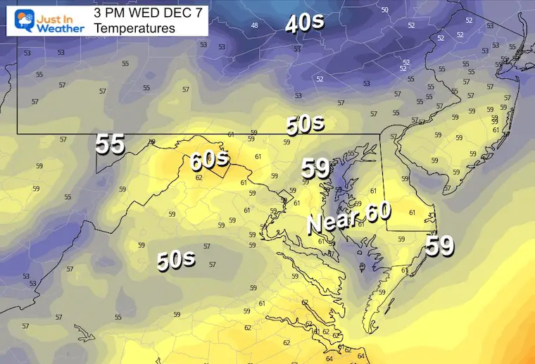
If we can get the fog to lift, temps will warm to the upper 50s and near 60ºF today.
Sign up and be the first to know!
Normal Low in Baltimore: 31ºF
Record 6ºF in 2002
SNOW: 0.8 inches in 1969
Normal High in Baltimore: 50ºF
Record 77ºF 1998
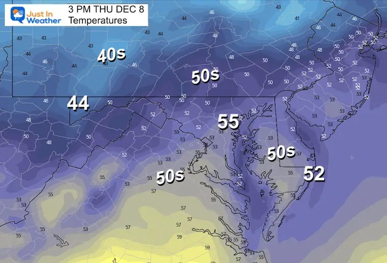
Not much movement on the thermometers.
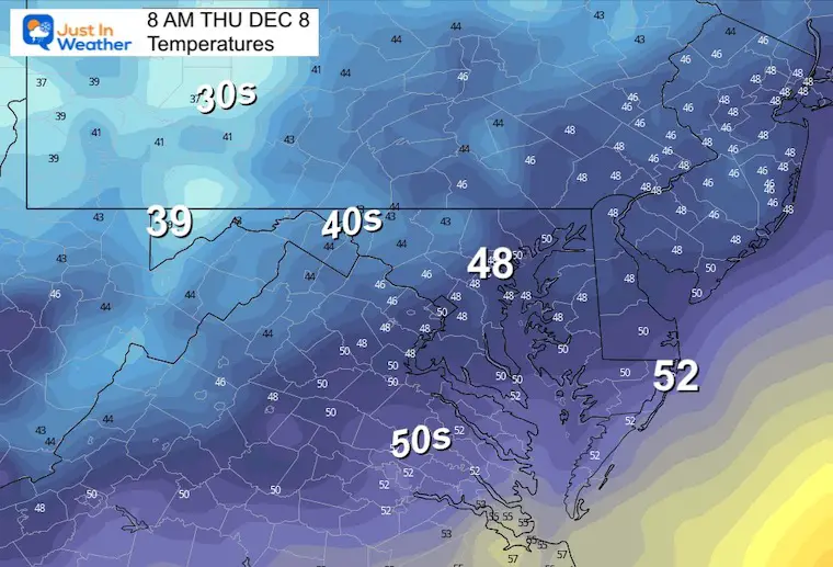
Still a little above average.
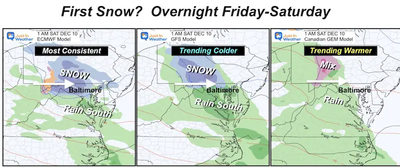
After today’s rain, we will watch the next impulse for Friday. I have stopped this at 10 PM Friday night with light snow entering the middle of our region.
I have been following this event for the anticipation of the magic with a first snowfall. It has been a light event and not expected to amount to much, let alone stick. The latest run looks very light, but I am still not ‘calling’ it until later today for what I believe we can legitimately expect. So, we will watch together.
The GFS Model had joined the European Model. This is simply to show the chance of snow falling in central Maryland. Not an indication of stickage or amounts.
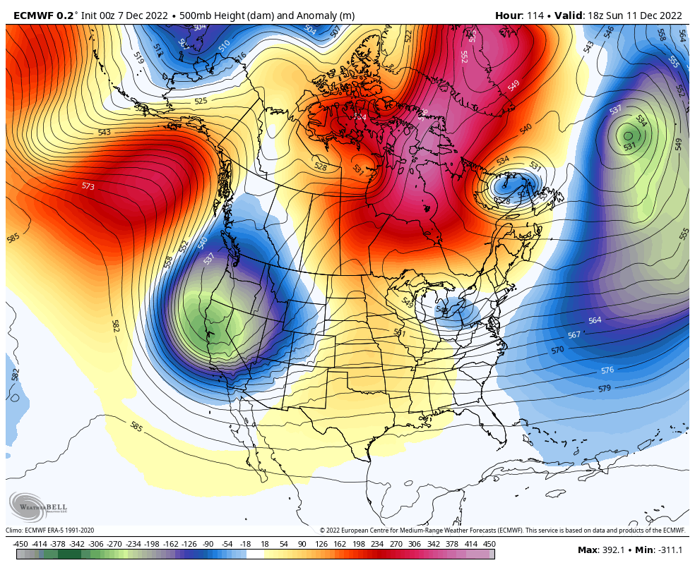
The European Model shows the evolution of the cold air. The attempt this weekend is the reason for the Friday night and Sunday event, but seems to be running into a challenge. Next week we see a stronger force resulting in cold air dominating the Eastern US.
I need to reinforce that I am still tracking the chance for light snow overnight Friday night, but it will be in the dark hours and a light event.
Waiting for the very cold air? So am I. The jet steam I showed above indicates it is on the way… just out of the scope of this 7-Day outlook.
I see many factors to support colder influence with multiple systems. Early and later in winter. Check it out.
October 27 Nor’easter Recap Still Breezy Then Next Storm Friday
October 27 Nor’easter Recap Still Breezy Then Next Storm Friday
September Starts Meteorological Autumn: Weather Climate Stats For Maryland at Baltimore
If you want a snowy winter, this is what you might want to look for in the rest of the tropical season. (You might be seeing a lot of commercial snow removal people out this Winter).
Rainbow Ice Cave In Mt. Rainier A Very Rare Find: Photos And Video
https://justinweather.com/2022/10/25/winter-weather-outlook-from-the-wooly-bear-caterpillar/
Winter Weather Folklore Top 20 And More Outlook Signals From Nature For Cold And Snow


Click to see more and ‘Book’ a visit to your school
