Rain Timeline Saturday And Weekend Overview
Friday Night Update
We continue in this 3 day cycle of weather systems, with the next event on the weekend. This has prompted many questions and direct messages about the timing for planning. So I want to address this in a post you can digest in about a minute or so.
The system is developing as we speak, so looking at the weather map does not suggest much. But simply put, the rain will be with us in the morning, making for an ideal opportunity to watch The US Men’s Soccer Match at The World Cup, then head out around lunchtime and the afternoon. Compare the live radar to the simulation forecast below.
Headlines:
- Saturday Morning: Rainy, Breezy and Mild
- Saturday Mid Day: Rain Ending, still mild.
- Saturday Afternoon: Still Mild, Dry, Showers in the mountains.
- Sunday: Colder
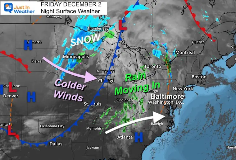
Friday Evening Surface Weather
Rain developing in the Ohio Valley through Kentucky and Tennessee is what is heading our way. It will be here before sunrise.
Yes, the storm system’s cold core is well to the north around the Canadian border. Snow is falling across Minnesota and northern Wisconsin.
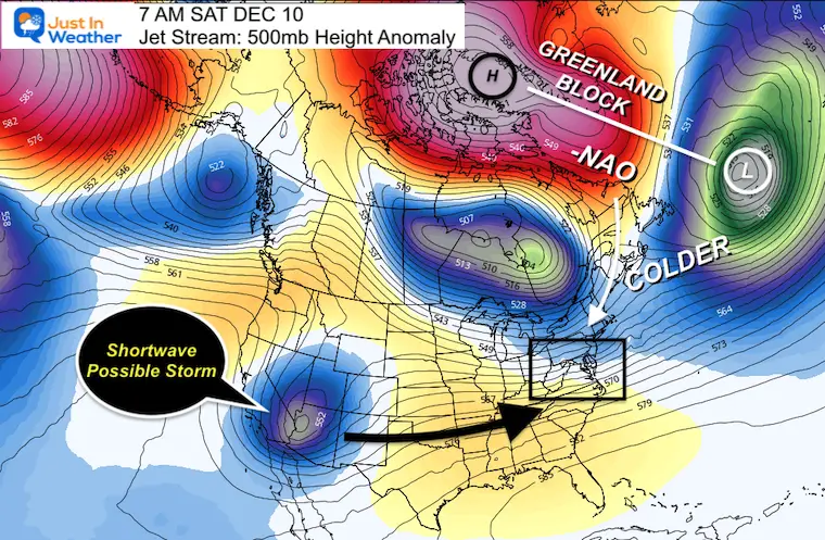
(There are signals that next weekend we may get our first attempt at winter weather. I will deal with that over this weekend).
Live Radar Widget
Use this to compare to the model plots below.
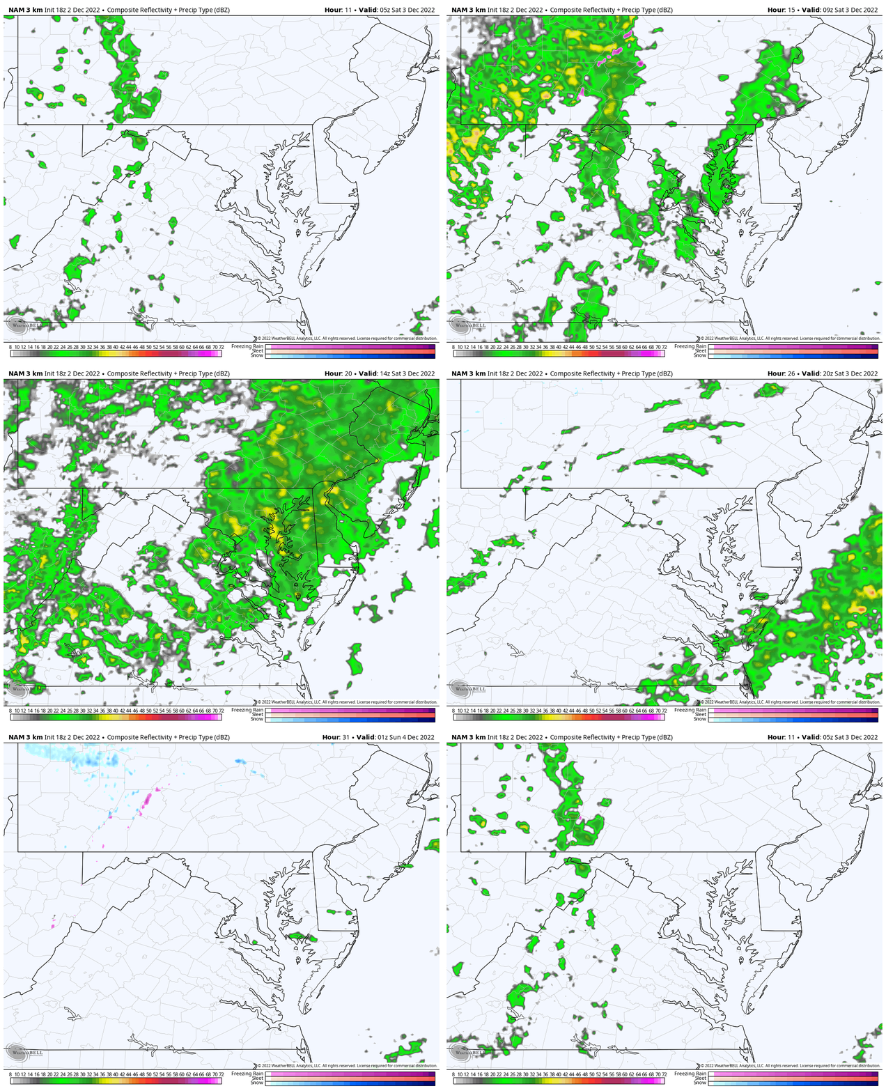
Saturday Radar Simulation
NAM 3 Km Midnight to 8 PM
(Key timeframe snapshots below)
Key Timeframes
Note: This product has tended to be about an hour behind, so we may see this verify an hour earlier than shown.
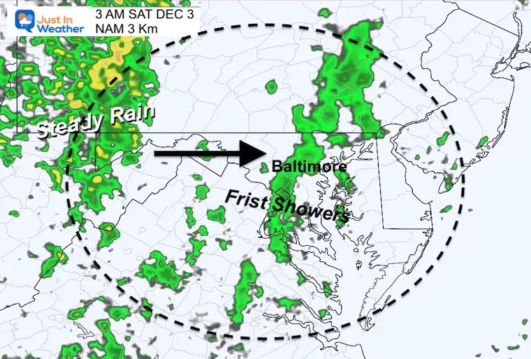
3 AM
Showers reaching metro areas. Steady rain in the mountains.
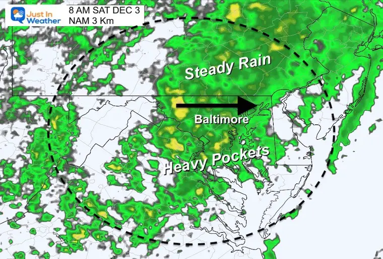
8 AM
Steady rain will expand across most of the region through the morning. There will be pockets of heavier showers.
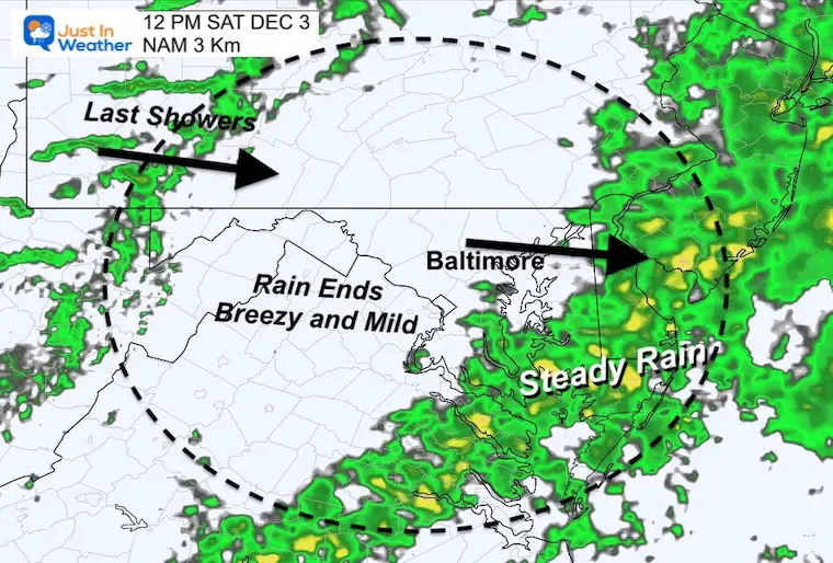
Noon
The band of heavy rain should be ending for Baltimore and Annapolis, then pushes through the Eastern Shore for another hour or two.
It will be breezy, mild but dry for much of the afternoon in central Maryland.
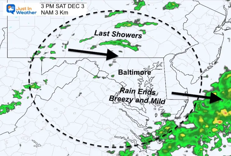
3 PM
While metro areas should remain dry, showers will redevelop in the western hills and north into central Pennsylvania.
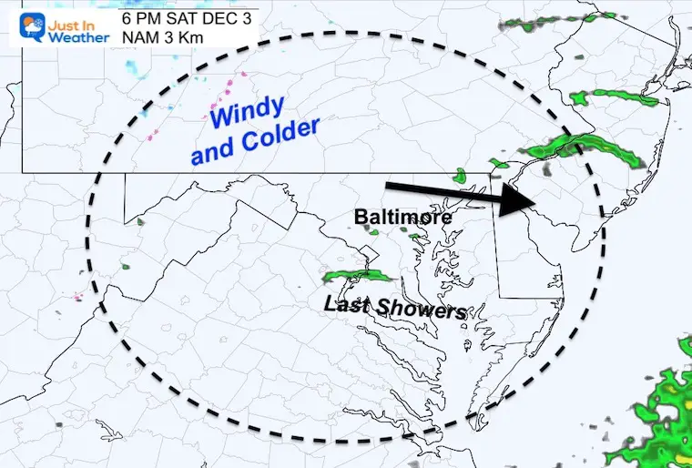
6 PM
Unlike the last system, that final band of rain will not be as pronounced. There will be a strong and colder breeze, but the showers will be hit or miss.
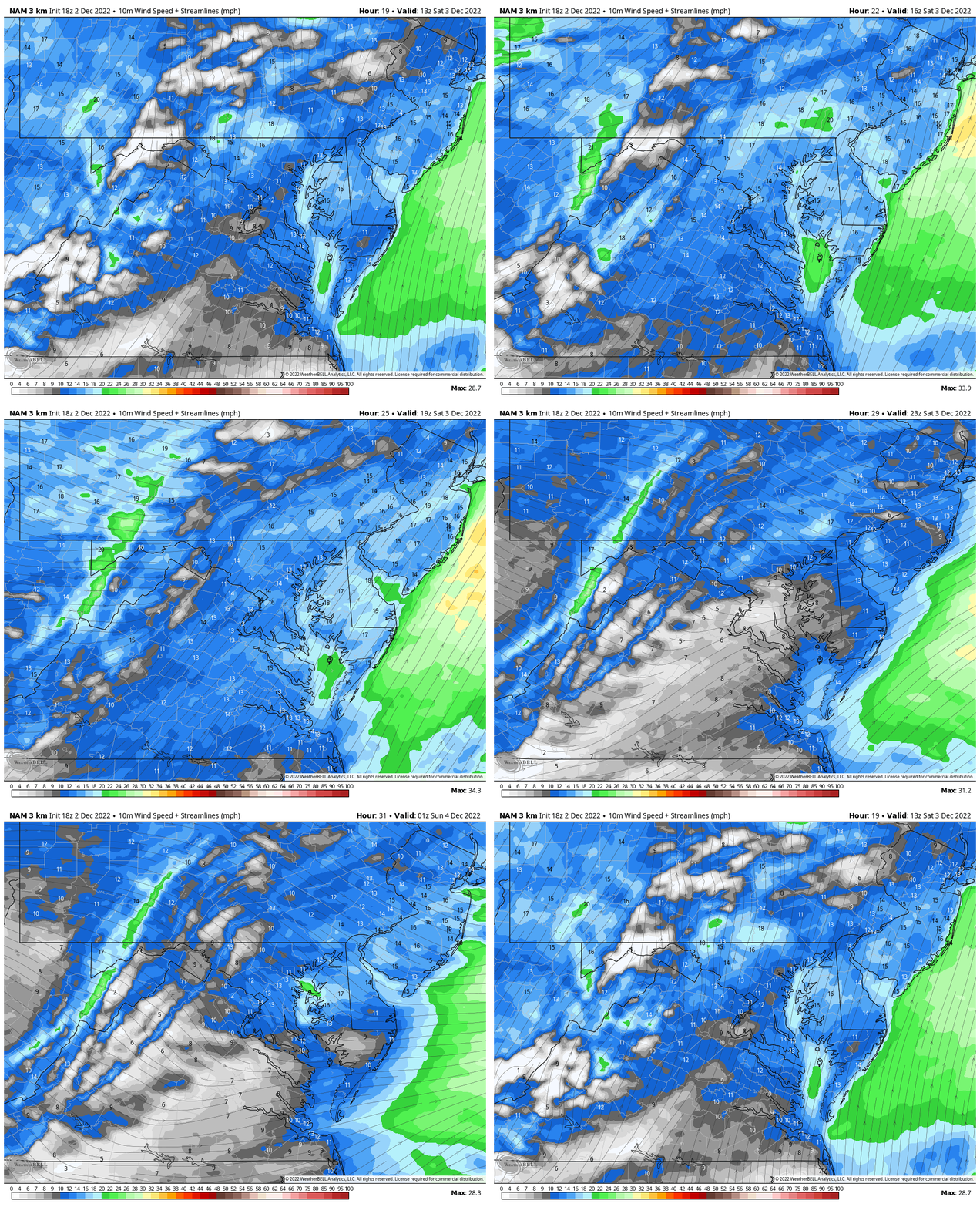
Wind Forecast
Saturday 8 AM to 8 PM
Winds will be breezy from the South, keeping the day mild. Then swing to the Northwest in the evening bringing back the colder air.
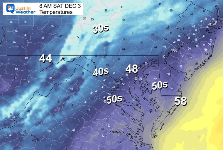
Temperature Forecast
Saturday Morning
With the rain and southerly wind, temps will be in the upper 40s to 50s.
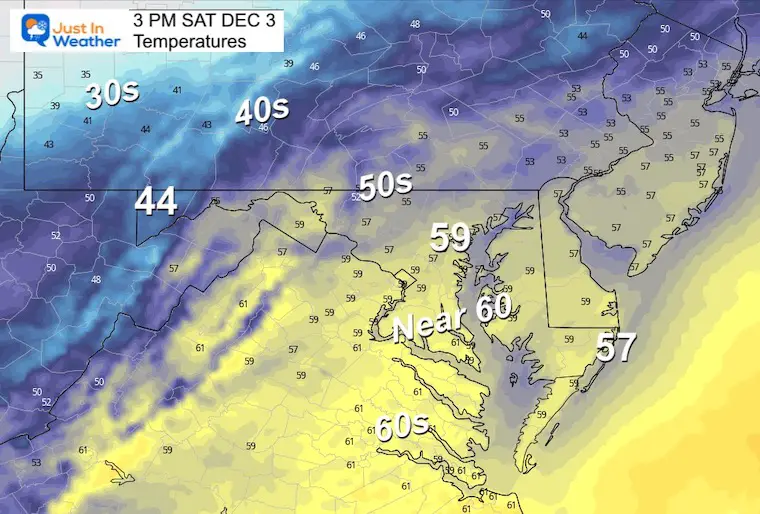
Saturday Afternoon
Remaining mild in the upper 50s to near 60, with the signal of colder air showing up in the mountains.
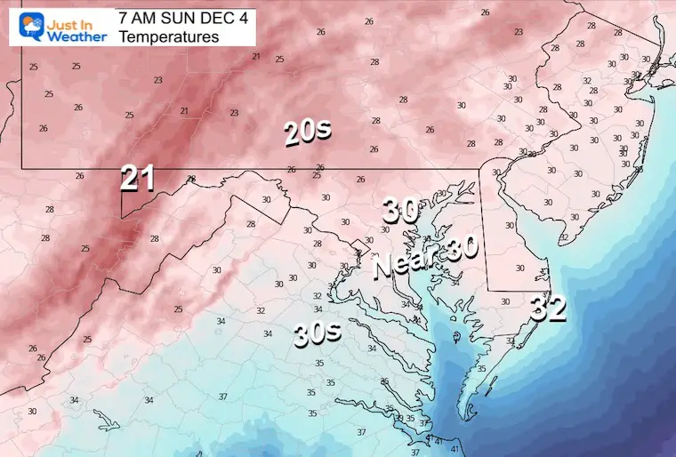
Sunday Morning
Most of the region will be below freezing with many west of the cities in the 20s.
Sunday Afternoon
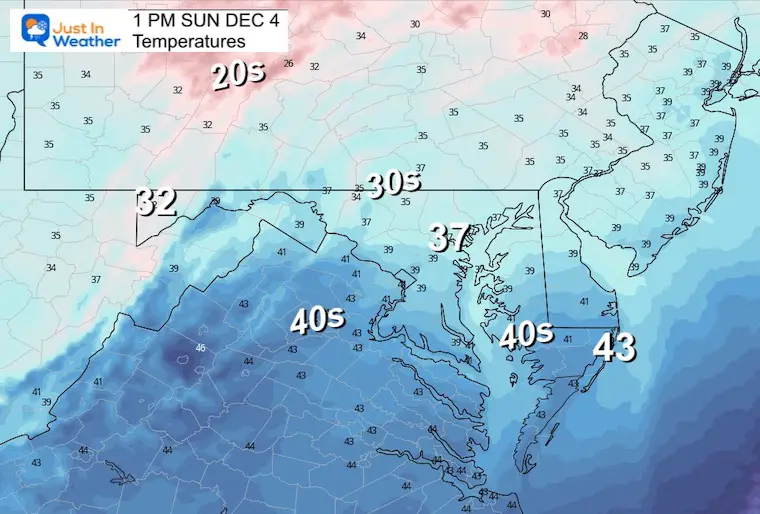
If you are heading to the Ravens Game, it will be cold… Remaining in the Upper 30s.
FYI
The buzz about wintry weather next weekend is growing. However, the models are still having trouble locking in on how it may evolve. I will address this over the weekend. I do not want to pump up the hype with info that is too vague now.
Faith in the Flakes.
COLD Pattern Change (Click Images For The Report)
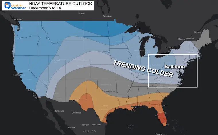
NOAA Outlook joins the party with COLDER TREND
NEW Faith In The Flakes Gear
Saturday, rain forecast, weekend, weather, radar
My Winter Outlook: Not A Typical La Niña!
I see many factors to support colder influence with multiple systems. Early and later in winter. Check it out.
October 27 Nor’easter Recap Still Breezy Then Next Storm Friday
Also See The Winter Outlook Series:
October 27 Nor’easter Recap Still Breezy Then Next Storm Friday
Farmer’s Almanac Comparison
September Starts Meteorological Autumn: Weather Climate Stats For Maryland at Baltimore
Triple Dip La Niña Winter
CONNECTION TO WINTER?
If you want a snowy winter, this is what you might want to look for in the rest of the tropical season. (You might be seeing a lot of commercial snow removal people out this Winter).
Rainbow Ice Cave In Mt. Rainier A Very Rare Find: Photos And Video
Wooly Bear Caterpillars
https://justinweather.com/2022/10/25/winter-weather-outlook-from-the-wooly-bear-caterpillar/
Persimmon Seeds
Click to see Top 20 and MORE
Winter Weather Folklore Top 20 And More Outlook Signals From Nature For Cold And Snow
Faith in the Flakes Gear
SNOWSTIX – Available Now
Normals And Records: Maryland and Baltimore Climate History
STEM Assemblies/In School Fields Trips Are Back
Click to see more and ‘Book’ a visit to your school
Please share your thoughts, best weather pics/videos, or just keep in touch via social media
-
Facebook: Justin Berk, Meteorologist
-
Twitter: @JustinWeather
-
Instagram: justinweather


