


May 4 Chilly And Wet Weekend: Live Radar
Saturday May 4 Morning Report May the 4th Be With You! There is a definite change in the Force we all will notice this morning. A band of rain has…
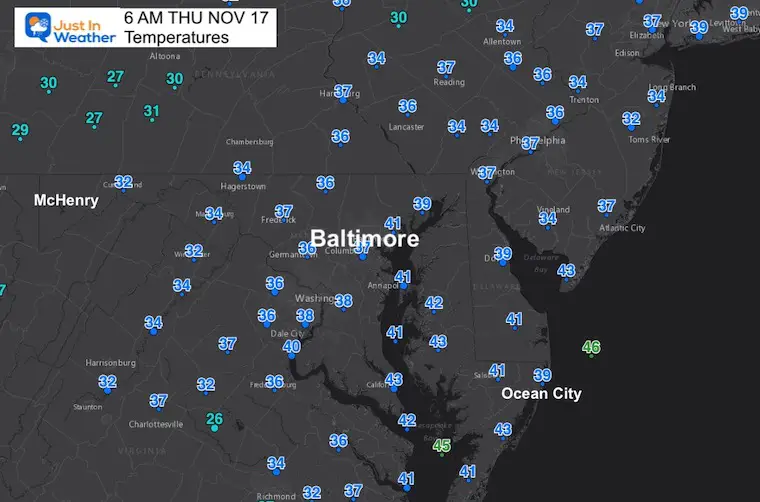
November 17 2022
Thursday Morning Update
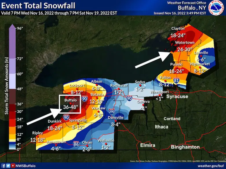
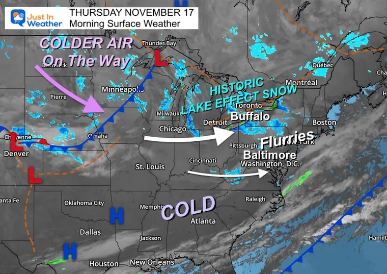
There is a lot of buzz about the historic Lake Effect Snow event starting for Buffalo NY. This morning we had a few flurries pass through, likely while you were sleeping. There will be another push of energy that will ignite more snow showers later on Friday which we will have a better chance to see.
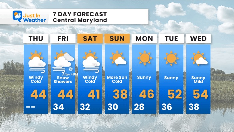
In the meantime, the theme for now into the weekend will be all about cold winds!
2 AM to 5:30 AM
These flurries passed through Hagerstown, Frederick, Westminster-Eldersburg, and even Towson. Have you seen any on your car?
Click here for that report.
Two ways to get notified more often:
Sign Up For My Newsletter
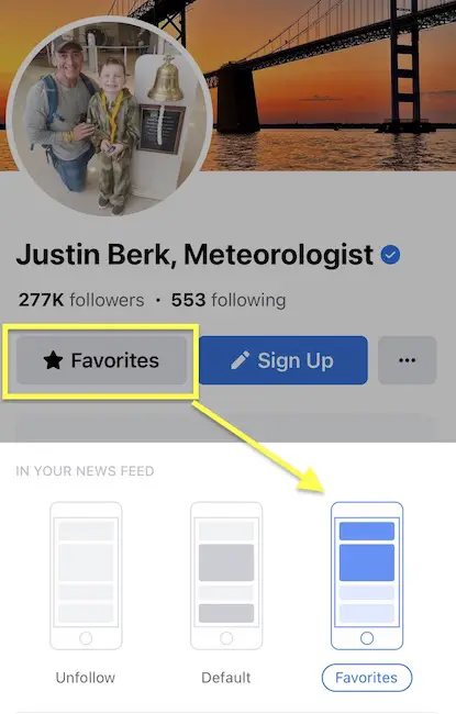
ALSO on Facebook
They keep changing the settings… Go to my page wall and click this button to mark it as *Favorites
Click this image to get to my page wall
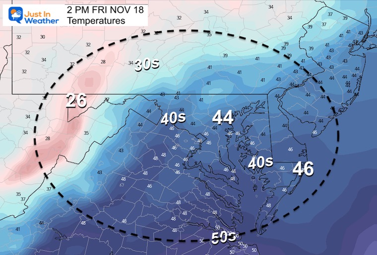
There is not an organized storm, simply cold air and some upper level energy. There its a cold front that will reinforce the colder air that we will track to reach us later on Friday. It will be the source of our next round of snow showers.
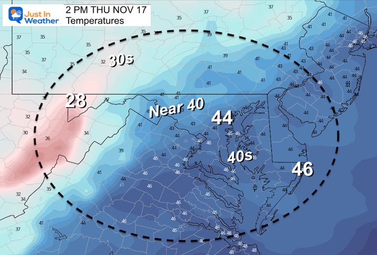
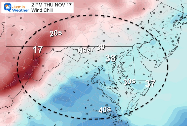
It will feel about 5 to 10 degrees colder.
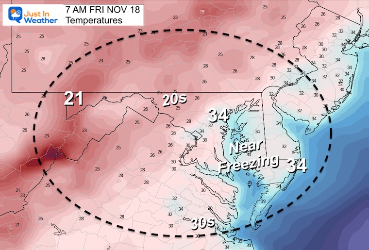
Normal Low in Baltimore: 36ºF
Record 20ºF in 1996
SNOW: 1” 1934
Normal High in Baltimore: 57ºF
Record 75ºF 1928
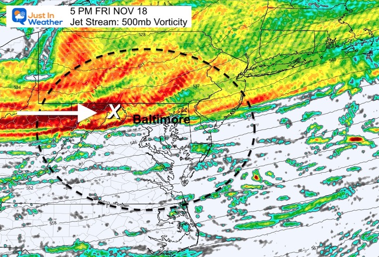
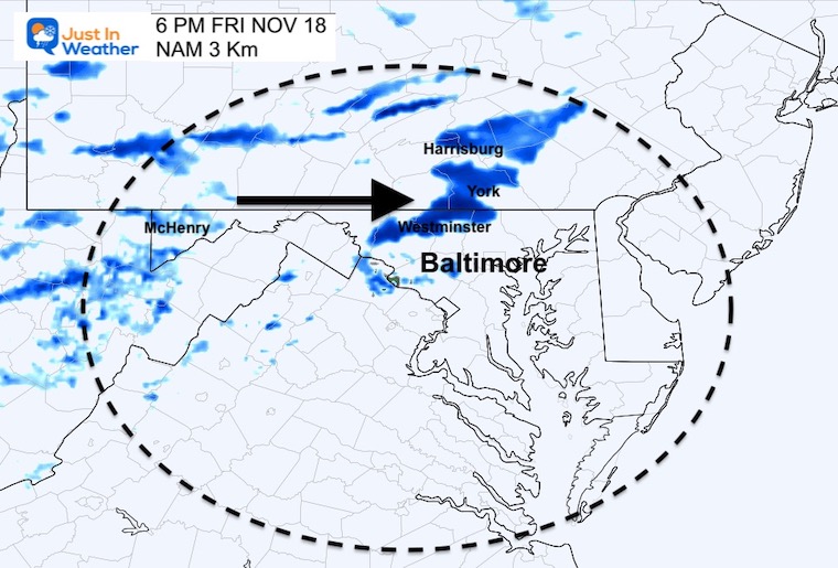
This is the upper level energy around 18,000 Ft that will help snow showers carry over the mountains.
Snow reaches:Hagerstown to Gettysburg and Harrisburg along Rt 15.
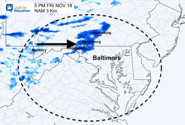
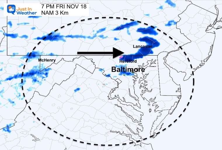
Snow reaches: Frederick to Westminster and York in PA.
Snow reaches: Northern Baltimore to Harford County in Maryland and Lancaster in Pennsylvania.
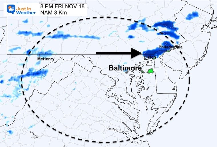
That snow shower will reach Cecil County MD to Philadelphia.
Click to see more and ‘Book’ a visit to your school

Winter Outlook 2023 From NOAA Very Different Than Farmers Almanacs
Winter Outlook 2023 Early Look At Snow From Two Farmers Almanacs
If you want a snowy winter, this is what you might want to look for in the rest of the tropical season. (You might be seeing a lot of commercial snow removal people out this Winter).
Record August For No Named Tropical Storms: Closer Look At Snow Following
Winter Weather Folklore Top 20 And More Outlook Signals From Nature For Cold And Snow


