October 2 Ghost Of Ian Reviving As Coastal Storm: Wind Advisories
October 2, 2022
Sunday Morning Update
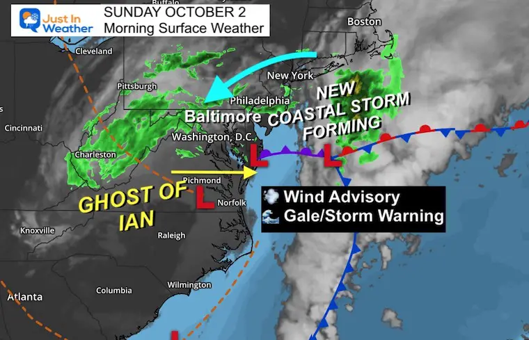
The remains of former Hurricane Ian are no longer tropical, but still trackable. We call this the ‘ghost’ and it is now part of a new storm developing off the Mid Atlantic coast that will affect us today and for a few days to follow.
This will be like a chilly Nor’easter with increasing rain and wind starting today. For over 40,000 people going to the Ravens game in Baltimore, it will be chilly and wet. The wind may play a role in the passing and kicking game.
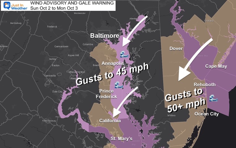
The Wind Advisory has been expanded (from last night’s report) to include Annapolis to St. Mary’s on the western side of the Chesapeake Bay. In addition, A Gale Warning is in effect through Monday.
Here’s a look at the radar, simulation, and wind forecast.
Weather Alerts
The wind direction is key! It will be FROM the North-Northeast. That will help push water OUT of the Chesapeake Bay, however some sloshing on to the western Shore could lead to local higher water there. But this is NOT A SURGE!
Wind Restrictions likely to continue on the bridges.
Coastal beaches including Delaware and Ocean City MD will experience a few days of continued beach erosion.
Morning Surface Weather
The Ghost of Ian is helping to reform a new coastal Low. This is why the winds will increase, the rain will enhance, and the temps will remain chilly (50s).
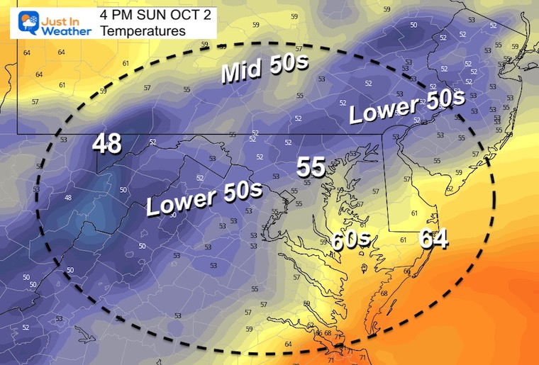
Morning Temperatures
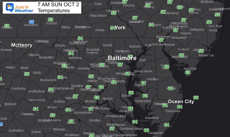
Not much movement on the thermometers today. In fact, temps may actually get cooler this afternoon falling through the 50s.
WEATHER DISCUSSION
Let’s look at the wind first, then the rain.
Wind Forecast
8 AM Sun to 10 PM Sun
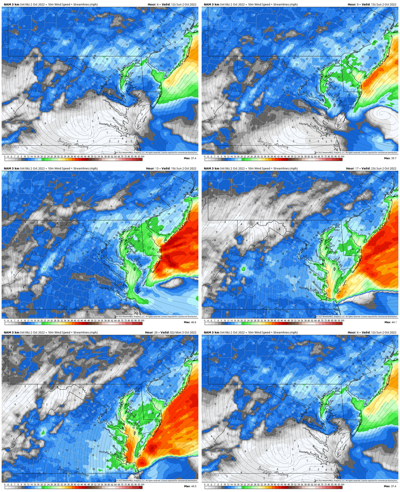
Peak Wind Gusts Sunday
- Metro areas up to 35 mph
- Annapolis through Delmarva: 40 to 50 mph. This is where we see Wind Advisories.
- Beaches: 50 mph or higher are possible
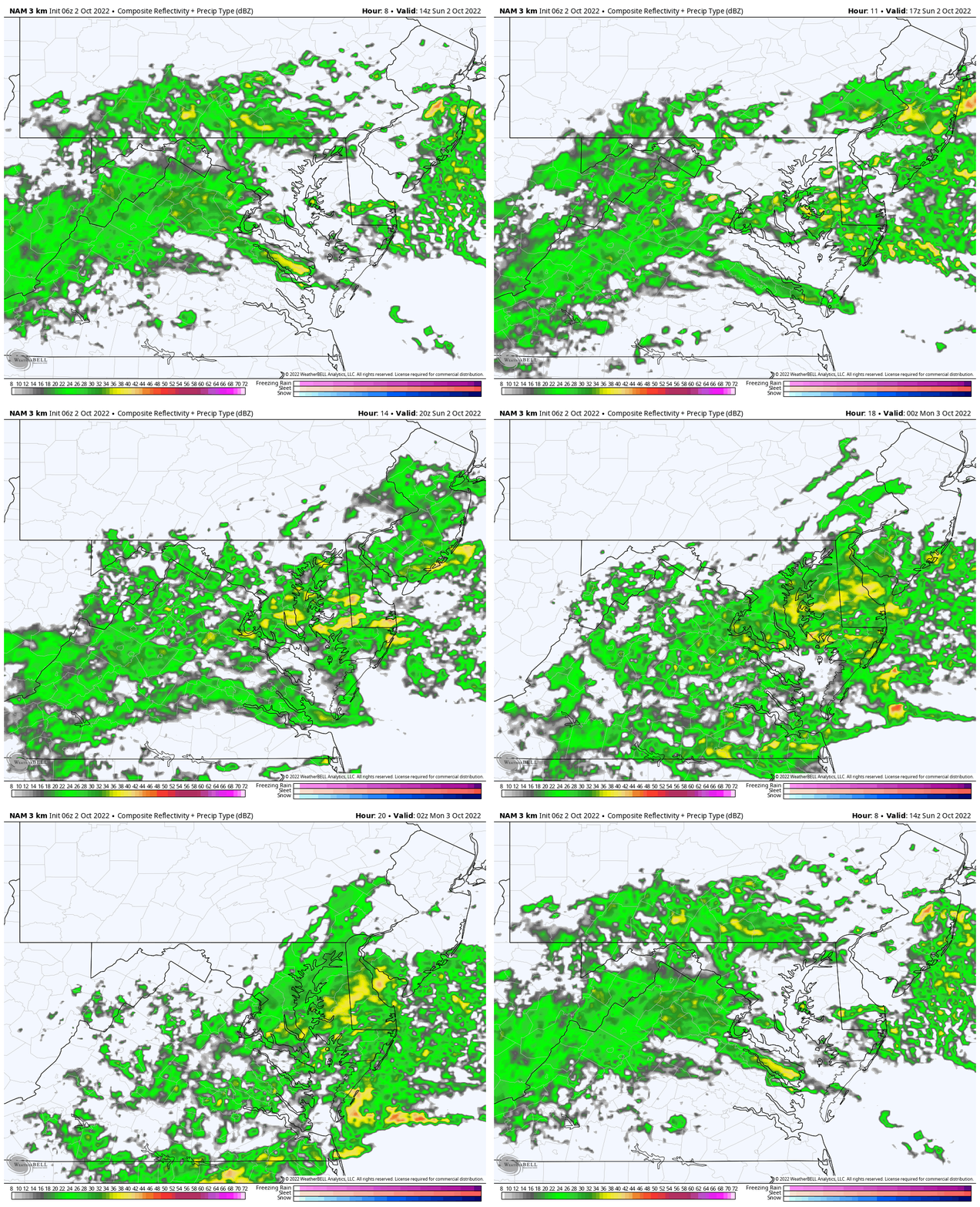
Rain Outlook
Compare the Live Radar to the simulation below
Live Radar
NAM 3 Km Model
10 AM to 10 PM Sunday
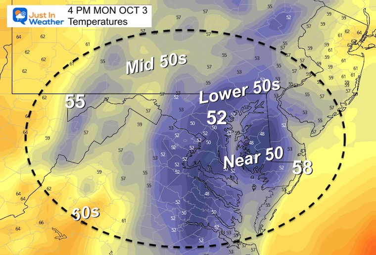
Temperatures at 4 PM
Remaining chilly or even getting cooler
CLIMATE DATA
TODAY October 2
Normal Low in Baltimore: 52ºF
Record 35ºF in 1997
Normal High in Baltimore: 74ºF
Record 99ºF 2019
Weather posts straight to your inbox
Sign up and be the first to know!
STORM EVOLUTION
A large cool pocket of air in the jet stream is nearly closed off. This is making it to the coast, where the contrast with warm ocean water will enhance the spin. This is where the ghost of Ian will revive as a new organized storm that could linger off the Mid Atlantic coast for a few days.
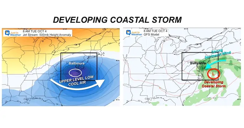
GFS Model Guidance
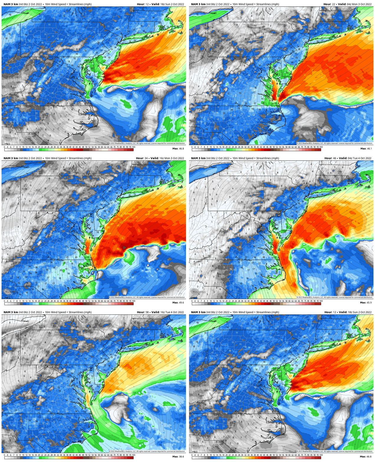
Winds 2 PM Sun to 2 PM Tue
The streamline winds show the flow from the Northeast, with the strongest winds along the coast.
GFS Model
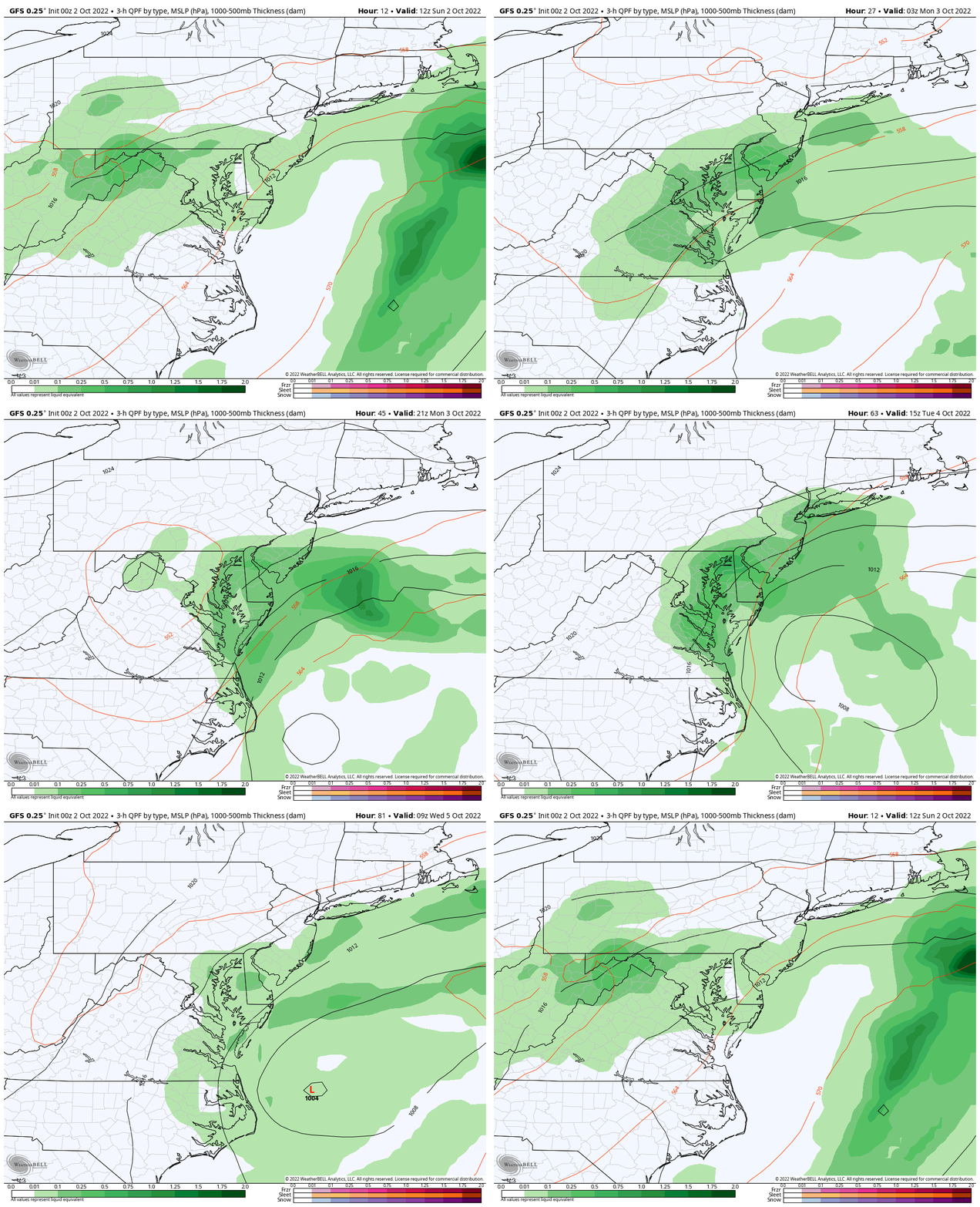
Surface Weather: 8 AM Sun To 8 AM Wed
Here we can see the Low Pressure develop and try to swing back to the coast… keeping the risk for rain and chilly winds in place for a few days.
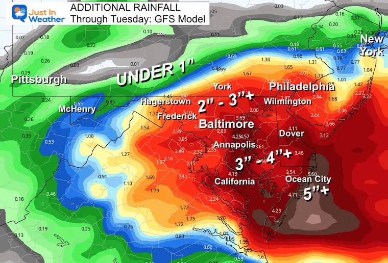
Rain (Additional) Through Tuesday
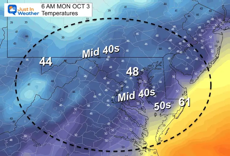
Temperatures
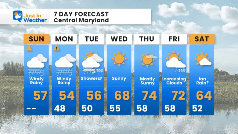
The model plots are considerably chilly. In fact I wonder how valid this may be, so I had to make some moderation on my 7 day graphic below… However, there is potential for us to remain lower.
Monday Morning
Monday Afternoon
7 Day Forecast
Temps remain chilly through Tuesday, then we get rewarded with sun and 70s for at least one or two days later in the week.
PATTERN CHANGER?
CONNECTION TO WINTER?
If you want a snowy winter, this is what you might want to look for in the rest of the tropical season.
Rainbow Ice Cave In Mt. Rainier A Very Rare Find: Photos And Video
Hurricane Season Forecast: June 1 Through November 30
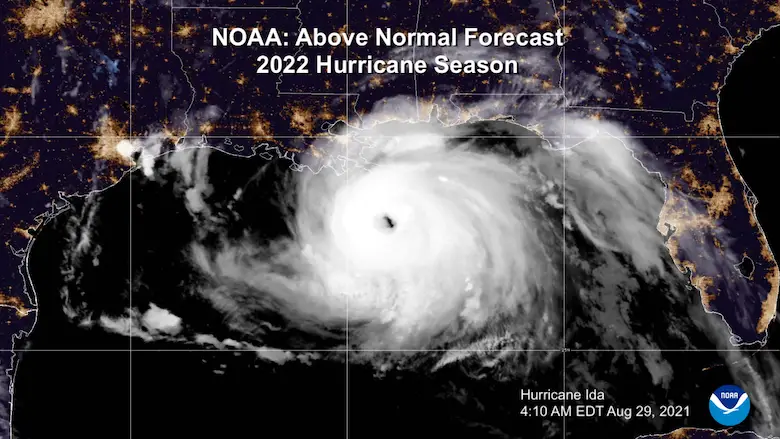
NOAA 2022 Hurricane Forecast- Above Normal Again
Related Posts
NOAA Study: Reducing Air Pollution INCREASED Tropical Storms
Atlantic Tropical History: Maps of Origin Regions Every 10 Days
Please share your thoughts, best weather pics/videos, or just keep in touch via social media
-
Facebook: Justin Berk, Meteorologist
-
Twitter: @JustinWeather
-
Instagram: justinweather


