


Average Last Frost or Freeze Dates And Map For Maryland
There is a good reason why many gardeners suggest NOT to plan tomatoes until after Mother’s Day. Early surges of warm air in spring can be deceiving. Just because the…
Sunday October 2, 2022
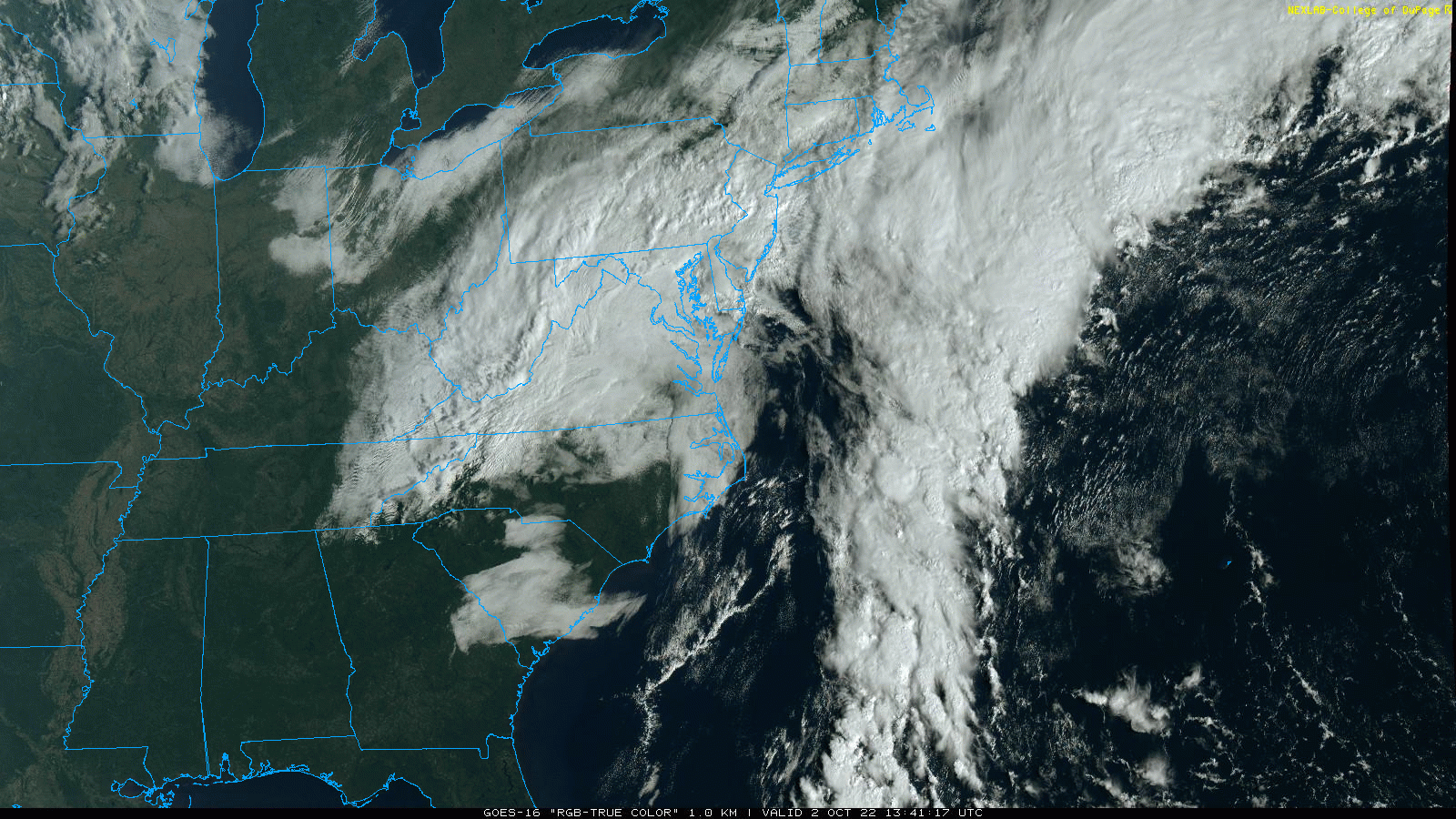
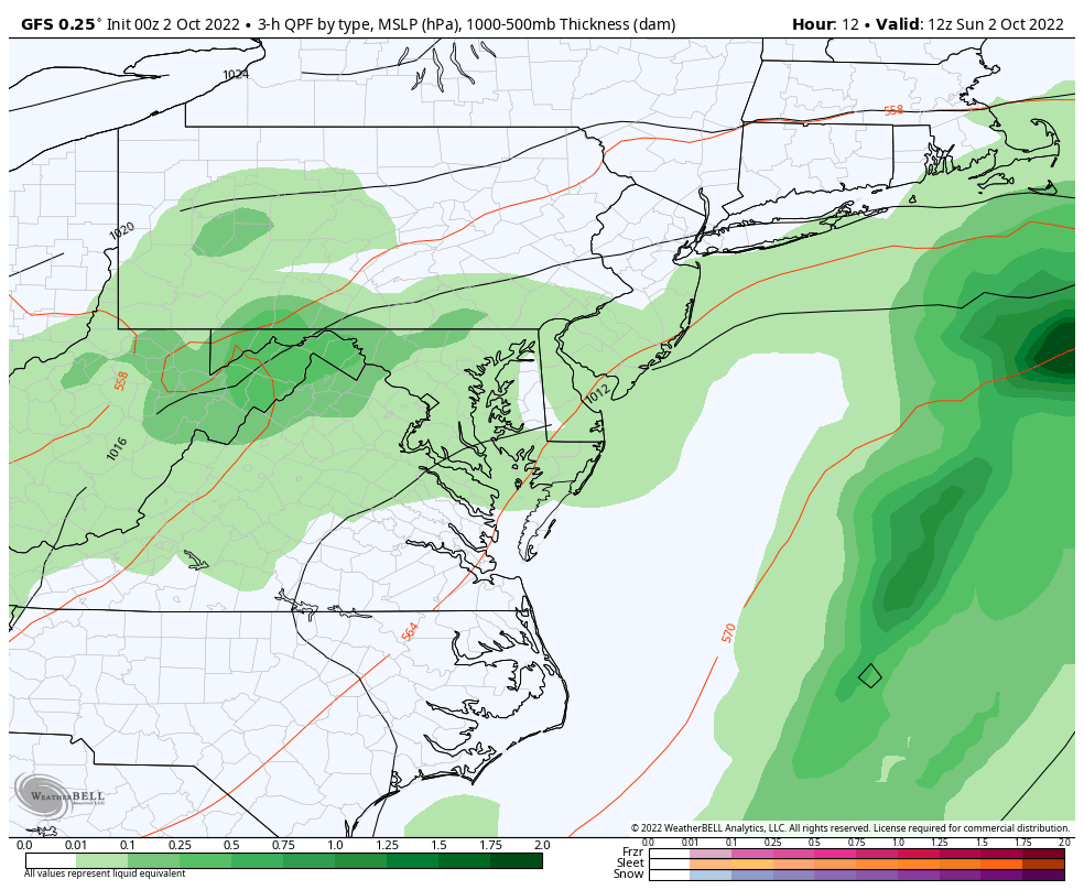
The Ghost of Ian is now forming a New Nor’easter and has continued to evolve in a way that is stronger and closer to the coast. We had expected high wind and rain to increase today and tonight, but the intensity expectation has gone up with the Low closer to the coast.
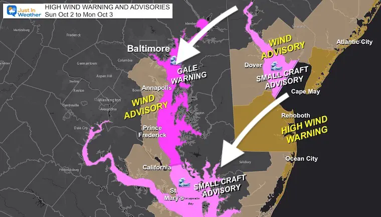
As a result, the high Wind Warning has been expanded to include central Delaware to the Ocean City Beaches. Winds may gust OVER 50 mph exasperating the beach erosion.
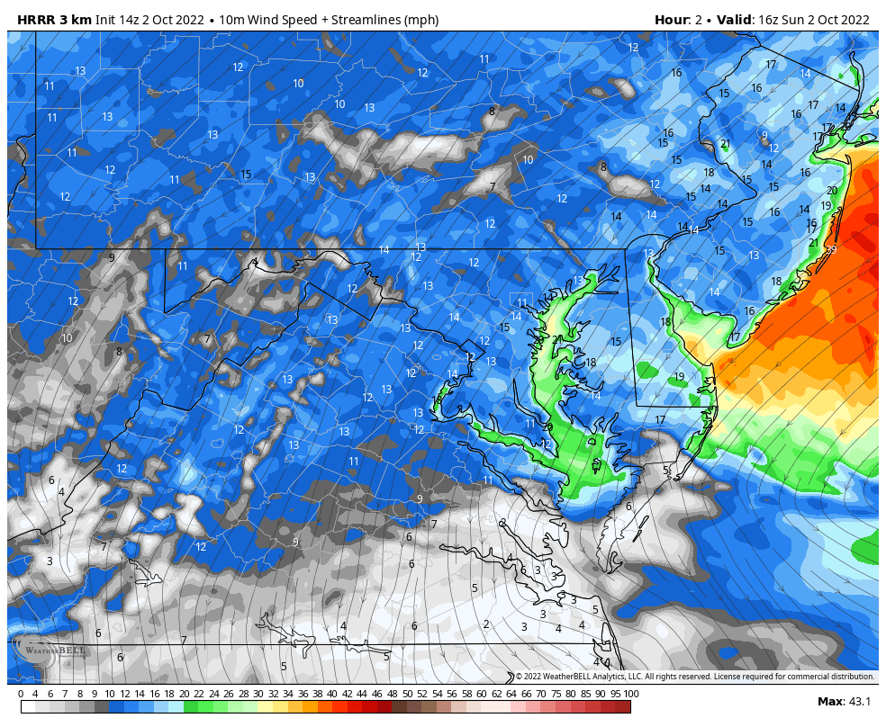
2 Hours ending at 11:30 AM
In addition to the beach problems, restrictions are likely to continue on the area bridges.
Winds will be coming FROM the Northeast
While winds will increase during the Ravens Game, they will be stronger tonight.
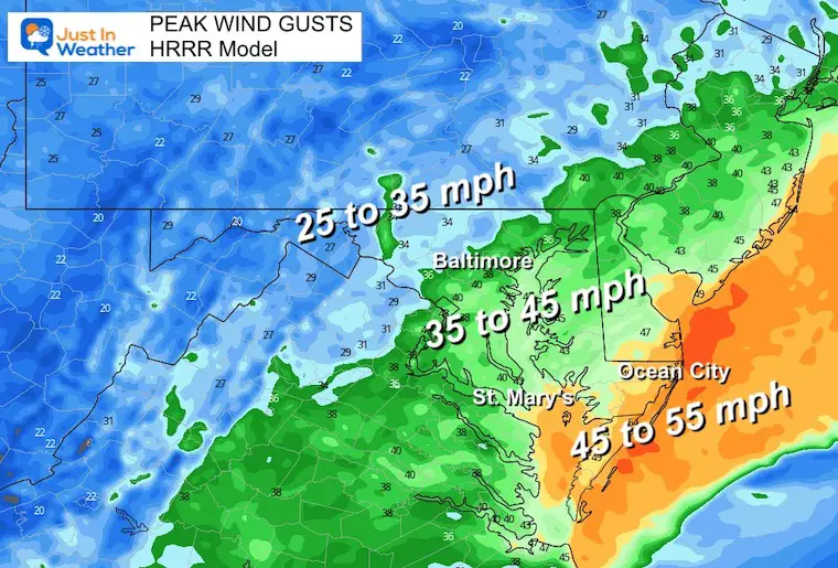
Central Maryland: 10 to 20 mph with higher winds by the water.
Southern Maryland To the Ocean Beaches: 20 to 40 mph
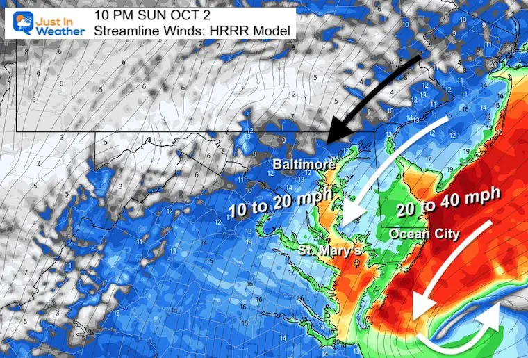
Central Maryland: Top winds may reach 35 to 45 mph
Southern Maryland To the Ocean Beaches: Tropical Storm ‘Force’ but not a tropical storm.
45 to 55 mph!
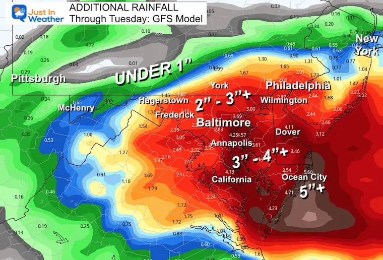
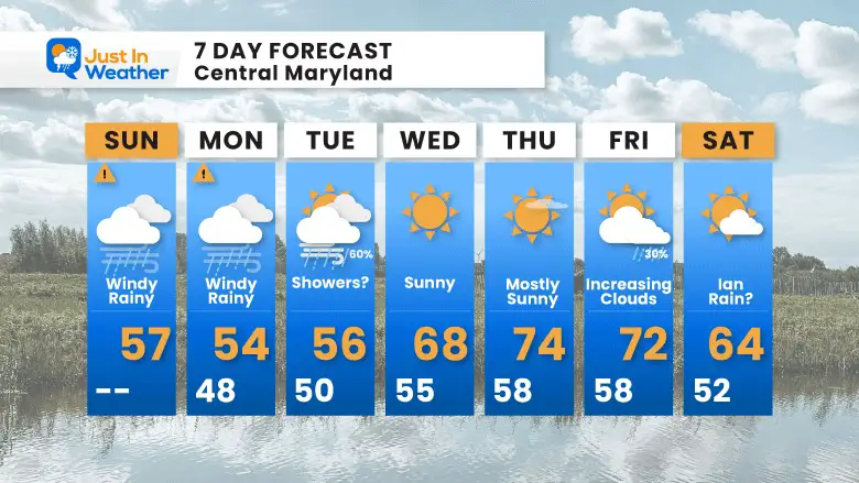
Temps remain chilly through Tuesday, then we will get rewarded with sun and 70s for at least one or two days later in the week.
Sunday Morning Full Weather Report
October 2 Ghost Of Ian Reviving As Coastal Storm: Wind Advisories
Hurricane Ian May Help Cooler Pattern Change: Monitor For Atmospheric Memory This Winter
If you want a snowy winter, this is what you might want to look for in the rest of the tropical season.
Record August For No Named Tropical Storms: Closer Look At Snow Following
NOAA 2022 Hurricane Forecast- Above Normal Again

NOAA Study: Reducing Air Pollution INCREASED Tropical Storms

Atlantic Tropical History: Maps of Origin Regions Every 10 Days

Click to see more and ‘Book’ a visit to your school
