


April 16 Stepping Back From Summer Heat To A Cool And Wet Pattern
Tuesday, April 16 Morning Report Yesterday was sincerely a summer preview! Temperatures did soar as expected into the mid-80s with BWI hitting the mark of 85ºF. This fell short of…
October 3, 2022
Monday Morning Update
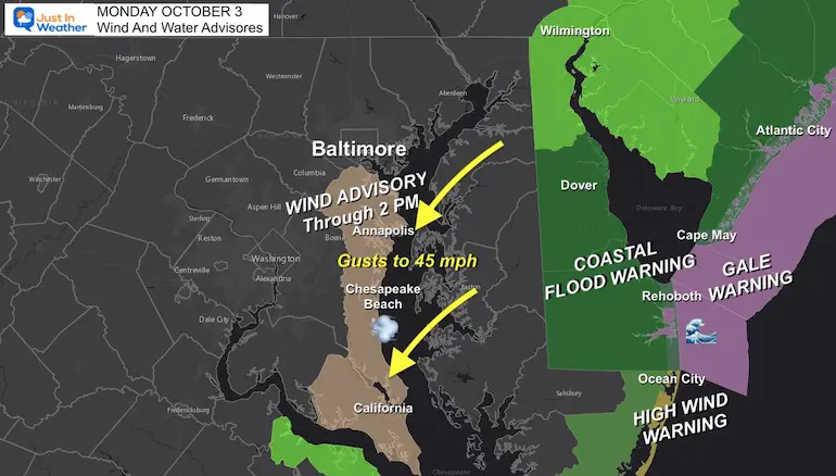
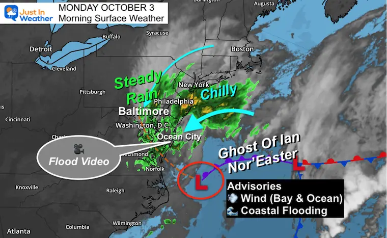
The Ghost of former Hurricane Ian continues now as a stalled Nor’easter off the Mid Atlantic coast. It reformed yesterday and will continue to hit us a little longer with steady rain, gusty winds, and coastal flooding.
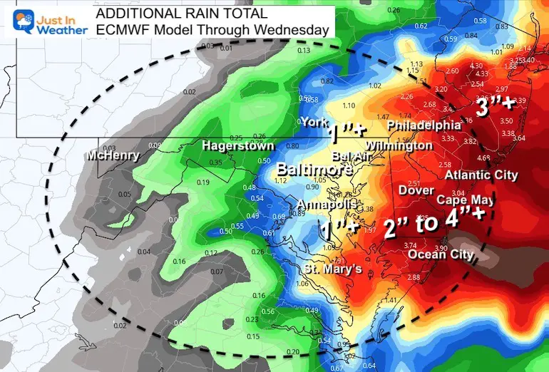
Additional rain totals are still high, and the winds this morning have upgraded the Wind Warning on the Bay Bridge to ‘Limited Restriction”. This means no empty box trailers can pass. We have a look at the live radar and wind forecast below.
The steady onshore flow has been expected to chomp away with more beach erosion, but it has also led to high water. Let’s start with new flood video:
Flooding In Ocean City Maryland
The Ghost of Ian#flooding in Ocean City #OCMD https://t.co/ZdqSlUeSkJ
— Justin Berk (@JustinWeather) October 3, 2022
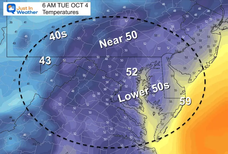
The Ghost of Ian continues as a stalled Nor’easter off the coast. This is why the winds will increase, the rain will enhance, and the temps will remain chilly in the 40s to near 50ºF.
*I am storing this in my Atmospheric Memory File for potential repeat in the winter.
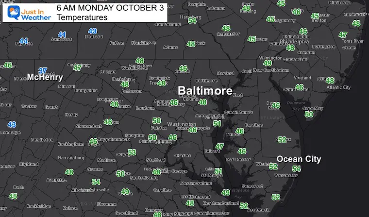
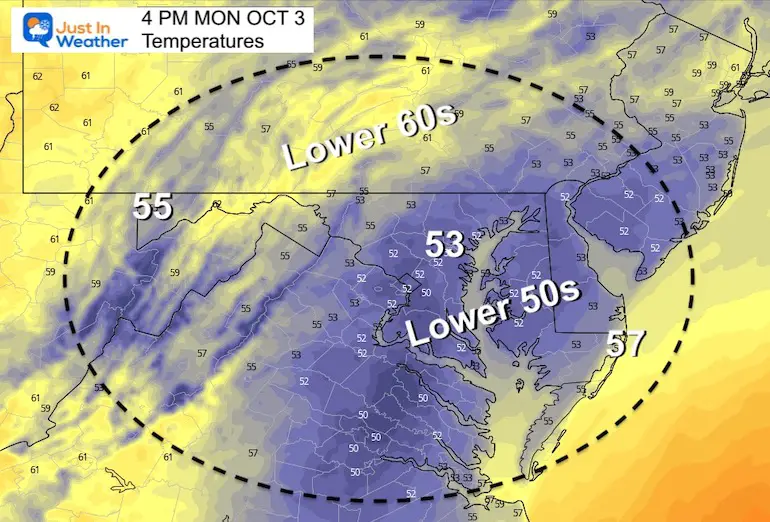
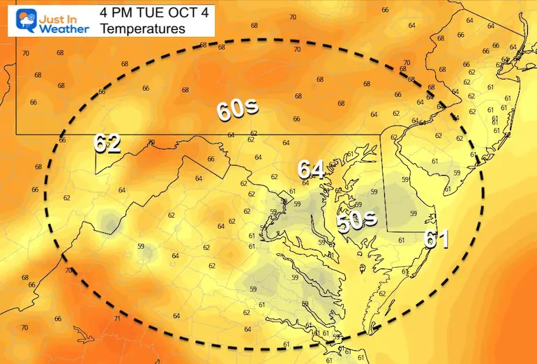
Not much movement on the thermometers again today. Plan for a wet day with mid 40s to lower 50s in the afternoon.
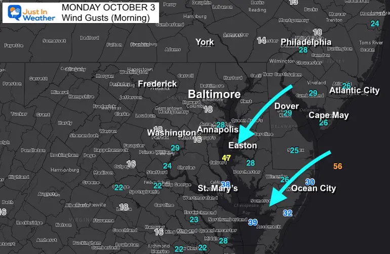
The winds continue from the North and Northeast. They will be stronger in the morning, then ease in the afternoon around the Bay…. But remain brisk along the ocean beaches.
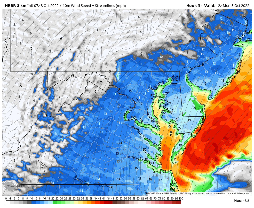
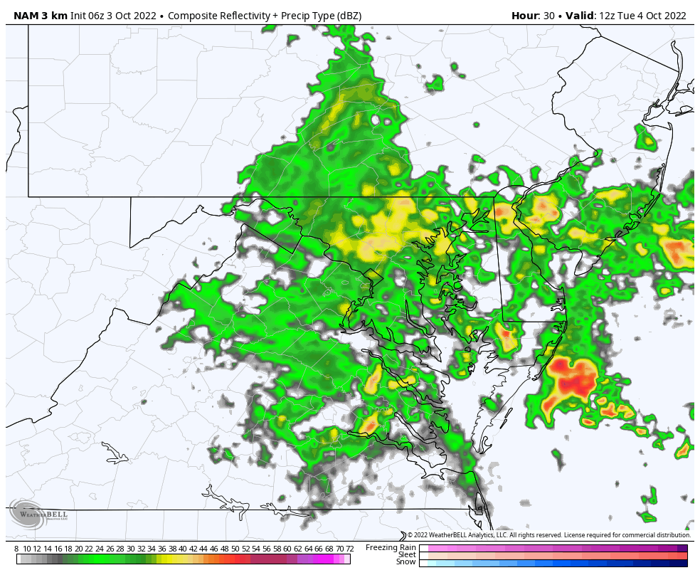
Steady rain will continue with the storm spinning off the coast. Heavier rain will fall near the Bay and across Delmarva in bands. Less rain farther inland to the west.
Remaining chilly!
Normal Low in Baltimore: 52ºF
Record 34ºF in 1974
Normal High in Baltimore: 73ºF
Record 92ºF 2019
Brought In Part By JP’s Custom Home Painting
The weather MUST be better then.


Low Pressure continues to spin off the east coast, even retrograding closer on Tuesday. Then it finally pulls away and fades on Wednesday. Yes, this Nor’easter has been born from the remains of former Hurricane Ian.
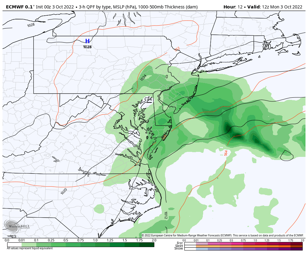
Around 1 inch in central Maryland to 4 inches or more by the beaches.
Temps may remain nearly the same as Monday afternoon.
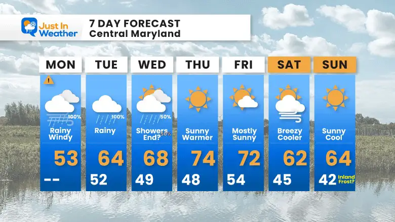
A little improvement, but still about 10 degrees cooler than normal.
Temps remain chilly with the storm, but as soon as the sun returns we will warm up to the 70s for the end of the work week. Then the next cool down will arrive, while remaining dry next weekend.
Hurricane Ian May Help Cooler Pattern Change: Monitor For Atmospheric Memory This Winter
If you want a snowy winter, this is what you might want to look for in the rest of the tropical season.
Record August For No Named Tropical Storms: Closer Look At Snow Following
NOAA 2022 Hurricane Forecast- Above Normal Again

NOAA Study: Reducing Air Pollution INCREASED Tropical Storms

Atlantic Tropical History: Maps of Origin Regions Every 10 Days

Click to see more and ‘Book’ a visit to your school
