


May 5 Soggy And Chilly Start With More Rain During The Week Ahead
Sunday May 5 Morning Report We are stuck in this muck! The wet weather pattern continues with a soggy start this Sunday morning. The rain will try to break up…
September 24, 2022
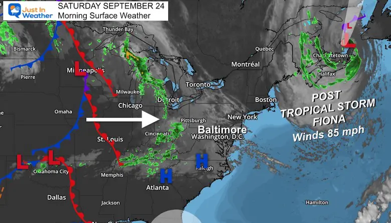
Saturday Morning Update
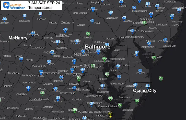
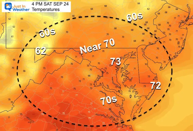
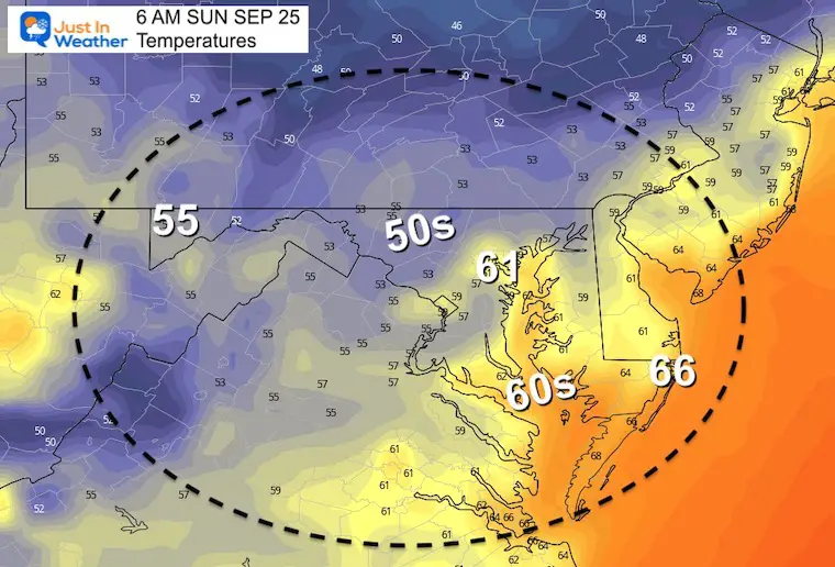
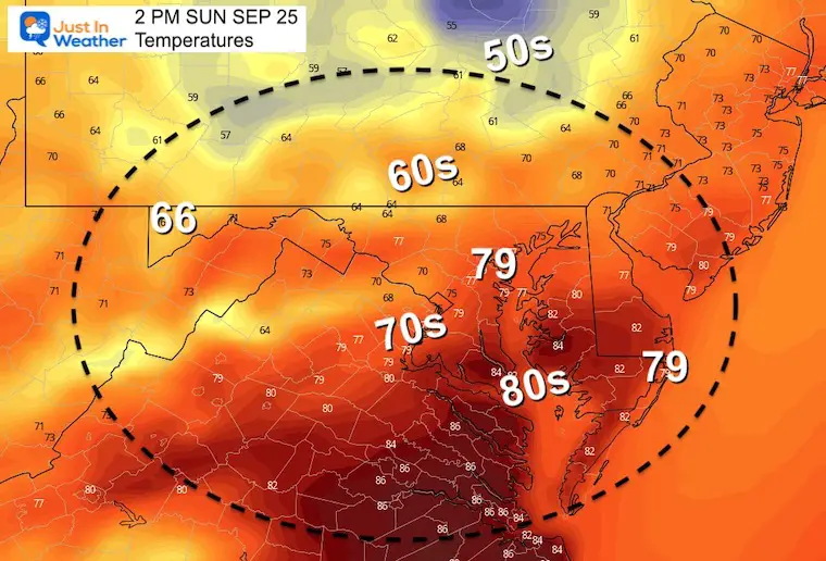
There is no doubt about autumn now! Temps this morning dropped into the 40s. We should recover today, but it will take a while to get back close to 70ºF. Make the most of it because Sunday will bring us showers and a storm line that could turn severe. The timing may be of added importance for anyone celebrating the start of the Rosh Hashanah holiday.
We also need to track newly named Tropical Storm Ian. It is expected to rapidly develop to a hurricane and possibly reach the US next week as a Category 3. The long range outlook brings rain our way next weekend. Compare two model plots below.
Note: Post Tropical Storm Fiona has crossed Nova Scotia as one of the strongest tropical events there. I will mark this date and location as a potential influencer for atmospheric memory this winter. Semi-permanent Lows tend to occupy this region (50N lat/50W long) and dominate a cold pattern for the Eastern US.
We will get debris clouds mixing with the sun from the system to our west. That will be our storm maker on Sunday.
Baltimore’s BWI bottomed out at 48ºF. Many inland valley spots between these official locations did reach the lower 40s.
We will have a mix of clouds, which could hold more areas in the 60s.
See the full morning report here. More on the long range rain forecast for us below….
Tropical Storm Ian Named: Forecast Could Hit US As Major Hurricane
Normal Low in Baltimore: 56ºF
Record 39ºF in 1983
Normal High in Baltimore: 77ºF
Record 95ºF 2010
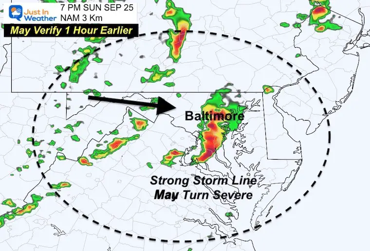
Showers may begin in the morning. As we have seen a lot lately, we tend to get more rain than this model plot shows…
We also tend to get the strong storms about 1 to 2 hours earlier than plotted. Consider metro Baltimore getting storms around 5 or 6 PM, which would bring them into Hagerstown and Frederick 3 to 4 PM, and cross Delmarva during the evening.
This is the National Hurricane Center forecast plot. Notice there is a wider cone of uncertainty! The trend has been for the last few storms to verify LEFT or WEST of the track. That is critical to how strong it could get, where it makes landfall, and the impact for us.

Both the European and GFS (farther west) Models show rain reaching us next weekend.
Wednesday Evening to Sunday Evening:
Track in the middle of the NHC plot. Rain reaches us Saturday AND Sunday according to this plot shown below.
Wednesday Evening to Sunday Evening
Track farther west for Florida, then swings through our region faster! Rain reaches us Saturday, but moves away on Sunday according to this plot.
Most of next week will be dry and seasonal, trending cooler. Next weekend is the wildcard for clouds and rain impact from the remains of Ian.

If you want a snowy winter, a busy tropical season AFTER a quiet August has done it before.
Record August For No Named Tropical Storms: Closer Look At Snow Following
NOAA Study: Reducing Air Pollution INCREASED Tropical Storms

Atlantic Tropical History: Maps of Origin Regions Every 10 Days


Winter Outlook 2023 Early Look At Snow From Two Farmers Almanacs