Conditions: Baltimore, Maryland, 04/24/2024 02:40:03 pm
Temperature

72°

Partly Cloudy

40°

Dew Point
Relative Humidity

31%

Feels Like

72°

Wind (W)

17mph

Air Pressure

29.9

Sun
Sun Rise

06:16 AM

Sun Set

07:53 PM

Day Length

13:37 Hours

Difference

2 min 19 sec gain

Moon
Moon Rise

08:56 PM

Moon Set

06:23 AM

Next: Last Quarter

May 01,2024

Moon Phase

Full Moon

Climate
Average Low

45°

68°

Average High
Record Low

32°


(2003)

93°


(1960)
Record High
Conditions

Space X Rocket Launch and Rain or Storm Timeline Sunday

space
Maryland Weather
Forecast
video

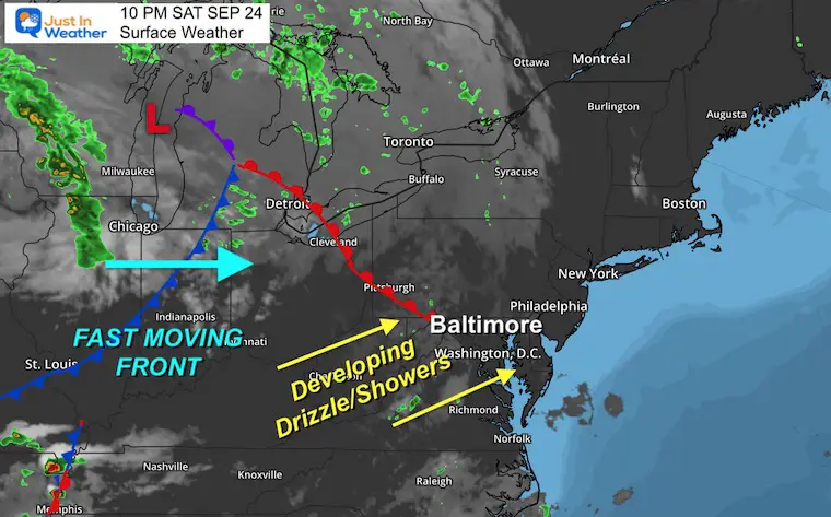
Saturday Evening Update

I hope you got outside to enjoy the first half of the weekend. I went on a 49 mile bike ride with my friend and was all set to relax for the evening.  Then I realized we have rain on the way Sunday. In fact, showers in the morning, then a line of strong to severe storms later in the day. But then my phone erupted with videos and photos asking if there was a meteor or comet. So, I figured I should begin with that.

That Thing In The Saturday Evening Sky

Space X had a rocket launch and it was seen across the entire Mid Atlantic region.  This was the first video I was able to get uploaded to Facebook, and I realize many of you may have missed that. So here it is. I hope you get a chance to see the comments. There are numerous additional videos and photos, I lost count. But more are being added and its amazing to see both the different perspectives and reactions. 


Local Weather

The crisp air we had Saturday is about to be replaced. This warm front is expected to ignite some drizzle, fog, and light rain showers early Sunday morning. That will be the brief warmer air mass moving in. It will be met with a fast moving cold front with multiple lines of storms in the afternoon and evening. 

Sunday Rain Timeline Suggestions 

Before Sunrise:

The HRRR Model shows light rain or drizzle breaking out across central Maryland between 4 AM and 8 AM.

First Line Of Storms Has Sped Up

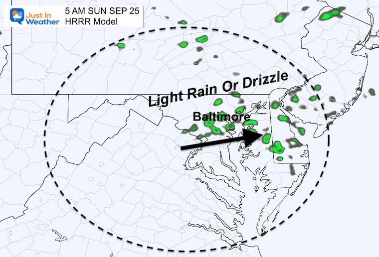
Please consider the error of the short range modeling, and this may still adjust anther hour faster… I will have a full update in my Sunday morning report. 

Simulations: 

HRRR Model

Animation 10 AM to 2 PM

September-24-rain-radar-sunday-morning

Timeline Slider —-> 10 AM to 2 PM

This is the same product as above, but you can control the hourly snapshots.

september-25-weather-storm-radar-hrrr-am-10
september-25-weather-storm-radar-hrrr-am-11
september-25-weather-storm-radar-hrrr-pm-12
september-25-weather-storm-radar-hrrr-pm-1
september-25-weather-storm-radar-hrrr-pm-2
previous arrow
next arrow
september-25-weather-storm-radar-hrrr-am-10
september-25-weather-storm-radar-hrrr-am-11
september-25-weather-storm-radar-hrrr-pm-12
september-25-weather-storm-radar-hrrr-pm-1
september-25-weather-storm-radar-hrrr-pm-2
previous arrow
next arrow


FV3 Model

Timeline Slider —-> 2 PM to 10 PM

This is the best match, but as you can see this first frame does not exactly match the intensity of the last frame above at 2 PM.

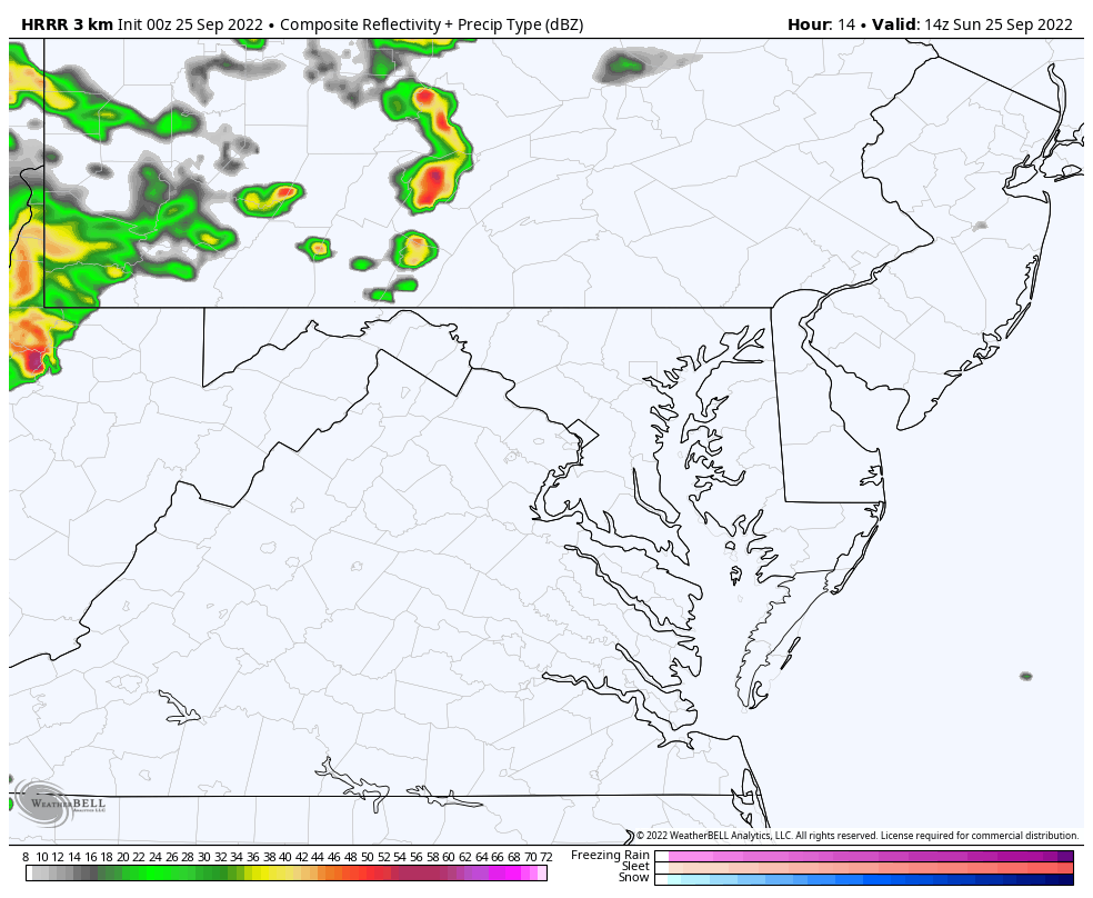
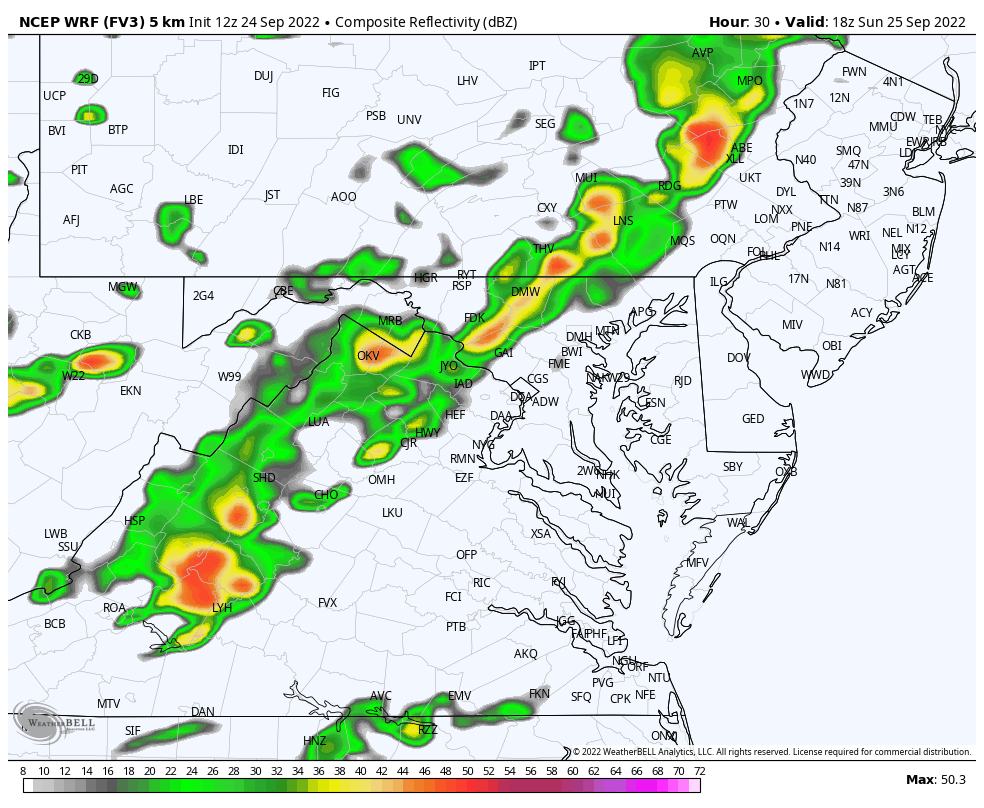
Here we see multiple lines of rain and storms. The initial push has a chance to be severe in metro areas. The next line will be stronger in Southern Maryland and extend to the coast at night. 

september-25-weather-storm-radar-fv3-sunday-pm-2
september-25-weather-storm-radar-fv3-sunday-pm-3
september-25-weather-storm-radar-fv3-sunday-pm-4
september-25-weather-storm-radar-fv3-sunday-pm-5
september-25-weather-storm-radar-fv3-sunday-pm-6
september-25-weather-storm-radar-fv3-sunday-pm-7
september-25-weather-storm-radar-fv3-sunday-pm-8
september-25-weather-storm-radar-fv3-sunday-pm-9
september-25-weather-storm-radar-fv3-sunday-pm-10
previous arrow
next arrow

FV3 Animation 2 PM to 10 PM

September-24-rain-radar-sunday-afternoon

Live Radar WIDGET

I’ve posted this in case you see this report in the early morning and want to see any development.

I have it zoomed in on metro Baltimore, but you can pan or pull out wider.

I will have a new report on Tropical Storm Ian around 6 AM Sunday, then the daily weather update by 8 AM.


Weather posts straight to your inbox

Sign up and be the first to know!


When Is The Typical FIRST FROST?

Average Frost And Freeze Dates in Maryland and Pennsylvania

In Case You Missed It: Seem Early Winter Outlooks

Winter Outlook 2023 La Niña Triple Dip Expectations

Winter Outlook 2023 Early Look At Snow From Two Farmers Almanacs


Please share your thoughts, best weather pics/videos, or just keep in touch via social media