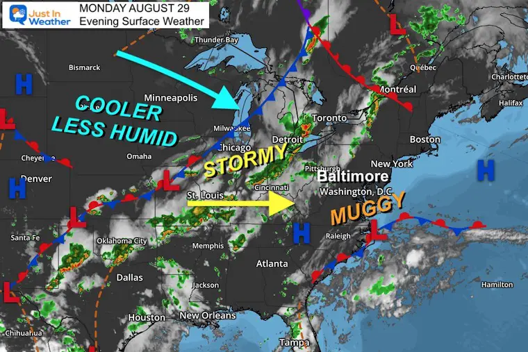
The latest heat wave is about to break, and as may be expected that means storms. These may turn severe, then bring relief on the other side for the remainder of the week.
The high temperature on Monday was 91ºF in Baltimore at BWI. This marks 5 days in a row at or above 90ºF, and 14 days this month. That may not be too excessive, however with most schools in our region now in session it might be time for more to welcome a cool down.
This also brings up the concern for after school and evening sports. So I wanted to share the expected timeline for storms across the region to help with you plans.
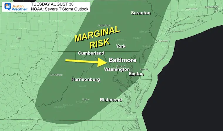
Severe Thunderstorm Risk Tuesday
NOAA has put a Marginal Risk for storms to turn severe. At this point, it may not prompt a region wide ‘Watch’, but some cells may reach those limits with damaging wind and large hail.
These are the type of storms that will likely pass through in half an hour or so. But that is enough to disrupt outdoor practice.
ANY STORM CAN PRODUCE LIGHTNING!
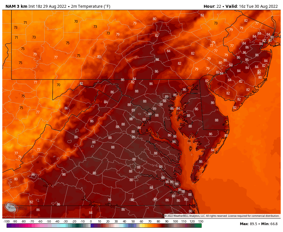
Watch Temps Drop
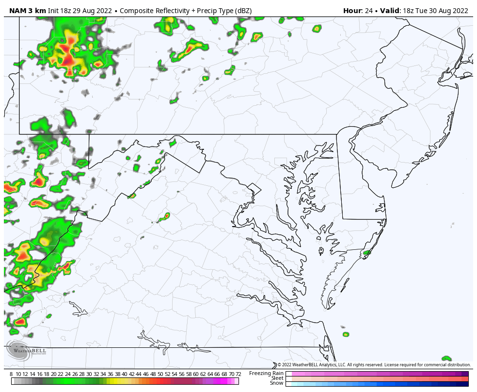
NAM 3Km: Noon to Midnight
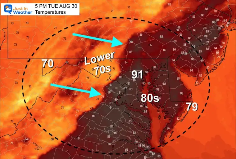
Snapshot at 5 PM
The signal here is that at this time, rain should have reached and cooled down Frederick and essentially all points west of the front mountain ridge. Meanwhile, temps hold in the lower 90s around metro Baltimore.
Radar Simulaitons
See the animation first, then the hourly slider below.
NAM 3 Km 2 PM to Midnight
Slider—> 3 PM to 10 PM
I’ve added a few towns to each slide to help with locations.
Please consider there could be a buffer of 1 to 2 hours off from this guideline. We will see if there is a trend earlier in the morning.
august-30-weather-storm-radar-tuesday-pm-3
august-30-weather-storm-radar-tuesday-pm-4
august-30-weather-storm-radar-tuesday-pm-5
august-30-weather-storm-radar-tuesday-pm-6
august-30-weather-storm-radar-tuesday-pm-7
august-30-weather-storm-radar-tuesday-pm-8
august-30-weather-storm-radar-tuesday-pm-9
august-30-weather-storm-radar-tuesday-pm-10
I will have more simulations to compare and refine the timing in my full morning report. I aim to publish that around 6:30 AM Tuesday.
I am aware there are some spelling and grammar typos. I have made a few public statements over the years, but if you are new here you may have missed it:
I have dyslexia, and found out at my second year at Cornell. It didn’t stop me from getting my meteorology degree, and being first to get the AMS CBM in the Baltimore/Washington region.
I do miss mistakes in my own proofreading. The autocorrect spell check on my computer sometimes does an injustice to make it worse.
All of the maps and information are accurate. The ‘wordy’ stuff can get sticky.
There is no editor that can check my work when I need it and have it ready to send out in a newsworthy timeline.
I accept this and perhaps proves what you read is really from me…