


May 5 Soggy And Chilly Start With More Rain During The Week Ahead
Sunday May 5 Morning Report We are stuck in this muck! The wet weather pattern continues with a soggy start this Sunday morning. The rain will try to break up…
Sunday August 28 2022
It is not a question of if, but rather when. As we approach the end of August, we enter the climatologically most active time of the year for developing tropical cyclones in the Atlantic Ocean Basin. The National Hurricane Center has increased the chances for development in the week ahead. Under normal conditions this should be expected, however, this has been anything but a normal year.
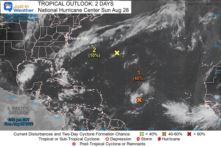
Before we get ahead of ourselves, I want to point out that the short-term outlook over the next 48 hours is marginally impressive. They give a 40% chance for this cluster of unorganized storms in the central Atlantic to develop into a named storm.
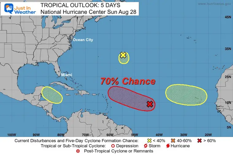
Extending the outlook to 5 Days: NOAA and the National Hurricane Center have upgraded the region to a 70% chance for a developing system. We will explore this below.
To date, we have not had a named storm all month. In fact, most of July as well. The last named system was Tropical Storm Colin on July 2. That was 57 days ago, which brings us up to two possible records.
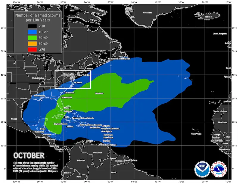
Augusts With No Named Storms
Barring a surprise, it is looking likely 2022 will follow as the third on this list.
The record was set at 61 days in 1999. If the Atlantic remains storm-free until September 3rd, then this will be declared the longest mid season drought on record. If we do get something named before then, this will rank as second place.
ALSO SEE:
Snowfall For Winters Following Very Quiet Tropical Seasons
Central Tropical Atlantic:
Recent satellite-derived wind data indicates that a broad area of low pressure located over the central tropical Atlantic Ocean is producing winds to near gale force, but the circulation remains elongated with an ill-defined center. Although environmental conditions ahead of the system do not appear conducive for significant development, a tropical depression, at the very least, is likely to form later this week while moving slowly toward the west and then west-northwest at 5 to 10 mph, toward the waters east and northeast of the Leeward Islands.
* Formation chance through 48 hours…medium…40 percent.
* Formation chance through 5 days…high…70 percent.
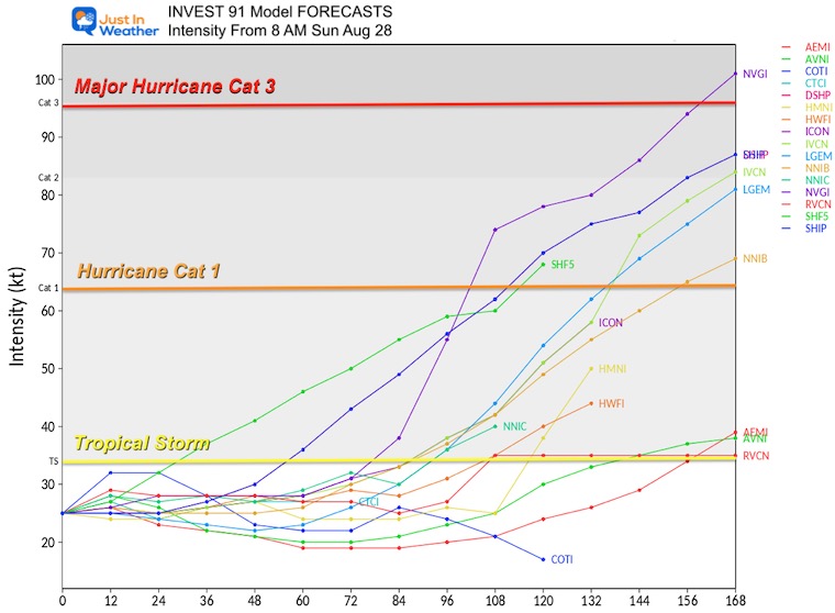
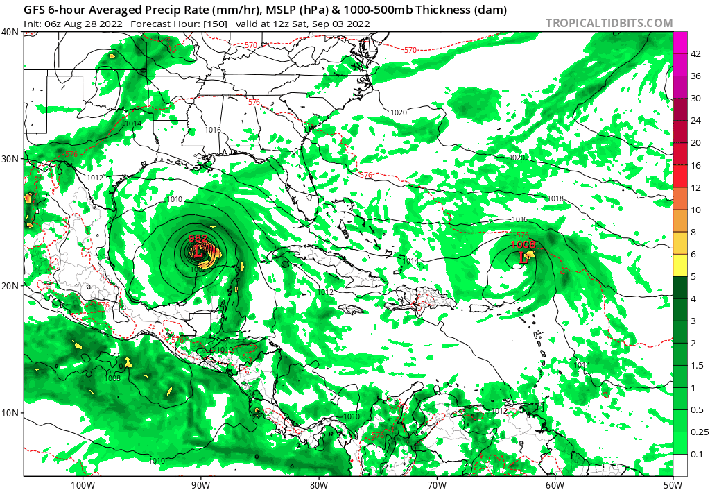
To explain how they come up with a number like 80% chance, we look at this chart. Here are 16 computer model simulations showing the forecast top winds from that system Invest 91L.
We can count up 12 of them showing tropical storm force winds (39 mph or higher) over the next 5 days. That is the 80% chance given in the outlook.
Here we can see the 5-day plot with this tropical wave or newly named storm passing north of the Greater Antilles Islands. But that is still a long way off for us…

This is the GFS Model showing the forecast plot for next weekend:
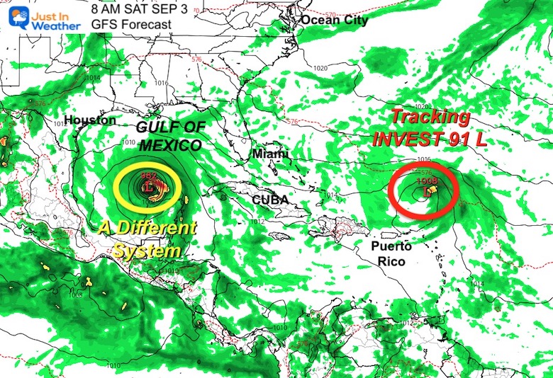
TWO THINGS?
Tracking that Invest 91L on the right…
Another System entering the Gulf of Mexico on the left looks more impressive.
Caveat: This is a plot from 150 hours to 348 hours away.
Saturday September 3 to Sunday September 11.
I highly DOUBT the validation of this, but it is the best I get to show you for now. We can use this in back reference to see if there is a trend, should either of these develop.
Historic Climate Data shows the most active time for the Atlantic is still a few weeks away. We cannot remain this quiet for the rest of the season.
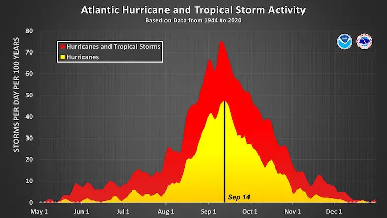
That is still up for debate. But the community at large is anticipation the Atlantic to WAKE UP and start pumping new storms in September. It has been bottled up and can get a burst of business should conditions arrive. There needs to be less wind sheer (lighter winds aloft) and diminished Saharan Dust from Africa.
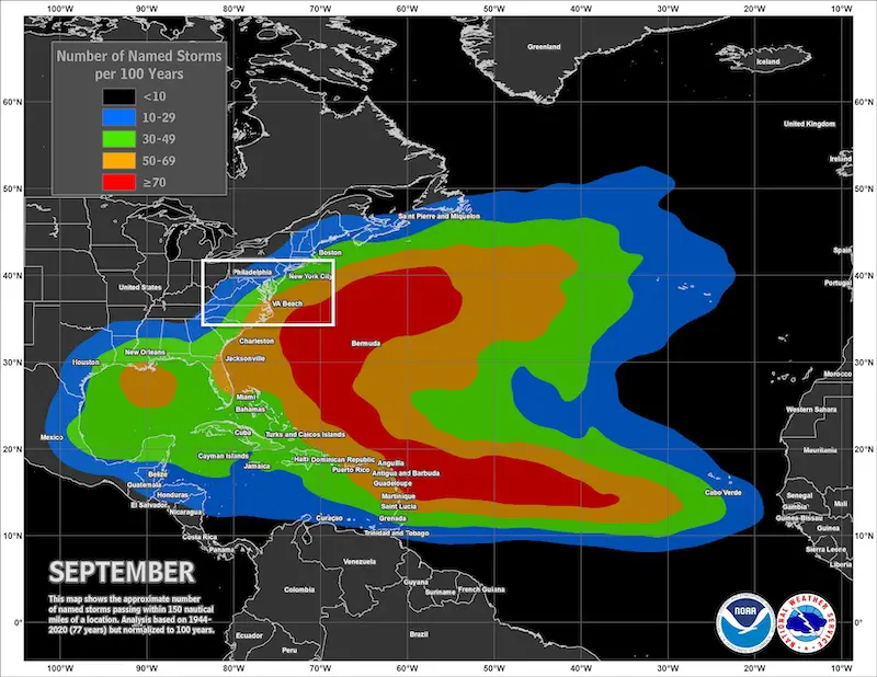
Atlantic Tropical History: Maps of Origin Regions Every 10 Days


NOAA Study: Reducing Air Pollution INCREASED Tropical Storms

NOAA 2022 Hurricane Forecast- Above Normal Again


By Popular Demand and Supporting Just In Power Kids
This is the shirt that Power Kid James and his family has embraced… They even surprised us with this sign during our Kids Trek Too event.
It is now available!

Click the image or here for more info

I am aware there are some spelling and grammar typos. I have made a few public statements over the years, but if you are new here you may have missed it:
I have dyslexia, and found out at my second year at Cornell. It didn’t stop me from getting my meteorology degree, and being first to get the AMS CBM in the Baltimore/Washington region.
I do miss mistakes in my own proofreading. The autocorrect spell check on my computer sometimes does an injustice to make it worse.
All of the maps and information are accurate. The ‘wordy’ stuff can get sticky.
There is no editor that can check my work when I need it and have it ready to send out in a newsworthy timeline.
I accept this and perhaps proves what you read is really from me…
It’s part of my charm.