One thing we can say about this summer is that often when we get rain, we get too much. We have avoided the extreme heat (until later this week), but we have had multiple events with flooding. Today may be another notch on the belt.
While the general expectation is for some storm cells to drop rainfall rates of 1 to 2 inches an hour, this can fall on places with soggy soil or leftover high water from recent storms Saturday or last week. So it can take less rain to lead to flooding with less ability for it to drain.
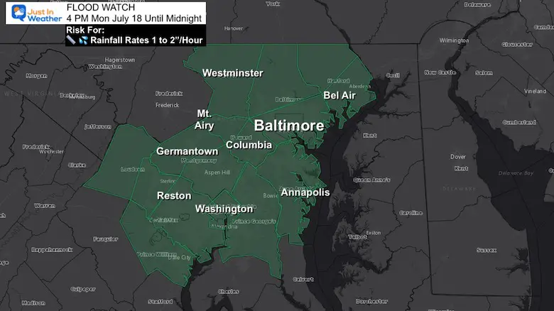
Flood Watch Map
Official National Weather Service Report
Part 1- (The other part is below the Radar Simulations)
WHAT...Flash flooding caused by excessive rainfall is possible.
WHERE...Portions of DC, Maryland and northern Virginia, including
the following areas:
DC, District of Columbia.
In Maryland:
Anne Arundel, Carroll, Central and Southeast Howard, Central and
Prince William/Manassas/Manassas Park and Western Loudoun.
In Addition To Flooding, We Have A Slight Risk For Severe Storms
Alert Reminder:
Watch: This will be issued when conditions support ‘potential’ for severe storms. Like a broad area for a 6 hour period.
Warning: This will be issued when a severe storm, flooding, or tornado is spotted. This will be tracked with towns in the path over specific time frame.
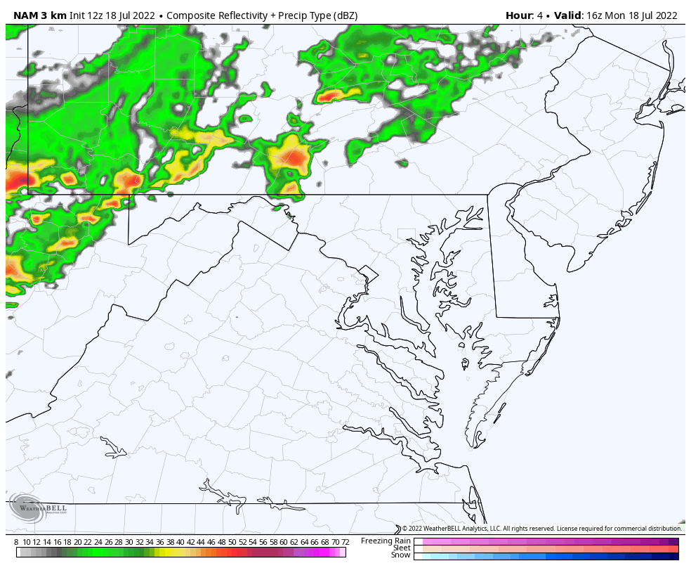
Radar Simulaitons
Please note this is a suggestion and has limitations.
I have pointed out many days where we get storms earlier and more widespread than shown here.
NAM 3 Km —-> slider
2 PM to 10 PM
Here we see the cluster and storm line reaching (suggested) metro Baltimore around 7 to 8 PM.
I added the highlight that the HRRR Model shows this stalling around Rt 50 after 8 PM… See that comparison below.
july-18-weather-radar-storm-nam-monday-pm-2
july-18-weather-radar-storm-nam-monday-pm-3
july-18-weather-radar-storm-nam-monday-pm-4
july-18-weather-radar-storm-nam-monday-pm-5
july-18-weather-radar-storm-nam-monday-pm-6
july-18-weather-radar-storm-nam-monday-pm-7
july-18-weather-radar-storm-nam-monday-pm-8
july-18-weather-radar-storm-nam-monday-pm-9
july-18-weather-radar-storm-nam-monday-pm-10
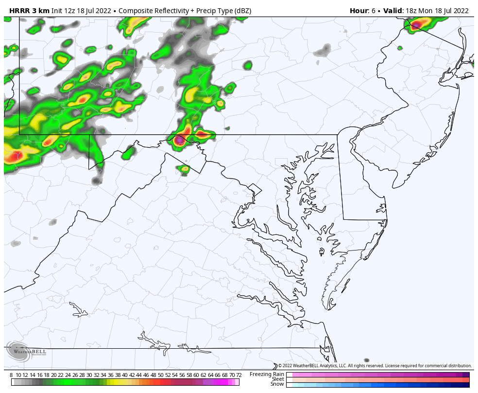
Animations
NAM 3Km 12 PM to 10 AM
HRRR 2 PM to Midnight
This model suggests the slowing down or staling of the storm line south of Baltimore between 8 PM and 10 PM or so…
Official National Weather Service Report
Part 2
This follows my suggestion that we should plan for some storms to develop earlier than model guidance (6 to 7 PM for metro Baltimore), and the possible stalling of the line south of Baltimore after sunset…
* WHEN…From 4 PM EDT this afternoon through this evening.
* IMPACTS…Excessive runoff may result in flooding of rivers,
creeks, streams, and other low-lying and flood-prone locations.
ADDITIONAL DETAILS…
– Afternoon to evening showers and thunderstorms may produce
very heavy rainfall capable of flash flooding. This could
include multiple rounds of storms which would enhance the
flood risk. Rainfall rates may reach 1 to 2 inches per hour,
locally higher in spots. The D.C. and Baltimore metros will
be the most susceptible given recent heavy rainfall the past
couple of weeks.
Live Lightning and Radar Widget
Storm Reports (preliminary) : Tuesday July 12
Was there a tornado? Here are my reports.
Still no formal statement from The National Weather Service
I am aware there are some spelling and grammar typos. I have made a few public statements over the years, but if you are new here you may have missed it:
I have dyslexia, and found out at my second year at Cornell. I didn’t stop me from getting my meteorology degree, and being first to get the AMS CBM in the Baltimore/Washington region.
I do miss my mistakes in my own proofreading. The autocorrect spell check on my computer sometimes does an injustice to make it worse.
All of the maps and information are accurate. The ‘wordy’ stuff can get sticky.
There is no editor that can check my work when I need it and have it ready to send out in a newsworthy timeline.
I accept this and perhaps proves what you read is really from me…