July 12 2022
Tuesday Afternoon Update
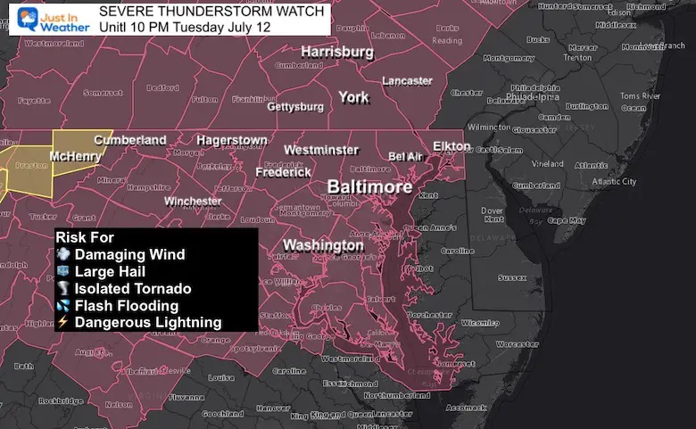
A follow up to the Enhanced Risk today, a new Severe Thunderstorm Watch has been issued. This expands a previous Watch Box into central Maryland.
This means that conditions are now present to develop storms with a greater chance to turn severe.
This may include damaging winds over 58 mph that could be from microbursts or straight line winds. In addition, more storms may have large hail over 1 inch diameter, and rotating supercells to produce an isolated tornado.
Severe Thunderstorm Watch
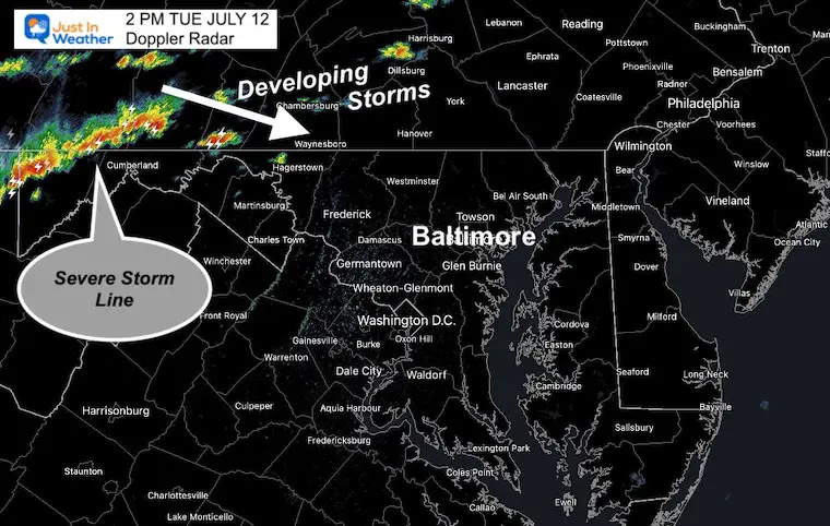
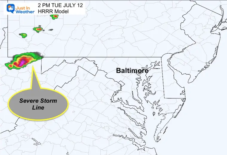
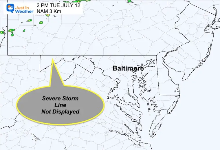
I need to reinforce that the short range models have been underperforming lately. I have a comparison at 2 PM to the actual radar to highlight this… So we can anticipate more activity than models suggest.
Potential (not a promise) for damaging wind, large hail, and an isolated tornado. Any storm may also produce flooding and dangerous lighting.
Below the simulations are the maps that break down of the risk assessment maps and new radar simulations plus live radar widget.
Severe Storm Alert Reminder
Watch: This will be issued when the potential development for a large areas over a 6 hour time frame.
Warning: This will be issued when a storm is happening and being tracked through specific towns. That may cover a 30 to 45 minute time frame.
Alerts Page:
All alerts will display in a banner on the top of the website. However, you can also go to this page and refresh for the complete NWS Alerts information as they are posted.
https://justinweather.com/alert_categories/nws-alert/
Live Radar Widget
More Active Than Suggested?
2 PM Comparison
Doppler Radar
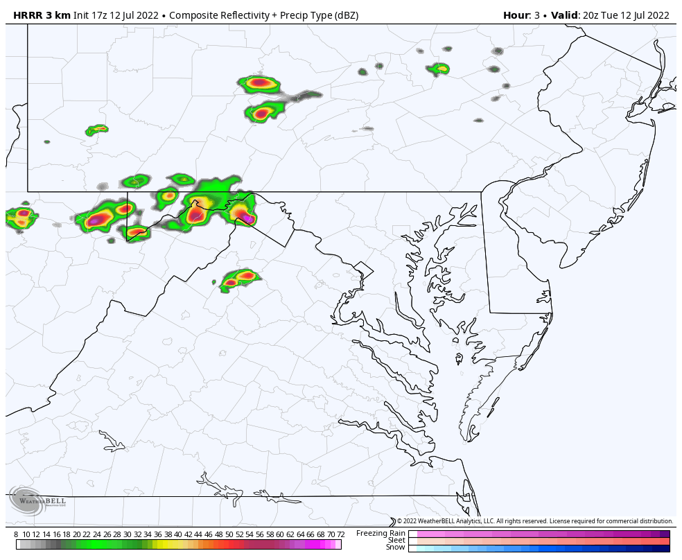
At 2 PM, Doppler Radar showed the line of storms moving into Garrett County in western MD, with seem cells breaking out ahead of it.
However, the short range models area already missing out on that.
HRRR Model
This model had the line in West Virginia, but missed on the action reaching Garrett County at this time.
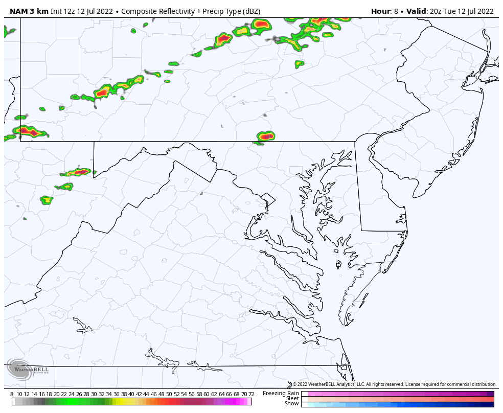
NAM 3 Km
This model missed the early activity all together. However the animation forecast below shows the flare up for metro areas late this afternoon.
Forecast Animations
4 PM to midnight….
I am showing both models to highlight the expected storm line, but it is possible the activity is more robust than shown here since they are missing out on the early development aready.
The peak timing of storms:
- 3 PM to 6 PM – Hagerstown to Harrisburg, then expanding across Southern Pennsylvania into northern Maryland.
- 5 PM to 8 PM – Central Maryland; however the line may break up within 15 miles of the Baltimore beltway.
- 8 PM to Midnight – Annapolis to Easton, then southern Maryland
HRRR Model
This product is more likely of the two, even though it splits the energy around Baltimore… a few cells can still reach the beltway.
NAM 3 Km Model
This product is still splitting the storm line with a void over central Maryland missing the beltway completely. I still can’t support a miss for Baltimore at this time.
Enhanced Risk For Severe Storms
The NOAA outlook has focused the Enhanced Risk for severe storms to include metropolitan Washington, Baltimore, York/Lancaster, and Philadelphia
Potential for damaging wind, large hail, and isolated tornados.
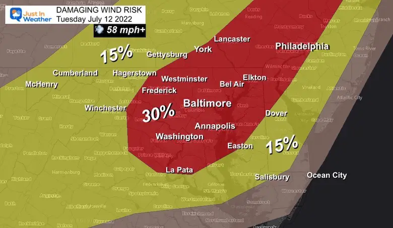
Damaging Wind Risk
There is a 30% chance of storms in this (red) region to produce winds in excess of 58 mph. This may be microbursts or straight line wind damage without a tornado. That can take down trees, power lines, and move lawn furniture.
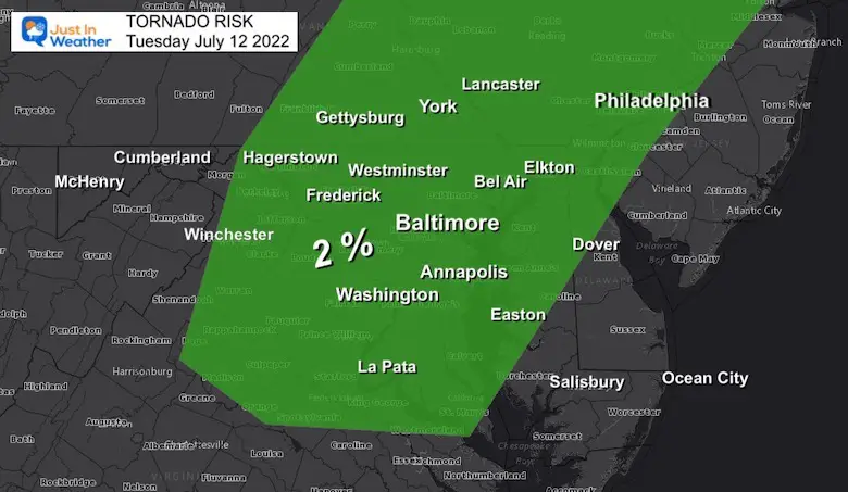
Tornado Risk
This is important to note: 2% of the storms may produce a tornado. Not all rotation will produce a funnel cloud touching the ground.
Looking Ahead
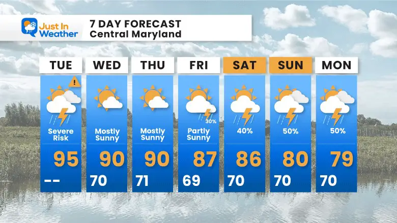
Plan Your Kayaking Day Now

Hurricane Season Forecast: June 1 Through November 30
NOAA 2022 Hurricane Forecast- Above Normal Again

Forecast From Colorado State University
Atlantic Hurricane Forecast

Related Posts
NOAA Study: Reducing Air Pollution INCREASED Tropical Storms

Atlantic Tropical History: Maps of Origin Regions Every 10 Days


Recent Storm Reports
May 22 Hail And Wind Damage

May 16 Large Hail Videos And Storm Tracking Map


Please share your thoughts, best weather pics/video, or just keep in touch via social media
*Disclaimer due to frequent questions:
I am aware there are some spelling and grammar typos. I have made a few public statements over the years, but if you are new here you may have missed it:
I have dyslexia, and found out at my second year at Cornell. I didn’t stop me from getting my meteorology degree, and being first to get the AMS CBM in the Baltimore/Washington region.
I do miss my mistakes in my own proofreading. The autocorrect spell check on my computer sometimes does an injustice to make it worse.
All of the maps and information are accurate. The ‘wordy’ stuff can get sticky.
There is no editor that can check my work when I need it and have it ready to send out in a newsworthy timeline.
I accept this and perhaps proves what you read is really from me…
It’s part of my charm.


