


July 18 Flood Watch In The Mountains Then Storms Expand Back This Weekend
Friday, July 18 2025 Morning Report There is some relief in sight, but I remain cautious. For the short term, today remains muggy, while the focus of strong storms and…
July 1 2022
Friday Late Afternoon Update
Following up from my earlier report when we tracked the storms popping and exceeding model guidance, The National Weather Service caught up to the event.
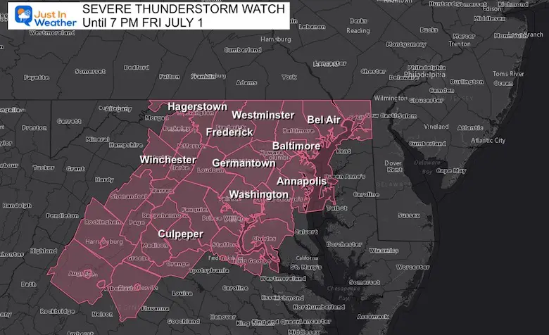
A Severe Thunderstorm Watch has been issued for central Maryland and northern Virginia unit 7 PM. So by the time you see this, there is not much left to go. I will spell the out below.
Severe Thunderstorm Watch Unit 7 PM
A Watch means conditions may produce more storms with damming wind or large hail.
Warnings will be issued for local towns or counties when an actual storm with these conditions pops up.
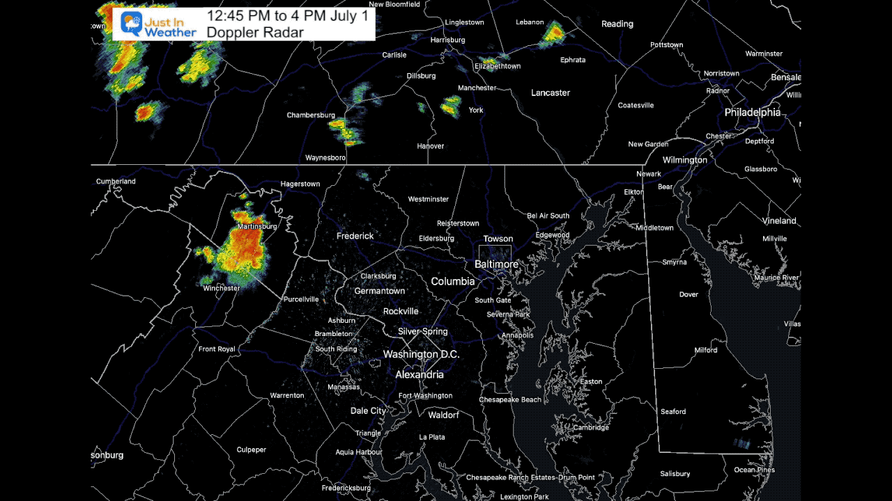
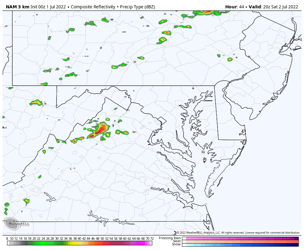
This is one loop with 100 images so it may take longer to load…
Martinsburg to Bel Air… This was an impressive cluster.
I wanted to show you the flare up of storms, and lighting explosion with the activity. Some tree damage has been reported with high wind gusts in York County, PA.
At the end of this loop, that cluster split around Bel Air, but regrouped to enter Cecil County in Northeastern MD.
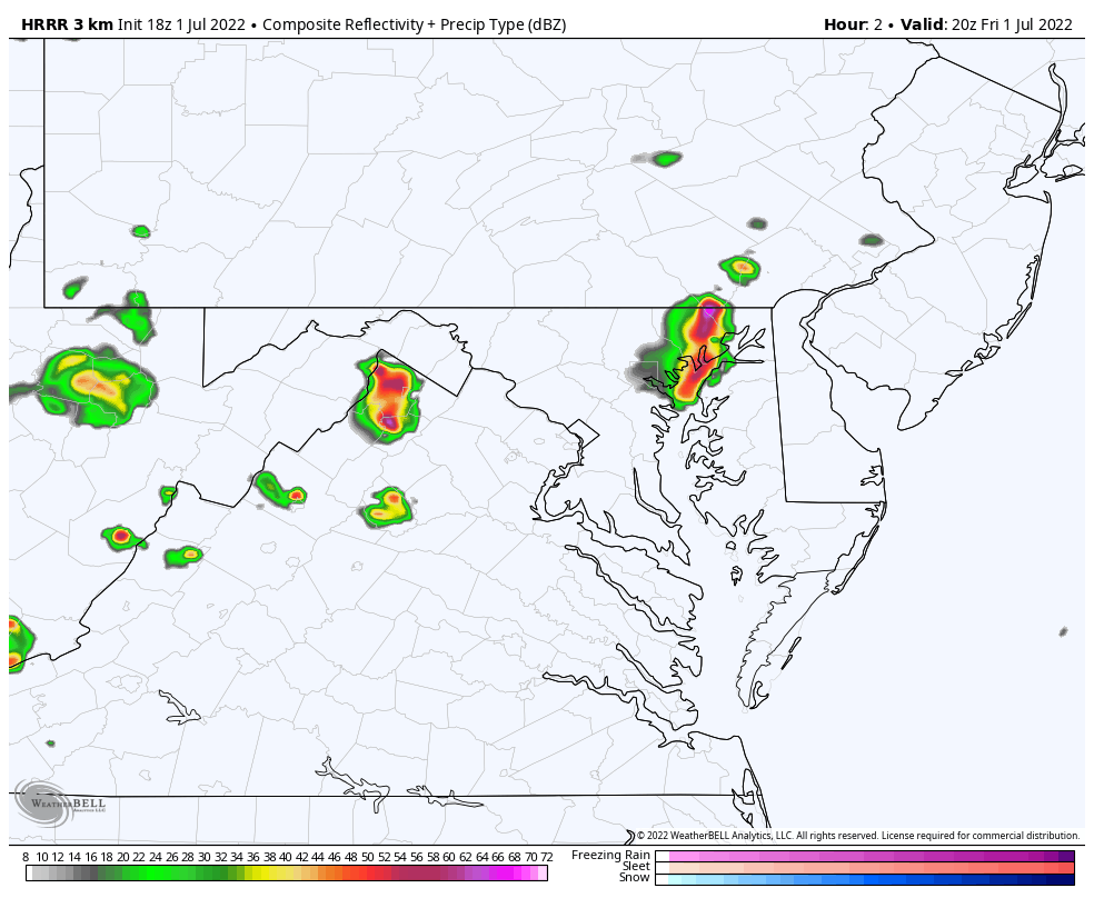
4 PM to 10 PM
Tracking that cell around Winchester, it may hold near Frederick, Germantown, Mt. Airy, and Howard County…. But fall apart close to Baltimore by 7 PM.
This is NOT a perfect product, but it does guide us to suggest the weakening of the storm cells after 6 to 7 PM, and fading away by sunset.
The activity in the mountains will also fade as the sun angle gets low and we lose the heating supply. So a quick drop of of energy and storms this evening.
weather, severe thunderstorm Watch, radar, Friday forecast
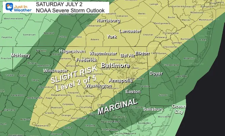
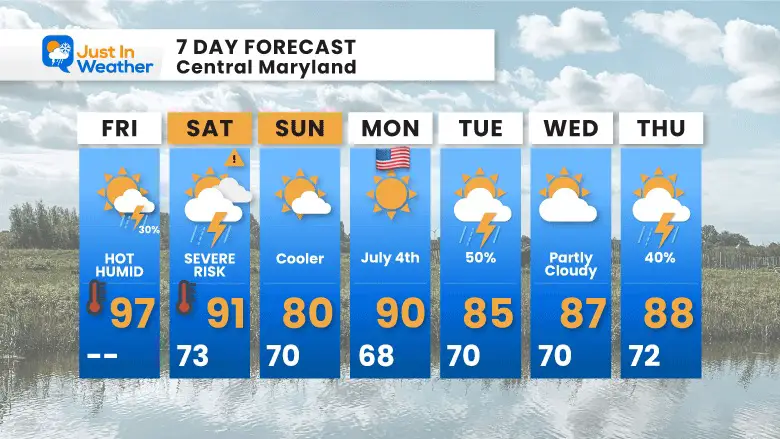
More humidity means a warmer morning, but maybe not as hot in the afternoon with storms. The risk for severe weather is centered on our region.
Morning
Afternoon
This looks like an issue mainly between the mountains and I-95/Metro Baltimore. It may reach Annapolis and Easton by 10 PM.
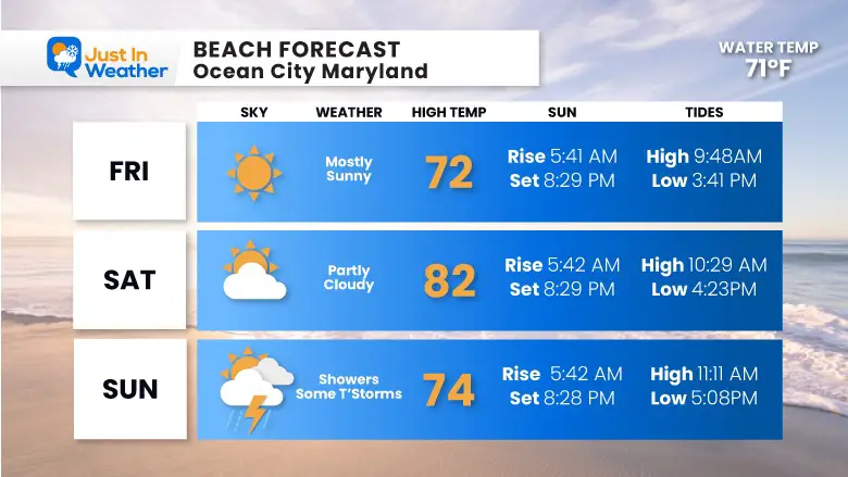
Farther south and to the beaches should remain dry.
Sunday will be cooler, but we ‘may’ see showers linger by the beaches. The overnight model guidance did move that farther south, but I want to see one more run before dropping that chance.
As of now, July 4th is looking good!
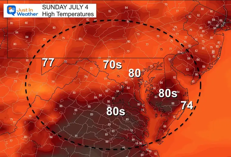

After storms that may turn severe on Saturday, it will be followed by a cooler Sunday. The July 4th- Monday should heat up again, but remain dry.
Another round of strong to severe storms is possible on Tuesday.
NOAA 2022 Hurricane Forecast- Above Normal Again


NOAA Study: Reducing Air Pollution INCREASED Tropical Storms

Atlantic Tropical History: Maps of Origin Regions Every 10 Days


May 16 Large Hail Videos And Storm Tracking Map


*Disclaimer due to frequent questions:
I am aware there are some spelling and grammar typos. I have made a few public statements over the years, but if you are new here you may have missed it:
I have dyslexia, and found out at my second year at Cornell. I didn’t stop me from getting my meteorology degree, and being first to get the AMS CBM in the Baltimore/Washington region.
I do miss my mistakes in my own proofreading. The autocorrect spell check on my computer sometimes does an injustice to make it worse.
All of the maps and information are accurate. The ‘wordy’ stuff can get sticky.
There is no editor that can check my work when I need it and have it ready to send out in a newsworthy timeline.
I accept this and perhaps proves what you read is really from me…
It’s part of my charm.