June 29 2022
Wednesday Morning Update
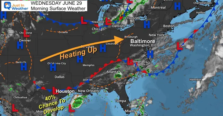
We are turning the corner to bring heat back into the Mid Atlantic. We have been spoiled with relatively cool weather much of Spring and early Summer. The reality check is about to be cashed, and we have a few chances for parts of our region to approach 100ºF over the next week.
Some bumps along the way will include a risk for severe storms on Saturday.
The tropics are heating up, with a. Tropical Storm Warning for the ABC Islands including Aruba and another system trying to form off of the Texas Coast.
Morning Surface Weather
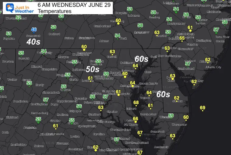
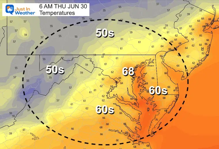
Morning Temperatures
Still comfortable…
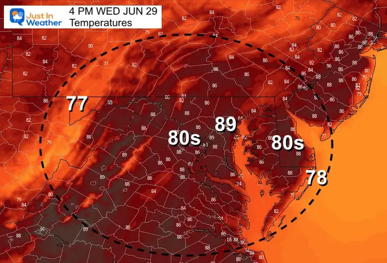
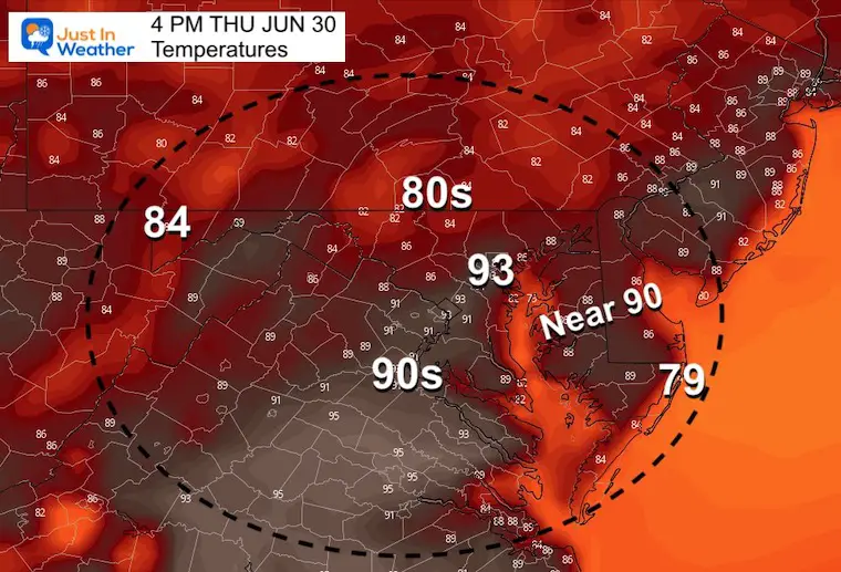
Afternoon Temperatures
Humidity will be creeping up. Some spots may reach 90ºF.
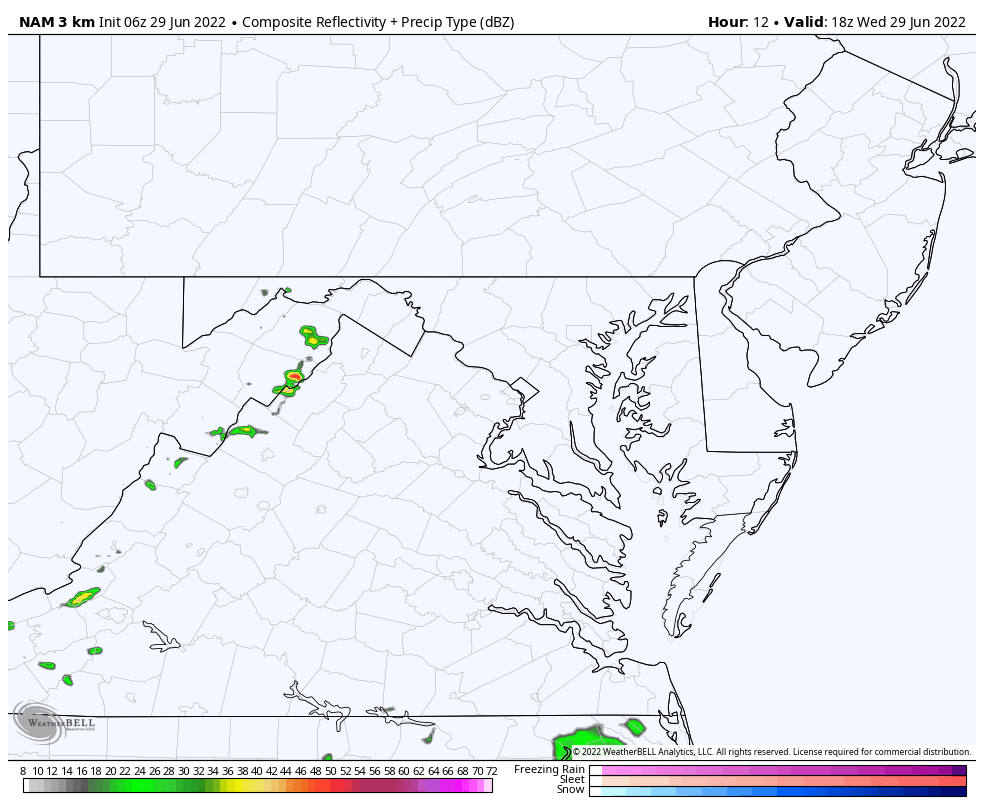
Afternoon Storm Risk?
Simulation – NAM 3 Km Model 2 PM tp 8 PM
A small chance for an isolated storm to develop between 3 PM and 6 PM- mainly along the mountains to the northern suburbs, and well west of Washington DC.
CLIMATE DATA
TODAY June 29th
Normal Low in Baltimore: 66ºF
Record 53ºF in 1974
Normal High in Baltimore: 87ºF
Record 105ºF 1934
Thursday
Here comes the heat and humidity cranking up.
Morning
Afternoon
Looking Ahead:
Friday Afternoon to July 4th Evening
Storms may turn severe on Saturday, with lingering rain on Sunday at the beaches.
As of now, July 4th is looking good!
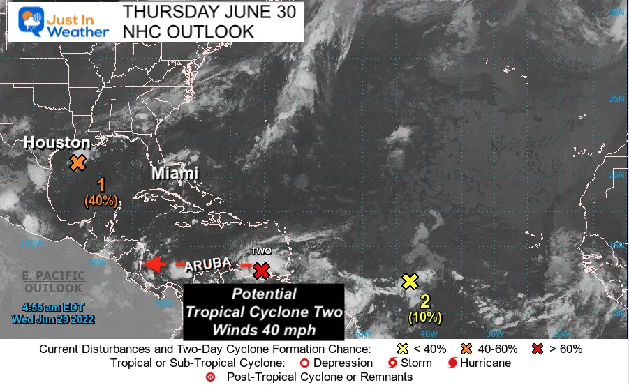
Tropical Weather
The National Hurricane Center has two main areas of interest.
The system off of the Texas coast has a 40% chance to develop before making landfall… This is expected to land south of Houston.
The Southern Caribbean system already has 40 mph winds, with is required for an upgrade and named tropical storm. That naming should happen today. It will be called ‘Bonnie’.
NHC Update
*Moving west at 30 mph is a quick moving system!
Forecast: A Tropical Storm Warning means conditions are expected within 36 mph.
This will intensify and pass close to the ABC Islands (Aruba, Bonair, and Curaçao) before sunrise on Thursday.
Wind forecast 50 to 63 mph
SUMMARY OF 500 AM AST...0900 UTC...INFORMATION
----------------------------------------------
LOCATION...11.3N 65.4W
ABOUT 200 MI...320 KM ESE OF CURACAO
ABOUT 420 MI...675 KM E OF NTHRN TIP OF GUAJIRA PNSULA COLOMBIA
MAXIMUM SUSTAINED WINDS...40 MPH...65 KM/H
PRESENT MOVEMENT...W OR 280 DEGREES AT 30 MPH...48 KM/H
MINIMUM CENTRAL PRESSURE...1010 MB...29.83 INCHES
National Hurricane Center: Tropical Storm ‘Bonnie’ Forecast Track
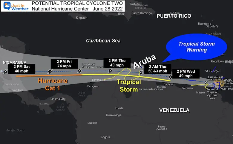
A Tropical Storm Warning is in effect for...
* Islas de Margarita, Coche and Cubagua
* Bonaire
* Curacao
* Aruba
* Coast of Venezuela from the Peninsula de Paraguana
westward to the Colombia/Venezuela border including the Gulf of
Venezuela.
* Coast of Colombia from the Colombia/Venezuela
border westward to Santa Marta
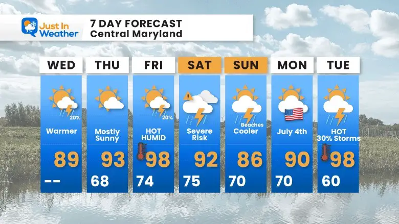
7 Day Forecast
Heat surges in at the end of the week. Humidity will make it feel like over 100ºF, but only for a couple of days.
Hurricane Season Forecast: June 1 Through November 30
NOAA 2022 Hurricane Forecast- Above Normal Again

Forecast From Colorado State University
Atlantic Hurricane Forecast

Related Posts
NOAA Study: Reducing Air Pollution INCREASED Tropical Storms

Atlantic Tropical History: Maps of Origin Regions Every 10 Days


Recent Storm Reports
May 22 Hail And Wind Damage

May 16 Large Hail Videos And Storm Tracking Map


Please share your thoughts, best weather pics/video, or just keep in touch via social media
*Disclaimer due to frequent questions:
I am aware there are some spelling and grammar typos. I have made a few public statements over the years, but if you are new here you may have missed it:
I have dyslexia, and found out at my second year at Cornell. I didn’t stop me from getting my meteorology degree, and being first to get the AMS CBM in the Baltimore/Washington region.
I do miss my mistakes in my own proofreading. The autocorrect spell check on my computer sometimes does an injustice to make it worse.
All of the maps and information are accurate. The ‘wordy’ stuff can get sticky.
There is no editor that can check my work when I need it and have it ready to send out in a newsworthy timeline.
I accept this and perhaps proves what you read is really from me…
It’s part of my charm.


