


July 12 Very Humid With Scattered Thunderstorms Later And More Storms Tomorrow
Saturday, July 12, 2025 Morning Report This may sound familiar: We remain in the ambiguous humid air mass. There is thick fog this morning, and the sun will dominate the…
June 27 2022
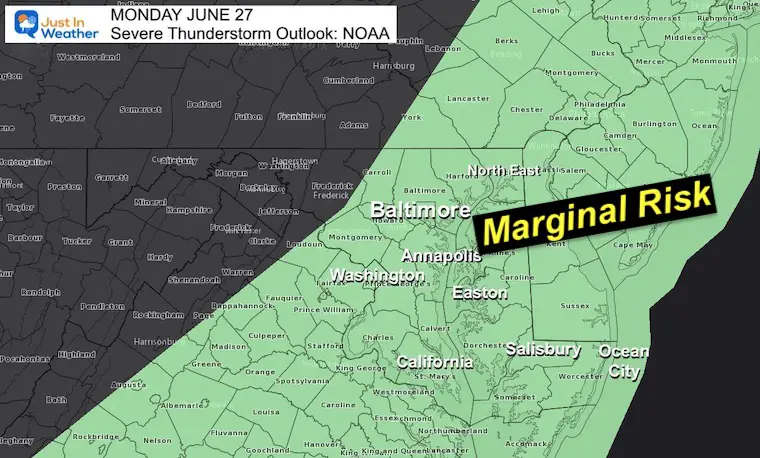
Monday Afternoon Update
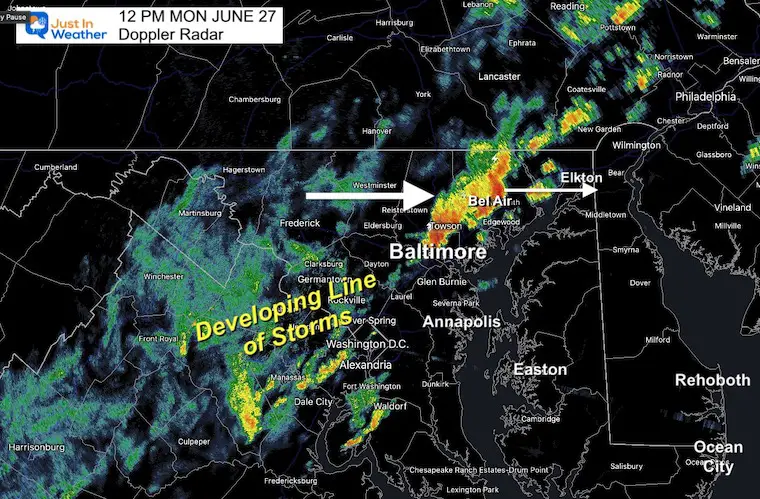
So far it looks like today’s forecast is behaving as expected. The recent development of thunderstorms with a cold front crossing central Maryland is pretty close to the simulation from this morning.
If anything, perhaps that cluster crossing Baltimore and Harford Counties was a little stronger, meaning that is on the way to Cecil County and Northern Delmarva. Perhaps we can extrapolate this for the rest of the day.
If you are at the beaches, you can anticipate a line of strong storms to arrive between 3 and 6 PM.
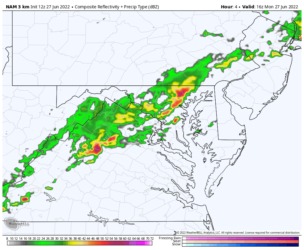
This update takes a look at the morning storm line, compares to the NAM 3 Km, which is the best performer, and a look at the simulation for the rest of today.
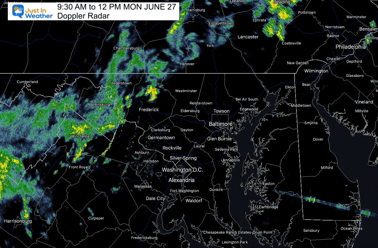
Compare this to the first image in the slider below. The live radar with lighting is below as well.
A line of heavy rain with some lighting and thunder has been crossing Baltimore and Towson. This is heading to Bel Air and Elkton.
This forecast image compared to the snapshot above matched up pretty well. This suggest a good initialization and handling for the rest of the day.


Normal Low in Baltimore: 65ºF
Record 50ºF in 1979
Normal High in Baltimore: 86ºF
Record 100ºF 2010
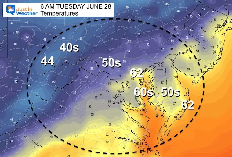
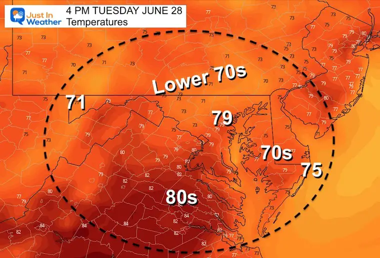
Temperatures will be cooler

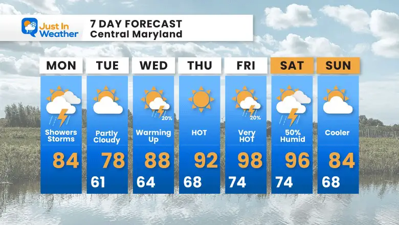
A cooler start to the week, then turning hot by Thursday and Friday
NOAA 2022 Hurricane Forecast- Above Normal Again


NOAA Study: Reducing Air Pollution INCREASED Tropical Storms

Atlantic Tropical History: Maps of Origin Regions Every 10 Days


May 16 Large Hail Videos And Storm Tracking Map


*Disclaimer due to frequent questions:
I am aware there are some spelling and grammar typos. I have made a few public statements over the years, but if you are new here you may have missed it:
I have dyslexia, and found out at my second year at Cornell. I didn’t stop me from getting my meteorology degree, and being first to get the AMS CBM in the Baltimore/Washington region.
I do miss my mistakes in my own proofreading. The autocorrect spell check on my computer sometimes does an injustice to make it worse.
All of the maps and information are accurate. The ‘wordy’ stuff can get sticky.
There is no editor that can check my work when I need it and have it ready to send out in a newsworthy timeline.
I accept this and perhaps proves what you read is really from me…
It’s part of my charm.