June 22 2022
Wednesday Afternoon Update
Let’s be real… The short range forecast was a fail. The storms that erupted already into parts of central Maryland and metro Washington were way ahead of schedule. Any storm may have dangerous lighting, local flash flooding, large hail, and an isolated tornado.
There is more on the way, and this is the time to nowcast. So I have included the radar widget below… And for fun have the new HRRR Simulation.
Severe Thunderstorm Watch
This means is is possible, but not a promise. If you get a warning, then there is a storm being tracked.
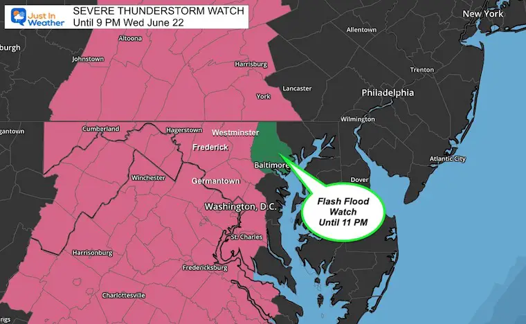
Any of these storms may contain damaging wind over 60 mph, large hail over 1 inch diameter, or an isolated tornado. Multiple storm cells may produce Flash Flooding with 1 to 3 inches of rain.
Let’s recap Round 1
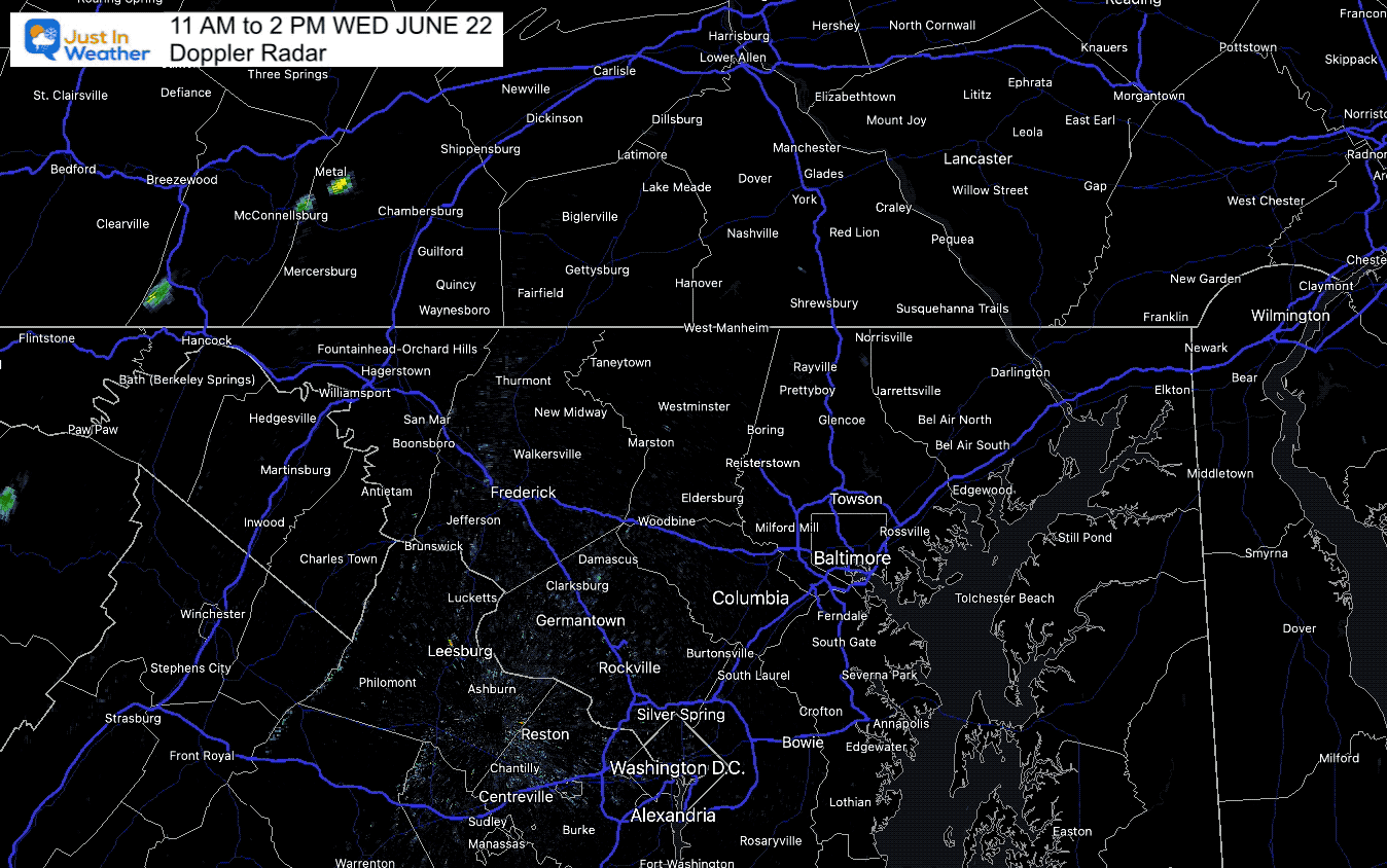
Radar Loop 11 AM to 2 PM
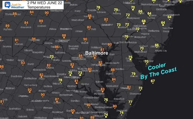
Temperatures
As of 2 PM we could see the mid to upper 80s inland compared to some colder 70s after storms have passed. Along the coast… That is the chill I mentioned.
Radar Snapshot at 3 PM
A Severe Thunderstorm Warning until 3:30 PM. Cells have contained hail 0.5″ to 1.0″ passing through Washington, Frederick, and Carroll Counties.
This is moving SOUTH at at 30 to 35 mph.
Westminster and Mount Airy are in the path.
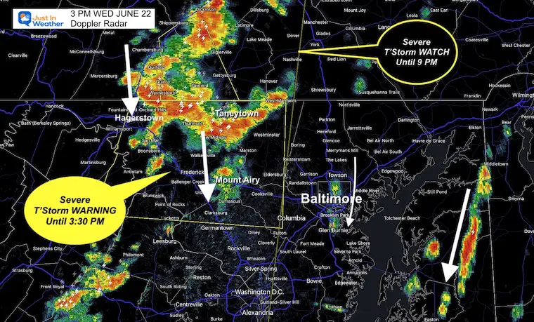
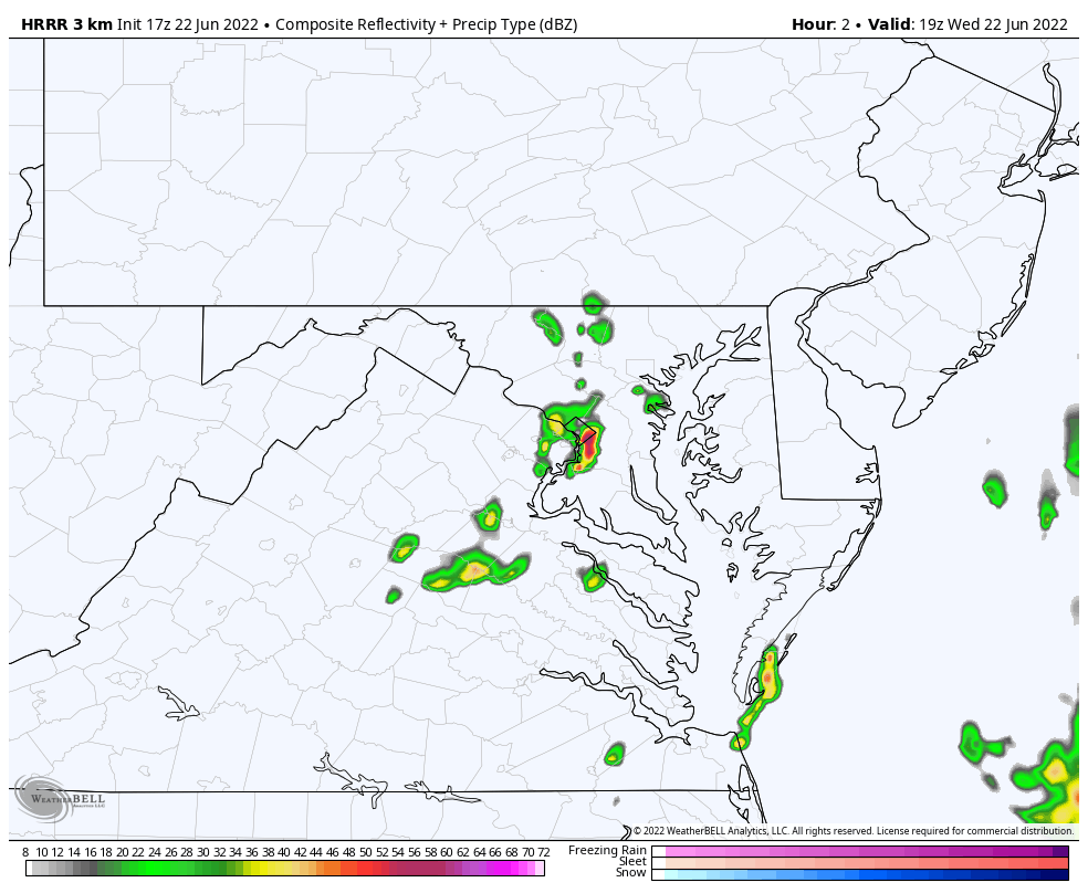
This shows how POOR the short range models have been. This cell is barely a blip in the first image (at 3 PM) in the forecast simulation below.
Radar Simulation:
3 PM Wed to 6 AM Thursday
This is a long loop to show that if you miss out on daytime storms, you may get in on the action tonight with rain continuing through sunrise tomorrow.
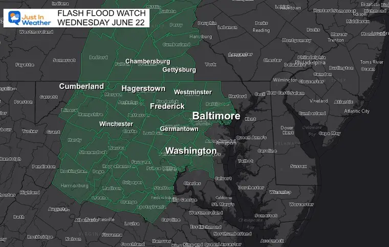
Flash Flood Watch
The National Weather Service expanded this to include counties west of Baltimore where those multiple heavy cells are more likely.
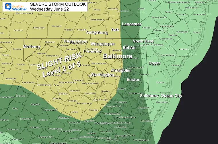
Wednesday Severe Storm Outlook
The highest risk for severe weather will be where the heat builds.
Storms may contain large hail, damaging winds, and isolated tornadoes.
Alert Reminder (When issued for severe storms, flooding, or tornado)
Watch: Means it MIGHT HAPPEN. This will often extend for up to 6 hours.
Warning: Means it IS HAPPENING NOW! This is a shorter time frame and will list towns included.
Live Radar Widget

Book Your Kayak or Paddle Boat Adventure On The North Chesapeake Bay
Hurricane Season Forecast: June 1 Through November 30
NOAA 2022 Hurricane Forecast- Above Normal Again

Forecast From Colorado State University
Atlantic Hurricane Forecast

Related Posts
NOAA Study: Reducing Air Pollution INCREASED Tropical Storms

Atlantic Tropical History: Maps of Origin Regions Every 10 Days


Recent Storm Reports
May 22 Hail And Wind Damage

May 16 Large Hail Videos And Storm Tracking Map


Please share your thoughts, best weather pics/video, or just keep in touch via social media
*Disclaimer due to frequent questions:
I am aware there are some spelling and grammar typos. I have made a few public statements over the years, but if you are new here you may have missed it:
I have dyslexia, and found out at my second year at Cornell. I didn’t stop me from getting my meteorology degree, and being first to get the AMS CBM in the Baltimore/Washington region.
I do miss my mistakes in my own proofreading. The autocorrect spell check on my computer sometimes does an injustice to make it worse.
All of the maps and information are accurate. The ‘wordy’ stuff can get sticky.
There is no editor that can check my work when I need it and have it ready to send out in a newsworthy timeline.
I accept this and perhaps proves what you read is really from me…
It’s part of my charm.


