3:30 PM June 16 2022
Thursday Afternoon Update
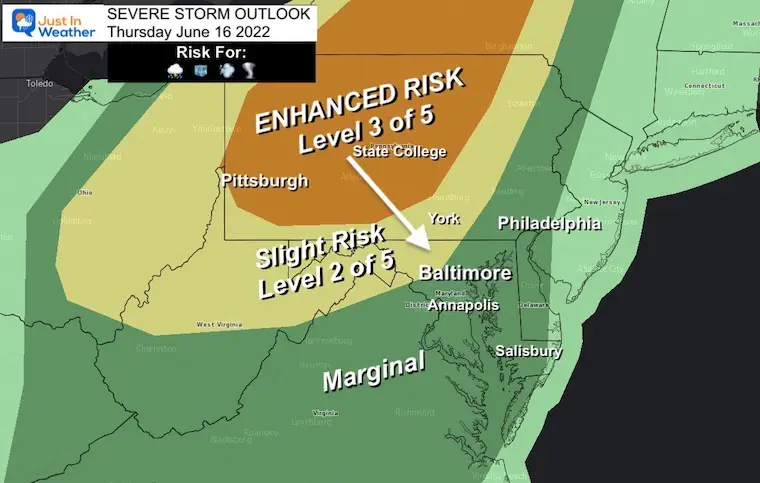
As expected, we have a volatile situation setting up for this afternoon and tonight. The good news is that you are reading this an aware. The bad news is that the short range modeling is not handling this well.
There are two more events expected… First with the afternoon heating. Second, with the squall line arriving from the north tonight.
Any storm has the capability to produce damaging winds, large hail, isolated tornados, and flash flooding. Any storm can produce dangerous lightning. Please pay close attention if you must be outside as many warning are being issued as these storms track through.
So, it will be more nowcasting this afternoon, with some model guidance later. I have included the Love Radar and Lighting Widget below, so if you do not have a good app, you can use it here.
Set Up: 3 PM Temperatures
This contrast is part of the problem. Where the storms passed this morning, temps are still in the 70s.
Where the sun broke out, into the 90s.
The boundary in between will be on the edge of the afternoon storms…
Severe Weather Alerts: (Tornado and Severe Thunderstorm)
Tornado Watch Until 11 PM – Central Pennsylvania
Severe Thunderstorm Watch Until 9 PM in Western PA
Until Midnight for Central Maryland and Northern Virginia
The National Weather Service has issued a Tornado Watch for much of Pennsylvania.
There have already been Severe Thunderstorm Warnings in Maryland and Virginia. NWS Sterling (Baltimore/Washington Office) just added metro Washington and Baltimore to the Watch until Midnight. As you will see in below, we will have storms extended past midnight into Southern Maryland.

Severe Weather Alert Reminder:
Watch means there is Potential, but not a promise.
Warning: A storm is occurring NOW and being tracked. Specific towns and times will be given.
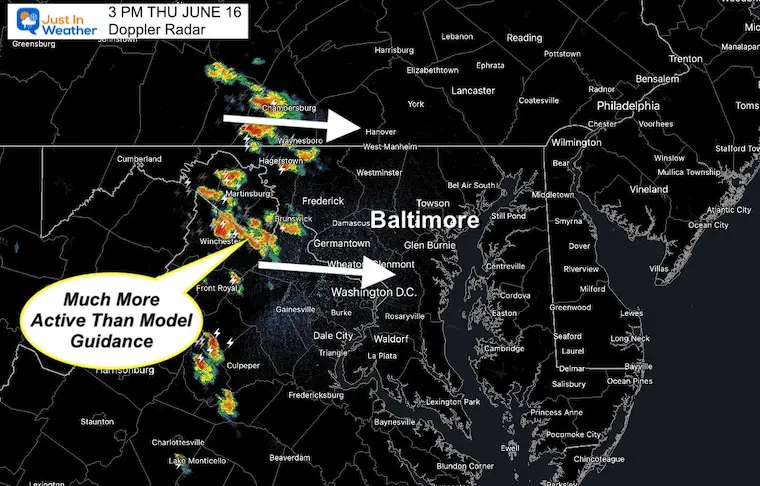
3 PM Doppler Radar Snapshot
There was a lot more activity recorded than models forecasted at this time. This is why I do not feel confident in the short range modeling…
See the Live Radar below to track at your own leisure.
3 PM HRRR Model Snapshot
This model showed some showers, but less impressive.

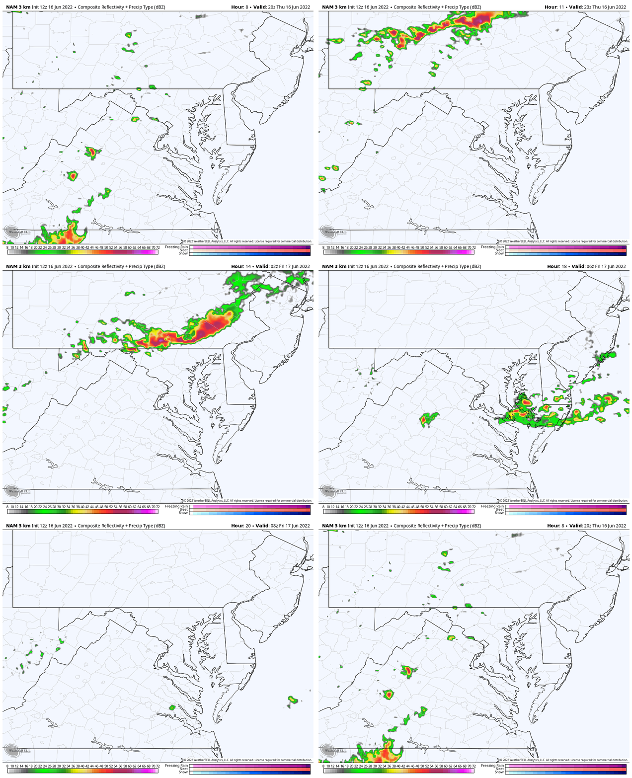
Radar Simulation Animation
NAM 3 Km Model 4 PM today to 4 AM Friday
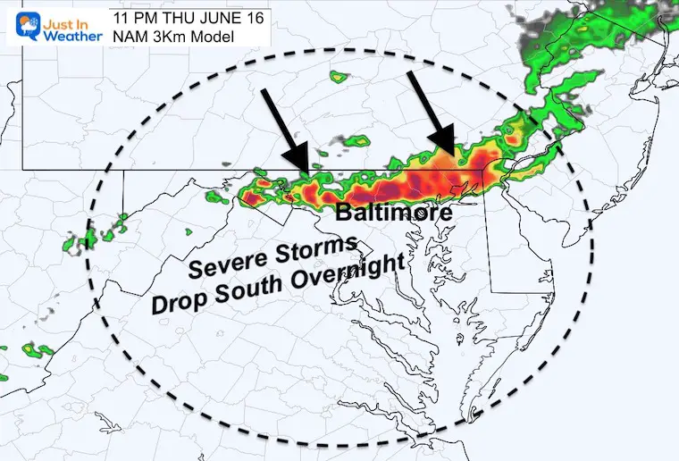
The main event will be the squall line that passed through southern PA through the end of that 11 PM Watch. Then entering central Maryland just before midnight, and southward through 4 AM Friday.
11 PM Snapshot: Main Event Entering Central Maryland
This is a rough gauge for when metro Baltimore can expect this line. I would give this a buffer, so prepare between 9 PM to Midnight. That is why I believe there will be an extension one of the Watch Boxes.
Live Radar and Lightning Widget
Alert Reminder:
A Watch may be issued for the region. This is for ‘potential’ over about a 6 hour period.
A Warning will be issued when there is a storm occurring to track. This will include towns in the path.
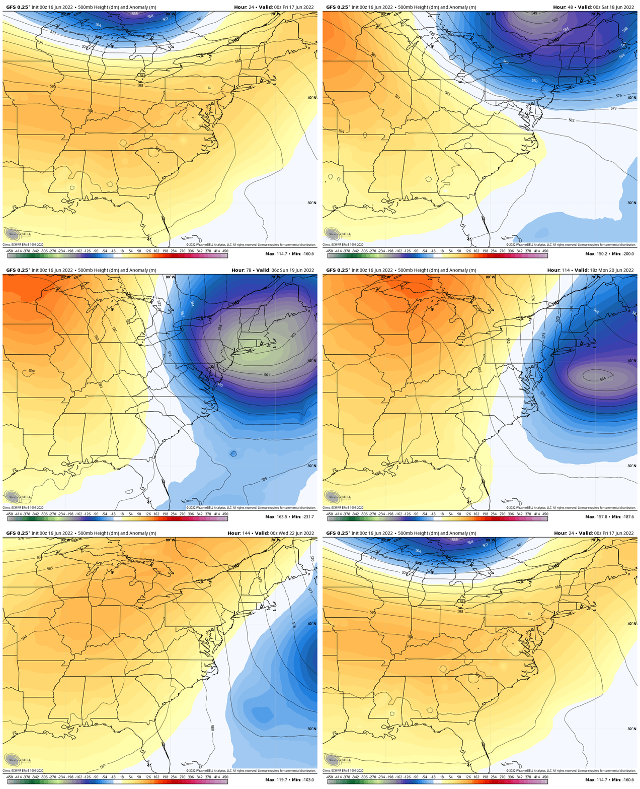
Looking Ahead: Jet Stream Animation
That pocket of cooler air this weekend will likely help morning sun build afternoon clouds… We should remain dry into the middle of next week.
TEACHER SPECIAL Click Here
$20 Off 2 hour Rental
Book Your Kayak or Paddle Boat Adventure On The North Chesapeake Bay
Weather posts straight to your inbox
Sign up and be the first to know!
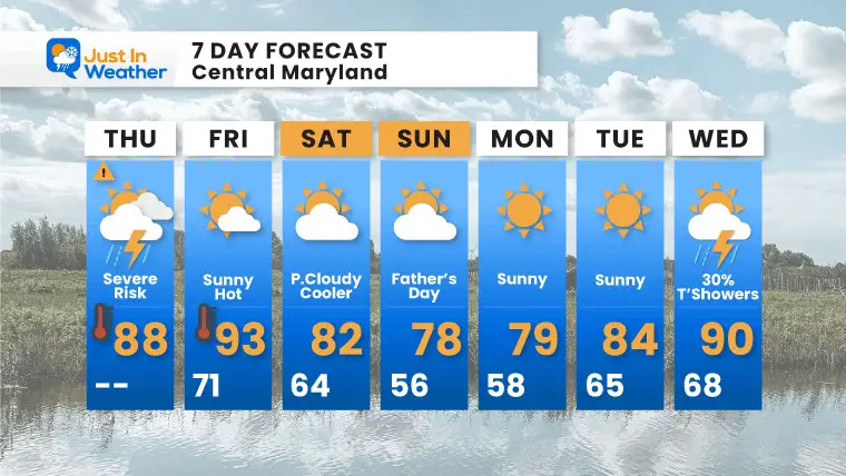
7 Day Forecast
With the cooler air this weekend, we may have a mix of afternoon clouds, but it will be pleasant. Next week we get back to warmer temps. Overall, a break from the rain for a while .
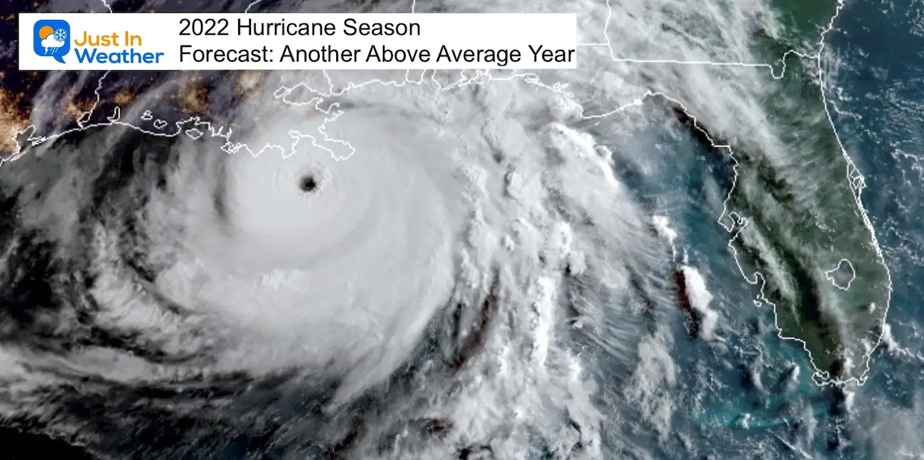
Hurricane Season Forecast: June 1 Through November 30
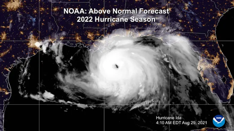
NOAA 2022 Hurricane Forecast- Above Normal Again
Forecast From Colorado State University
Related Posts
NOAA Study: Reducing Air Pollution INCREASED Tropical Storms
Atlantic Tropical History: Maps of Origin Regions Every 10 Days
Recent Storm Reports
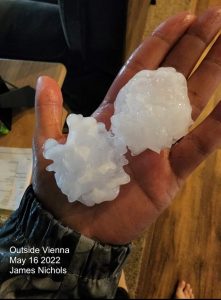
May 16 Large Hail Videos And Storm Tracking Map
Please share your thoughts, best weather pics/video, or just keep in touch via social media
Facebook: Justin Berk, Meteorologist
Twitter: @JustinWeather
Instagram: justinweather
*Disclaimer due to frequent questions:
I am aware there are some spelling and grammar typos. I have made a few public statements over the years, but if you are new here you may have missed it:
I have dyslexia, and found out at my second year at Cornell. I didn’t stop me from getting my meteorology degree, and being first to get the AMS CBM in the Baltimore/Washington region.
I do miss my mistakes in my own proofreading. The autocorrect spell check on my computer sometimes does an injustice to make it worse.
All of the maps and information are accurate. The ‘wordy’ stuff can get sticky.
There is no editor that can check my work when I need it and have it ready to send out in a newsworthy timeline.
I accept this and perhaps proves what you read is really from me…
It’s part of my charm.


