


May 1 Weather Gradual Cooling Trend Will Bring Rain Into The Weekend
Wednesday, May 1 Morning Report One of the marks of May Day is an ancient European holiday celebrating the start of summer. It feels like we have had our taste…
May 31 2022 Tuesday Night Update
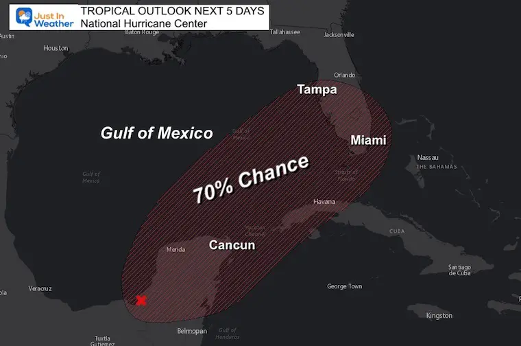
Can a hurricane cross for the Pacific to the Atlantic? In this case, sort of. Hurricane Agatha just hit Mexico on Monday as a Category 2 storm off of the Pacific Ocean. It is crossing the mountains and will emerge from the Yucatan Peninsula with enough support in the atmosphere to reorganize. At this point it will be in the Atlantic Basin and get a new name.
The National Hurricane Center has given a 40% chance for this to form over the next 48 hours and 70% over the next 5 days for this to form.
Once winds reach 40 mph, we will be talking about Tropical Storm Alex, which is then likely to cross Florida by the weekend.
The first Eastern Pacific Tropical Cyclone was named on May 28, 2022 off the coast of Mexico.
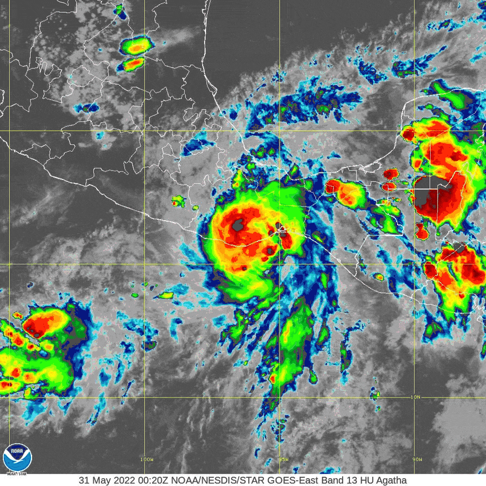
This was named Agatha, and it reached Category 2 intensity with top winds of 110 mph on Monday May 30, 2022 (yesterday).
Agatha made landfall at 5 PM EDT near San Pedro Pochulta with 105 mph winds. This was southeast of the Mexican resort city of Acapulco.
It has moved inland and weekend significantly today.
Tracking former Hurricane Agatha into southern Mexico. It is no longer considered a tropical system, but may emerge in the Atlantic basin and reform.
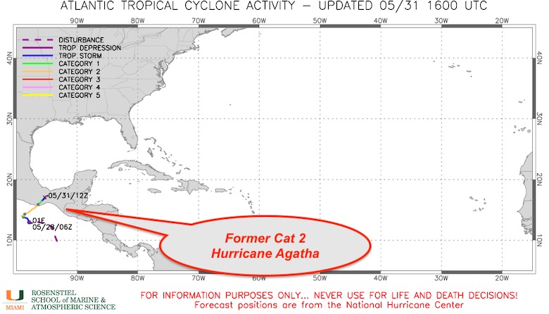
There is enough spin in the atmosphere, and proper conditions, that this is expected to emerge along the Bay of Campeche of Gulf of Mexico north of the Yucatan Peninsula later this week.
As a result, NOAA gives this a 70% chance to become a tropical cyclone (again).
Since this will be in a difference open basin (Atlantic) it will be given a new name, Alex.
Close View
Wide View
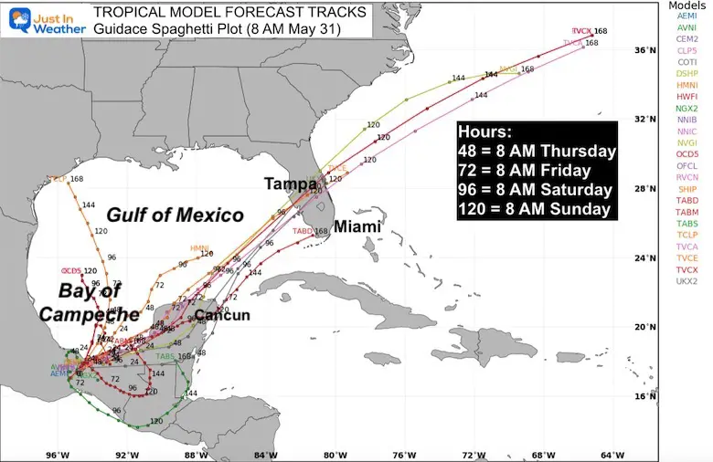
This is an overlay of 24 different model forecast tracks.
The numbers on the lines represent the hour forecast… which I expanded on in the image.
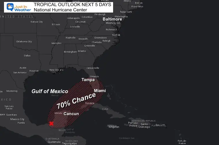
It does look like a pass across southern Florida by the weekend.
How strong will depend in part if this can intensity along the the Bay of Campeche shoreline or wait until entering the Gulf north of Cancun.
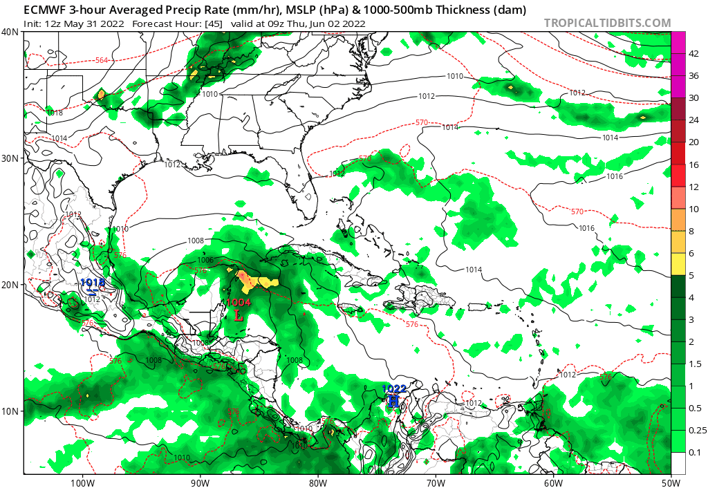
Thursday Morning to Sunday 10 AM
This looks like a pass south of Tampa, then cutting a little closer to the North Carolina Coast.
It is doubtful to reach Maryland, but expect rip currents for the Mid Atlantic beaches next weekend.
NOAA 2022 Hurricane Forecast- Above Normal Again


NOAA Study: Reducing Air Pollution INCREASED Tropical Storms

Atlantic Tropical History: Maps of Origin Regions Every 10 Days


May 16 Large Hail Videos And Storm Tracking Map


*Disclaimer due to frequent questions:
I am aware there are some spelling and grammar typos. I have made a few public statements over the years, but if you are new here you may have missed it:
I have dyslexia, and found out at my second year at Cornell. I didn’t stop me from getting my meteorology degree, and being first to get the AMS CBM in the Baltimore/Washington region.
I do miss my mistakes in my own proofreading. The autocorrect spell check on my computer sometimes does an injustice to make it worse.
All of the maps and information are accurate. The ‘wordy’ stuff can get sticky.
There is no editor that can check my work when I need it and have it ready to send out in a newsworthy timeline.
I accept this and perhaps proves what you read is really from me…
It’s part of my charm.