April 5 Tracking Rain Returning: Spreading North Later Then More This Week
Monday Morning Report
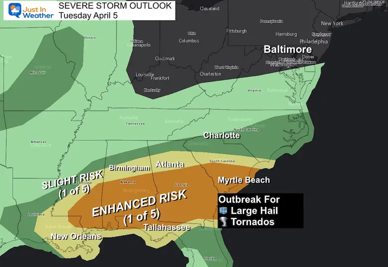
There should be sun this morning and light wind most of the day. However, clouds will be on the increase so that sun will fade this afternoon. I don’t want to say dreary week, but it may seem that way. Rain will move in for Tuesday and some form of rain will be with us just about every day this work week. Next weekend will turn windy and colder again.
Monday Morning Set Up
Surface Weather
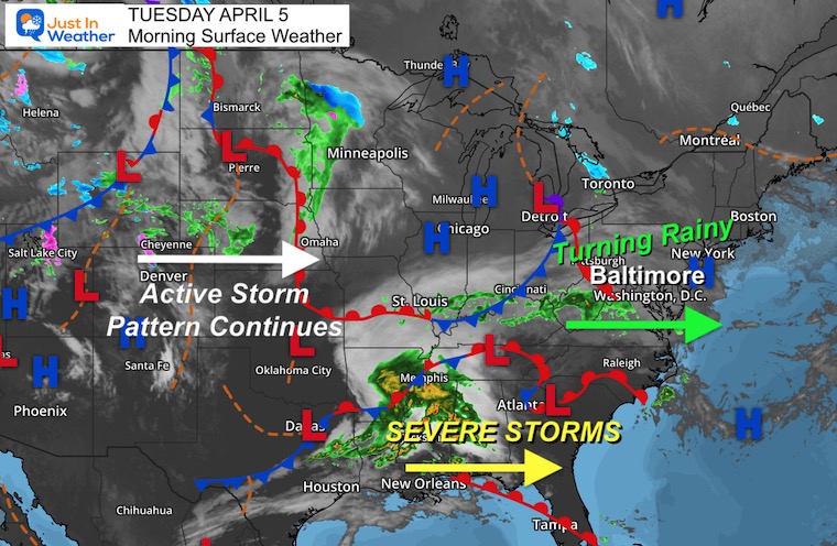
Severe Storm Outlook From NOAA
There is risk for an outbreak across the Gulf Coast States this afternoon and tonight.
We will not get that in the Mid Atlantic, but the atmosphere is changed for more.
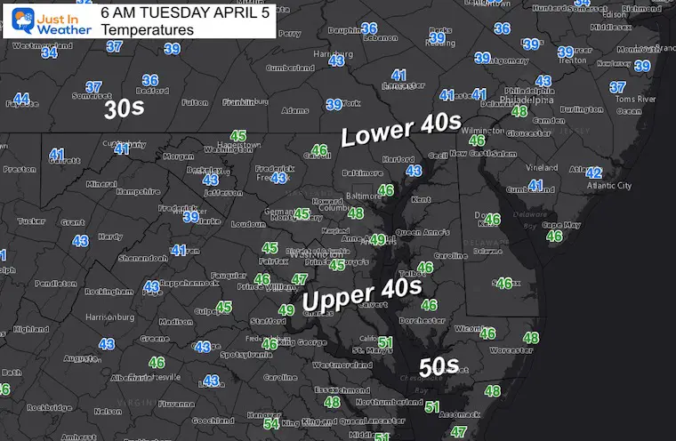
Morning Temperatures
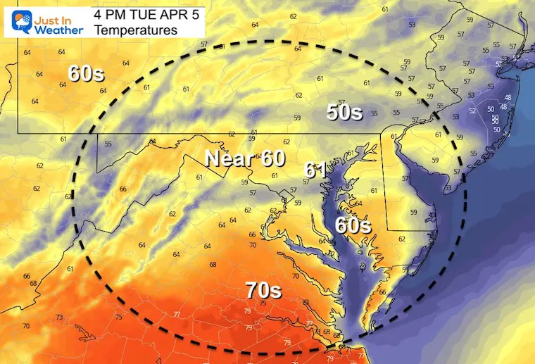
Afternoon Temperatures
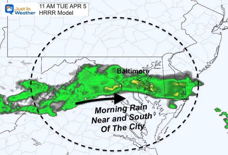
Rain Forecast
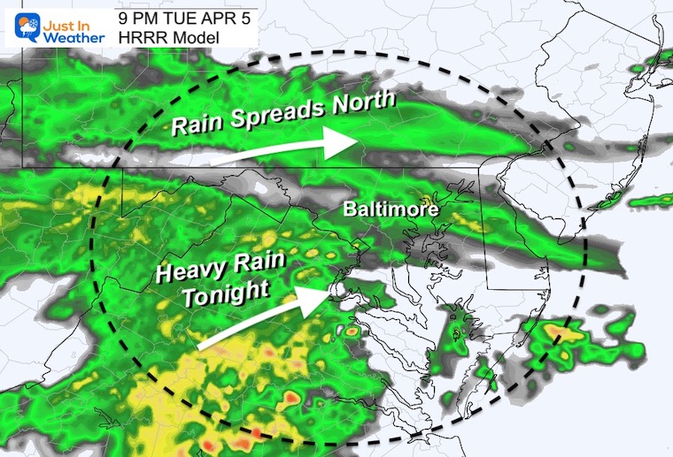
Morning: A band of rain reaches central Maryland mainly near and south of Baltimore.
Afternoon/Evening: Rain will expand North during the day.
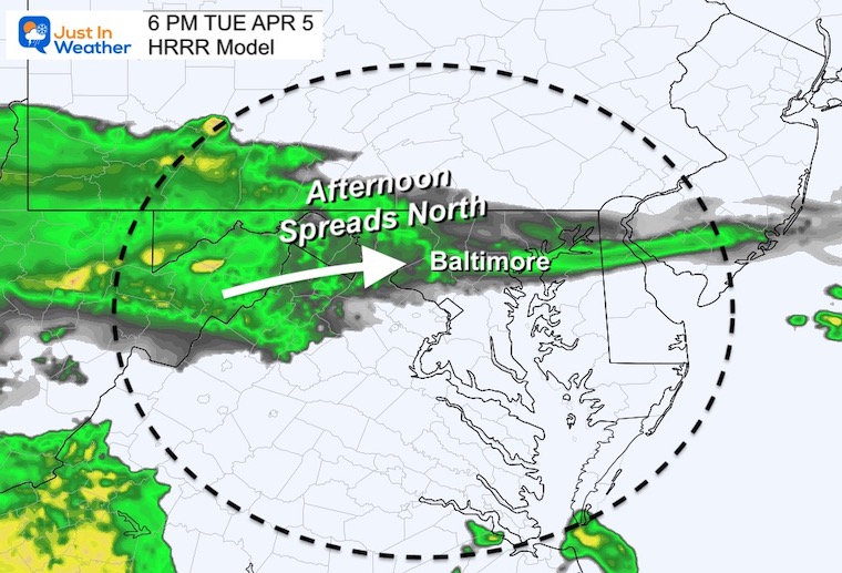
Tonight: Heavy rain, may be loud at times.
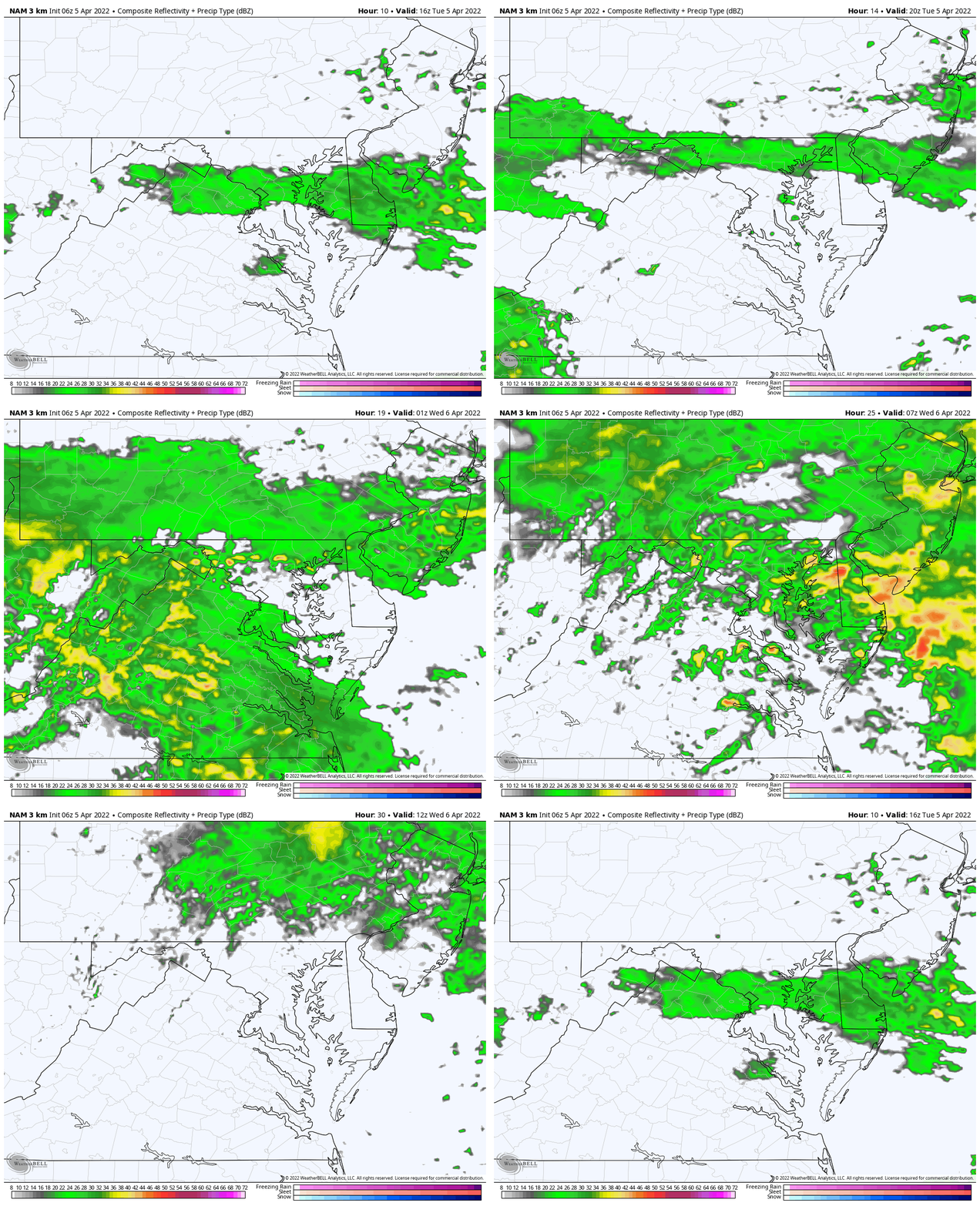
Rain Forecast: Noon Tuesday To 8 AM Wednesday
This helps show how the rain will expand north after noon with HEAVY RAIN overnight. Most should end for our region tomorrow morning.
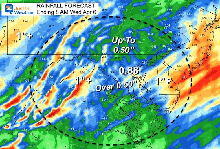
Rain Totals By Morning
Yes, this products tend to overplay totals. However, much of the region can conservatively expect over 1/2″ of total rain.
CLIMATE DATA
TODAY April 5
Seasonal Snow: 14.4”
Normal Low in Baltimore: 40ºF
Record 25º F in 1881
Normal High in Baltimore: 61ºF
Record 84ºF 2010
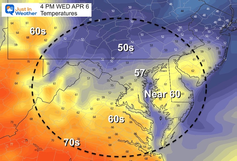
Wednesday Morning Temperatures
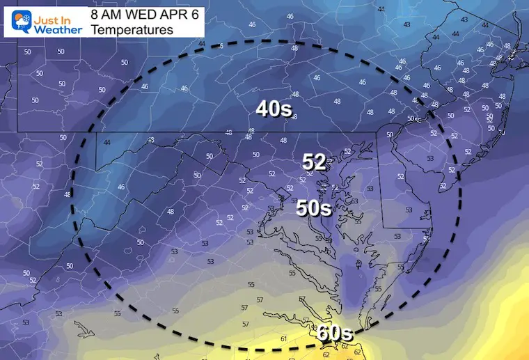
Wednesday Afternoon Temperatures
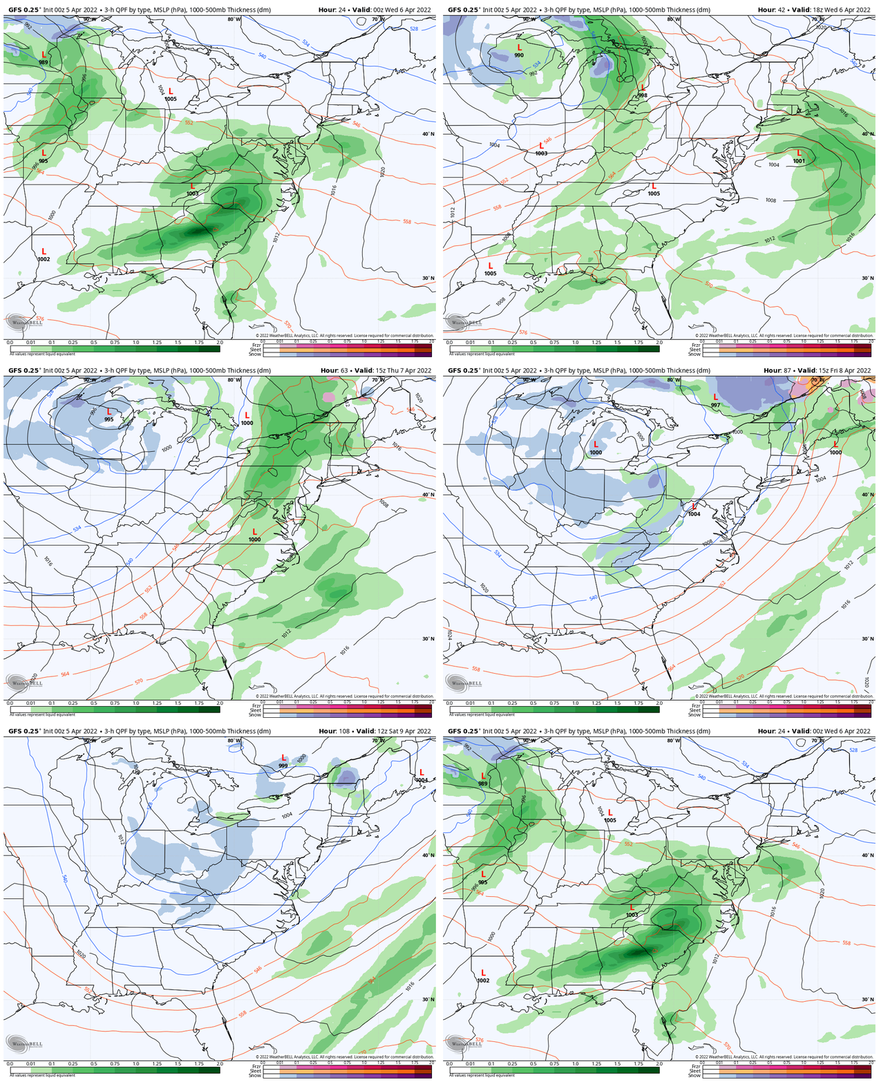
Looking Ahead:
Rain Simulation Tuesday Evening To Saturday Afternoon
- Break Wednesday…
- Thursday: T’Storms
- Friday and Saturday afternoon rain
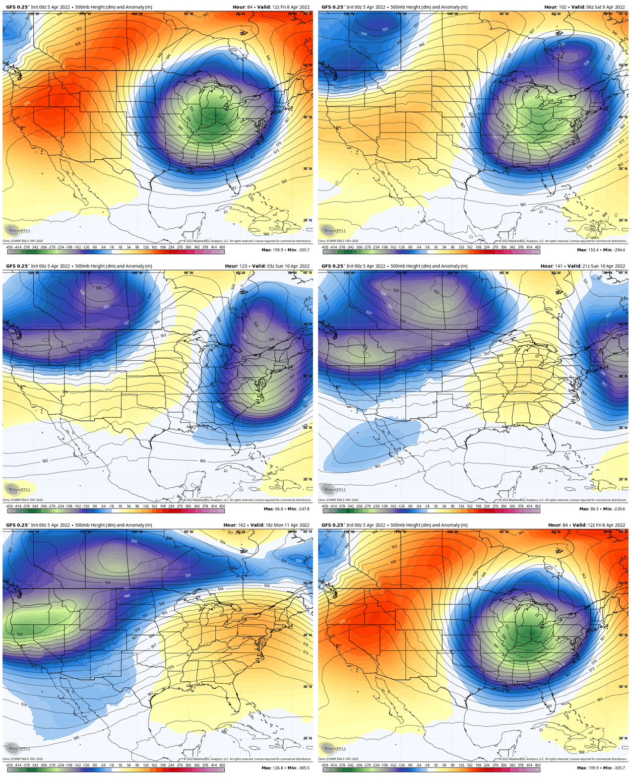
Jet Stream: 500mb Height Anomaly
Friday to Monday – Flip from chilly to very warm!
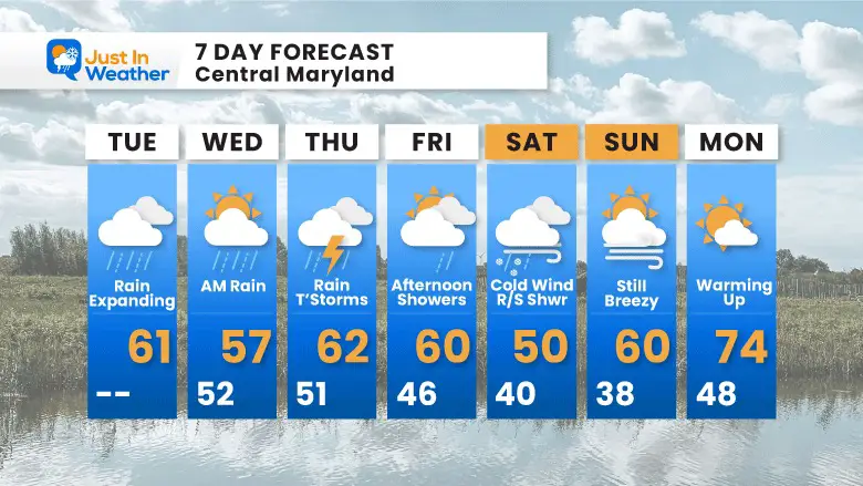
7 Day Forecast
Rain just about each day until the weekend.
A break Wednesday AFTER early morning rain departs..
Friday and Saturday mainly AFTERNOON showers.
Next Monday: The first signal of the warm up.
Weather posts straight to your inbox
Sign up and be the first to know!
ALSO SEE
What is Faith in the Flakes: History of December 5th Snow
ALL FITF GEAR
FITF THUNDERSNOW
Winter Outlook Series:
Last Winter Recap: My Old Outlook And Your Grades Of My Storm Forecasts
Winter Weather Page – Lots of resources
Solar Cycle Increasing Sunspots Suggests More Snow
Comparing 4 Different Farmer’s Almanacs: Majority colder winter outlook than NOAA
NOAA Winter Outlook- But Read The Fine Print
Signals For Early Start To Winter In November
Winter Outlook Series: La Nina Double Dip
Nor’easters May Give Hint For Winter La Nina Pattern
Winter Folklore Checklist
Please share your thoughts, best weather pics/video, or just keep in touch via social media
Facebook: Justin Berk, Meteorologist
Twitter: @JustinWeather
Instagram: justinweather
*Disclaimer due to frequent questions:
I am aware there are some spelling and grammar typos. I have made a few public statements over the years, but if you are new here you may have missed it:
I have dyslexia, and found out at my second year at Cornell. I didn’t stop me from getting my meteorology degree, and being first to get the AMS CBM in the Baltimore/Washington region.
I do miss my mistakes in my own proofreading. The autocorrect spell check on my computer sometimes does an injustice to make it worse.
All of the maps and information are accurate. The ‘wordy’ stuff can get sticky.
There is no editor that can check my work when I need it and have it ready to send out in a newsworthy timeline.
I accept this and perhaps proves what you read is really from me…
It’s part of my charm.
#FITF


