Wednesday March 30 2022
Mid Morning Update
Winter Weather Advisory Issued By The National Weather Service
- Light Freezing Rain may produce a glaze of ice:
- In Maryland: Frederick, Carroll, Northern Baltimore, and Northwest Harford Counties.
- Until 11 AM
At 9:27 AM- NWS in State College PA EXPANDED this to finally include Adams, York, and Lancaster as well.

I do not think this will be a big problem. I am just sharing the message from NWS.
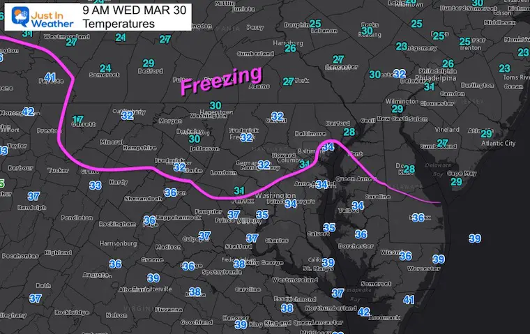
Earlier I had mention the higher early Spring sun angle helping. It will! However, after a very cold night and preceding cold days, the ground is cold enough to support icing… especially in shaded areas and north side of hills.
Doppler Radar Snapshot
The showers are moving to the Southeast…
But the entire line is along a Warm Front Moving North.
Once this passes, we get into more seasonal and then much warmer air…

Temperatures
Region
Close Up
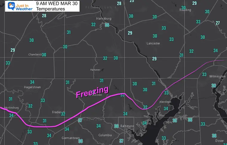
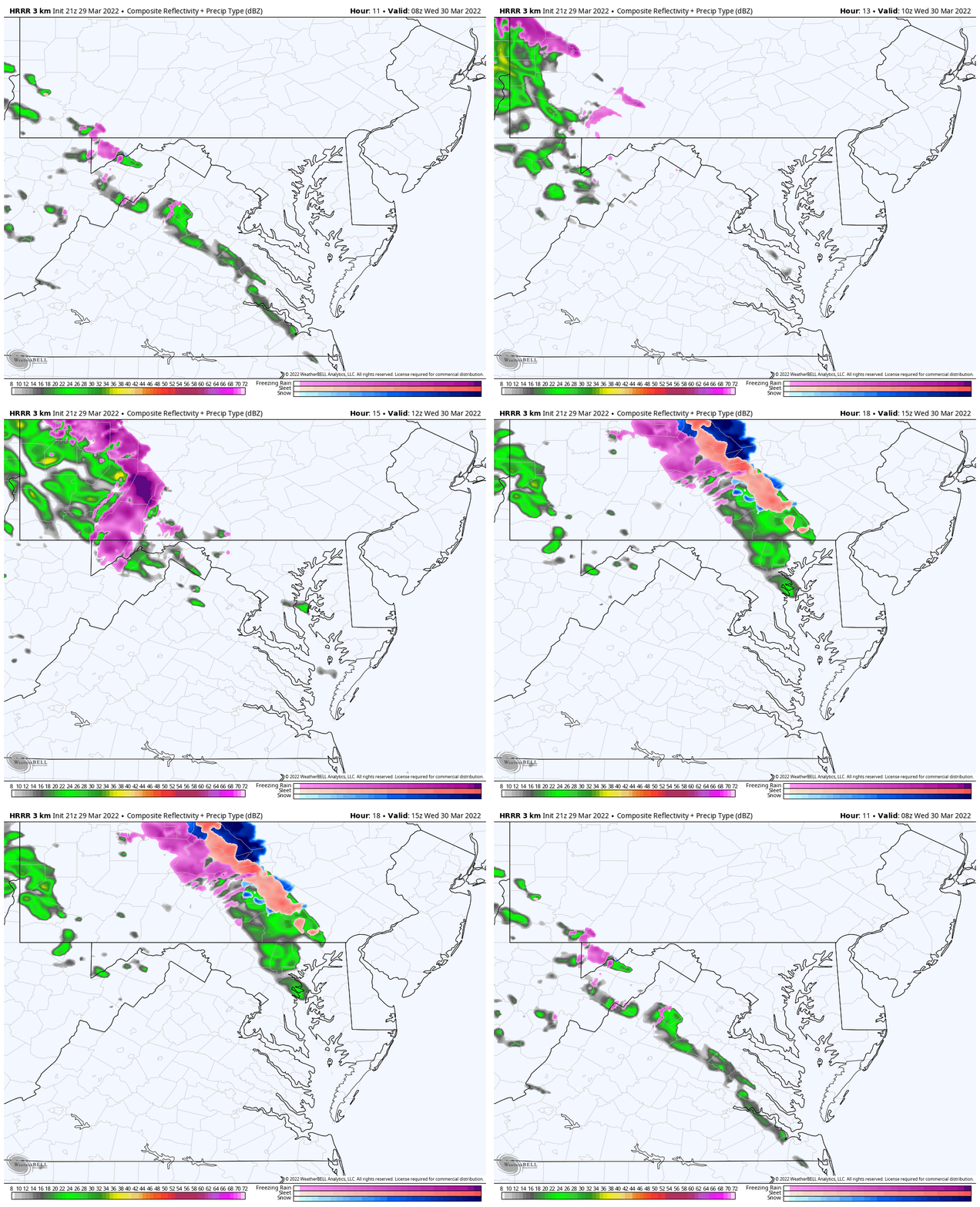
Forecast Through Noon
Forecast Maps have NOT handled this event well.. So we just watch for the light stuff and gradual thaw…
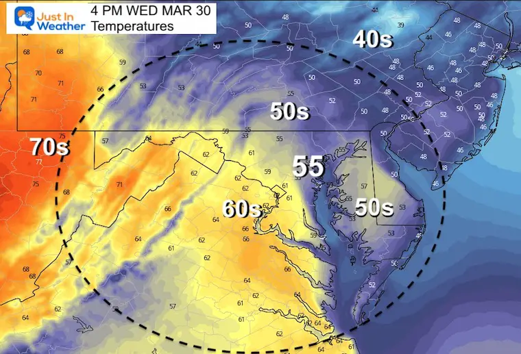
Afternoon Temperatures
THURSDAY
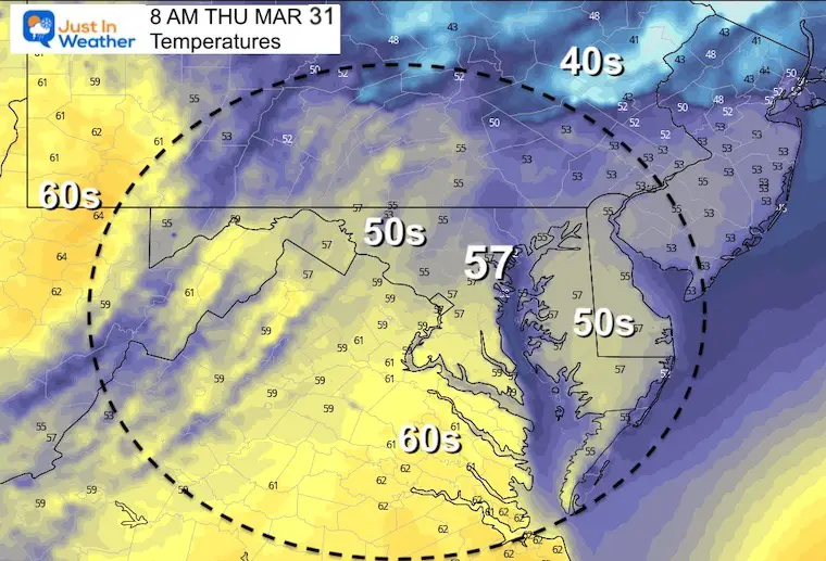
Morning Temperatures
Temperatures should keep rising overnight through morning…
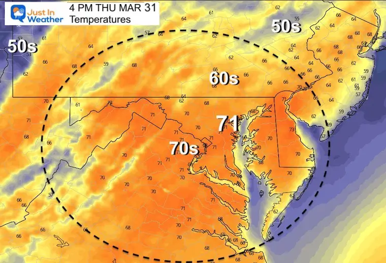
Afternoon- Back to near 70ºF
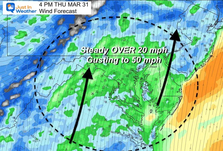
WINDY DAY
WE can’t seem to stop the strong wind flow… Winds will be steady OVER 20 mph and gusting to 50 mph or higher in the afternoon.
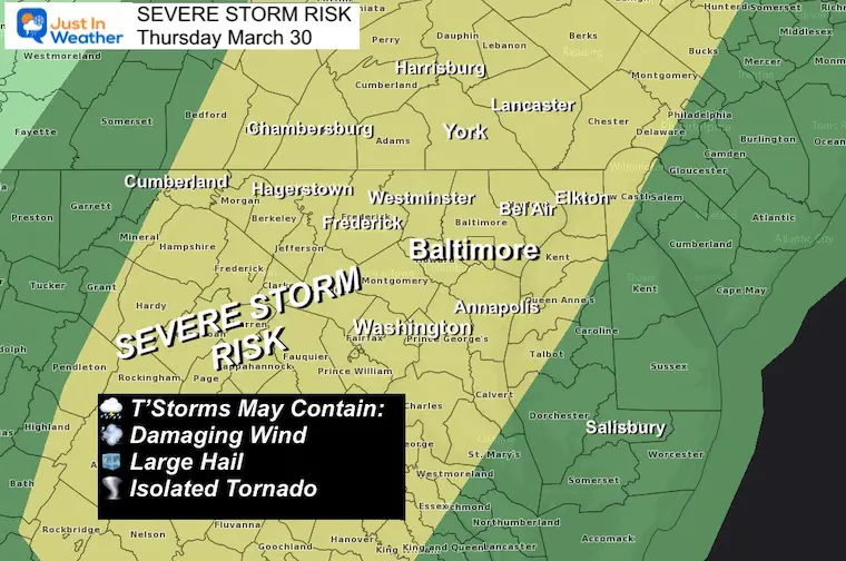
Thursday Severe Storm Risk From NOAA
- Higher Chance for damaging wind and large hail.
- Lower chance for a tornado.
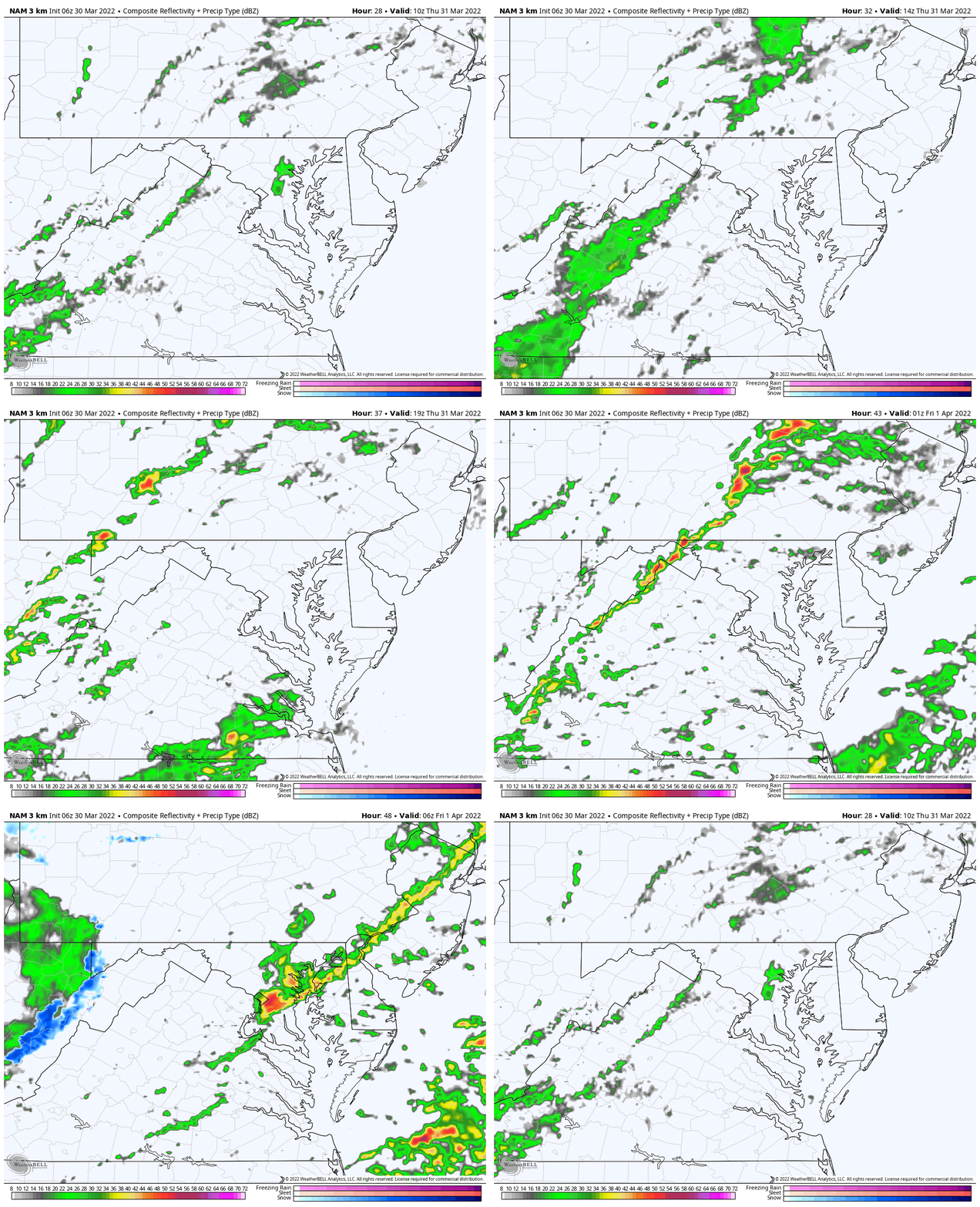
Forecast Animation 5 AM Thursday to 2 AM Friday
Morning showers may be matched by more in the afternoon…It looks like the main cold front and line of severe storms will be in the evening and overnight.
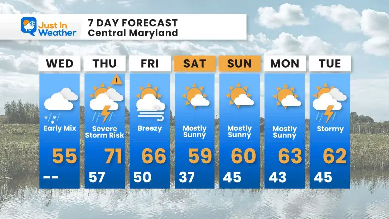
7 Day Forecast
- Thursday: Strong warming winds and a few storms.
- Friday: Strong cooler winds, even an isolated shower in the afternoon.
- This weekend will be cooler but not nearly as cold as we just had.
- We should have a stretch of few sunny and seasonal days.
Weather posts straight to your inbox
Sign up and be the first to know!
ALSO SEE
What is Faith in the Flakes: History of December 5th Snow
ALL FITF GEAR
FITF THUNDERSNOW
Winter Outlook Series:
Last Winter Recap: My Old Outlook And Your Grades Of My Storm Forecasts
Winter Weather Page – Lots of resources
Solar Cycle Increasing Sunspots Suggests More Snow
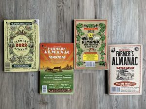
Comparing 4 Different Farmer’s Almanacs: Majority colder winter outlook than NOAA
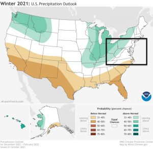
NOAA Winter Outlook- But Read The Fine Print
Signals For Early Start To Winter In November
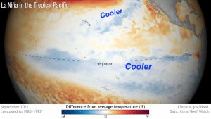
Winter Outlook Series: La Nina Double Dip
Nor’easters May Give Hint For Winter La Nina Pattern
Winter Folklore Checklist
Please share your thoughts, best weather pics/video, or just keep in touch via social media
Facebook: Justin Berk, Meteorologist
Twitter: @JustinWeather
Instagram: justinweather
*Disclaimer due to frequent questions:
I am aware there are some spelling and grammar typos. I have made a few public statements over the years, but if you are new here you may have missed it:
I have dyslexia, and found out at my second year at Cornell. I didn’t stop me from getting my meteorology degree, and being first to get the AMS CBM in the Baltimore/Washington region.
I do miss my mistakes in my own proofreading. The autocorrect spell check on my computer sometimes does an injustice to make it worse.
All of the maps and information are accurate. The ‘wordy’ stuff can get sticky.
There is no editor that can check my work when I need it and have it ready to send out in a newsworthy timeline.
I accept this and perhaps proves what you read is really from me…
It’s part of my charm.
#FITF


