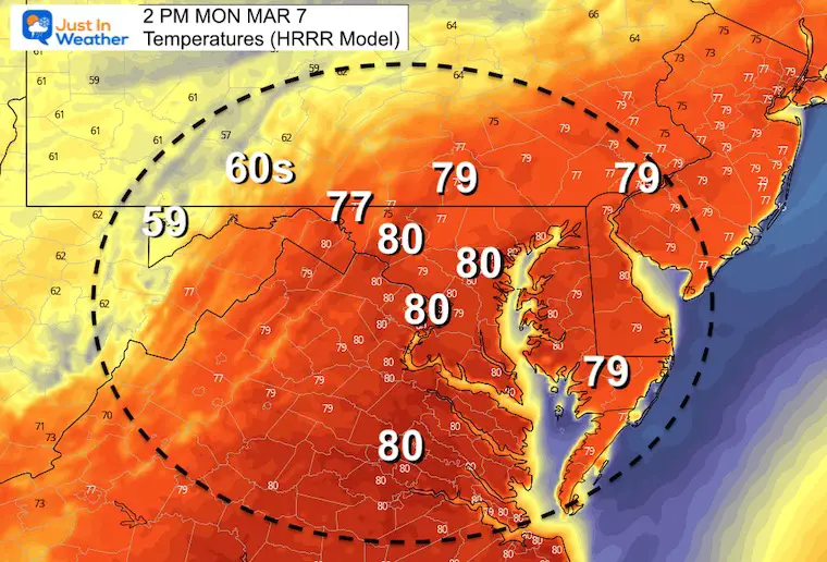
I honestly didn’t know how to title this weather report as we will have just about everything thrown at us over the next few days.For starters, warm winds today now seems to be on point to bump temps higher than first through. BWI may reach 80ºF, but should at least break the old record of 76ºF.
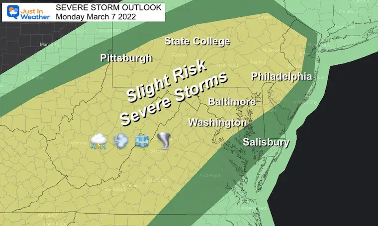
Severe Weather: We have a Wind Advisory AND Slight Risk for Severe Storms. Then Snow will fall on Wednesday, but temps should not be cold enough to support stickage. So it will just be falling on wet ground.
Wind Advisory
See the wind forecast animation below.
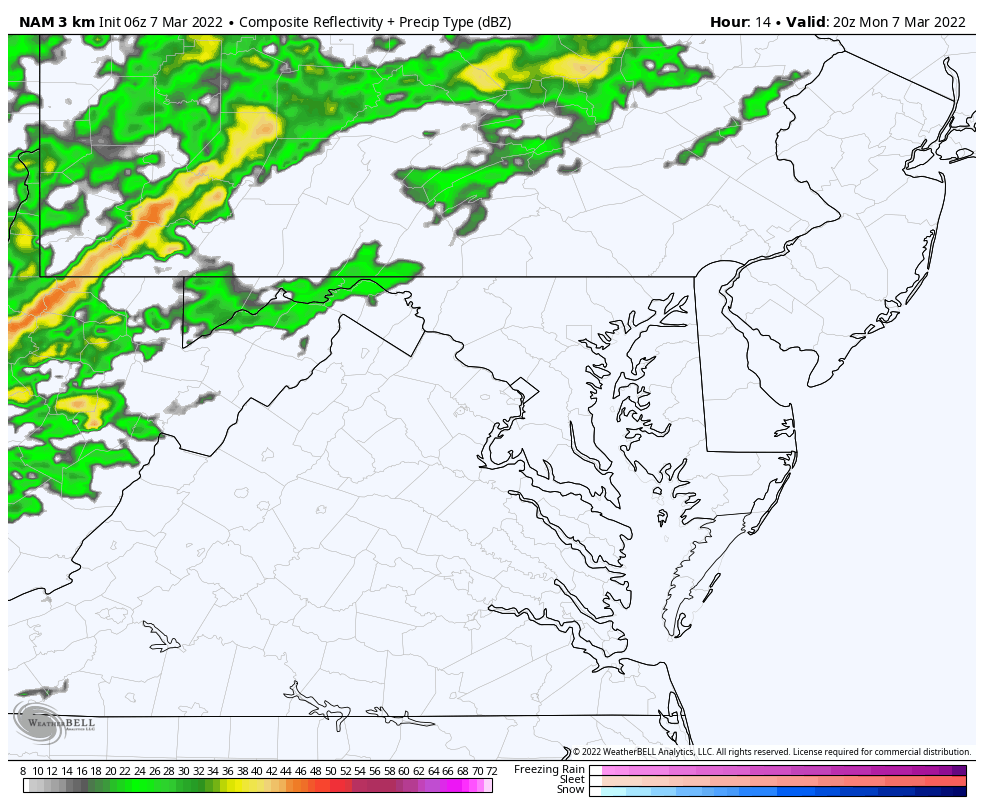
Severe Storm Risk
Threat for a line of storms to produce damaging winds, large hail, and isolated tornados.
Headlines
Record High Temps: Near 80ºF at BWI
Wind Advisory: Wind Gusts to 50 mph
Sever Storm Risk: 5 PM to 8 PM
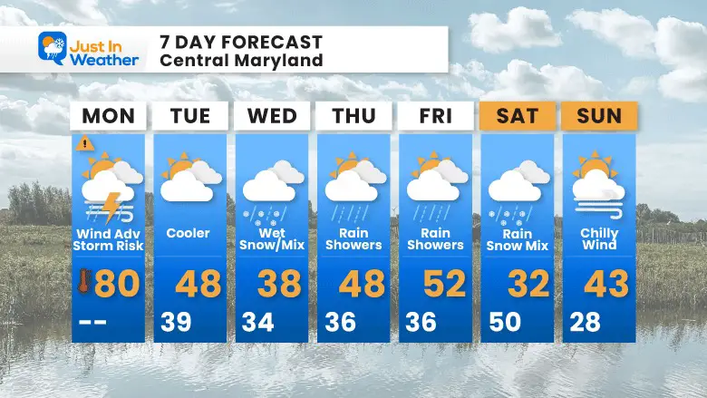
Wednesday: Snow (falling on wet ground)
Looking Ahead: Saturday Rain/Snow then arctic front
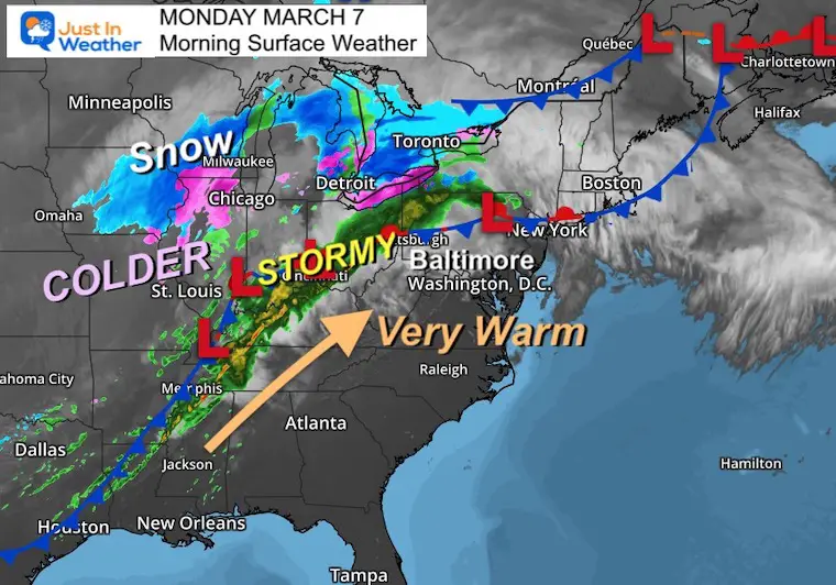
Morning Surface Weather
Warm air is ready in place this morning. Winds will increase to pump in the record temps today. A line of strong storms separates the winter cold and snow on the other side. That round of snow is NOT for us, but there will be some developing for our region on Wednesday.
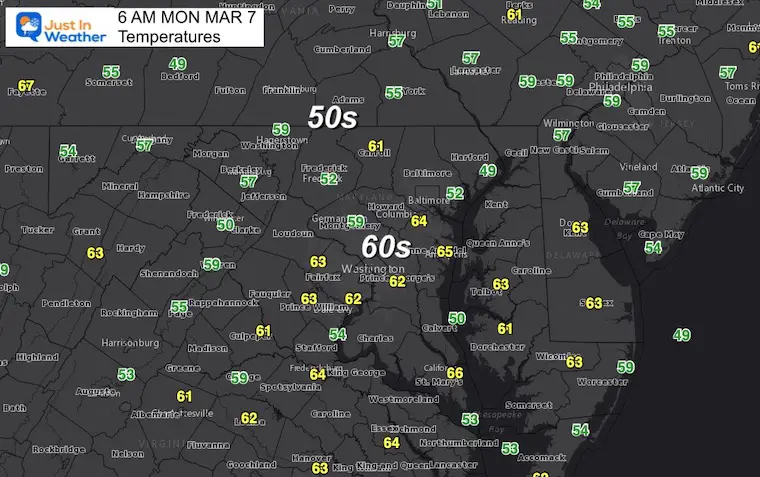
Temperatures
Already a warm start…
Afternoon Temperatures
Record for Baltimore is 76ºF set in 1974 at BWI
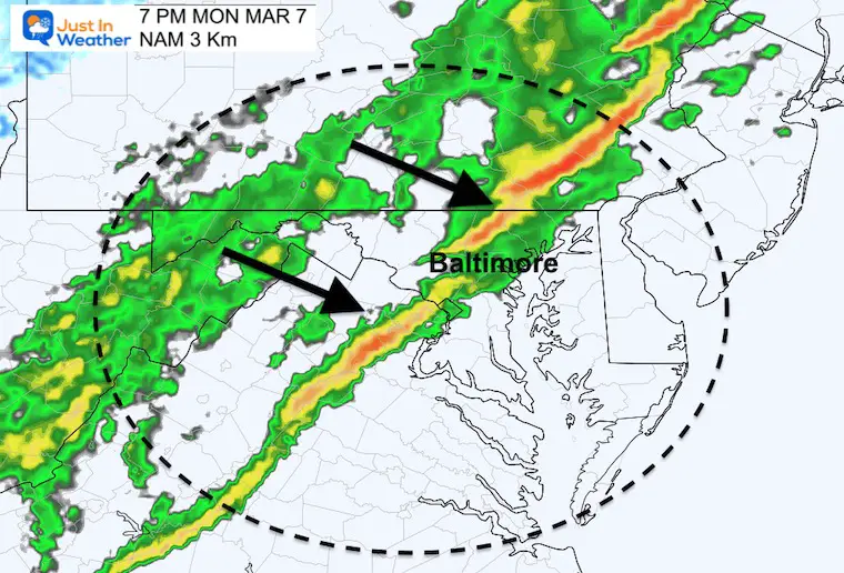
Storm Animation 3 PM to 10 PM
Snapshot: 7 PM
The line of storms approaching metro Baltimore/Central region.
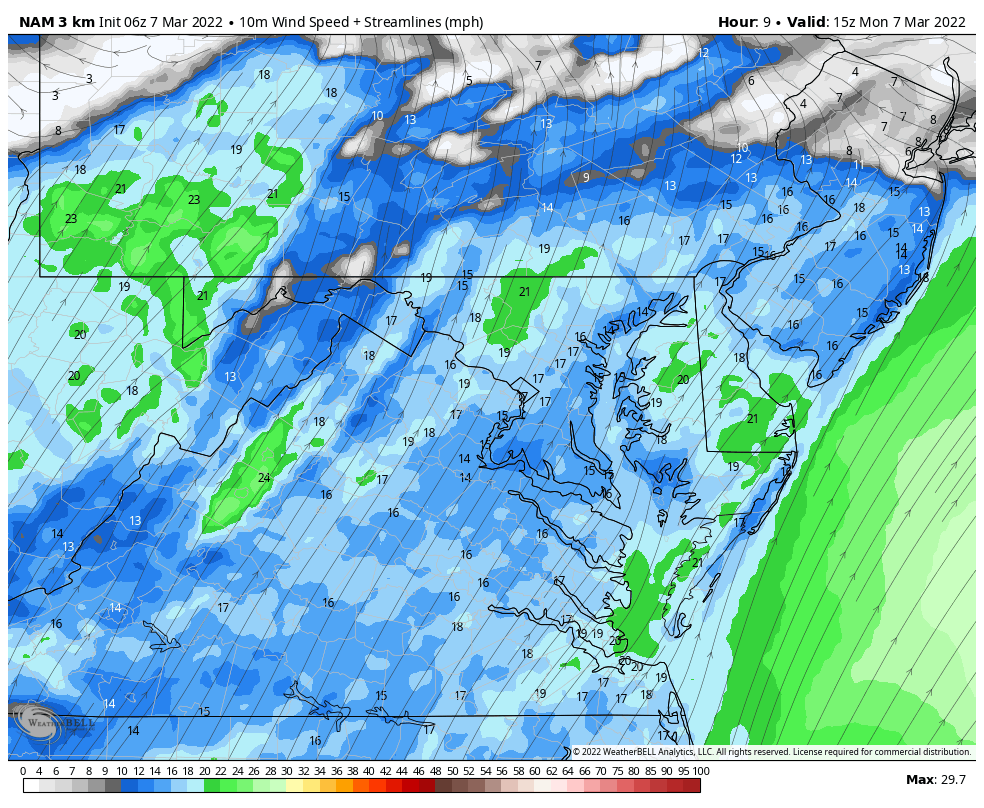
Wind Forecast Animation 10 AM to Midnight
Watch the direction change with the front this evening.
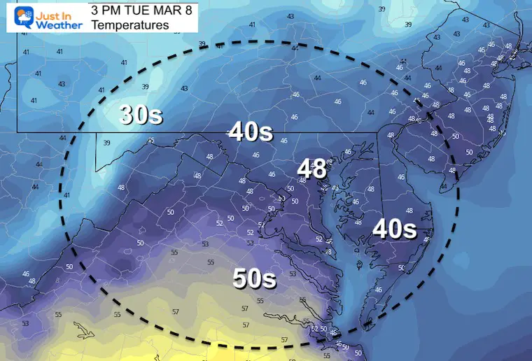
*Much colder tomorrow… See the maps below
Weather Almanac: Climate Data at BWI
TODAY March 7
Seasonal Snow: 14”
Normal Low in Baltimore:31ºF
Record 6º F in2015
Normal High in Baltimore: 51ºF
Record 76ºF 1974
Tuesday Temperatures
Morning
Afternoon
Wednesday Snow —> slider
Here’s the development on the GFS Model.Yes, the EuropeanModel shows it as well.
march-7-weather-snow-wednesday-am-4
march-7-weather-snow-wednesday-am-7
march-7-weather-snow-wednesday-am-10
march-7-weather-snow-wednesday-pm-1
march-7-weather-snow-wednesday-pm-4
march-7-weather-snow-wednesday-pm-7
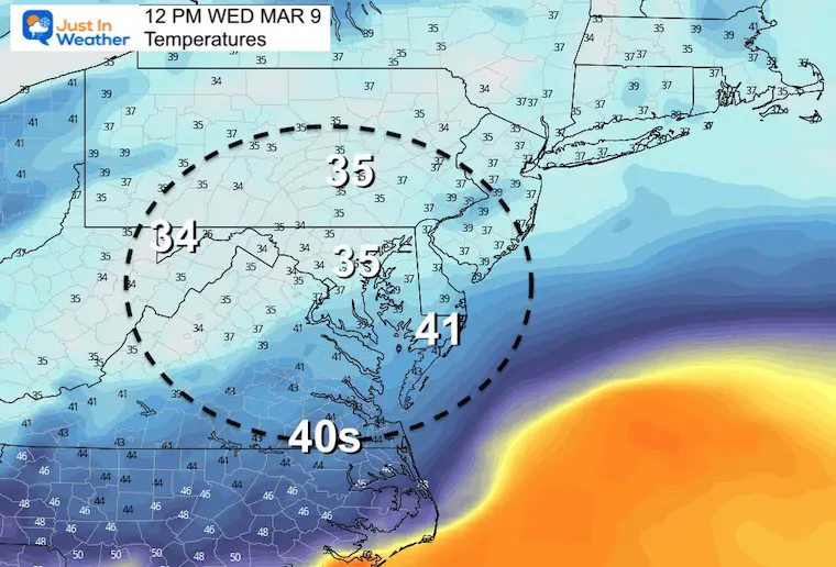
Temperatures at Noon
Just above freezing, meaning roads should remain wet.
Looking Ahead: Saturday Snow?
The GFS Model trended a little west with the Low.This brings more rain for central areas, that may end with snow…
*Important Note: The expectation for March snow in our region is that we need it to fall at night to have a chance to impact roads… Daytime snow usually melts on contact.So we will need to watch
I am aware there are some spelling and grammar typos. I have made a few public statements over the years, but if you are new here you may have missed it:
I have dyslexia, and found out at my second year at Cornell. I didn’t stop me from getting my meteorology degree, and being first to get the AMS CBM in the Baltimore/Washington region.
I do miss my mistakes in my own proofreading. The autocorrect spell check on my computer sometimes does an injustice to make it worse.
All of the maps and information are accurate. The ‘wordy’ stuff can get sticky.
There is no editor that can check my work when I need it and have it ready to send out in a newsworthy timeline.
I accept this and perhaps proves what you read is really from me…