Saturday March 5
Morning Report
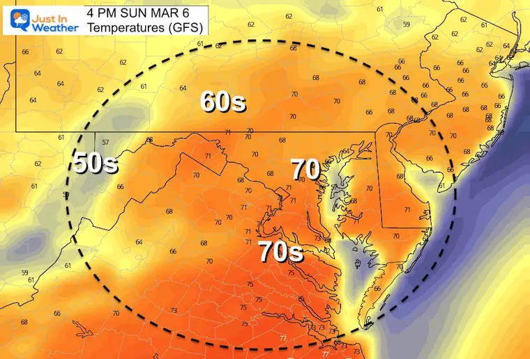
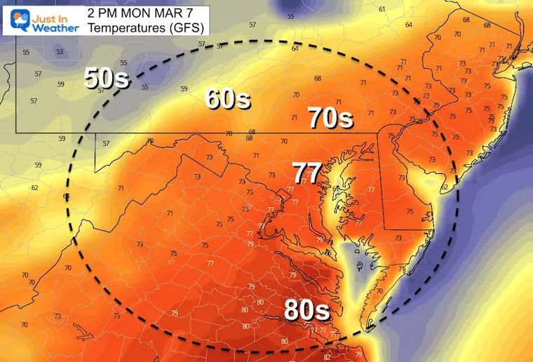
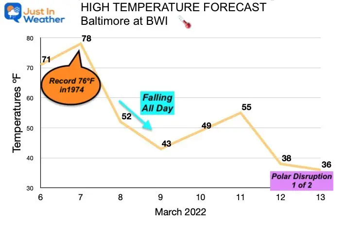
We are in for a bumpy ride, but in the short term on the upswing. Warmer air is flowing in the weekend, with the trade off of more clouds. After highs in the 40s yesterday, we expect 70s tomorrow, and a new record high on Monday.
Arctic air is ready to return, and may first show up mid week with a rain/snow mix. Then the first of two disruptions of the Polar Vortex showing up next weekend.
Morning Surface Weather
Today will remain mostly cloudy, but the shift to warmer air will show up. The really warm stuff is still a day away…

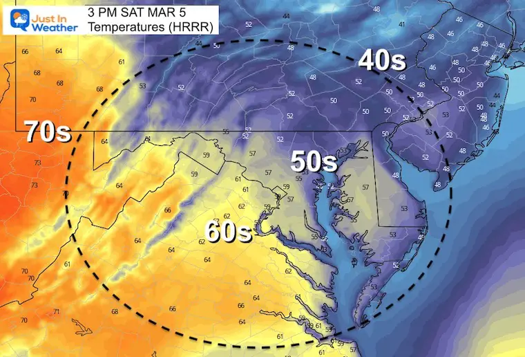
Temperatures
It has been cold, and feels it with the cloud cover.

Afternoon Temperatures
Weather Almanac: Climate Data at BWI
TODAY March 5
Seasonal Snow: 14”
Normal Low in Baltimore: 30ºF
Record 10º F in 1873
Normal High in Baltimore: 50ºF
Record 83ºF 1976
Sunday Temperatures
Morning

Afternoon
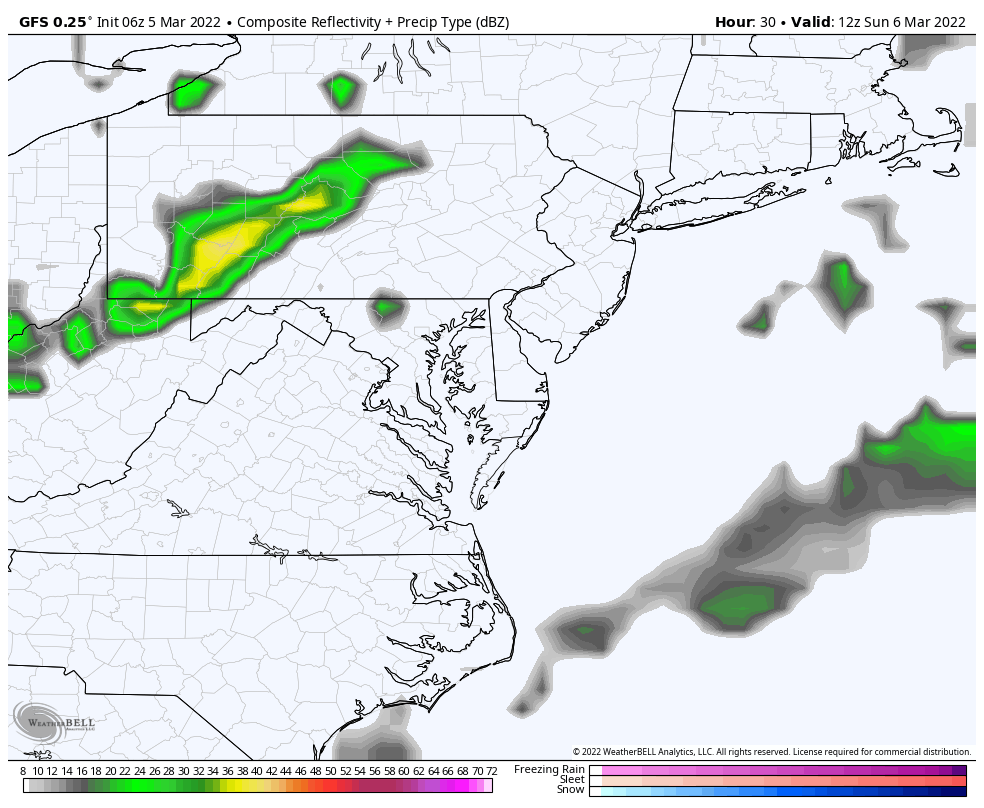
Rain Animation:
Showers will be scattered Sunday, then Monday AFTER the warm day a line of rain and possible T’storms arrives at night.
Monday High Temperatures
The record for Baltimore is 76ºF set in 1974 at BWI
My forecast is a little higher than this for Baltimore as we often end up above model numbers.
Quick Outlook…
Looking Ahead: Temperature Expectations
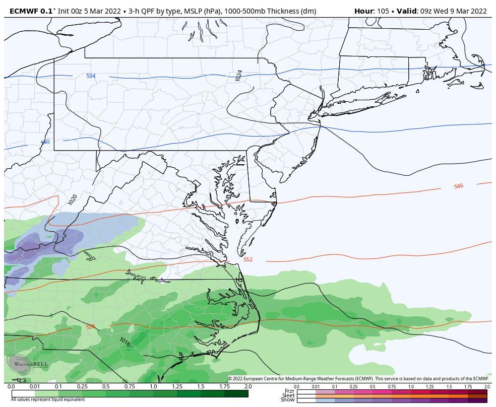
Animation: Wednesday (ECMWF)
Rain may mix with wet snow as temps fall!
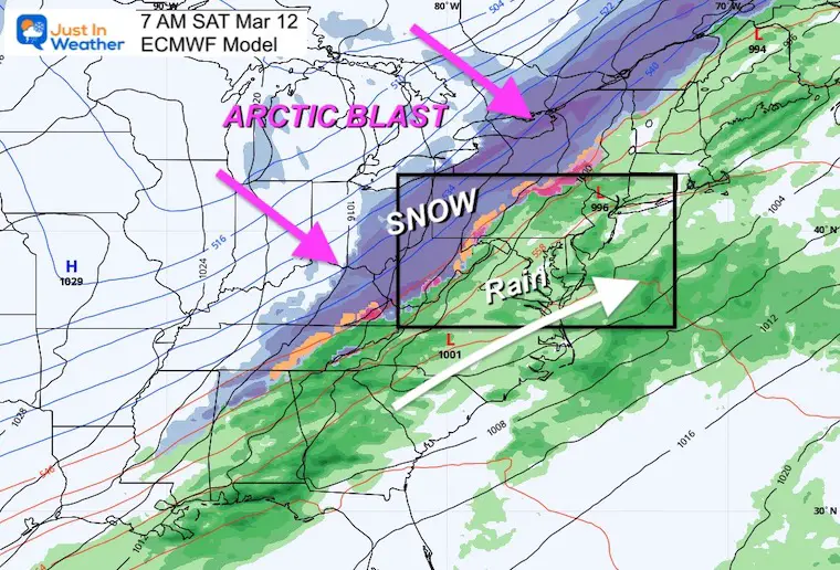
NEXT SATURDAY Snapshot
Here we see the polar front with the Polar Vortex Disruption seen on the European Model. While we may escape with chilly rain and snow staying in the mountain… it will be close enough to watch. THEN it will feel like winter again.
*Western Maryland and the ski areas between Wisp, Snowshoe, Canaan, and Seven Springs could get close to a foot of new snow.
Explore More:
Click to see Polar Vortex Disruptions mid March

7 Day Forecast
The Record High for Monday March 7 was 76ºF in 1974. This has the best chance to be broken.
Reminder: The Polar Vortex Disruption will arrive next weekend… beyond this 7 Day outlook…

ALSO SEE
ALL FITF GEAR

FITF THUNDERSNOW


Winter Outlook Series:
My Call For Snowfall

Last Winter Recap: My Old Outlook And Your Grades Of My Storm Forecasts


Please share your thoughts, best weather pics/video, or just keep in touch via social media
*Disclaimer due to frequent questions:
I am aware there are some spelling and grammar typos. I have made a few public statements over the years, but if you are new here you may have missed it:
I have dyslexia, and found out at my second year at Cornell. I didn’t stop me from getting my meteorology degree, and being first to get the AMS CBM in the Baltimore/Washington region.
I do miss my mistakes in my own proofreading. The autocorrect spell check on my computer sometimes does an injustice to make it worse.
All of the maps and information are accurate. The ‘wordy’ stuff can get sticky.
There is no editor that can check my work when I need it and have it ready to send out in a newsworthy timeline.
I accept this and perhaps proves what you read is really from me…
It’s part of my charm.
#FITF


