Friday March 4
Morning Report
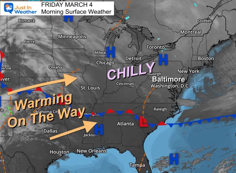
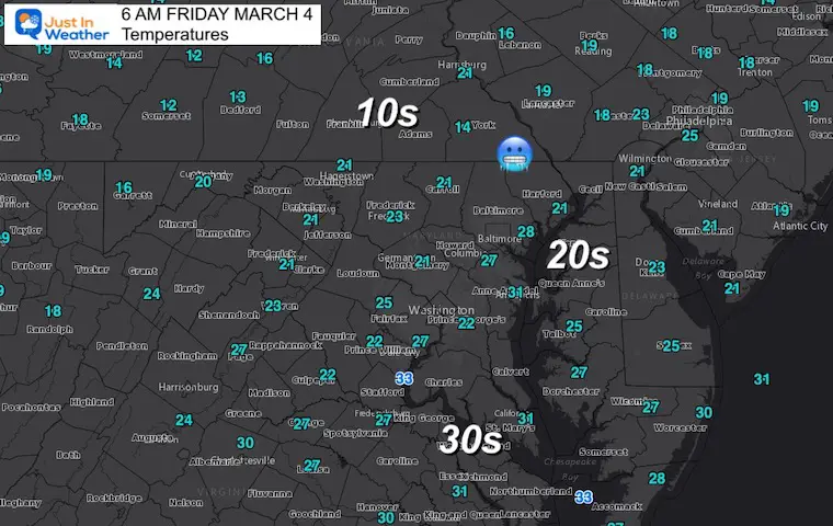
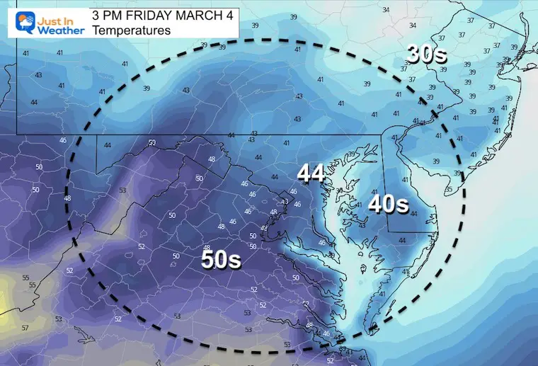
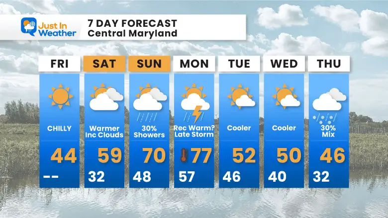
I may end up repeating myself every day for the next week: March is full of surprises. I start with that because after our cold morning, temps will warm this weekend. We may end up with a record high in the upper 70s by Monday.
Then…
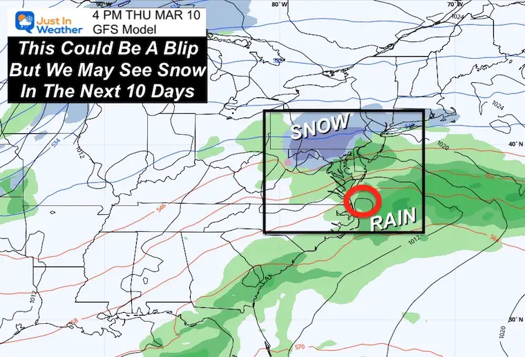
WINTER IS NOT DONE YET! A Polar Vortex Disruption is expected next week. The GFS Model briefly put snow on the map nearby Thursday, then next weekend could be some of the coldest air of the season! I will have a report this afternoon dedicated to that.
Trivia: On this date in 2014, BWI dropped to +4ºF, marking the COLDEST temperature for the month ever measured in our region.
Morning Surface Weather
Temperatures
Afternoon Temperatures
Weather Almanac: Climate Data at BWI
TODAY March 4
Seasonal Snow: 14”
Normal Low in Baltimore: 30ºF
Record 4º F in 2014
Normal High in Baltimore: 50ºF
Record 80ºF 1923
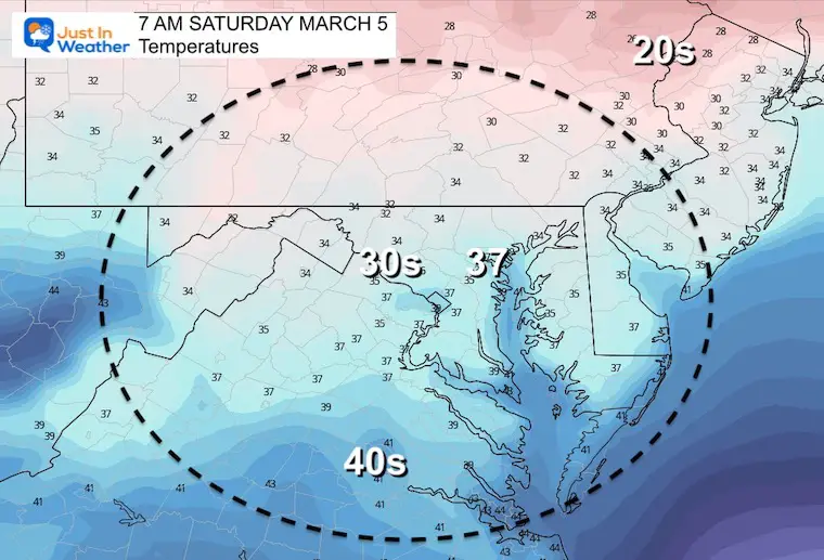
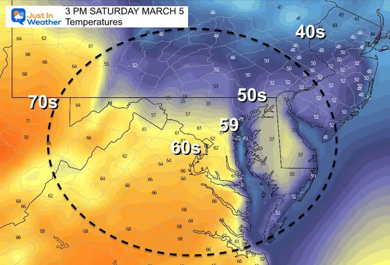
Saturday Temperatures
Morning
Afternoon
Note: It will be chilly closer to the water. A surge of warmer air will push through Sunday and Monday.
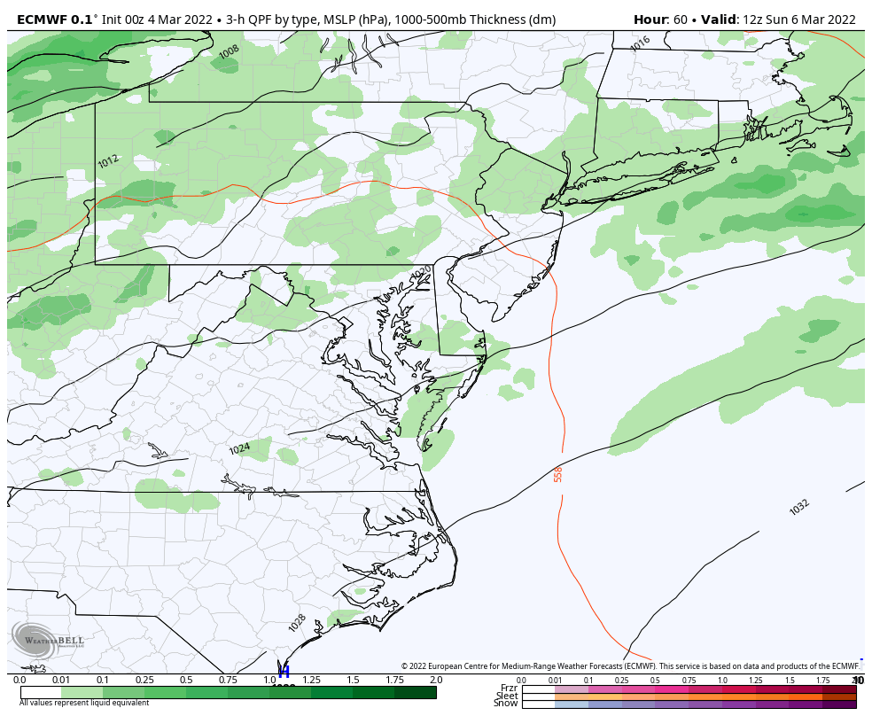
Animation: 7 AM Sun to 7 AM Tue
Rain Showers possible on Sunday as the warmer air moves in… Ten the next rain risk will be AFTER our warm Monday when thunderstorms will be possible at night.
Thursday Snapshot
This may have been a blip, but I wanted to show you the GFS Model trying to drop snow nearby. There may be more to focus on over the next 10 days.
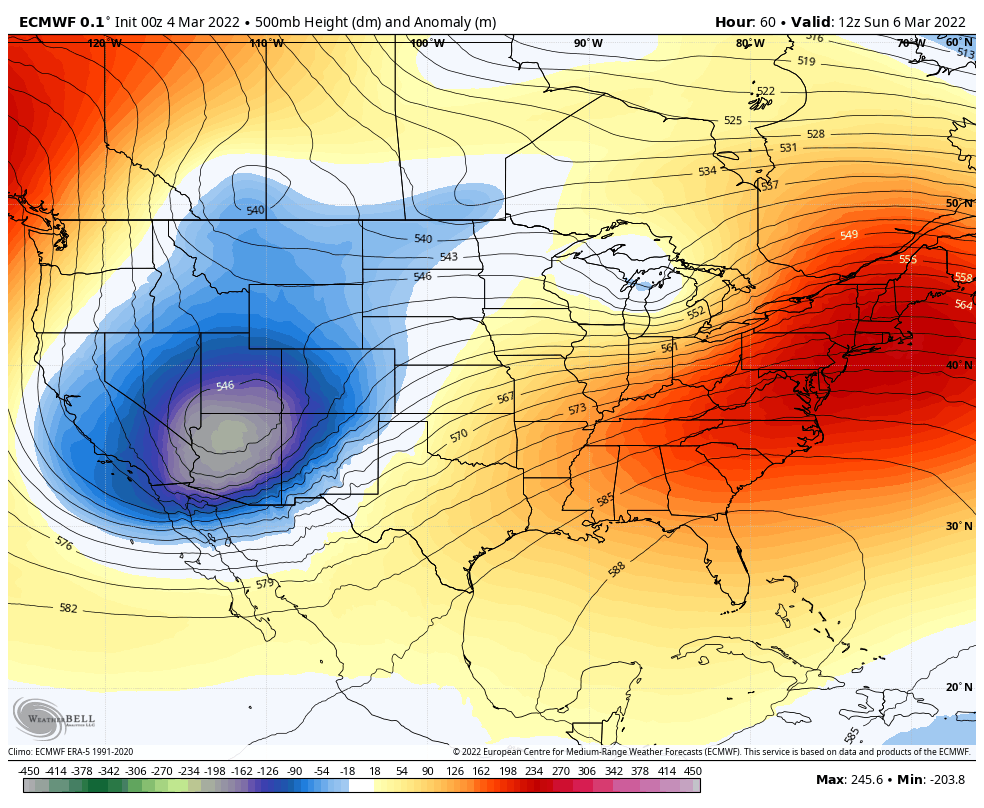
Jet Stream
7 AM Sun Mar 6 to 7 PM Sat Mar 12
Red: Big Ridge = Very Warm
Blue/Green: Deep Trough = Very Cold
7 Day Forecast
The Record High for Sun March 6 was 76ºF in 1935. Breaching this will be a stretch.
The Record High for Mon March 7 was 76ºF in 1974. This has the best chance to be broken.
ALSO SEE
ALL FITF GEAR

FITF THUNDERSNOW


Winter Outlook Series:
My Call For Snowfall

Last Winter Recap: My Old Outlook And Your Grades Of My Storm Forecasts


Please share your thoughts, best weather pics/video, or just keep in touch via social media
*Disclaimer due to frequent questions:
I am aware there are some spelling and grammar typos. I have made a few public statements over the years, but if you are new here you may have missed it:
I have dyslexia, and found out at my second year at Cornell. I didn’t stop me from getting my meteorology degree, and being first to get the AMS CBM in the Baltimore/Washington region.
I do miss my mistakes in my own proofreading. The autocorrect spell check on my computer sometimes does an injustice to make it worse.
All of the maps and information are accurate. The ‘wordy’ stuff can get sticky.
There is no editor that can check my work when I need it and have it ready to send out in a newsworthy timeline.
I accept this and perhaps proves what you read is really from me…
It’s part of my charm.
#FITF


