We are a far cry from the mid 70s of yesterday, but it’s the gift that keeps on giving.Today (Thursday) was spent mostly in the mid 30s and there was a light mix of snow and sleet that feel.We have had time to chill the warmed ground, but there is more to come.More cold and icy precipitation.
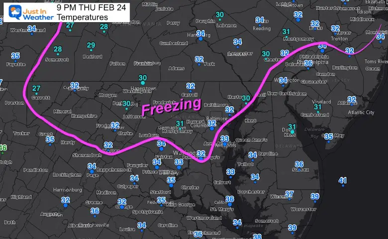
At 9 PM Baltimore reported 32ºF as freezing rain moves in.The concern is not for BWI, downtown, or even Annapolis and around the Bay.This is for the colder inland areas under the Winter Weather Advisory.
The difference between this set up and the prior icing expectations (on tow other Friday mornings) is that this is NOT starting in the morning with the freeze. We have all night for additional time to chill the pavement.
Temperatures At 9 PM
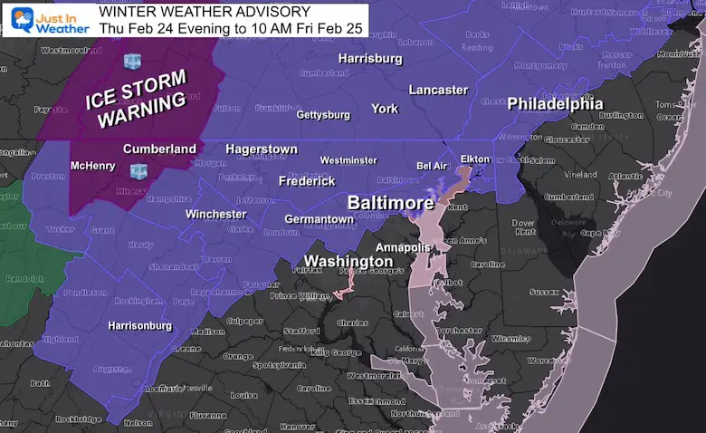
Winter Weather Advisory
Most of the Advisory Region is at or below freezing now.
I realize there are two primary groups that may care if there is icing overnight (since there will be a thaw in the morning).
Third Shift Workers and First Responders
Teachers and kids wondering if school will be affected to let them sleep in.
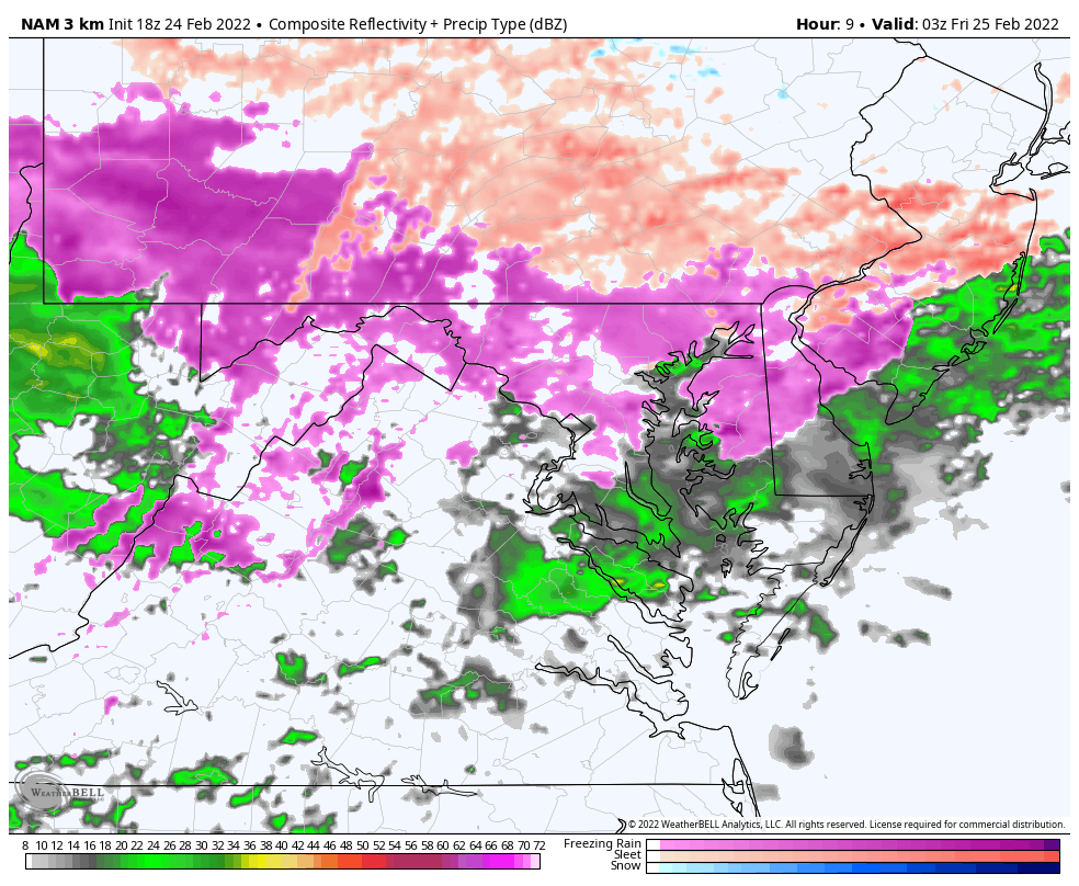
The best I can do now is show you the developing freezing rain simulation AND temperature timeline by the hour.
There will be some icing on car windows, signs, tree branches, and railings.Elevated bridges and overpasses as well. However, the surface has retained some heat from yesterday and will be last to chill… This is the wild card, but it is possible to develop some areas of icing overnight.
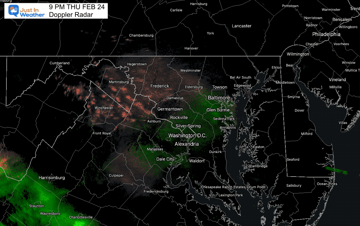
Radar Loop: 2 Hours Ending at 9 PM
Color Code
Pink – Freezing Rain
Green – Rain
The next wave of precipitation is right on time, and will be developing over the next two hours.
9 PM Set Up
Radar Simulation: 10 PM Thu to 10 AM Fri
Temperature Timeline—-> slider
NAM 3 Km Model
The freezing temps should hold through midnight in most of the advisory area. Then slowly warm within a few hours of daybreak.
This will be a close call, but there is a chance for icing on roads in all of the Advisory areas… With a greater chance near the Maryland/PA line and northward.
february-25-weather-temperatures-pm-11
february-25-weather-temperatures-am-12
february-25-weather-temperatures-am-1
february-25-weather-temperatures-am-2
february-25-weather-temperatures-am-3
february-25-weather-temperatures-am-4
february-25-weather-temperatures-am-5
february-25-weather-temperatures-am-6
february-25-weather-temperatures-am-7
february-25-weather-temperatures-am-8
february-25-weather-temperatures-am-9
Afternoon Temperatures
After the morning thaw, a brief surge of mild air will build in, before the return of cold air for the weekend.
I will have the full forecast in my Friday morning report.
I am aware there are some spelling and grammar typos. I have made a few public statements over the years, but if you are new here you may have missed it:
I have dyslexia, and found out at my second year at Cornell. I didn’t stop me from getting my meteorology degree, and being first to get the AMS CBM in the Baltimore/Washington region.
I do miss my mistakes in my own proofreading. The autocorrect spell check on my computer sometimes does an injustice to make it worse.
All of the maps and information are accurate. The ‘wordy’ stuff can get sticky.
There is no editor that can check my work when I need it and have it ready to send out in a newsworthy timeline.
I accept this and perhaps proves what you read is really from me…