This is as abrupt of a change in less than one day as I have ever seen. Baltimore’s BWI reached 76ºF yesterday, and today in the 30s with snow and sleet expected. It will be light, and likely not stick, but it’s quite the flip.
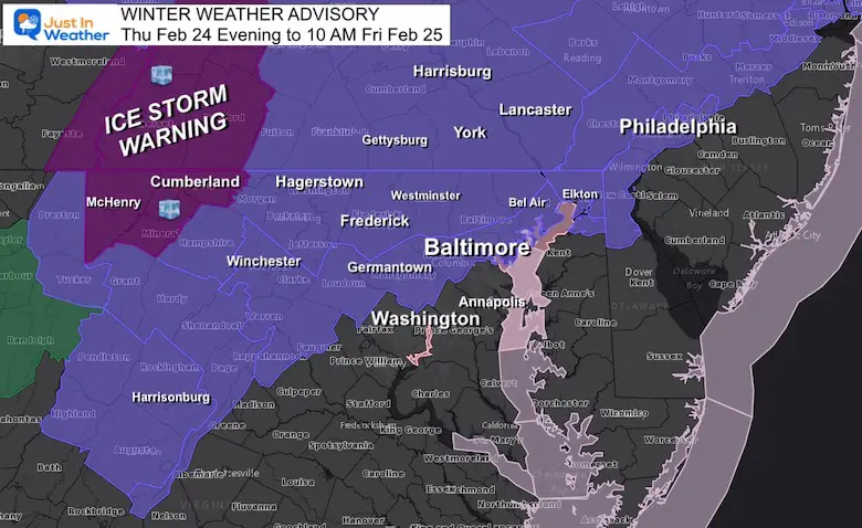
A Winter Weather Advisory will go into effect this evening to Friday morning mainly north and west of the cities. Yes, the ground is warm, but will have some assistance to chill today and some places may get icy overnight, before thawing in the morning.
In this post: Key timeframes for temps and radar simulation.Plus, the cold air reinforces this weekend.
Winter Weather Advisory
7 PM THU to 10 AM FRI for most of our region. Any snow or sleet on grasses areas up to 1/2″.
ICE STORM WARNING: Western Maryland (up top 1″ snow and 1/3″ ice)
*This is likely to be cancelled earlier*
Headlines:
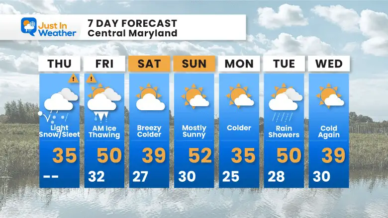
Today: Light Snow And Sleet Develop (little to no stickage)
This Evening: Sleet and Freezing (Advisory)
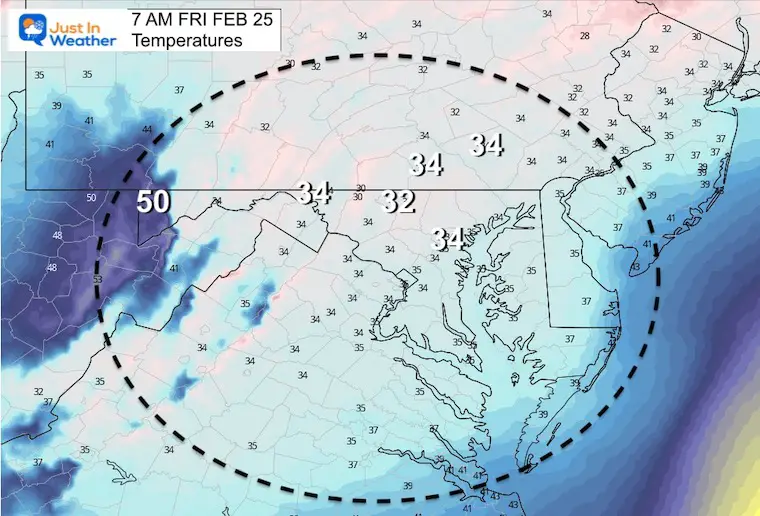
Friday Morning: Gradual Thaw by daybreak for most.
Some icing may occur on pavement in northern /western Maryland and southern PA overnight.
Friday Morning: Thawing
Weekend: Turning Cold Again
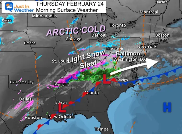
Morning Surface Weather
The cold front has pushed into North Carolina. Waves of Low Pressure has produced rain, sleet, and snow on the north side and already moving in up the mountains already.
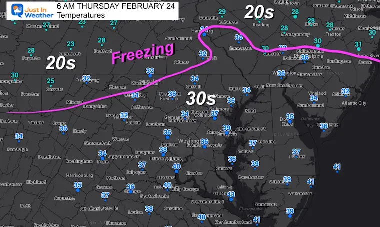
Temperatures This Morning
The freezing line is still progressing, and will advance today with the developing light snow and sleet. This should reach Central Maryland during the day, but not to worry about stickage during the day with daylight and warmer ground.
When Will It Being? What Will It Be?
Wave 1: Late Morning To Mid Afternoon (snow/sleet)
Wave 2: Tonight brings Sleet/Freeing Rain
Wave 1 – Today
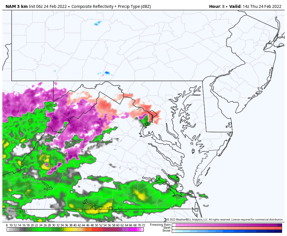
The GFS Model is showing light snow early this afternoon north of I-70 into southern PA. But the NAM 3 Km is leaning more to towards the mix, which is a warmer solution and given our recent history is what I am leaning towards.
Either way we should not see any issues on the roads during daylight.
Color Code
Blue – Snow
Orange/Peach – Sleet/Mix
Pink/Purple – Freezing Rain
GFS Solution —> slider
February-24-weather-sleet-snow-am-10
february-24-weather-sleet-snow-pm-1
february-24-weather-sleet-snow-pm-4
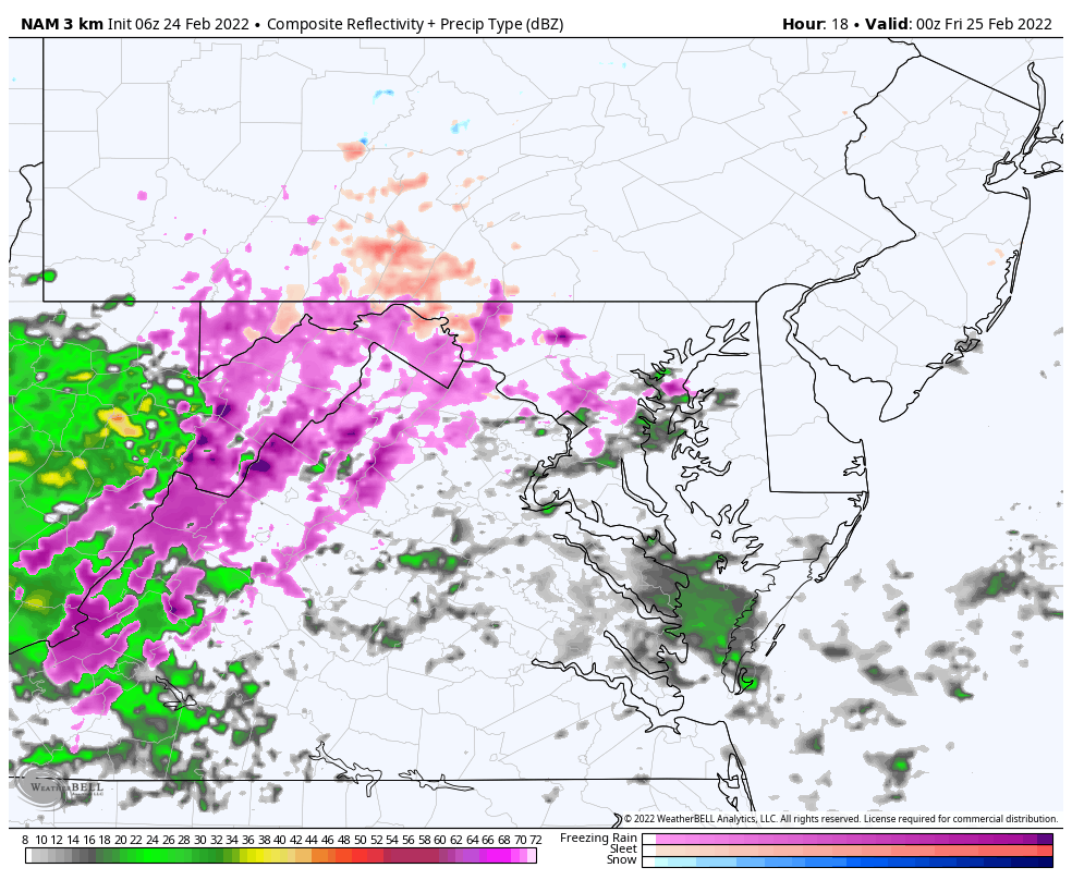
NAM 3 Km Solution
Animation 9 AM to 5 PM
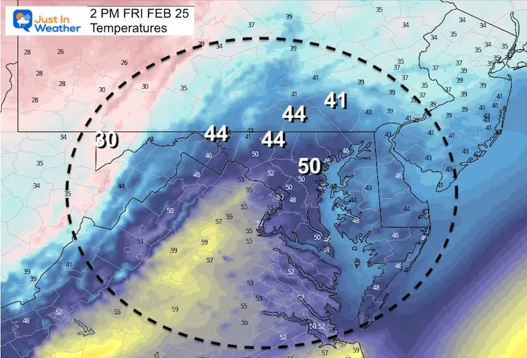
Temperatures Mid Afternoon
Wave 2 – Tonight
NAM 3 Km Model
7 PM THU to 7 AM FRI
Developing sleet and mostly freezing rain.
Warm enough for just rain (green) for Washington, Annapolis, and Baltimore along I-95.
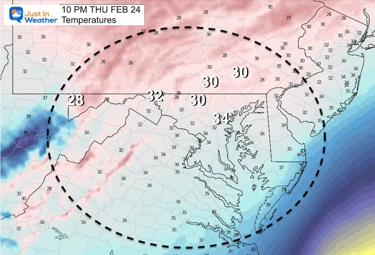
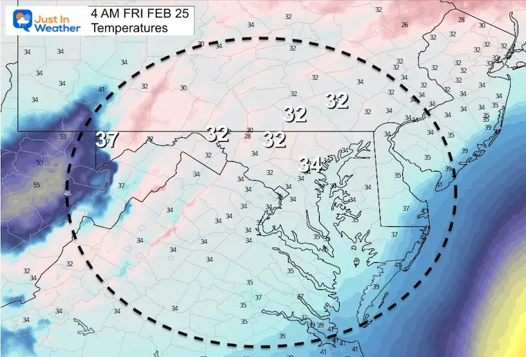
Temperatures Tonight
10 PM
4 AM Friday
Weather Almanac: Climate Data at BWI
TODAY February 24
Trivia
Yesterday’s 76ºF missed the record of 77ºF set in 1874 in Baltimore. Our records are actually quite unscientific since there have been at least 5 different locations for official weather observations since the 1870s.
Seasonal Snow: 14”
Normal Low in Baltimore:28ºF
Record +2 F in1873
Normal High in Baltimore: 47ºF
Record 79ºF 1985
Friday Weather
The event may linger some showers early, but the trend will focus on the temperatures and thawing.
I am aware there are some spelling and grammar typos. I have made a few public statements over the years, but if you are new here you may have missed it:
I have dyslexia, and found out at my second year at Cornell. I didn’t stop me from getting my meteorology degree, and being first to get the AMS CBM in the Baltimore/Washington region.
I do miss my mistakes in my own proofreading. The autocorrect spell check on my computer sometimes does an injustice to make it worse.
All of the maps and information are accurate. The ‘wordy’ stuff can get sticky.
There is no editor that can check my work when I need it and have it ready to send out in a newsworthy timeline.
I accept this and perhaps proves what you read is really from me…