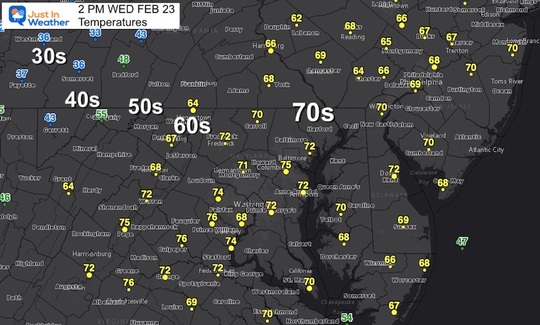
OK, it’s really warm a I write this and snow or sleet is still planned for tomorrow. Temperatures have exceeded expectations with Baltimore hitting 75ºF any BWI at 2 PM. The record for this date was 78ºF set way back in 1874, so this is a rare event.
The amount of locations in the 70s covers most of our region beyond Baltimore up to Southern PA and down into Northern Virginia.But the 30s have reached Western Maryland and that will reach us tonight.
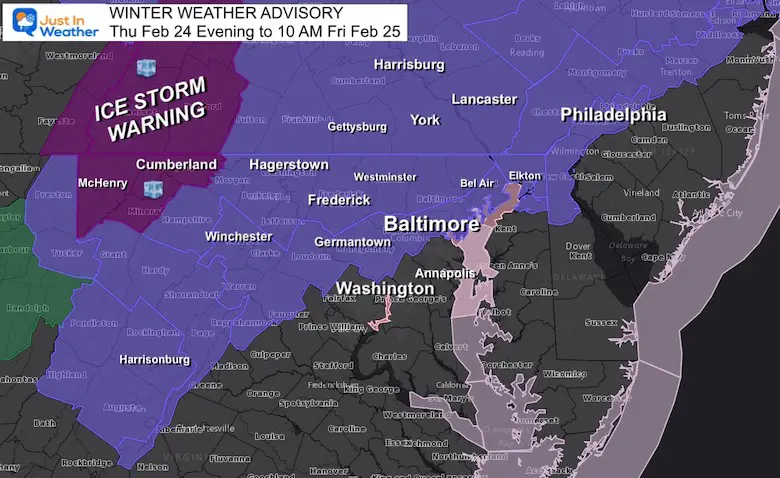
Tomorrow we get the ‘burn’ of winter trying to throw us a reminder.We are still set for a developing mix of snow, sleet, and freezing rain.Yes, the ground is warm, but the bulk of the event in the nighttime hours may allow for some icing.
Afternoon Temperatures
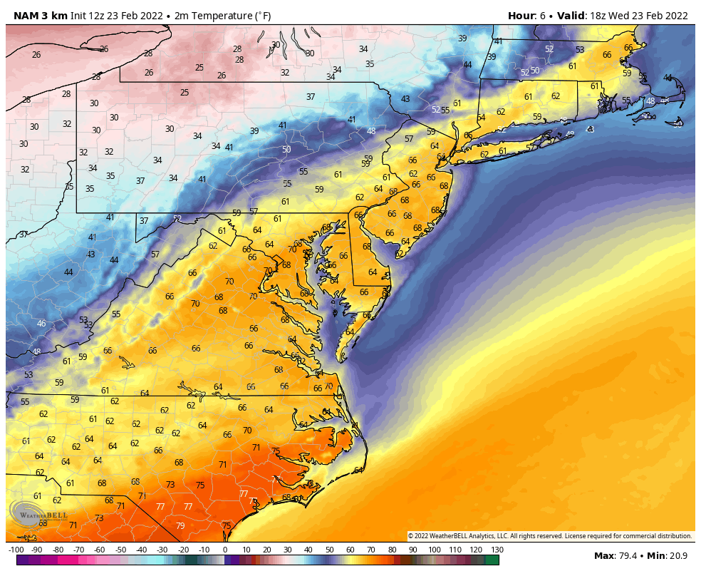
Temperature Forecast Animation:
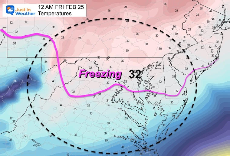
2 PM Wed to 7 AM Thu
Watch the drop to the 30s and freezing by Thursday morning.
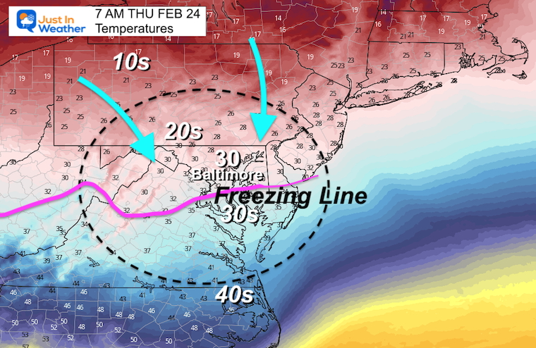
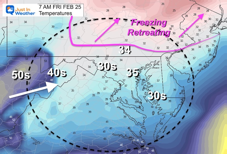
7 AM Thursday- Snapshot
The freezing line should push south of Baltimore by tomorrow morning.
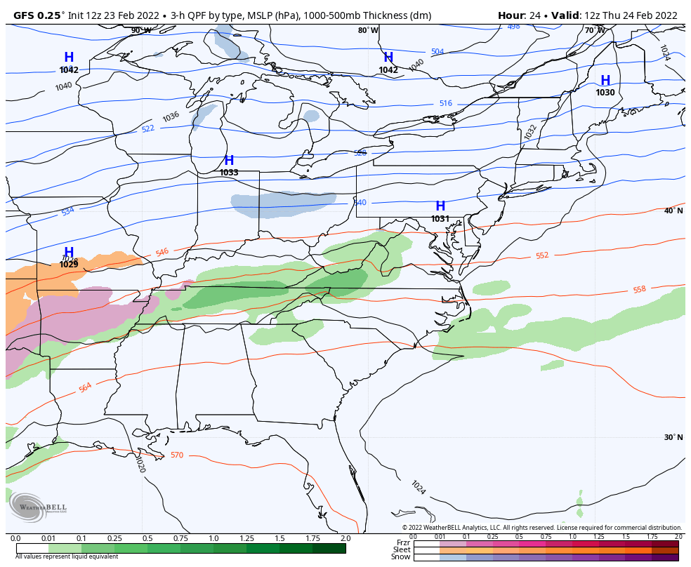
A wave of Low Pressure will develop along the old cold front.This may come in two impulses. The first being late morning to early afternoon.The second will develop into the evening and overnight.
The ice potential will be tricky due to the warm ground. But if there is any road icing, it would be Thursday evening and overnight. Temps will be near or below freezing around Baltimore and Washington, but more likely north of the cities.
Some icing may could be an issue up to the start of the commute Friday morning near and north of the PA line.
Check it out.
Color Code:
Blue = snow
Orange = Sleet/Mix
Pink = Freezing Rain
Green = Rain
GFS Model – Wide View
GFS Model – Closer View
Timeline —-> slider
february-23-weather-snow-ice-thursday-am-10
february-23-weather-snow-ice-thursday-pm-1
february-23-weather-snow-ice-thursday-pm-4
february-23-weather-snow-ice-thursday-pm-7
february-23-weather-snow-ice-thursday-pm-10
february-23-weather-snow-ice-friday-am-1
february-23-weather-snow-ice-friday-am-4
february-23-weather-snow-ice-friday-am-7
february-23-weather-snow-ice-friday-am-10
february-23-weather-snow-ice-friday-pm-1
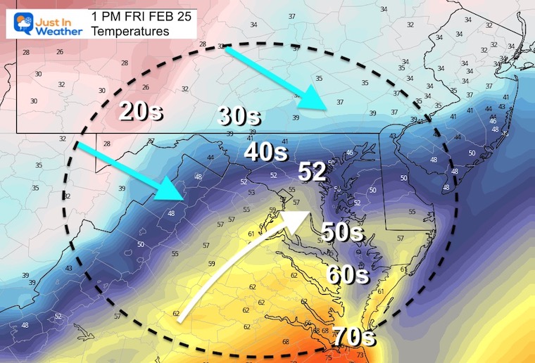
Temperatures Friday
Tracking the Freezing Line moving north…
By Sunrise, ground temps should be thawing across Southern PA as well
By Afternoon, we should be done with the rain, and a brief warming will be followed by another cool down into the weekend.
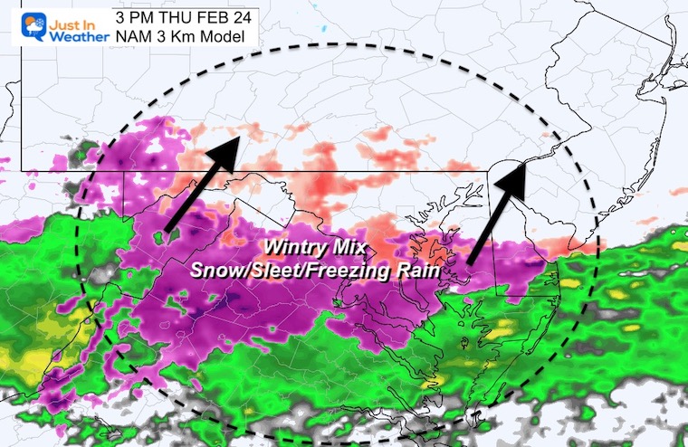
Back to Thursday Afternoon…
The GFS Model above shows a large break in the activity until the evening hours.Here the NAM 3 Km develop the wintry mix sooner in central Maryland and southern PA.This model has a higher resolution and may be showing light precipitation better, so it’s worth considering for evening plans between 5 PM and 10 PM.
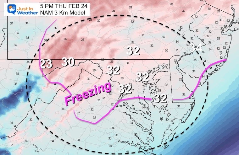
Temps forecast to be around Freezing By Evening
I will have a closer look at the timeline to help you plan in my evening update.
I am aware there are some spelling and grammar typos. I have made a few public statements over the years, but if you are new here you may have missed it:
I have dyslexia, and found out at my second year at Cornell. I didn’t stop me from getting my meteorology degree, and being first to get the AMS CBM in the Baltimore/Washington region.
I do miss my mistakes in my own proofreading. The autocorrect spell check on my computer sometimes does an injustice to make it worse.
All of the maps and information are accurate. The ‘wordy’ stuff can get sticky.
There is no editor that can check my work when I need it and have it ready to send out in a newsworthy timeline.
I accept this and perhaps proves what you read is really from me…