Wednesday February 23
Morning Report
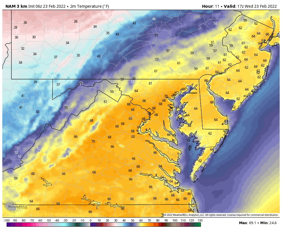
A Wild Wednesday setting up in reverse. Temps are already in the 60s, and may peak near 70ºF early this afternoon. A strong cold front will drop temps fast later today and tonight with many getting close to freezing by midnight.
Trivia
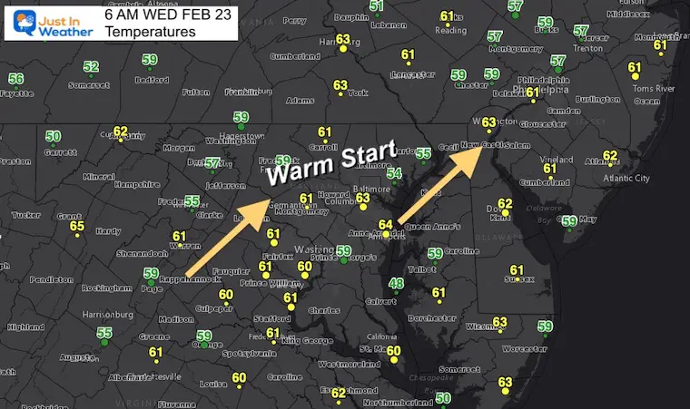
The ‘normal’ high temp for this date is 47ºF at BWI. This morning is starting nearly 20 degrees above that.
Headlines:
- Warm Start; Windy Afternoon Brings Back The Cold
- Thursday: Colder with Snow/Sleet/ Freezing Rain mix
- Friday: Icy Start North? Most of the day will thaw.
- Weekend: COLDER
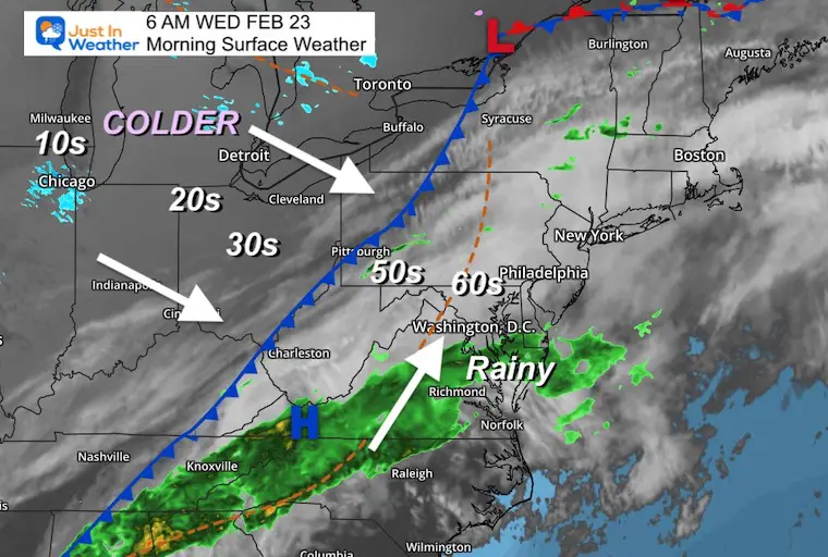
Morning Surface Weather
A strong cold front is our main story. Some rain in southern Maryland this morning. The cold winds will be noticeable after 2 PM
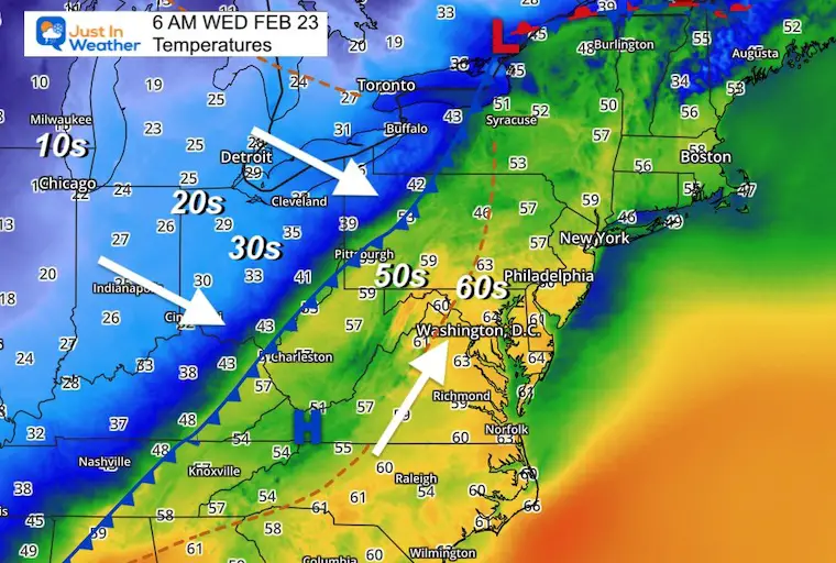
Temperatures This Morning
STRONG COLD FRONT
Temps range form the mid 60s in much of our region to 30s and 20s behind the cold front.
Local Temperatures
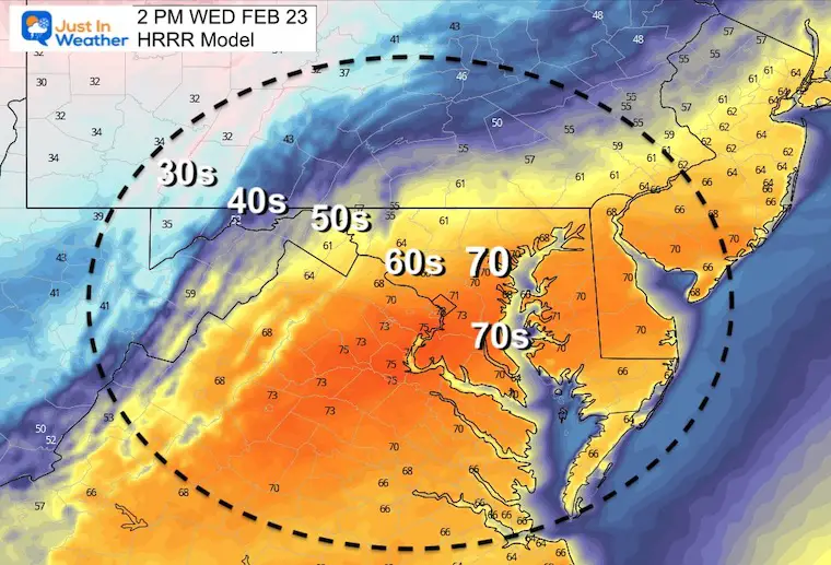
Afternoon at 2 PM
Temperature Animation To Midnight
From nearly 70ºF to Freezing!
Weather Almanac: Climate Data at BWI
TODAY February 23
Seasonal Snow: 14”
Normal Low in Baltimore: 28ºF
Record +5 F in 1963
Normal High in Baltimore: 47ºF
Record 78ºF 1874
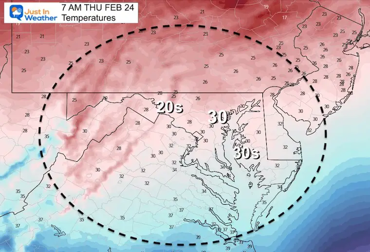
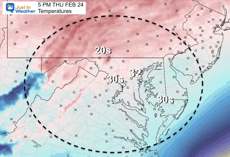
Thursday Weather
7 AM
Snapshot 5 PM
Temps
Icing
Developing wintry mix of some snow, mostly sleet and freezing rain. This will expand north through the evening.
Thursday evening will be the most impactful time that may affect plans.
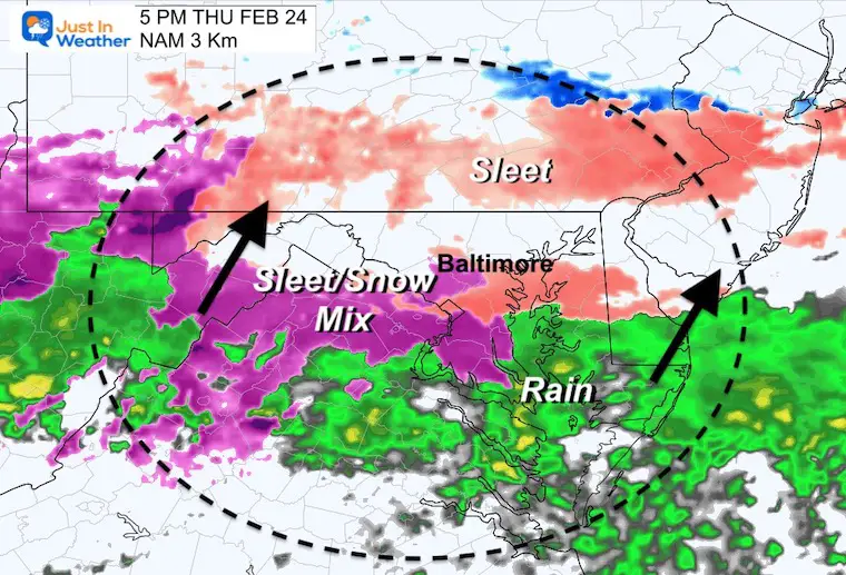
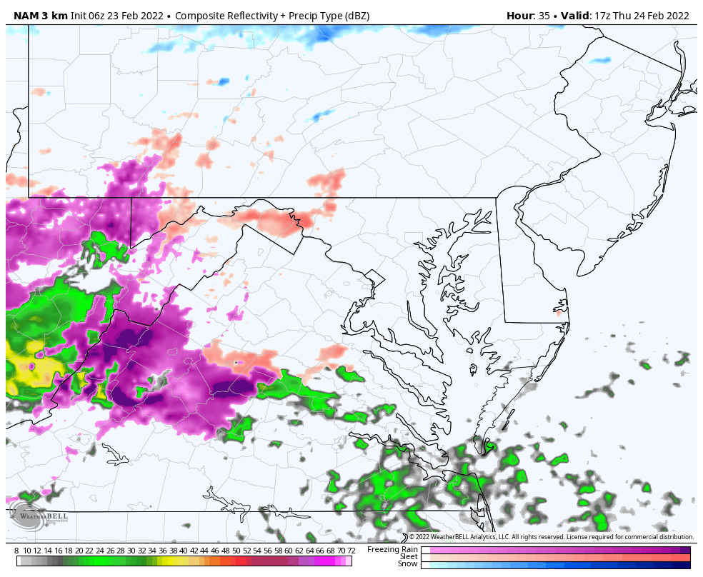
Radar Simulation
Noon Through Midnight
The windy mix will enhance and expand north through Thursday evening. If there is any impact on travel, it will most likely be this time.
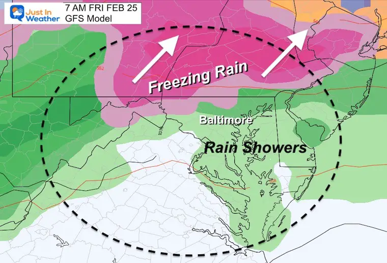
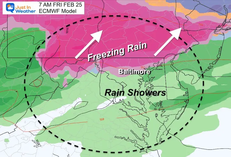
Friday Morning
While the NAM 3 Km Model shown above looks like the precipitation at midnight, the Global Models have it continuing through morning.
GFS Model
European Model
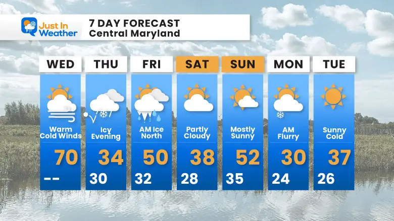
7 Day Forecast
ALSO SEE
ALL FITF GEAR

FITF THUNDERSNOW


Winter Outlook Series:
My Call For Snowfall

Last Winter Recap: My Old Outlook And Your Grades Of My Storm Forecasts


Please share your thoughts, best weather pics/video, or just keep in touch via social media
*Disclaimer due to frequent questions:
I am aware there are some spelling and grammar typos. I have made a few public statements over the years, but if you are new here you may have missed it:
I have dyslexia, and found out at my second year at Cornell. I didn’t stop me from getting my meteorology degree, and being first to get the AMS CBM in the Baltimore/Washington region.
I do miss my mistakes in my own proofreading. The autocorrect spell check on my computer sometimes does an injustice to make it worse.
All of the maps and information are accurate. The ‘wordy’ stuff can get sticky.
There is no editor that can check my work when I need it and have it ready to send out in a newsworthy timeline.
I accept this and perhaps proves what you read is really from me…
It’s part of my charm.
#FITF


