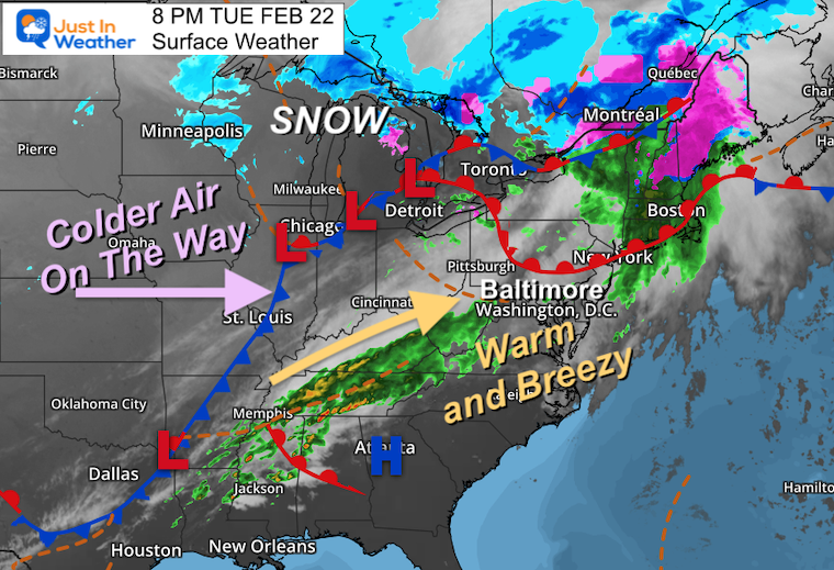
The rain that moved through this afternoon was part of a warm front.Winds have gusted to 36 mph and after sunset pushed temps into the upper 60s.The warm air will remain into the middle of Wednesday.
As our luck would have it, the next push of arctic air will push in colder air later in the day, and be established for the next wave of moisture with a reminder it is still winter!
That sets us up for developing snow, sleet, and freezing rain.I realize the shock factor alone is worth the mention, but that we don’t want to overplay this.Yes, I amalso aware that the ground may remain sufficiently warm to offset stickage.So, this may be more ambience. But some inland areas will remain below freeing into Friday morning and worth tracking for any potential problems that may develop.
By the way, winter is NOT done and may throw a few more cold shots and surprises our way into March.
Evening Set Up
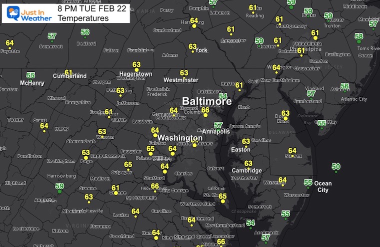
Evening Temperatures
For most of these locations, the readings at 8 PM are the high for the day! The warmest in Baltimore at BWI at 66ºF.
BWI just recorded a wind gust of 36 mph, also the strongest push of air for the day.
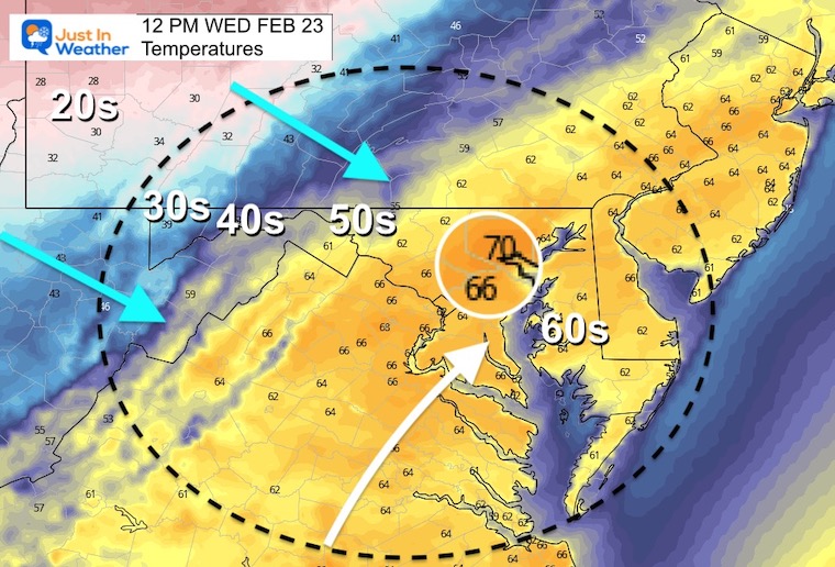
Thursday Noon
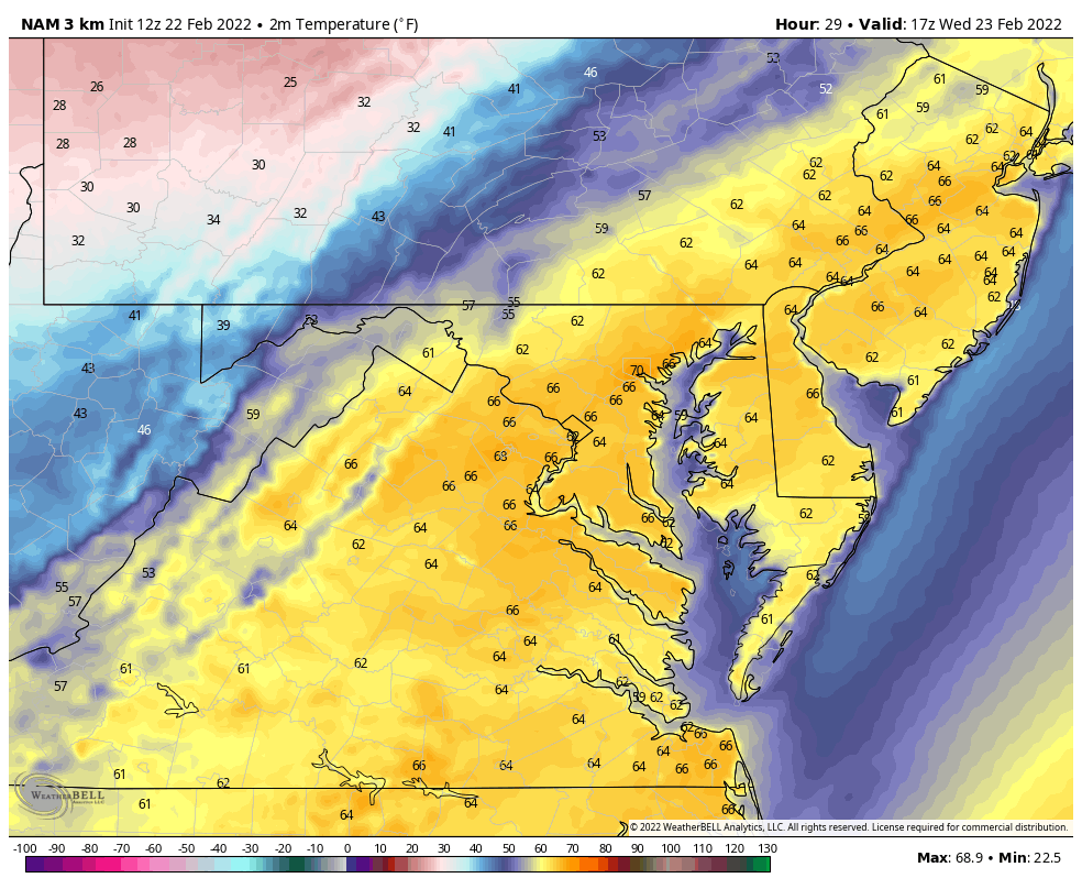
I wanted to jump ahead to when the temps may peak around Baltimore (magnified region) between 66ºF and 70ºF.The colder air will be on the move in a hurry…
Temperature Animation:
12 PM Wed to 7 AM Thu
Watch the drop to the 30s before midnight, and freezing by sunrise on Thursday.
Thursday: Winter Tries To Return
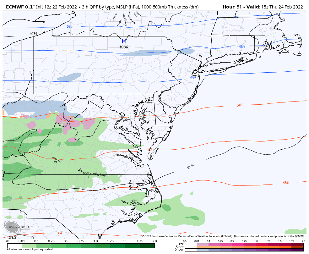
There is agreement among many models that a band of light snow or sleet will develop on Thursday, and enhance at night with a push of warmer air aloft. The result should be rain and freezing rain splitting central Maryland back to the mountains and into southern PA. A more robust snow and ice event will fall over New England into Friday.
BeforeI show the maps, here are my thoughts:
Thursday: light snow or sleet.
Thursday Night: Wintry Mix to Freezing Rain, mainly west and north of I-95.
South of Baltimore to Washington and Annapolis and across the Bay will just be wet.
West and North of Baltimore have a chance to develop some ice.The best chance for any ground impact into Friday morning will be closer to the PA line.
One complicated factor will be the ground temps. While the air may be cold enough to support icing on elevated surfaces, the pavement (roads) will be the wildcard.
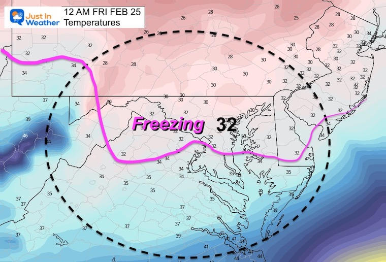
Midnight: 12 AM Friday
Recall that we have had a few occasions where temps were slightly higher than forecast. That may affect the icing potential overnight.
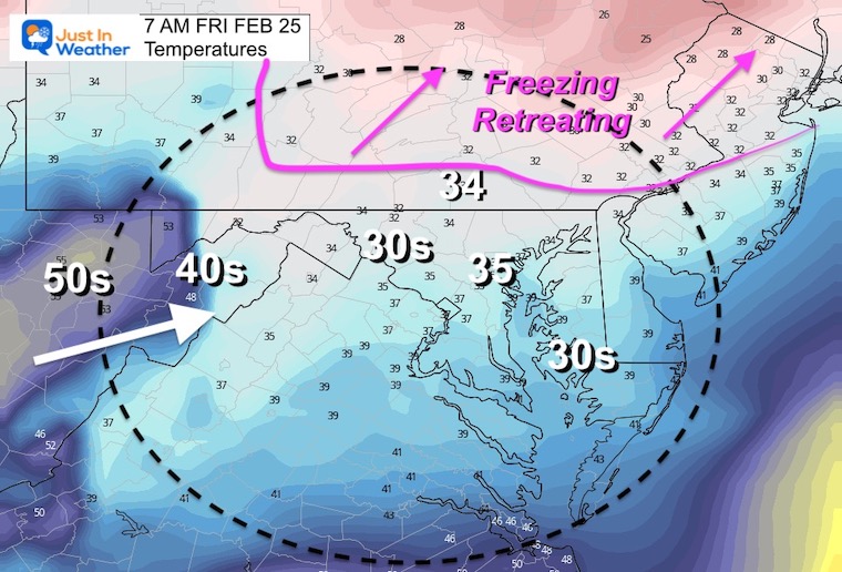
Morning: 7 AM
If this verifies, then the freezing line will push to the PA Turnpike around sunrise. Icing impact on the commute in our region will be minimal if at all.. But if there is any ice on the ground, we will need to factor how much and time for thawing.
I would suggest this will be a marginal travel concern for now.
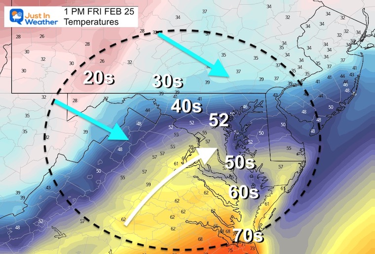
Afternoon
Check the contrast of 70s by VA Beach to 20s in western Maryland.
This looks like a modified version of what we will see Wednesday. A warm surge will be replaced by colder air arriving during the afternoon and evening.
Looking Ahead-
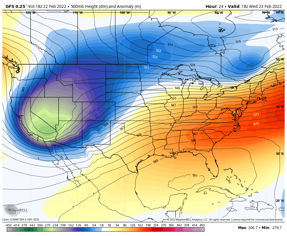
Jet Stream: 1 PM Wed Feb 23 to 1 Pm Wed Mar 2
With a large ridge in the Western US (orange), there will be an attempt for the trough to hold the cold longer into next week for the Northeast.
This is not full on winter cold, but definitely on the edge of cold enough should another system make a run at us.
With all due respect, as we turn the corner into March it gets hard to generate sustained cold air for The Mid Atlantic. But considering we have had some impressive late winter storms, the overall pattern is worth watching. It would take something special to make it happen though if you still have Faith in the Flakes.
I am aware there are some spelling and grammar typos. I have made a few public statements over the years, but if you are new here you may have missed it:
I have dyslexia, and found out at my second year at Cornell. I didn’t stop me from getting my meteorology degree, and being first to get the AMS CBM in the Baltimore/Washington region.
I do miss my mistakes in my own proofreading. The autocorrect spell check on my computer sometimes does an injustice to make it worse.
All of the maps and information are accurate. The ‘wordy’ stuff can get sticky.
There is no editor that can check my work when I need it and have it ready to send out in a newsworthy timeline.
I accept this and perhaps proves what you read is really from me…