Icing On Friday Morning Now Has Support From European Model
Tuesday February 1 2022
Evening Report
Earlier this afternoon I showed two winter weather events form the GFS Model. This included rain turning to an ice storm on Friday morning, then a coastal Low with moderate to heavy snow on Sunday. Now that I have had a look at the European Model, I wanted to show you the agreement and the differences.
Before getting in to it, I should address a common question: Hey Justin, why are you taking about snow on Sunday? Even one of my local TV buddies as razzing me about that. Truth is, Sunday is 5 days away. That is within my window of comfort to address a winter storm. What I contrast below will show why it is still a wild card.
European ECMWF Model
Storm 1: Rain to Ice to Snow?
7 AM Thursday to 10 PM Friday
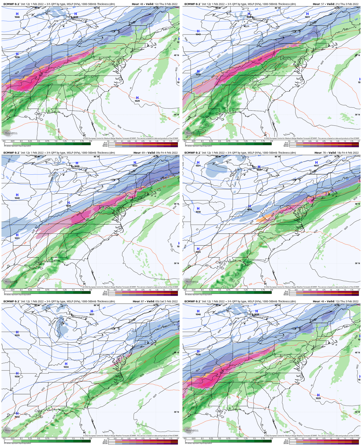
This animation shows a trend to a colder solution. This didn’t have much wintry precipitation yesterday, but now is clearing showing a long duration of icing (pink). Let’s take a closer look and comparison below.
Closer Look
Simulation Timeline —-> slider
I’ve highlight locations that might be impacted by the icing. It is important to note the more likely impact region would be west and north of Baltimore based on this model. But I added the GFS Model timeline slider below so you can compare them to each other.
ECMWF Model Suggestion For Impact
- To get icing on the roads when starting as plain rain, temps need to drop below freezing before sunrise, that gives time before any sun angle and battle for ground warmth.
- How low the temps go is also important… and we will see more on that below.
- Based on this, I feel more confident suggesting ice will be an issue for work and school from western Maryland to Southern PA. This includes Hagerstown, Frederick, Westminster, York, Northern Baltimore/Harford County.
- Baltimore Beltway/City and south (based on this) would get into the cold air too late. That is similar to the event we had on Jan 20th.
UPDATE WEDNESDAY MORNING
Click to see: Ice Impact More Likely Just West/North Of Cities
Compare To The GFS Model
(Fast And Colder)
Simulation Timeline —-> slider
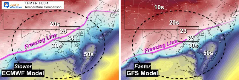
This shows the colder air arriving at least 3 hours earlier overnight. This is due to a deeper cold air mass, which then pushes farther south than the Euro…
Temperatures AND Timing Are Key!
- While this ECMWF has trended to more cold air and a distinct push of ice into central Maryland, it is slower than the GFS Model.
- The GFS has a deeper layer of cold air, allowing it to move faster, farther south, and much colder behind.
Compare the temps behind the front at 7 AM Friday:
- ECWMF: Baltimore still above freezing and Westminster down to 28ºF (icing )
- GFS: Baltimore just reaching freezing and Westminster down to 23ºF (faster and more extensive icing)
Should The GFS Get Respect?
Reminder that the GFS Model had a few winning forecasts last month. However, the last weekend blizzard prediction was won by the European Model.
Last night and earlier today I gave credit to the GFS Model for being persistent in bringing in cold air and icing Friday morning. Now we see the Euro playing catch up…
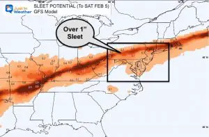
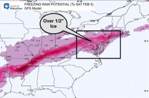
Also See: My prior report for the GFS Breakdown of freezing rain and ice
This includes an idea of how much ice may fall.
Storm 2: Sunday Snow?
My due diligence is to also show the comparison for the second event.
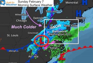
In my prior repair I showed the GFS Model brining a follow up coastal Low with moderate to heavy snow on Sunday.
Well, here’s the European (left) compared to that GFS (right).
What a HUGE difference. It’s tough enough to plot how far the icing impact will reach on Friday, here is the difference between NOTHING and a Snow Storm.

What would you do?
I know it is my job to digest the models and then put out a forecast I see most likely. I like to show you behind the scenes and view what I do. This lets you see the possibilities and even spot the trends to get a handle or think ahead the modeling.
The GFS has been consistent with this event as well, which is why now less than 5 days away it is worth repeating as a possibility, but not a promise at this time.
I will have the overnight runs to show you in the morning. At this stage, I am still looking for two things:
- Friday: Timing the cold air and resulting icing
- Sunday: If the GFS hold the storm and if the ECMWF plays catch up again.
Tuesday is Groundhog Day. Phil’s track record is only about 39%, but I will be rooting for more winter regardless.
Legend has it, If you wear White (of FITF ) on February 2, you will root on winter. If you wear Green, that helps to bring on early spring.
Want to join in? Let me know…
Faith in the Flakes
Weather posts straight to your inbox
Sign up and be the first to know!
ALSO SEE
What is Faith in the Flakes: History of December 5th Snow
ALL FITF GEAR
FITF THUNDERSNOW
Winter Outlook Series:
Last Winter Recap: My Old Outlook And Your Grades Of My Storm Forecasts
Winter Weather Page – Lots of resources
Solar Cycle Increasing Sunspots Suggests More Snow
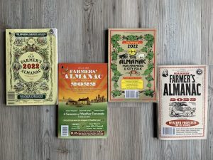
Comparing 4 Different Farmer’s Almanacs: Majority colder winter outlook than NOAA
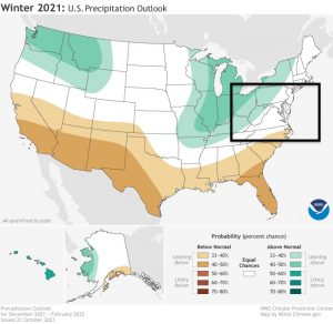
NOAA Winter Outlook- But Read The Fine Print
Signals For Early Start To Winter In November
Winter Outlook Series: La Nina Double Dip
Nor’easters May Give Hint For Winter La Nina Pattern
Winter Folklore Checklist
Please share your thoughts, best weather pics/video, or just keep in touch via social media
Facebook: Justin Berk, Meteorologist
Twitter: @JustinWeather
Instagram: justinweather
*Disclaimer due to frequent questions:
I am aware there are some spelling and grammar typos. I have made a few public statements over the years, but if you are new here you may have missed it:
I have dyslexia, and found out at my second year at Cornell. I didn’t stop me from getting my meteorology degree, and being first to get the AMS CBM in the Baltimore/Washington region.
I do miss my mistakes in my own proofreading. The autocorrect spell check on my computer sometimes does an injustice to make it worse.
All of the maps and information are accurate. The ‘wordy’ stuff can get sticky.
There is no editor that can check my work when I need it and have it ready to send out in a newsworthy timeline.
I accept this and perhaps proves what you read is really from me…
It’s part of my charm.
#FITF


