Tuesday February 1 2022
Afternoon Report
Our new month is continuing the active winter weather pattern. Regardless of what the ground hog sys tomorrow, perhaps winter weather is stepping it up a notch. Last night I gave credit to the GFS Model for being persistent in bringing in cold air Friday morning. So the mild rain event has a chance to turn into an ice storm. I don’t use that term loosely with the potential for 0.25 to 0.50 inch of icing.
The pother consistency has been a quick coastal storm moving in Sunday morning with snow. That is what I will highlight below.

Please note, this is the GFS Model, which has a few winning forecasts last month validating the $500,0000 upgrades. However, the last blizzard prediction was won by the European Model. That ECMWF is less aggressive with these two events. I will focus on that model when newer data arrives this afternoon.
Storm Animation: GFS Model
7 AM Wednesday to 7 PM Sunday
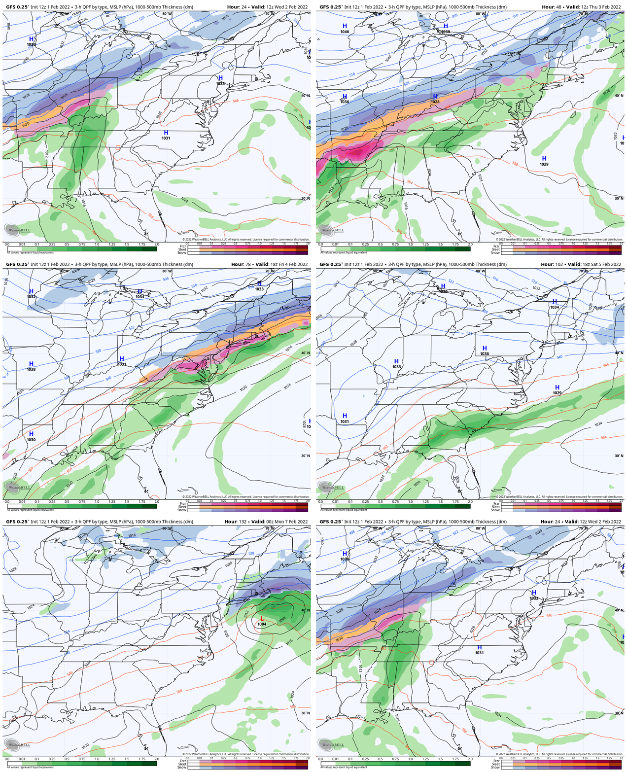
Now, let’s focus on the first event ending Saturday morning.
I wanted to show the predicted precipitation plots. Then a closer look at storm animations and timelines, and the Sunday event below.
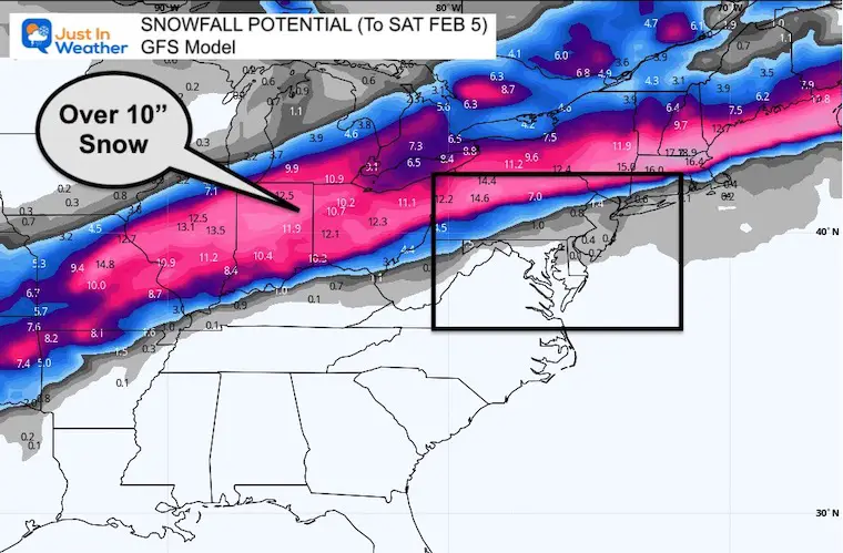
Forecast Snow
I feel safer plotting this because it is not for our region, and highlights the broad spectrum of snow coverage compared to the ice below.
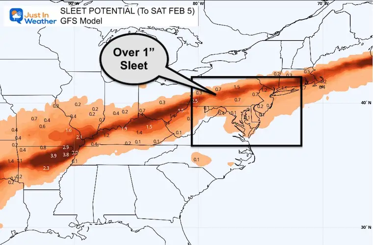
Forecast Sleet
This is the accumulation of frozen granules.
Forecast Freezing Rain
This is the liquid rain freezing to ice on contact. This can be the most impactful to weigh down trees and power lines.

Closer Look: Mid Atlantic
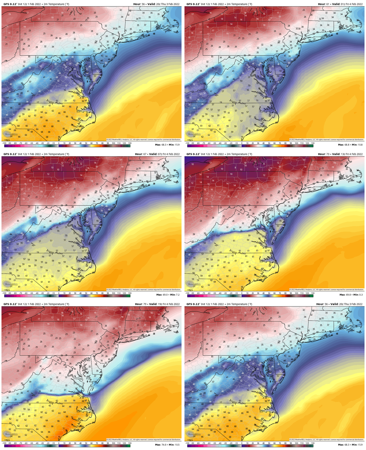
This is a matter of timing. The GFS Model has been trending to bring the cold air in sooner. At this point, our inland areas may drop below freezing Thursday night, then spread across metro areas Friday morning.
Temperature Animation
7 PM Thu to 7 PM Fri
Precipitation Animation
7 PM Thu to 7 PM Fri
Why not snow? In this case, the cold air will be at the surface, while warmer air above freezing will remain at cloud level. The thickness or depth of cold air will determine if the rain falling will freeze into pellets on the way down (sleet) or remain liquid and then freeze on contact (freezing rain).

Timeline —> slider
These are 3 hour snapshots from the GFS Model. I annotated the ares that will be first affected around that time.
UPDATE:
Click to COMPARE TO EUROPEAN MODEL
IF JUST GOT COLDER TOO
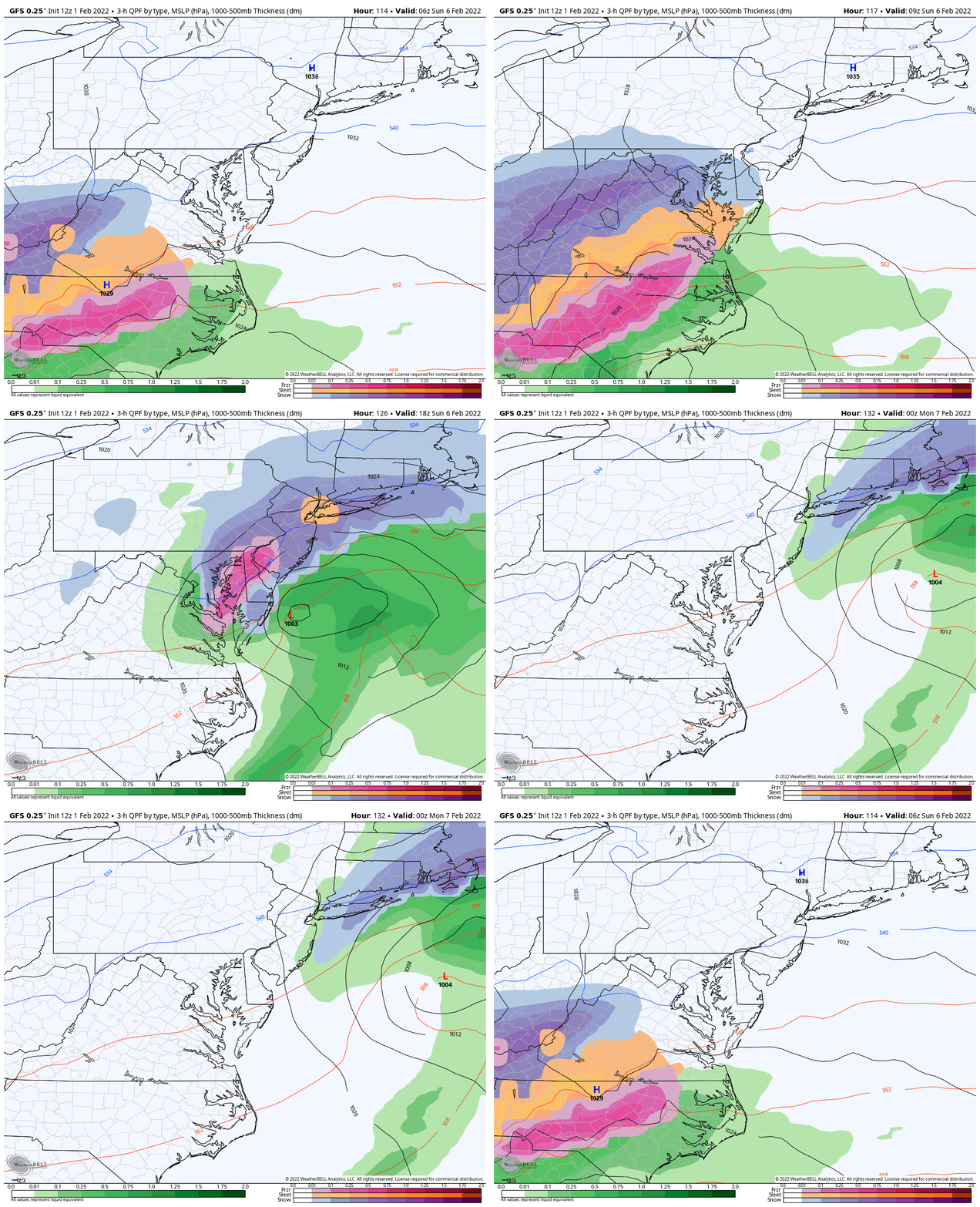
Second Event: Sunday Snow?
GFS Model 1 AM Sunday to 7 PM Sunday
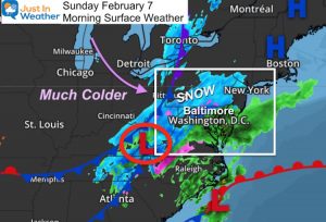
If this plays out, then after this ice event, we will watch for Low Pressure to move up the coast with snow by Sunday morning.
This is two storms away, so it is impossible to ask how much may fall. The timing and intensity suggests a moderate event.
UPDATE:
This Model Has Since Pulled Back On The Storm… Actually Catching Up To the European Suppression Of This Second Storm

Older GFS Model Plot
Weather posts straight to your inbox
Sign up and be the first to know!
ALSO SEE
What is Faith in the Flakes: History of December 5th Snow
ALL FITF GEAR
FITF THUNDERSNOW
Winter Outlook Series:
Last Winter Recap: My Old Outlook And Your Grades Of My Storm Forecasts
Winter Weather Page – Lots of resources
Solar Cycle Increasing Sunspots Suggests More Snow
Comparing 4 Different Farmer’s Almanacs: Majority colder winter outlook than NOAA
NOAA Winter Outlook- But Read The Fine Print
Signals For Early Start To Winter In November
Winter Outlook Series: La Nina Double Dip
Nor’easters May Give Hint For Winter La Nina Pattern
Winter Folklore Checklist
Please share your thoughts, best weather pics/video, or just keep in touch via social media
Facebook: Justin Berk, Meteorologist
Twitter: @JustinWeather
Instagram: justinweather
*Disclaimer due to frequent questions:
I am aware there are some spelling and grammar typos. I have made a few public statements over the years, but if you are new here you may have missed it:
I have dyslexia, and found out at my second year at Cornell. I didn’t stop me from getting my meteorology degree, and being first to get the AMS CBM in the Baltimore/Washington region.
I do miss my mistakes in my own proofreading. The autocorrect spell check on my computer sometimes does an injustice to make it worse.
All of the maps and information are accurate. The ‘wordy’ stuff can get sticky.
There is no editor that can check my work when I need it and have it ready to send out in a newsworthy timeline.
I accept this and perhaps proves what you read is really from me…
It’s part of my charm.
#FITF


