


January 13 Mild Ahead Of Arctic Front That Will Bring Rain To Snow Later Wednesday
Tuesday January 13 We are once again back to mild afternoons with sunshine, but that is about to change. The next cold front will usher in a series of arctic…
Friday January 21 – Morning Report
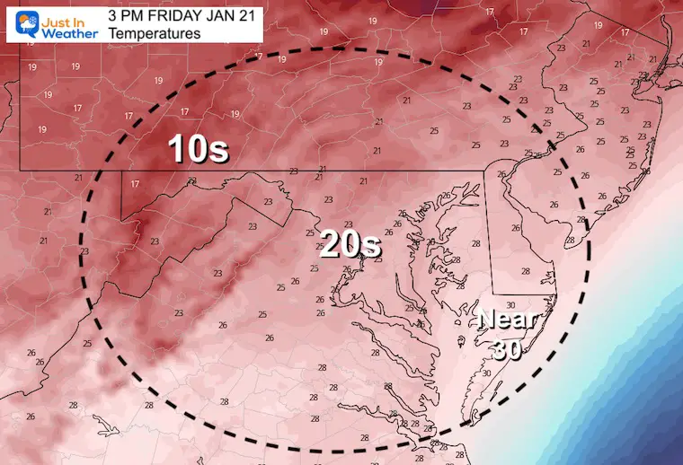
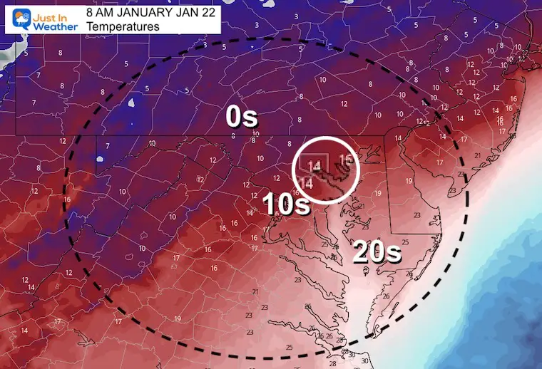
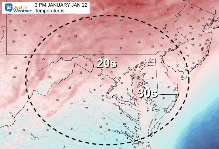
This one is going to hurt! The coldest air of the season is here and still might bottom out tonight. Baltimore has already reached 15ºF twice this month (4th and 16th). It could drop below that by Saturday morning. The record was -7ºF in 1984, so we can’t complain too much.
In addition, the snow in Southern Maryland had a chance to stick, while the wet roads may have iced over in the deep freeze!
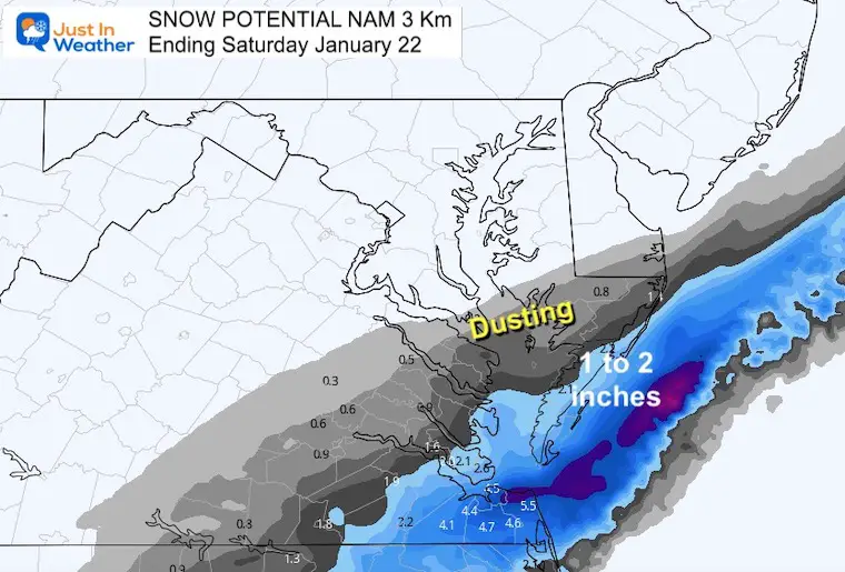
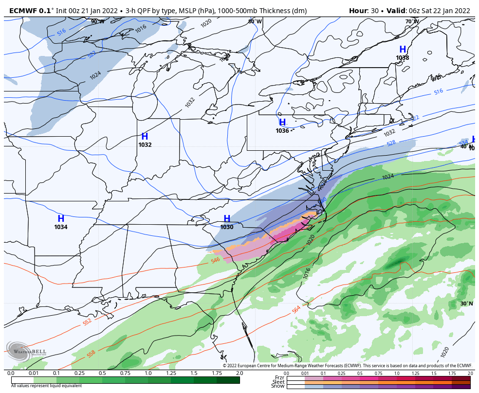
The spotlight remains near the coast, with a Winter Weather Advisory in extreme southeastern Maryland, including Ocean City for that coastal storm overnight.
There will be a few clippers with hits of more light snow in the next week.
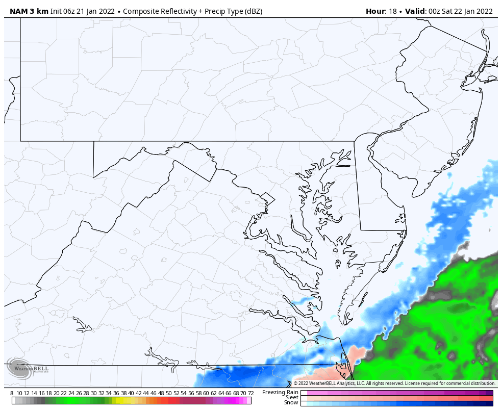
The Low Pressure that caused the problems delaying our cold air yesterday had formed a little farther east. The lingering effect is what is going to cause the next system to stay southeast and barely clip coastal Maryland.
More on the Winter Weather Advisory below…

Bittern Cold Reminders:

See the Home Page for maps that update every 10 minutes
This includes Maryland’s Somerset and Worcester Counties.
Pocomoke City, Berlin, Snow Hill, And Ocean City are included.
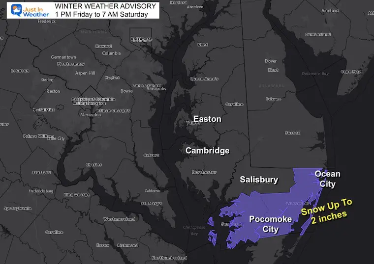
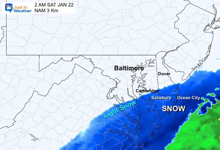
The northern edge of light snow ‘may’ reach Cambridge. But most will be east and south of Salisbury to Ocean City.
7 PM Friday to 7 AM Saturday
I chose this plot to match the NAM 3 Km animation. The range of potential is up to 2 inches in the Advisory Zone.
TODAY January 21
Normal Low in Baltimore: 24ºF
Record -6ºF in 1985
Normal High in Baltimore: 41ºF
Record 66ºF 1921
If BWI reaches 14ºF or lower, that would be the coldest of this season.
Here we can see the coastal storm jump off the Carolina Coast tonight, allowing the core of the arctic cold to fill in.
This will be followed by a weak clipper with flurries or snow showers Sunday evening. Then another arctic cold front with rain changing to snow on Tuesday.
We enter the weekend very cold, and a small system could bring light snow showers Sunday evening.
Most of the outlook is cold, with one mild day Tuesday. That will include a cold front that brings another round of rain ending as snow.

Sign up and be the first to know!


Last Winter Recap: My Old Outlook And Your Grades Of My Storm Forecasts


