


July 5 Heating Up And Tropical Storm Chantal Expected To Get Named Today
Saturday, July 5 2025 Morning Report After the beautiful Independence Day we just had, we will see a little increase in heat and humidity today and tomorrow. There is a…
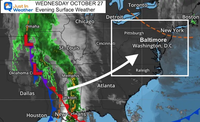
Wednesday Evening October 27
The next storm from the Pacific will be here on Friday. It has already been responsible for hurricane force winds in the Pacific Northwest Coast and tornado outbreaks in the Deep South. The energy is significant and holding together well enough to have a major impact on The Mid Atlantic next.
Here is a quick look at Headlines and Maps for what to expect. I will have more details on Thursday.
This storm extends from the Canadian border to the Gulf Coast. We will be getting impacted from the portion of the storm that just plowed through Louisiana with a severe outbreak today. Clouds will increase late Thursday, but the main event for us with be all day Friday.
Thursday Morning To Saturday Afternoon. The main event will be during the day Friday. On Saturday the upper level Low will be responsible for unsettled cool air, and perhaps some afternoon showers popping up.
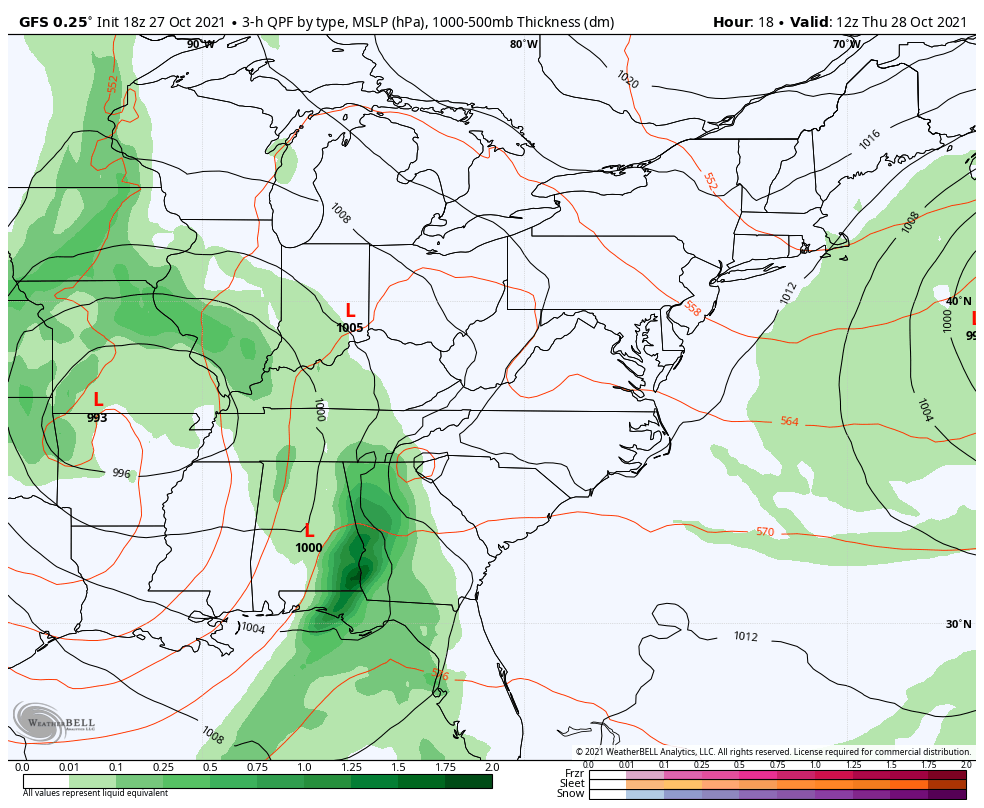
The peak of the storm will bring a band of very heavy rain, along with strong winds from the East-Southeast. There is a wide range of timing among the modeling, but safe to plan for this to be an all day event.
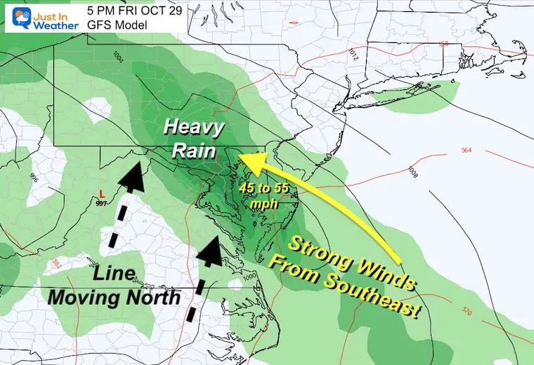
I added this map in motion to show the wind flow FROM the Southeast and East. That will pile water up on the Bay. It also helps enhance any storm potential in metro areas.
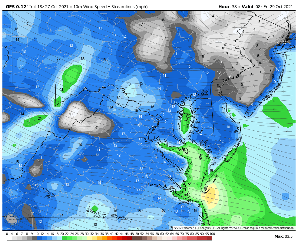
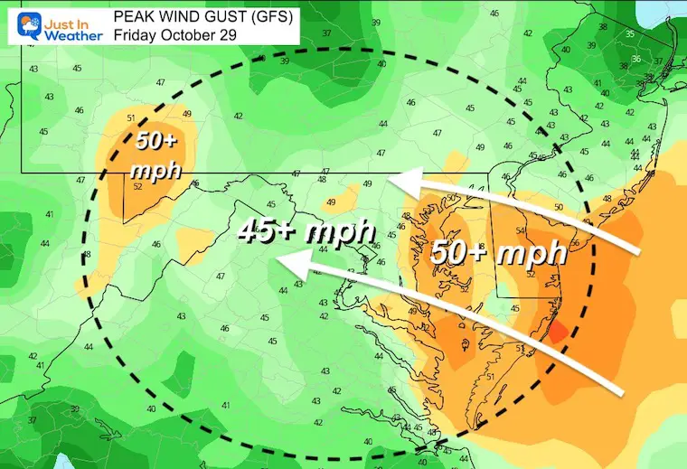
A wide area of 45 to 55 mph. It is possible some spots surpass 60 mph, especially on hills and by the water. I would expect wind restrictions on bridges.
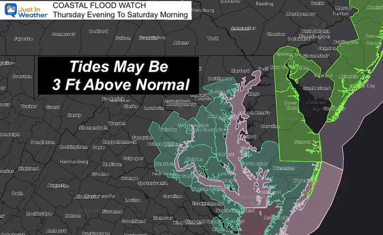
High Tides may be more than Feet above normal as winds pile the water up the Bay, and along the coast.
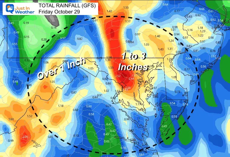
Flooding potential with a wide area over 1 inch, but pockets over 2 inches.
Most will fall during the day on Friday.
Also See:
NOAA Winter Outlook- But Read The Fine Print
Winter Weather Folklore Checklist
Signals For Early Start To Winter In November
Winter Outlook Series: La Nina Double Dip
Nor’easters May Give Hint For Winter La Nina Pattern

