October 22 Cooler Today Then Chilly With Rain Next Week
Friday October 22
Yesterday Baltimore hit 78ºF. We will not see that again (outside) for a long time.
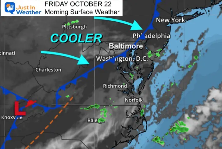
A cold front is crossing the region this morning, shifting our winds and bringing in the pattern change. This is where we finally transition to full autumn mode with cooler air, some frosty mornings, and a few storms.
Warm days are still possible, but they will be few and far between.
Morning Surface Weather
This is not a strong cold front, but it does have some clouds this morning. The winds are not necessarily strong either, but will come from a cooler direction and may gust to 15 mph at times.
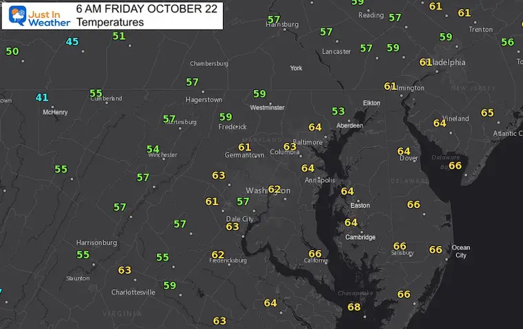
Morning Temperatures
These readings may seem like previous mornings. However, they will not be moving much during the day.
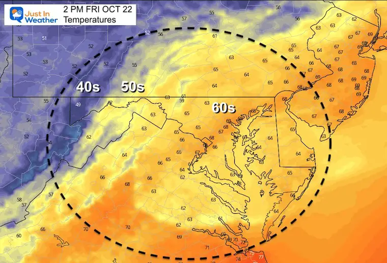
Afternoon Temperatures
These numbers will be close to seasonal averages for this date.
Weather Almanac: Climate Data
TODAY October 22
Normal Low in Baltimore: 44ºF
Record 31ºF in 1952
Normal High in Baltimore: 65ºF
Record 85º F 1979
Also See:
NOAA Winter Outlook- But Read The Fine Print
Signals For Early Start To Winter In November
Winter Outlook Series: La Nina Double Dip
Full Hunter’s Moon May Appear Full For 3 Nights
Waterspout Among Top 10 Storm Photos Saturday
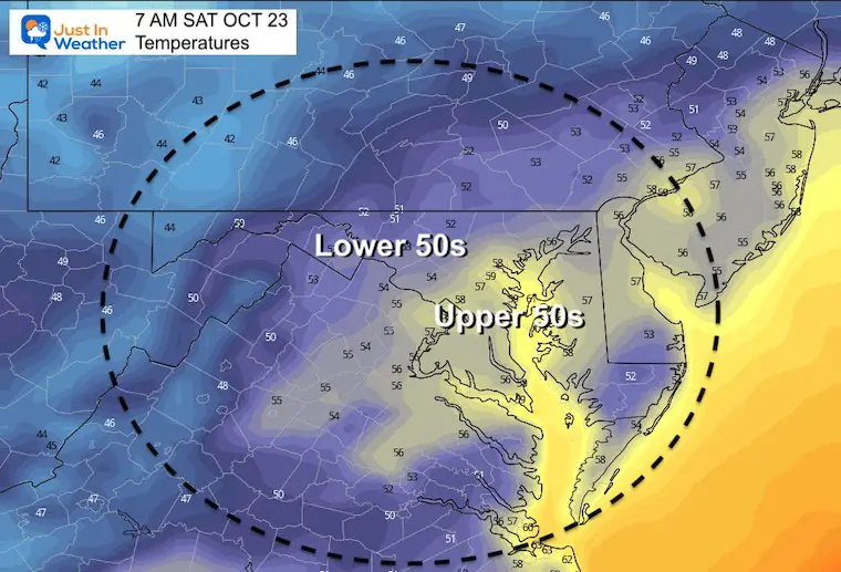
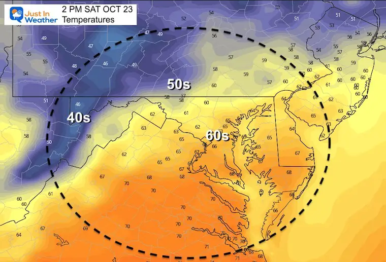
Temperatures Saturday
Morning
Afternoon
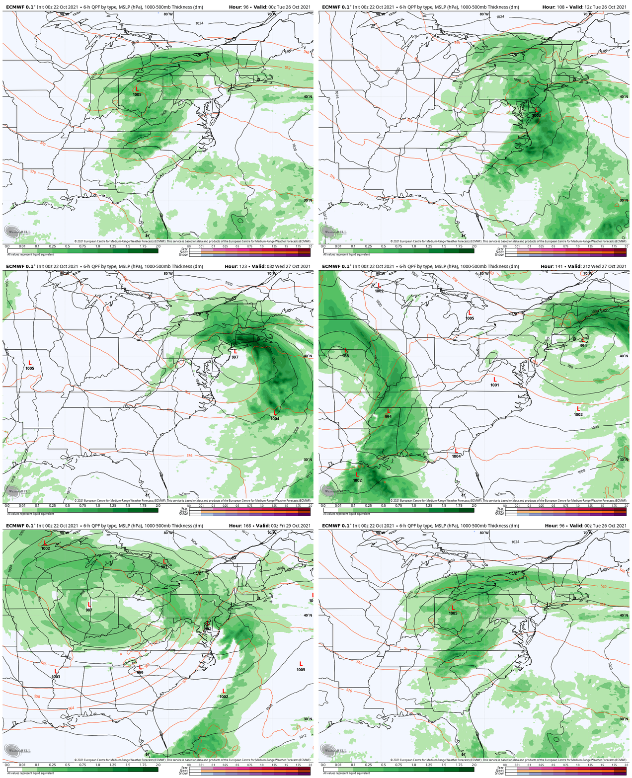
Looking Ahead
A series of very strong storms is moving off of the Pacific Ocean into the western US. The track of these systems will reach us next week. That will bring in a few rain events, along with cooler temps.
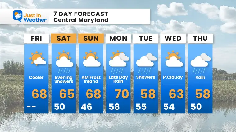
7 Day Forecast
Weather posts straight to your inbox
Sign up and be the first to know!
Faith in the Flakes Gear
SNOWSTIX – Available Now
Please share your thoughts, best weather pics/video, or just keep in touch via social media
Facebook: Justin Berk, Meteorologist
Twitter: @JustinWeather
Instagram: justinweather
Email Updates
Please make sure you sign up for my newsletter.
See the SUBSCRIBE button at the bottom of the page.
This way you will get an email to make sure you are notified with each new post.


